NatureScot pre-application guidance for onshore wind farms
Version: October 2025
This latest version provides further guidance for assessing slope stability (under the heading Soils and Geomorphology)
Purpose
This guidance presents our ‘standing’ pre-application advice to developers and consultants who are preparing applications and Environmental Impact Assessment (EIA) reports for onshore wind farm developments.
It outlines NatureScot’s advice on the type of survey and assessment work that is likely to be required to support an application.
The guidance is aimed at a range of people involved in preparing and reviewing applications, for example, developers, consultants and consenting authorities.
In this guidance:
- We use ‘consenting authority’ as shorthand to encompass both Scottish Ministers and planning authorities.
- The term ‘pre-application’ encompasses the formal EIA scoping stage.
The service that NatureScot provides
Our pre-application engagement provides an opportunity to resolve potential problems early on and help speed up decision-making.
Our Service Statement and related guidance set out the level of engagement to expect during the planning process.
The focus of our case-specific advice will be on natural heritage issues of national interest. Our framework for determining issues of national interest is set out in our guidance on ‘Identifying Natural Heritage Issues of National Interest in Development Proposals’. This guidance is particularly relevant to identifying impacts that may raise issues of national interest beyond protected areas of national or international importance.
Our level of engagement and the scope and detail of our advice for any specific case will be in proportion to the nature, scale and importance of the potential impacts.
Noting our national remit, a ‘no comment’ response from us should not be interpreted as meaning there are no other significant effects that need to be considered, either within the scope of an EIA or when determining applications.
If we do not provide case-specific advice, then our standing advice (including this pre-application guidance) should help inform the scope of any EIA.
Developers and consultants should allow sufficient time in the projects plan to accommodate our advice. Our typical customer care timescale for responding to pre-application requests is within 20 working days but there can be delays in responding when other statutory consultations take priority.
Initial developer or consultant contact with us should be through InformedDECISION.
Any information submitted to us during pre-application discussions may be subject to a request under the Environmental Information (Scotland) Regulations 2004. For this reason, although we are happy to receive information about the proposal at the pre-application stage, we cannot do so on the basis that we hold that information in confidence. Developers can take some steps to help us manage their information by separating out, and clearly marking, environmentally and commercially sensitive information. They can also provide us with an explanation of the harm that would occur if information was released.
It is worth noting that we only wish consultation on the discharge of planning conditions applied at our request to avoid an outright objection, or if we have otherwise agreed to be consulted. Therefore, we normally prefer not to be ‘written into’ proposed planning conditions within EIA reports.
General advice to help inform the EIA
Our website includes onshore wind energy guidance and information to help ensure that developers undertake a robust EIA. Our guidance is subject to periodic review, so please ensure you are accessing the latest version from our website. The complete list of our standing advice and guidance helps provide easy reference to latest versions of documents.
This pre-application guidance highlights some key standing guidance and also provides new advice not covered in our other published guidance, for example on turbine lighting (Annex 1) and repowering applications.
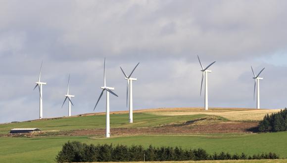
Landscape
General advice for all proposals
Our guidance on siting and design should be used to inform the siting and design of the proposal in order to help minimise landscape and visual impacts at the early stage of scheme development.
Our guidance on visual representation should be used to produce visualisations to accompany applications which are easy to understand and which can be verified.
Our guidance on cumulative landscape and visual assessment should be used in undertaking an assessment of the combined effects of a set of developments.
National Scenic Areas and National Parks
National Planning Framework 4 (NPF4) Policy 4(c) states that development proposals that will affect a National Scenic Area (NSA) or National Park (NP) should only be supported where:
- The objectives of the designation and the overall integrity of the areas will not be compromised; or
- Any significant adverse effects on the qualities for which the area has been designated are clearly outweighed by social, environmental or economic benefits of national importance.
Where significant effects on the special qualities are likely, developers should refer to our website information and advice on NSAs and on National Parks. We are also developing guidance on how to assess effects on NSA Special Qualities and can provide a draft copy of that guidance by request.
Wild Land Areas
NPF4 has significantly changed policy relating to Wild Land Areas (WLA). There is now a greater distinction between policy requirements for developments within and outwith WLA, and certain types of development within WLA are now supported. Annex A of our guidance Identifying Natural Heritage Issues of National Interest sets out how we will respond to proposals of different types within and outwith WLA.
NPF4 Policy 4(g) indicates that only certain categories of development proposals will be supported within WLA. These include where the proposal will support meeting renewable energy targets (this encompasses proposals to generate, transmit and store renewable energy). All such proposals must be accompanied by a wild land impact assessment which sets out how design, siting, or other mitigation measures have been, and will be, used to minimise significant impacts on the qualities of the WLA, as well as any management and monitoring arrangements where appropriate.
Our advice and guidance on WLAs should be applied to proposals in WLAs whose nature, siting, scale or design are likely to result in a significant effect on the qualities of a WLA.
NPF4 Policy 4(g) states that buffer zones around wild land will not be applied, and effects of development outwith WLAs will not be a significant consideration. In our view, the consequence of this policy is that when a decision maker, e.g. Scottish Ministers or a Planning Authority, is making a determination regarding an application for a proposed development outwith a WLA, the effects of that proposed development on the qualities of the WLA would not be a significant consideration in making that determination.
However, in seeking the best design solution for a proposed development, the wild land assessment guidance (which compliments the approach set out in Guidelines for Landscape and Visual Impact Assessment) is a useful process by which the significant effects are identified and can potentially be mitigated through appropriate design iterations. Wild land assessments may help to inform the decision maker about the full range of significant effects for proposals sited outwith WLAs.
Local Landscape Areas
Our website provides helpful general information on Local Landscape Areas (LLAs), with site-specific information and advice on LLAs available from local planning authorities.
Turbine Lighting
For advice on assessing turbine lighting effects and mitigation options see the joint Scottish Government Guidance on Aviation Lighting Impact Assessment.
Ecology
Terrestrial habitat survey
Habitat surveys covering the entire development site will help inform potential redesign or micro-siting, and will help identify potential areas for habitat restoration and enhancement. The assessment should encompass all areas affected by the development including, for example, habitat indirectly affected by hydrological changes.
We advise that habitat surveys should include:
- Phase 1 habitat survey
- National Vegetation Classification (NVC) survey of habitats listed on Annex 1 of the EC Habitats Directive and UK Biodiversity Action Plan (UKBAP) Priority Habitat, accompanied by supporting vegetation quadrat information
- Records of any rare and scarce plant species
We have adopted the European Nature Information System (EUNIS) as our standard habitat classification system for terrestrial habitat data and mapping. We therefore recommend that all habitat surveys should also include EUNIS codes. We have published a manual and correspondence tables for EUNIS habitats in Scotland.
The UK Habitat Classification (UKHab) survey can be used in place of a broad Phase 1 habitat survey but has not been fully validated in Scotland.
There is a JNCC interactive spreadsheet of habitat correspondences (2008) which may be helpful to show how different habitat classifications relate to one other.
There should also be related assessment of habitat condition, e.g. as affected by grazing pressure, drainage, burning etc. There may be cases where important habitat types are affected but they are currently in a degraded or unfavourable condition. It is essential not to under-estimate the importance of habitats in sub-optimal condition where there is potential for restoration.
Applicants should consider how the selected turbine model might affect habitat loss predictions, noting that different models may have different hard-standing requirements. If a particular model is not committed to at application stage, the loss predictions in the EIA report should take account of the reasonable worst-case. Predictions should also consider whether there is potential for detailed site investigations, at post-consent stage, to give rise to larger than expected footprints.
Peatlands
Peatland is an important habitat supporting biodiversity, and the underlying peat is a key carbon store. Proposals should seek to avoid peatlands where possible and minimise peatland disturbance. Where peatland is affected, there will need to be sufficient peatland restoration in order to compensate for losses and deliver additional biodiversity enhancement. Peatland restoration is often an important element in terms of mitigation, compensation and enhancement for wind farms in Scotland.
NatureScot’s consultation advice will focus on peatland habitat while Scottish Environment Protection Agency (SEPA) advice will tend to focus on peat and carbon. These differing roles are discussed in the Joint working arrangement between SEPA and NatureScot on planning consultations.
Our detailed peatland advice for applicants is contained in our guidance on Advising on peatland, carbon-rich soils and priority peatland habitats in development management (Revised November 2023). This document will evolve as additional information and evidence informs our understanding, including additional outputs from the Peat Expert Advisory Group and development of a Scottish biodiversity metric.
NPF4 Policy 5d requires that ‘where development on peatland, carbon-rich soils or priority peatland is proposed, a detailed site-specific assessment will be required’. The Carbon and Peatland map 2016 is a useful guide to screen where areas of peatland are likely to occur, but should not be regarded as definitive. In addition to habitat survey information (see above), development proposals on peat, whether in the Carbon and Peatland 2016 mapped area or not, should therefore be supported by a site-specific and detailed peat survey. This should be undertaken in line with Scottish Government peatland survey guidance.
Proposals should be designed and constructed in accordance with the mitigation hierarchy. EIA reports should demonstrate how the information from the peat and habitat surveys has been used to:
- Avoid and minimise disruption to carbon-rich soils, deep peat and priority peatland habitat by informing decisions on site design and layout. A key aim of site design should be avoiding losses of peatland habitat in near-natural condition, or habitats that are demonstrating similar quality. Besides protecting nature, avoidance will help reduce carbon release and the technical challenges of managing peat. In particular, access tracks are elements that can result in the greatest land take, habitat fragmentation and, potentially, hydrological disruption. The EIA report should provide rationale for their location and type (whether “floating” or “cut and fill”) and should describe track construction methods.
- Further minimise direct and indirect impacts by informing appropriate good practice construction and restoration measures. These measures should be detailed in a draft Construction Environmental Management Plan, a draft Peat Management Plan, and a draft Peat Landslide Hazard Risk Assessment submitted with the application.
- Inform the measures required to compensate the residual impacts of the development on peatland and to enhance wider biodiversity (noting the requirements of NPF4 Policy 3). These measures should be set out in a sufficiently detailed outline Habitat Management Plan (HMP) submitted with the application (see Annex 2 of our peatland guidance). Our detailed peatland guidance also provides our recommendations on the amount of restoration needed to achieve compensation (1:10 ratio of area of peatland lost:area of peatland restored) and to achieve additional biodiversity enhancement (a further 10% of the baseline extent of priority peatland habitat). We advise that applications proposing less than our 1:10 recommendation should clearly address the factors noted in our guidance as part of their reasoning.
The outline Habitat Management Plan (HMP) submitted at application stage should clearly set out the type and scale of mitigation, compensation and enhancement it will deliver, and contain enough detail to demonstrate that proposals for peatland restoration are likely to be effective. We recommend the provision of information similar to that required for a Peatland ACTION application. For example, clear mapping of the condition of the peatland habitats (whether Near-Natural, Modified, Drained and Actively Eroding), identification of site-based restoration features (hags, gullies, peat dams etc), identification of a ‘restoration footprint’ around these features, based on identification of ditches to be blocked for example. The outline HMP should include information on past and current management, and proposals for future management including explanation of how grazing/ browsing will be appropriately managed. It should describe the proposed restoration methods informed by best practice advice, including our website guidance on peatland restoration techniques, and particularly our technical compendium. When preparing the outline HMP, applicants should refer to our guidance on what to consider and include in HMPs. We recommend confirmation, at application stage, of landowner in-principle agreement to the proposed outline HMP measures (including any grazing management) to help ensure these are deliverable.
Information on predicted losses of peatland (including indirect losses), and the proposed mitigation, compensation and enhancement should be clearly set out and concisely summarised in any application, so that this can be easily understood by decision makers. This should include mapped information showing areas of peatland loss and areas to be restored (as per the Peatland ACTION ‘restoration footprint’ guidance). The apportioning of the proposed peatland restoration between mitigation, compensation and enhancement should also be clear in the appraisal.
Peatland ACTION has recently launched an interactive peatland restoration data mapping portal. This provides a resource with which applicants can check any potential overlap between existing Peatland ACTION restoration projects and development sites.
Soils and geomorphology
Biodiversity enhancement proposals should take full account of the underlying soils and substrates and be appropriate to their supporting properties and the processes they control.
Soils and geomorphology are also key considerations when assessing slope stability. All soil types (peat, non-peat and regolith[1]) can be vulnerable to slope failure which could result in movement of materials downslope, erosion and changes to surface and sub-surface drainage patterns. These impacts can affect habitats, freshwater environments and protected areas.
Construction and operation of wind farm infrastructure (e.g. tracks and hard standings) can increase runoff, undercut or load slopes, and make instability more likely. If there is a potential risk of slope instability directly, or indirectly affecting nationally or internationally important features both within and beyond protected areas, applicants should demonstrate that they have:
- identified areas of potential slope instability (both large scale and localised)
- used these findings to inform the siting, design and construction of wind farm infrastructure
- assessed potential impacts of slope instability on protected areas, habitats and hydrology both up-slope and down-slope of site infrastructure; and
- explained how potentially significant impacts during construction, operation, habitat reinstatement and restoration will be mitigated.
[1] Regolith is a blanket of unconsolidated, heterogeneous superficial deposits overlying bedrock. It varies in thickness and composition depending on the parent material(s), mode of transport and deposition. In Scotland it is typically a product of glacial, fluvio-glacial and fluvial deposition (alluvium), and weathering.
Trees and forestry
If tree felling/ woodland clearance will be required as part of the proposed development, we recommend that developers contact Scottish Forestry at as early a stage as possible to discuss the Control of Woodland Removal Policy and the implications it may have on the development. Developers should also refer to the SEPA, NatureScot and Scottish Forestry joint guidance on use of trees cleared to facilitate development on afforested land.
Freshwater
For all proposals, we expect, as a minimum, a habitat survey of all areas directly (e.g. watercourse crossings) or indirectly (e.g. sediment run off) affected by the development and appropriate buffers up and downstream. This should inform the likelihood of the presence of salmonids, eels, freshwater pearl mussel and other protected/ Biodiversity Action Plan (BAP) species and so the need or otherwise for species-specific surveys. Where there is suitable habitat for freshwater pearl mussel, and particularly where salmonids are present, we would expect survey following the method referenced in our standing guidance for freshwater pearl mussels. Geographical exceptions for this survey requirement would be the Borders, Lothian and some parts of Fife where freshwater pearl mussel are unlikely to be present. Advice on the need or otherwise for freshwater pearl mussel surveys in Fife should be sought from the NatureScot Area Office or the relevant case officer.
Where there is connectivity to protected areas, e.g. river or loch Special Area of Conservation (SAC), then a higher level of targeted survey effort and assessment may be needed (e.g. to inform an appropriate assessment for a SAC).
Marine Directorate – Science, Evidence, Data and Digital (MD-SEDD) provides scoping and monitoring guidance for freshwater and diadromous fish (including salmon) which should be followed for proposed section 36 applications. For wind farms with a proposed capacity of 50MW or less, MD-SEDD also encourage their guidance to be consulted given that the potential impact pathways on freshwater and diadromous fish and associated fisheries are the same regardless of the proposed generating capacity.
Developers will also find it helpful to refer to our guidance and information on wind farm development.
Protected species
The presence (or potential presence) of other legally protected species must be factored into the planning and design of wind farm proposals. If there is evidence to suggest that a protected species is present on site, or may be affected by the proposed development, steps must be taken to establish this, and any impacts on protected species must be fully considered prior to the determination of the application. Recent, site-specific surveys are therefore required to provide reassurance on presence or absence, and inform the required considerations. Our standing advice notes for protected species help set out survey (and mitigation) requirements for a range of species, including:
- Badger
- Bats
- Beaver
- Freshwater pearl mussel
- Great crested newt
- Mountain hare
- Otter
- Pine marten
- Red squirrel
- Reptiles
- Water vole
- Wildcat
The absence of existing records for a particular location does not necessarily mean that protected species are not present, so new species surveys should not be ruled out solely for this reason. It could just be because that location has not been adequately surveyed before. In addition, some species have been found in unexpected places, for example remnant freshwater pearl mussel populations above impassable fish obstacles.
Should surveys identify that a protected species could be affected by the development, then a Species Protection Plan will be required. The Species Protection Plan should include:
- measures proposed to minimise impacts on the species, including annotated maps and/or photographs showing the location of any measures proposed and how they relate to survey information and construction work;
- a summary of any residual impacts once the above measures are taken into account;
- details of any licensing requirements.
Where impacts on a protected species cannot be avoided, certain activities may only be undertaken with a licence from NatureScot. It is important that any licensing issues are considered as part of an application for planning permission or section 36 consent. Where licensing may be relevant, there will be a need for the consenting authority and developer to satisfy that the tests for that licence are likely to be met before the application is approved. If not, there may be an unnecessary delay to a development proceeding, or the applicant could risk being unable to make practical use of any permission/ consent or could risk committing an offence. Our standing advice includes advice on the likelihood (with reference to relevant ‘tests’) that a licence will be granted. Applicants should contact [email protected] regarding any licence application. Further information and application forms are on our species licensing webpages.
Note that pre-construction survey will usually be required for the species already considered at pre-application stage (i.e. their presence, or potential presence, presented a potential risk of damage or disturbance). Pre-construction surveys enable checks for new occupation, or changed distribution, further to the original survey, and so help ascertain whether protected species could be affected by the development. Pre-construction surveys can further inform mitigation measures in Species Protection Plans submitted as part of the planning application. If species had not required a protection plan at the application stage, but the pre-construction surveys identify new risks, then a plan will need to be prepared for those species.
Advice on the timing of pre-construction surveys is contained in our standing advice notes. In general, for those species that can be surveyed at any time of the year (e.g. badger and otter), surveys should be completed as close to the construction period as possible, and no more than three months before the start of works. For species with restricted survey periods (e.g. great-crested newt, pine marten, reptiles, water vole, roosting bats), pre-construction surveys should be completed as close to the start of works as possible, and always within the most recent survey period. This takes account, for example, of where you can only survey for the species in the summer and you plan to begin development in late winter; in which case the most recent pre-construction survey information you could possibly gather would be from the preceding summer survey period.
There are some protected species (e.g. moths and other invertebrates, and amphibians) that, with standard mitigation, are unlikely to experience any significant environmental effects. Such species will not normally require surveys to inform the EIA, unless they are European Protected Species (EPS) or qualifying features of protected areas. Instead, we advise that developers should normally be able to apply mitigation during construction to minimise impacts and avoid committing an offence. Where these species are likely to be present, standard mitigation should be outlined in the application or EIA report. Applicants should however provide clear reasoning for scoping out species surveys, either in the scoping report submitted to the relevant consenting authority or in the EIA report.
Our website provides an A-Z guide on which species are legally protected.
Applicants should consider opportunities to incorporate biodiversity enhancement measures for protected species. Our Developing with Nature guidance does not include more specialist measures applicable to rarer species but does encompass a range of possible measures that will support more common species as well as some that enjoy special protection. Local Biodiversity Action Plans and specific species initiatives can help identify species that are a priority for action and upon which work might focus.
Bats
Bat surveys and the subsequent assessment of potential impacts should follow the methods described in our guidance on bats and onshore wind turbines - survey, assessment and mitigation.
As noted in the guidance, the reduction in speed resulting from feathering compared with normal idling may reduce bat fatality rates by up to 50%. As this option does not result in any loss of output, as best practice, it is recommended wherever it is practically possible.
Our advice on turbine lighting and bats is contained at Annex 1 of this pre-application guidance.
Our guidance on bats and onshore wind turbines advises that applicants use the secure online tool Ecobat to provide a measure of relative bat activity, however we note that Ecobat is currently offline for essential maintenance. Users should check the Mammal Society’s Ecobat website for further updates and hopefully the application will relaunch in the near future. In the interim, we suggest that EIA reports might explain the unavailability of EcoBat and that alternative analysis should attempt to reasonably infer the level of relative bat activity, for example by comparing target site activity data with that from similar surveys in comparable geographic locations and habitat types. Regardless of the analytical approach, we advise that data is still presented in the format suggested at Appendix 1 of the guidance.
Wild deer
If wild deer use the development site, developers should assess the implications of the proposal on deer and the indirect impacts on other interests (e.g. habitats, neighbours, roads, etc.). Applicants should present the assessment as part of the EIA report, even if concluding that impacts are unlikely. The assessment may indicate the need for management to avoid adverse impacts. If so, we advise the need for a deer management statement, either as part of a Habitat Management Plan or as a stand-alone document. For some sites, the modification of an existing Deer Management Plan covering a wider area may be more appropriate. We do not expect developers to exert control over land that they have no rights over. However, we encourage a collaborative approach with neighbouring landowners and managers to avoid adverse impacts on the interests of all parties. A deer management statement may be included amongst the EIA report’s submitted mitigation measures, or produced to comply with a planning condition. See our guidance on what to consider and include in deer assessments and management at development sites.
Ornithology
Our website provides a range of guidance about wind farm impacts on birds. This includes our guidance on bird survey.
We generally recommend the collection of a minimum of two complete years of bird survey data to allow for variation in bird use, unless it can be demonstrated that a shorter period of survey is sufficient. If you are proposing less than two years of bird survey, we advise you seek agreement from the relevant consenting authority, who may then consult with NatureScot where appropriate.
Our advice on turbine lighting and birds is contained at Annex 1 of this pre-application guidance.
Our standing advice note on planning consultations and birds should further help applicants submit proposals that minimise impacts.
A buffer should be provided between black grouse lek sites and wind turbines/ associated infrastructure.
- We advise that the developer incorporate a buffer of at least 500m between the lek(s) and a turbine to minimise the risk of displacement during operation.
- During construction, we recommend that a 750m buffer is applied around the lek(s) where no construction activity is allowed (including vehicle movements along tracks) before 9am in the months of April and May. This is to avoid causing disturbance to lekking birds during the sensitive breeding season.
There may be site-specific cases where a greater or lesser distance might be appropriate (e.g. due to topography, importance of the lek site, etc.), and reasoned justification must be provided. Developers also need to consider the foraging and roosting habitat within 1.5km of the lek, and assess how that will be impacted by development (e.g. substantial loss of foraging habitat could cause birds to abandon the lek).
Applicants should consider the opportunities to incorporate biodiversity enhancement measures for birds. Compensation (and enhancement) will usually focus on the species that are most affected by the proposal, but Local Biodiversity Action Plans and specific species initiatives can also help identify species that are a priority for action. While developers should prioritise on-site compensation and enhancement before off-site delivery, in some cases measures for birds may be more effective further from the development site, where there may be less disturbance, collision risk, and also more space to establish viable species ranges as part of ‘landscape scale’ projects.
Survey ‘shelf life’
Survey ‘shelf life’ relates to how long we consider that survey results remain valid before an updated survey is required. Our standing advice notes for protected species and our bird survey guidance contain our advice on this.
In general, for those species that can be surveyed at any time of the year (e.g. badger, beaver, otter, red squirrel and wildcat) our advice is:
- Pre-application surveys normally remain valid for two years, and should be repeated if the application is delayed beyond that. In certain cases, it may be clearly evident that that there has been no substantive change in number, distribution or activity since the original survey was undertaken. An initial walkover survey may help confirm that existing information is reliable, or identify where new survey work is required.
For those species with restricted survey periods (bats, freshwater pearl mussels, great-crested newt, pine marten, reptiles and water vole) our advice is:
- Pre-application surveys normally remain valid for two more survey periods, and should be repeated if the application is going to be delayed beyond the start of a third survey period, unless it is clearly evident that there has been no substantive change in number, distribution or activity since the original survey was undertaken.
If substantive land use, guidance, habitat or population changes have occurred since the survey, we recommend that applicants seek advice from the relevant consenting authority (who may then consult with NatureScot where appropriate) prior to submission of the application. This will help to ensure the surveys remain an adequate basis for the impacts to be fully considered prior to determination.
As noted in our bird survey guidance, to help ensure that bird data are reliable and not too dated we advise that it should have been collected within the last five years, or within three years if the populations of key species are believed to be changing rapidly. Please seek advice from the relevant consenting authority (who may then consult with NatureScot where appropriate) if populations of key bird species are suspected to be changing rapidly or if there have been substantial habitat changes between the survey and application submission e.g. the baseline has changed say from large area of mature plantation to clear-felled open ground.
We will normally accept greater reliance on existing ecological survey information for applications to vary section 36 consents, as discussed in our staff guidance on dealing with s36 variation applications.
Departing from typical survey methodologies
Where proposed survey methods or other work deviates from the published guidance, we recommend that in advance of the survey this is agreed with the consenting authority (who may then consult with NatureScot where appropriate). A full description of the methodology used should be provided in the EIA report, along with an explanation of why any deviations are considered appropriate. Technical appendices should be used for this where appropriate.
Enhancing biodiversity
NPF4 sets out new requirements for development to deliver positive effects for biodiversity, primarily under Policy 3.
For national and major developments, or those subject to EIA, Policy 3b notes that proposals will only be supported where it can be demonstrated that they will conserve, restore and enhance biodiversity, including nature networks, so they are in a demonstrably better state than without intervention. The policy requires that such proposals demonstrate significant biodiversity enhancement, in addition to any proposed mitigation. Only when actions result in biodiversity being left in a better state than before development are positive effects secured.
The Scottish Government Draft Planning Guidance on Biodiversity (published November 2023) provides further advice on delivering biodiversity enhancement to clarify understanding of NPF4 Policy 3. Although labelled as “Draft Guidance” it is intended that it should be used now to assist in implementation and delivery of Policy 3.
We advise that:
- Development proposals should clearly set out the type and scale of enhancement they will deliver, ensuring that applications clearly distinguish between those elements mitigating or compensating for adverse effects and those delivering enhancement.
- Developers should prioritise on-site enhancement before off-site delivery. Where purely on-site enhancement is not possible, the Scottish Government draft guidance sets out further considerations for off-site delivery.
- It is also important that applications demonstrate that the enhancement is to be secured within a reasonable timescale and with reasonable certainty, including appropriate management and monitoring arrangements, and sustained for the future (preferably in perpetuity) in order to deliver a lasting legacy.
- Information on predicted losses, and the proposed mitigation, compensation and enhancement should be clearly set out, and also concisely summarised, in any application, so that this can be easily understood by decision makers.
- Enhancement requires consideration of all biodiversity, not just the significant effects that are the focus of EIA.
Our Developing with Nature guidance has been prepared, in discussion with Scottish Government, to support local development applications. It sets out a number of common measures to enhance biodiversity that are widely applicable. For national, major and EIA developments, more detailed assessment and more ambitious measures are likely to be required, but elements of our Developing with Nature guidance may still be helpful.
For information and updates, please see our enhancing biodiversity webpage.
Variation applications
For applications to vary existing consented wind farms, we would highlight that Scottish Government’s guidance for variation of section 36 consents sets out helpful assessment principles at paragraphs 32 and 33. NatureScot has also produced related staff guidance on dealing with s36 variation applications.
Applications for repowering
Repowering is in its relative infancy and we are still learning about the assessment required. Some aspects of survey and assessment will need to be different because of the presence of existing turbines. Assessment is likely to benefit from a tailored site-specific approach.
Repowering and birds
Please engage early with us before commissioning bird surveys in particular. In some circumstances, it is possible that new bird survey may be unnecessary, for example, if contextual data clearly suggests there is little bird interest present on the site, or if good, recent, post construction monitoring data is available. Typically, however, we expect that there should be one year of new distribution and abundance bird surveys, following our bird survey guidance. If the proposal includes an extension beyond the footprint of the existing wind farm, then two years of full bird survey work is likely to be required in those areas, following the standard approach for any wind farm extension.
Compared to a new wind farm development, a greater qualitative element (with reasoned judgements) may be required for the bird assessment. The assessment could potentially draw upon various sources of information, including:
- original survey data and assessment;
- relevant additional survey information;
- post-construction monitoring data, e.g. records of carcass searches/ collisions recorded;
- data held by the Scottish Raptor Study Group, RSPB etc.; and
- up-to-date information about conservation status, legal status, disturbance distances and collision risk avoidance rates for any sensitive species present.
Collision risk modelling calculations are meant to be based on flight activity when there are no turbines present. However, assessments for repowering are likely to take place while the existing wind farm is still in situ. The risk of collision with moving wind turbine blades is related to the amount of flight activity over the proposed development site, the species’ behaviour, and the ability of birds to detect and manoeuvre around rotating blades. The standard method of quantifying potential bird collisions with onshore turbines takes account of an ‘avoidance rate’, which is applied to account for behavioural adaptation of birds to the presence of turbines. However, such avoidance behaviour (causing changes in bird flight activity/ distribution) will already be happening on a site where the wind farm is in place. It is not valid, therefore, to undertake collision risk modelling as set out in our guidance based on vantage point observations when there are turbines present. The results of such calculations will not be meaningful.
A better approach to re-evaluating collision risk for repowering would be to overlay the original vantage point data onto the new turbine layout, for which turbines are likely to have different locations and potentially different dimensions. Any extensions to the wind farm that occupy new ground will probably need new vantage point survey work, unless previous vantage point observations cover the new area satisfactorily.
Also, while not valid as a basis for collision risk modelling, in some cases new vantage point surveys could still be useful to inform a general understanding of flight activity (e.g. assessing flight corridors between roosting and feeding areas).
However, we recommend developers agree the validity of any approach with the relevant consenting authority at the pre-application stage, in consultation with NatureScot where appropriate.
Repowering and other ecological survey
Unless relevant post-construction monitoring data of sufficient quality exists, developers should undertake new surveys covering species other than birds, including survey of freshwater interests, bat roosts and bat activity.
New habitat survey is likely to be required, unless there is sufficient evidence indicating that habitats are unchanged since the original survey, or the affected habitats are of low importance, such as intensively managed farmland.
Original peat survey information may still be relevant where conditions have not changed, but more survey may be necessary to comply with the latest peat survey guidance and in areas not previously covered, where new infrastructure is now proposed.
Repowering and habitat management/ enhancement
The success of habitat management associated with the original scheme should be reviewed and the repowering proposal should endeavor to avoid undoing previous restoration, compensation or enhancement work where possible. New habitat management proposals should build on existing management, with a focus on ground not likely to be suitable for future infrastructure, e.g. constrained peatland areas or areas of low wind speed.
In quantifying biodiversity losses and gains, applicants should consider expectations for habitat restoration at decommissioning of the existing wind farm. The assessment should be clear how this accounted for to allow transparency when demonstrating that offsetting and biodiversity enhancement requirements are met. The overall balance should take account of: areas that otherwise would have been restored at decommissioning but are being retained; and, previous habitat compensation and enhancement areas that are being retained.
Repowering and visual representation
Paragraph 220 of our visualisation guidance offers brief advice on visualisations specifically for repowering schemes. However, as an update to the position set out in that guidance (and pending its revision), we advise that repowering visualisations are compiled as follows:
- In terms of the ‘baseline panorama and matching wireline’, the baseline panorama is an illustration of the current landscape (not including the proposal) and should show the wider landscape and visual context. This should include the existing wind farm (to be repowered), i.e. do not remove the existing turbines from the baseline panorama as para 220 of our 2017 visualisation guidance currently states.
- As per the standard visualisation package, the matching wireline within the ‘baseline panorama and wireline’ should show the wind farm proposal and all other wind farms included in the cumulative assessment. This should include turbines at different stages in the planning process i.e. Operational, Under Construction, Consented, Appeal/Application – each of these stages shown in a different colour in order to make it clear what is existing and approved, and what is proposed. We advise that this matching wireline should also include the existing wind farm (to be repowered), but that it will be particularly important to clearly distinguish (i.e. through use of colour, or ‘greying out’) the existing turbines that will be removed for repowering.
- It may also be helpful to produce another copy of the ‘baseline panorama and matching wireline’ where the wireline drawing shows the same cumulative scenario, but without the existing turbines (to be repowered).
- The single page ‘wireline’ should show the repowering proposal with numbered turbines, but should not show the existing wind farm turbines (to be repowered). This wireline will be valuable in allowing the assessor to compare the position and scale of the proposed turbines to the existing view of a landscape.
- Finally, the ‘photomontage’ visual should show the repowering proposal ‘photomontaged in’ and the existing turbines (to be repowered) removed.
In summary, we advise that the ‘baseline panorama and wireline’ visuals should show the existing wind farm turbines (to be repowered), but that these turbines should not be included in the single page wireline or the final photomontage visual. This approach follows the ‘standard’ visualisation advice as far as is reasonable, adapting it to appropriately take account of the removal of the existing turbines for repowering. Visualisations following this approach are available for the ‘Windy Standard I Repower’ project (ref. ECU00003324).
Repowering and LVIA methodology
We acknowledge that repowering assessment is still evolving. However, the ‘Windy Standard I Repower’ application referred to above (ref. ECU00003324) adopted a very helpful approach to LVIA (as described at para 6.4.8 of the EIA report’s landscape chapter). This took account of the mutual exclusivity of the existing wind farm and the proposed development by assessing the proposal with two different baseline scenarios: a ‘comparative’ baseline; and a ‘restored’ baseline. The LVIA considered both of these scenarios throughout the detailed assessment of effects on landscape receptors, viewpoints and visual receptors.
Access and recreation
Consideration should be given to the existing and potential use of the area for recreation by the general public, with reference to Scottish access rights under the Land Reform (Scotland) Act 2003 and rights of way. Planning Authorities including National Park Authorities have a duty to uphold access rights within their areas. These authorities have a lead role in advising on access management within the development site, including the effects of the development on existing access and opportunities for improved access provision. We recommend that developers engage with planning authorities in the preparation of any access management plan, if required. This should identify the current recreational activities in the area and any positive or negative impacts that may occur because of the development during both construction and operation. We would wish to be involved at an early stage where impacts on nationally important recreation interests are identified.
Consideration should be given to the design of any new infrastructure such as tracks and signs to improve access provision and experience. When operational, the design should also ensure as much continued recreational use of the site as possible and minimise the visual impact from new and existing paths and tracks.
Access should be managed actively during the construction phase, with restrictions kept to the minimum area and a duration that is practical and reasonable, and adapted as the site develops to focus on where actual risks are present. This approach is likely to encourage greater compliance by the public and will therefore be more effective in meeting safety needs, including obligations under the Construction (Design & Management) Regulations. Further information about access provision and management can be found in the guidance on good practice during wind farm construction.
Grid connection
If the applicant has confirmed details of all or part of the grid connection at the time of EIA report submission, these details should be presented in the EIA report along with assessments of the impacts of the grid connection on the natural heritage, in particular with respect to any protected areas affected.
Decommissioning and restoration
We advise that developers consider decommissioning and post-operational restoration during the initial design phase of the development, to help ensure that decommissioning of infrastructure and the restoration of habitats and ecosystems is achievable and practical once the development has ceased operating. Our guidance on decommissioning recommends that it is good practice to include an outline Decommissioning and Restoration Plan (DRP) in the EIA report or other documents supporting a planning application. Prior to consent it will not be possible to plan for decommissioning in detail, so the outline DRP should be brief but provide an appropriate level of detail about how the site infrastructure may be removed and how the site is intended to be restored. We recommend revision of the DRP 3-5 years prior to the year of decommissioning, to provide full details of decommissioning and restoration for approval by the planning authority. This is because environmental conditions, laws and techniques may change during the operational lifetime of a scheme. Further survey work may be required to inform the final decommissioning plan. As a guide, we suggest that the final decommissioning plan should contain a similar level of detail to a Construction and Environmental Management Plan (CEMP).
Restoration should include the removal of new tracks and restoration of existing tracks to their pre-wind farm width during the decommissioning process, to return the site to the same or better state than pre-construction. However, we recognise that there could be situations where retention of some tracks might be beneficial (e.g. for access and recreation where they provide links to important routes, where removal may cause damage to important natural heritage interests, etc.). The pros and cons of track removal/retention for each individual site can be considered more fully in the 3-5 years prior to a decision being taken on decommissioning. This should be done in consultation with the planning authority (and NatureScot and SEPA, as appropriate).
Presenting information
Demonstrating consideration of consultees’ advice
To help demonstrate consideration of scoping and other pre-application advice, it is useful for applicants to provide a table summarising the specific key points raised at scoping/ during pre-application, alongside information on matters have been addressed.
Presentation of assessment information
Where an assessment has been carried out, it can be useful to present that information in the EIA report, even if the conclusion is that there will not be significant effects. This helps demonstrate that all relevant interests are adequately considered. However, this does not mean that every issue needs covered in detail in the EIA report.
A table of issues/ interests initially considered but then scoped out of further assessment should be provided in an annex, along with a short justification for each issue/ interest.
Schedule of mitigation/ compensation/ enhancement
A schedule of environmental mitigation/ compensation/ enhancement should be provided for developments with impacts on multiple natural heritage interests. The schedule should compile all the environmental mitigation/ enhancement measures into one list/ table, for ease of reference.
Including environmentally sensitive information
Sensitive species information should be presented in a confidential annex with restricted circulation, for example, please see our guidance on environmentally sensitive bird information.
Technical appendices
Full survey details including raw data, workings for calculations and results should be presented in the EIA report. Technical appendices should be used for this where appropriate.
Ease of use
For ease of use, we advise that text chapters and appendices of EIA reports are presented on A4 paper (rather than A3). We recommend provision of landscape figures in a ring binder (rather than being spiral or otherwise bound), for ease of use during site visits.
Presenting figures
All figures (including maps, photographs and other visualisations) should be clear and of good quality, of an appropriate scale, with distinct legends and scale bar (where appropriate).
All applications that require an EIA should include landscape and visual impact assessment visualisations that comply with the standards set out in our visual representation guidance.
All ecological figures should show the application boundary, proposed turbines, tracks and other temporary and permanent infrastructure locations, as well as the relevant ecological information/survey results (e.g. otter couches, pine marten scats, etc.).
Figures should also be used to show the area surveyed/ transects/ quadrat locations etc., for each survey undertaken. It may be possible to include this information on the results map, where doing so will not obscure the results. For whole development site surveys, it may be appropriate to refer to the boundary shown on the site layout map, rather than provide multiple figures showing the same thing.
Presenting bird survey information
For any vantage point surveys, a view-shed map should be presented showing numbered vantage point locations, the 180-degree arc of view/ visibility from each vantage point, and areas of overlap. The arc of views should be coloured in such a way that they are distinct from each other, and any overlaps are obvious (without obscuring the underlying topography and site detail).
Flight maps should be presented with labelled or otherwise defined (by colour and/or line type) flight lines, showing the flights banded into below, at and above collision risk height, referenced to a table of flight survey data. Depending on the amount of flight activity, it may be beneficial to present figures by species and/or breeding season. For example, non-breeding season greylag geese flights on one figure, breeding greylag geese flights on another figure, breeding golden eagle flights on another figure, etc.. All figures should show the application boundary, turbine locations, proposed tracks and other infrastructure.
Nest/ territory locations for target species should be included but comply with our guidance on environmentally sensitive bird information.
All raw bird survey data must be included in an annex and include the dates, times and weather conditions of surveys.
Describing survey methodologies
Full survey methodologies need not be presented in the EIA report where they have followed recognised methodologies that are publicly available (e.g. via the NatureScot website). A figure along with an outline description including dates, weather conditions (where relevant to the survey type) and how the survey was undertaken, along with a link to the methodology is sufficient. (E.g. “A habitat suitability survey was undertaken on 12 July 2020 along the watercourses shown in figure X. Watercourses A and B were identified as having potential freshwater pearl mussel habitat, so were surveyed for freshwater pearl mussel on 13 July 2020 following NatureScot’s survey methodology). The weather when the surveys were carried out was dry, with little rain in the preceding week. Consequently the water was considered to be at normal level.”)
Providing us with copies of the EIA report
Please speak to the relevant case officer about providing a hard copy and/ or digital copy of the EIA report to us. We will often now access EIA report information through planning portals, or the ECU website, but we do typically require a hard copy of LVIA material (including the LVIA chapter, all visualisations, ZTV maps, and any related technical appendices).
Please also remember to send us electronic versions of any confidential annexes.
If sending us electronic information, the digital file sizes should be relatively small (ideally <10MB per document) to allow us to manage these easily on our own file system, although larger file sizes can sometimes be accommodated.
Electronic file names should clearly indicate the name of the proposal and the content of the document or figure (e.g. “Little Loch wind farm - LVIA Figure 6.18a - VP8 Bonar Bridge”). Doing this will save us time identifying the content and/ or renaming the electronic documents that we save to our own files.
Last updated: