Peatland ACTION – Open Data
Datasets collected as part of Peatland ACTION projects

Welcome to the Peatland ACTION Open Data section, which comprises datasets collected as part of Peatland ACTION projects.
The data are available under Open Government Licence, and details of how these can be accessed are shown below. These data will be updated new datasets are made available. Get in touch if you have any queries [email protected]
Please acknowledge use of our open data using the following attribution statement:
Contains Peatland ACTION data licensed under the Open Government Licence v3.0
Contains Peatland ACTION data licensed under the Open Government Licence v3.0
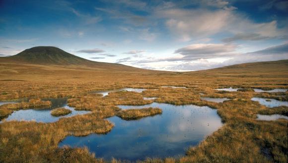
Peatland ACTION sites
Locations where Peatland ACTION restoration work has taken place since 2013. These data will be updated periodically.
- Peatland ACTION completed restoration centroids (available in several formats including CSV, ESRI Shapefile, Geopackage etc.)
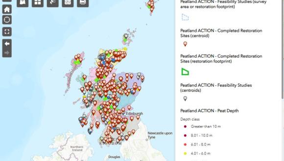
Peat Depth and Condition
Consolidated spatial dataset of peat depth and condition records collected across Scotland. The information is collected during peat depth surveys which are required for NatureScot Peatland ACTION projects. Additional datasets will be added to the database when they become available.
- Peat depth & Peatland Condition (available in several formats including CSV, ESRI Shapefile, Geopackage etc.)
Bare peat
The dataset shows larger expanses of bare peat across Scotland from Sentinel 2 imagery taken in summer 2018. Resolution of 10 m x 10 m Sentinel 2 pixels. This was produced by NatureScot’s GIG Earth Observation team for the Peatland ACTION project to facilitate the identification of areas of exposed peat.
- Scottish bare peat (online app)
- NatureScot Natural Spaces website (Google Earth KML; GML 3.1.1; ESRI shapefile)
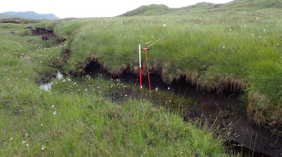
Water table depth
Water table depth monitoring has been undertaken at 35 Peatland ACTION restoration sites across Scotland since 2014. The data for each site can be viewed and downloaded from our Peatland ACTION Hydrology Explorer app. Data collection is ongoing and the app is updated with the latest water table data annually. Peatland ACTION has also funded water table monitoring at Forsinard Flows Nature Reserve in collaboration with the RSPB and at Loch Orasaigh (Isle of Lewis) as part of the Internet of Things.
- Peatland ACTION Hydrology Explorer (Online interactive).
- The raw data (CSV) and associated information is also available on request from the Peatland ACTION data team.
- RSPB Forsinard Flow Nature Reserve - water table depth and vegetation data (zip files)
- Loch Orasaigh Internet of Things (online interactive)
Rainfall
Rainfall has been recorded at 25 Peatland ACTION restoration sites across Scotland since 2014. These data are summarised as total daily rainfall in millimetres. The rain gauges are Lambreich Precipitation sensors with an automatic tipping bucket and a Hobo logger.
Note: some datasets are not continuous since installation due to technical failures.
- Rain gauge locations (CSV dataset)
- Rain gauge data (CSV dataset) available on request from the Peatland ACTION data team.
Vegetation
The effectiveness of Peatland ACTION restoration activities was assessed by monitoring vegetation and other environmental variables. These surveys were carried out on Peatland ACTION sites in 2014 and 2015 to amass a baseline dataset, and again in 2021 to investigate the changes in the intervening period. Sites were selected to include raised bog and blanket bog, and encompassed a range of bog vegetation types and restoration approaches. A total of 1,002 quadrats on 16 sites were surveyed for the baseline survey, and 873 quadrats on 13 sites were surveyed in the repeat survey. The sample areas included restored areas, unrestored control areas and unmodified reference areas. The raw datasets can be downloaded from the report appendices. Appendix 2B in the repeat survey (2021) contains the data from both surveys with one row per replicate (quadrat). The simplified raw data from both surveys is formatted as one row per record.
Our key datasets have been added to ArcGIS Online (AGOL) to provide an interactive map based view. More datasets will be added in the future.
Last updated: