InSAR peatland condition class and condition change - data download portal

Welcome to the InSAR peatland condition class and condition change data download page
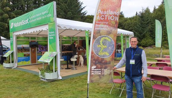
NatureScot Peatland ACTION have funded the development of methods to use interferometric synthetic aperture radar (InSAR) to map the condition and trajectory of change of peatlands at the landscape scale. The work was undertaken by the University of Nottingham and the University of the Highlands and Islands and is detailed in three recently published NatureScot commissioned research reports:
- NatureScot Research Report 1308 Analysis of an InSAR “bog breathing” based classification of peatland condition relative to field observations in Cairnsmore NNR.
- NatureScot Research Report 1355 A summary of surface motion remote sensing methods for the monitoring of peatland.
- NatureScot Research Report 1356 Application of surface motion remote sensing to quantify the condition and trajectory of change of c.680,000 ha of peatland.
In Research Report 1356 the methods are evaluated at the landscape scale with approximately 680,000 ha of Scotland’s peatlands being monitored over an eight-year period. The spatial data outputs of this work can be downloaded for use in GIS software, access to the download portal.
The data is available in three formats:
- CSV file
- GeoPackage
- ESRI file geodatabase
Additional symbology files are available for download for QGIS and ESRI software.
The primary satellite radar data (Sentinel-1) was provided for free by the European Space Agency (ESA). These data were then further processed by Terra Motion Limited and then the University of Nottingham.
Information on what is mapped
It is essential to note that the classification system is not mapping ecological condition but provides measures of condition based on ground motion that results from the combined effects of ecology, hydrology and mechanics. It does not replace detailed assessment of peatland ecology or hydrology condition should specific measures of these parameters be required.
Areas classed as ‘good’ may reflect areas in good ecological condition that do not require restoration work, but the good class also encompasses areas that may contain patches of bare peat with the soft, wet nature of the peat still resulting in a dynamic surface motion. The ‘stiff’ class can also represent the near natural condition on areas with steeper slopes that are naturally well drained or on peatland margins. In flatter areas that collect water, the stiff class may result from artificial drainage.
For detailed information on the classes used, please see the “Conceptual model and classification” section and Table 1 in the associated NatureScot Commissioned Research Report RR1356:
The three classes used and their characteristics are summarised here:
- Degrading:
- sustained subsidence in the trend, possibly at variable rates, with or without evidence of seasonal oscillations
- active subsidence due to loss of water and/or oxidation of the peat and/or active erosion
- vegetation will change as water table depths deepen, with shrub (e.g. Calluna vulgaris) or scrub (e.g. Betula spp., Pinus contorta, Picea sitchensis) becoming increasingly dominant. The characteristic surface motion signals are based on those that correspond to areas of actively draining, clear-felled, and eroding sites.
- Good:
- dynamic surface swelling in winter in response to water storage in soft spongy peat
- the multi-annual trend in the surface level is stable or rising
- indicative of resilient behaviour as the surface can adapt to the position of the water table
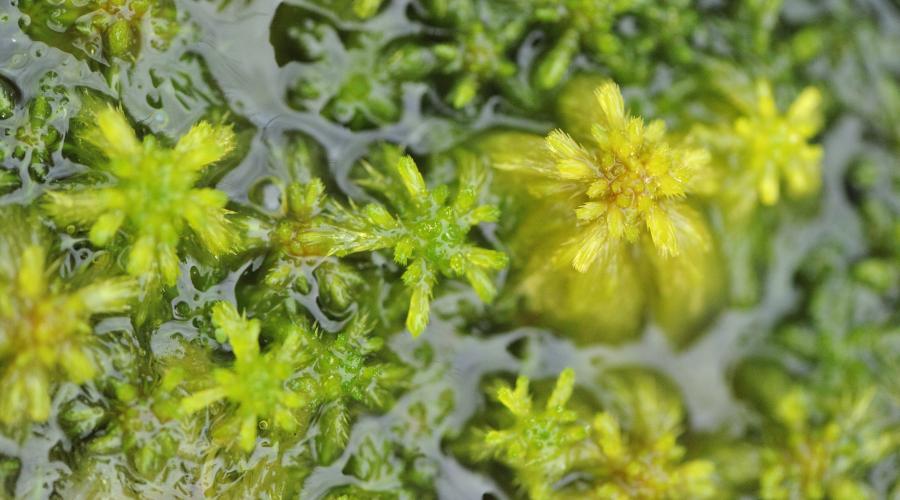
- near natural or rewetted peatland with a shallow water table and soft to spongy surface, e.g. near natural sphagnum peat
- if not in good ecological condition (e.g. wet gully bases) these areas are likely to be more responsive to restoration on account of their natural tendency to hold water.
- Stiff:
- the multi-annual trend in the surface level is stable
- non-dynamic surface indicative of stiff consolidated peat
- typical of well drained environments and the later stage of degradation (when peat has consolidated) including areas of upland peat that have experienced long-term erosion
- likely to have a vegetation layer dominated by shrub or grasses.
Potential uses of the data
The report has shown how the data can be used to monitor peatland response to restoration and infrastructure. With further analyses this could lead to better restoration design in future projects. The data could also potentially be used to prioritise areas for restoration or monitor how peatlands are responding to climate change.
FAQs
What is the relationship of the classification to water table depth?
While there is no doubt that a sustained shallow water table is a characteristic of peat in good condition the classification is based on the mechanical behaviour associated with sustained shallow water table depths. An example of a contradiction that can arise is when restoration produces a shallow water table in stiff peat and dynamic surface motion has yet to establish. The question is really whether this peat should be in good condition or not. In our definition the peat would be classed as stiff and only classed as good when resilient mechanical behaviour (i.e. a return of seasonal oscillations) is established.
Is stiff peat a near natural condition or the result of degradation?
This very much depends on the situation within a landscape. In areas that are naturally well drained e.g. steeper slopes and margins, stiff peat is the near natural condition and, in this setting, would be an appropriate target state following restoration. Whereas in flatter central parts of the peatlands that should be poorly drained, stiff peat is indicative of past degradation (e.g. drainage) leading to consolidation.
Why are areas of eroding upland peat which we know are degraded often classified as stiff, or even good, rather than degrading?
Areas of eroding upland peat often consist of peat hags and gullies. If the erosion is long-established the hags will be stiff, consolidated and covered in shrub. This has been proven by direct measurement in the field (Marshall et al., 2022). The gully bases on the other hand will be wet, may contain bare peat, be in variably vegetated condition and may contain peat that is re-establishing. It is the relative contribution of hags and gullies to the overall signal from the 20 x 20 m area that will determine the classification. In areas that are classed as good, the gullies will be swelling in winter in response to water storage, and this classification suggests predisposition to restoration.
How big an impact does annual weather patterns have on the results?
Annual weather patterns cause the peat surface motion to vary, for example droughts lead to greater subsidence and irreversible compaction of the peat and the better the condition the greater the short-term response. Antecedent conditions also affect the surface motion, for example it took two years for some areas of near natural peat to recover their natural dynamic behaviour following the 2018 drought. This is important as it provides the natural context in which restoration progress needs to be measured. Restoration areas also display a strong weather response. For example, comparing a large number of restoration sites on the Whitelee Windfarm (Mitchell et al., 2025) it has been shown that traditional drain blocking techniques that generate more open water display larger weather driven fluctuations in surface motion (probably on account of evaporation from pools) than wave damming techniques which show little negative change in response to the same periods of dry weather.
Why does negative change sometimes occur following restoration?
Restoration is initially a disruptive process that can modify the structure of the peat and compress the peat. This is even more extreme in areas of ground smoothing as part of forest to bog restoration, where a bare peat surface is initially exposed, and a positive response may be delayed for a few years until bog vegetation is established. It is therefore not unusual to observed negative change shortly after restoration work.
Sometimes the trajectory of change and change in condition appear to be contradictory i.e. the overall trajectory of change can be positive but the condition changes from good to stiff or vice versa; why?
A change in condition from stiff to good means it has started oscillating in the winter and vice versa. Positive change, as measured using the change detection method, either means the trend has started to swell or that rates of subsidence have reduced and vice versa. By putting these two pieces of information together you can deduce the nature of the change. For example, a change in condition from stiff to good means that the surface has become more dynamic, but this need not necessarily be accompanied by a marked change in the long-term trend. This situation may occur over rewetted thin peat or where rewetting produces a thin dynamic surface layer over stiff peat with limited capacity for sustained long-term swelling. A change from good to stiff could be accompanied by a positive trajectory when deep rewetting causes peat in good condition which has been compacted during restoration to swell without creating a seasonally dynamic surface.
Last updated: