Nature30 - How to nominate
Nominate your area for Nature30 recognition.
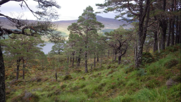
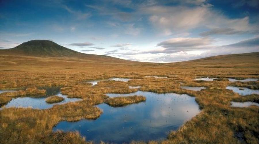
Do you own or manage land or fresh water that contributes to conservation efforts?
Nominate your land
If you wish to nominate an area of land that you own or manage for Nature30 assessment and recognition, please complete and submit the Nomination Form to [email protected].
There is no closing date for nominations, NatureScot is open to receive applications at any time.
The nomination form outlines the criteria that need to be met, the corresponding questions you’ll need to answer and the expectations on those managing Nature30 sites. It also provides supportive guidance the details/evidence you may wish to provide.
Given the wide breadth in areas that could be a Nature30 site, we’ve done our best to provide clarity on questions without providing so much information that it becomes unrealistic for users to read and so unhelpful.
NatureScot are keen to support those interested in nominating a site and can provide help in filling in a Nomination Form. Please get in touch if you would like to discuss eligibility, or if you have any questions regarding the criteria or evidence needed to demonstrate how you meet them.
The Nomination Form and supporting guidance has been created in consultation with a Stakeholder Group and pilot sites to ensure it works for Scotland. We may continue to adjust the process or documentation in response to further feedback from applicants. The criteria and questions will remain, but guidance may evolve.
View and download the latest version of the Nature30 Nomination Form.
Contact us
If you have any queries about Nature30, please email [email protected]. Alternatively, do get in touch with your local NatureScot Officer.
Data Privacy Notice
What Kind of Data We Collect and why
Personal Data
- Name and primary email address - to ensure we have a point of contact for correspondence regarding the nomination of a site
Other data we collect
- Site name: to ensure the recognised site is identifiable in assessment and recognition
- Site boundary (including size): A Nature30 site must have a site boundary to qualify
- Other site details: Additional evidence, such as land management plan, may be provided to ensure the site meets the Nature30 criteria
How we obtain your personal data
The personal data is gathered directly from you during one or more of the methods below:
- You submit the information via the nomination form
- You submit the information as supporting evidence as part of the nomination process
How we use your personal data
NatureScot uses the data submitted by you to:
- To determine whether the site meets, and continue to meets, the criteria to be recognised as a Nature30 site and contribute to the 30 by 30 target.
When and why, we share your personal information
- We may share personal data with individuals for the purpose of assisting us in assessment such as assessment panel members.
- Site name, boundary, biodiversity value, governance type and summary of the site will be shared publicly on the national database for protected areas. This will also be publicly available through NatureScot data downloads (spatial data hub) and NatureScot’s SiteLink.
- Recognised sites contribute to the UK target for 30 by 30 and therefore the international target for 30 by 30. Therefore, the above data will be shared with the JNCC for UK level reporting, and publicly available on, the World Database for OECMs; site name, boundary, governance type, and year of recognition.
Our legal basis for using your personal data
We must process your personal data so we can carry out our duties for natural heritage and the 30 by 30 target and as a result we are processing your data for the performance of a task carried out in the public interest.
This means you have the right to:
- Ask for copies of information about you and be told why we’re using it.
- Have incorrect information about you corrected.
- Object to your information being used by NatureScot because of your specific situation.
- Restrict our use of information about you where:
- we are using incorrect information
- our use of your information is unlawful and you want us to restrict its use rather than delete it
- NatureScot doesn’t need your information any more but you need it for legal action
- you have the right to object to information and you are using that right
Your Personal Data Rights
- Ask for copies of information about you and be told why we’re using it;
- Have incorrect information about you corrected;
- Object to your information being used by NatureScot because of your specific situation;
- Restrict our use of information about you where:
- we are using incorrect information;
- our use of your information is unlawful and you want us to restrict its use rather than delete it;
- NatureScot doesn’t need your information any more but you need it for legal action;
- you have the right to object to information, and you are using that right.
More information on your rights is available on the Your Personal Data Rights page.
The UK Information Commissioner also has more information about your rights on their website.
Subject Access Requests
To make a request please write/email the Data Protection Officer, NatureScot, Battleby, Redgorton, Perth, PH1 3EW [email protected] giving us your name and contact details and a description of the data you want to see. We will respond as soon as we can and by 30 days after your request at the latest. We might ask you to provide some form of identification so we don't give data about you to the wrong person by mistake.
How long we keep your data
We will keep your data for the duration of the nomination process until a decision has been made on recognition.
If the site is successful in recognition, we will keep your data for the duration the site is recognised. Recognition may be stopped on the request of NatureScot or the site owner.
If the site is not successful in recognition, we will keep the data until the applicant makes it clear they are no longer interested in being recognised.
If NatureScot is unsure on the landowners intention (eg. We have not received communications for 6 months). We will delete data after 2 years from the last saved communication.
How we are keeping your data secure
NatureScot aims to protect your personal information through a system of organisational and technical security measures. NatureScot will ensure that:
- All personal individual contact data is only used for the purposes specified.
- Data is stored securely within the platform which has been penetration tested and meets the criteria specified within the National Cyber Security Centre 14 Cloud Security Principles assessment.
- Data is stored in a secure manner with the required safety tests carried out and is processed and stored in an accurate and reliable manner. This means that data will be recorded as provided by users. Once entered into the system, safeguards will be in place to prevent loss, corruption, or unauthorised modification of data.
- Regular backups will be maintained to ensure data can be restored in the event of system failure or data loss. Data accuracy is maintained through secure storage practices, periodic system reviews, and compliance with relevant data protection and environmental monitoring standards.
- All NatureScot laptops are managed and encrypted.
- Users require a Corporate account and a valid username and password to access the laptop and network resources.
- User-based access control are implemented to ensure staff have the correct levels of access to the data.
- The database that houses the results of assessments, user data and user authentication is currently hosted in the UK.
Complaints and customer care
We're committed to providing you with an excellent service and your views and feedback are really important to us. If something goes wrong or you are dissatisfied with our services, please tell us so we can try to put things right for you. We welcome compliments as well.
For further information, please visit our customer care page.
Guidance for Submitting Spatial Data
***Where you do not have access to mapping software or expertise NatureScot are able to help, please just let us know.***
As the spatial dataset showing the boundary of your area will, for transparency reasons, be made publicly available it must be free from any licensing restrictions that could prevent publication.
If you are able to provide your own spatial boundary data then the information below outlines how/when we are able to use this.
If you are not able to provide a digital boundary then NatureScot are able to support and digitise drawn boundaries.
1. File formats we accept
- Preferred formats:
- ESRI Shapefile (.shp, .shx, .dbf, .prj – all files together in a zipped folder)
- GeoPackage (.gpkg)
- GeoJSON (.geojson)
- The data must be vector polygon(s) representing the boundary.
- Include the correct coordinate reference system (CRS) – we recommend British National Grid (EPSG:27700) or WGS84 (EPSG:4326).
2. Licensing requirements
Your submitted data must be legally publishable as open data.
That means:
- It must not be directly copied or digitised from mapping products or datasets that have restrictive licenses (e.g., Ordnance Survey MasterMap, OS OpenData with attribution but not allowing relicensing, aerial photography under restrictive licence).
- If it is based on licensed data, you must:
- Have explicit permission from the rights holder to release the derived data under an open licence.
- Provide proof of that permission (e.g., a copy of the licence or written confirmation).
- Wherever possible, use only open-source or public-domain base maps for creating your boundaries (e.g., OpenStreetMap, aerial imagery released under an open licence, your own GPS survey).
3. Open licence declaration
- You must agree that the boundary data you submit will be published under the Open Government Licence (OGL).
- Your submission should include the statement:
“I confirm that this dataset is free from third-party rights and may be published under the Open Government Licence.”
4. How to create compliant boundary data
If you are drawing the boundary yourself:
- Use open data as a background (e.g., OpenStreetMap layers, satellite imagery from providers like ESRI World Imagery if licence permits open publication).
- Use GPS survey data collected by you or your contractor.
- Avoid using restricted datasets like Ordnance Survey MasterMap unless you have confirmed rights to publish.
5. Submitting your data
- Email your zipped shapefile/GeoPackage/GeoJSON to [email protected]
- Include the licence declaration and (if applicable) permission evidence.
6. What happens next
- We will check the data for format, quality, and licensing compliance.
- If your dataset does not meet these guidelines, we will return it for correction.
- Approved datasets will be published on NatureScot’s open data portal / sitelink.
Example statement for applicants to include:
I, [name], confirm that the attached spatial dataset, “[Site Name] boundary”, is free from third-party rights, is not derived from restricted-licence mapping data, and may be published by NatureScot under the Open Government Licence.
Contacts
30x30
Last updated: