Sea-level history
Changing sea levels over the last 20,000 years have had a remarkable effect on the shape of Scotland’s coastline.
Sea-level highs and lows
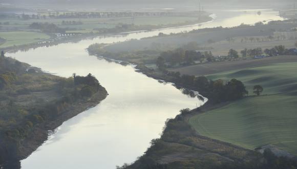
Sea levels in Central Scotland were at their highest around 20,000 years ago as the ice was melting and the land was still depressed.
They then fell for a time, but rose again between about 9,500 and 6,500 years ago, when areas such as the Carse of Stirling, Carse of Gowrie and the lower Clyde were extended marine inlets.
Later, rebound of the land overtook global sea-level rise and the coastline emerged once more.
Effects of glaciation
Scotland’s last ice sheet began to melt about 20,000 years ago. It released vast amounts of water back into the world’s oceans, as did other northern hemisphere ice caps.
This had two effects:
- global sea level rose
- the land that was no longer depressed by the ice rebounded upwards
The interplay between these two effects has driven changes in relative sea level around Scotland’s coastline.
This has resulted in:
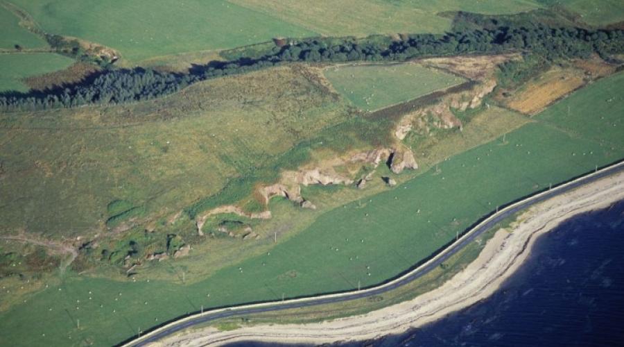
- Scotland’s interior being raised above sea level over the last few thousand years – e.g. Arran
- the coastline of more peripheral areas being submerged below sea level – e.g. South Uist
To find out what’s happening now, read about present and future sea levels.
Last updated: