NatureScot Research Report 1381 - Deer Vehicle Collisions - a review of mitigation measures and their effectiveness - applying the findings at a site-specific scale
Published: 2025
Authors: Langbein, J. (Langbein Wildlife Associates)
Cite as: Langbein, J. 2025. Deer Vehicle Collisions - a review of mitigation measures and their effectiveness - applying the findings at a site-specific scale. NatureScot Research Report 1381.
Contents
- Keywords
- Background
- Main findings
- Acknowledgements
- Abbreviations
- Introduction
- Methods
- Results
- Discussion of site visit findings
-
Potential mitigation options
- Constraints and opportunities in the trunk road environment
- Approaches to mitigation: Major interchanges and roundabouts
- Approaches to mitigation: Single carriageway trunk roads
- Evaluation of suitability of measures in a local context
- Combinations of potential mitigation measures by site
- Measures not thought suitable for the selected locations
- Monitoring the effectiveness of a DVC strategy
- Conclusions
- References
- Annexes
Keywords
deer vehicle collision; wildlife vehicle collision; mitigation; Scottish road network
Background
NatureScot and Transport Scotland together commissioned a report reviewing deer-vehicle collision (DVC) mitigation measures at an international scale and providing an assessment of their efficacy and cost effectiveness.
In an extension of that project, they set out to investigate what might be the potentially most suitable mitigation options at a site-specific scale. Three major trunk road interchanges previously identified as DVC hotspots in Central Scotland, and a fourth DVC hotspot in the Highlands were chosen as the focus for this work. The aim was to help identify mitigation options for possible implementation at these and other comparable locations on the Scottish road network.
Assessments included desk top reviews of past numbers and seasonality of DVC records near each site, consultation with adjoining landholders regarding their deer management, and walk-over visits to each of the four trunk road hotspots. Additionally, in the case of the Highland location, visits to neighbouring sections of road where concerns over DVCs had been raised by local residents were also made.
Main findings
- Site-specific seasonal patterns of DVCs will help determine the appropriate timing for mitigation measures such as deployment of mobile variable message signs (VMS) or control of deer numbers on land neighbouring the trunk road estate.
- A seasonal peak in DVC incidents occurred from late spring to early summer at the two motorway interchanges in the Central Belt, and in late autumn at the A9 in East Sutherland. At the A82 site, DVCs were distributed more widely throughout the year.
- Year-to-year variation in DVCs was greatest at the multi-lane interchanges in the Central Belt. The cyclical nature of DVC occurrence, with peaks approximately every four to five years at those sites, may be related to the small home range sizes of roe deer; high DVC tolls one year leading to several years of lower roe density and fewer DVCs at that locality until the population recovers through births or immigration.
- To better accommodate the high level of annual variation in DVCs within individual sites, a more stratified approach to hotspot analysis, based on five or more years of DVC data rather than three years and accounting for differences in under-reporting of DVCs between areas of high human population and more remote regions, and between multi-lane and single-carriageway trunk roads, is recommended.
- Three major road interchanges in the Central Belt enclosed large areas of dense scrub, woodland, and high rough grassland. Many of these vegetated 'islands' provide cover and food readily sufficient to attract and sustain several deer throughout spring and summer, leading to seasonal rather than year-round occupancy.
- High levels of red deer road-crossing activity, primarily during hours of darkness, were confirmed at several sections of the A9 Lothbeg to Ord of Caithness, with animals accessing grazing on the southbound side from holding cover to the north.
- A single mitigation measure used in isolation is unlikely to lead to a sustained reduction in DVCs. Best results are likely to be achieved through combining a range of complementary measures, including engagement with, and cooperation from neighbouring landowners/ managers.
- For most DVC hotspots, the mitigation strategy will feature vegetation management to reduce the attractiveness of an area and/or to increase visibility.
- Deployment of temporary VMS should be considered where DVC occurrence shows distinctive seasonal peaks. This should be activated from dusk to dawn when deer tend to be most active.
- Sections of the A9 study site offer good opportunities for a trial of Roadside Animal Detection Systems (RADS).
- DVC mitigation strategies should include monitoring schemes for assessing the effectiveness of the site-specific measures taken. The collation of data relating to the implementation of mitigation measures across the Scottish road network would be invaluable for informing future country-specific mitigation strategies.
Acknowledgements
The author would like to thank NatureScot and Transport Scotland for funding this work, and for advice and support throughout by in particular Dominic Sargent (NatureScot project lead). Many thanks are due also to Kevin McCulloch and David Shaw (NatureScot), Angus Corby (Transport Scotland), Peter Wrigley and Vivienne Reijnen (BEAR Scotland Ltd.) and Craig McGarvie and Clare Murray (AMEY) for facilitating access, useful discussions and assistance during site visits. Thanks also to Mike Lush (Idox Ltd.) for arranging access to GIS DVC data, and to Rory Putman, co-author of our earlier DVC mitigation literature review that led up to and helped inform the present work.
Abbreviations
Deer Management Group (DMG)
Deer Vehicle Collision (DVC)
Roadside Animal Detection System (RADS)
Trunk Road Operating Company (TROC)
Variable Message Sign (VMS)
Wildlife Management Officer (WMO)
Wildlife Vehicle Collision (WVC)
Introduction
Rising traffic volumes combined with range expansion of the four deer species living wild in Scotland over the past two decades have led to deer-vehicle collisions (DVCs) becoming increasingly common, not just in rural but also peri-urban and even some urban parts of Scotland.
NatureScot and Transport Scotland have been monitoring annual trends in numbers and distribution of DVCs for many years (Langbein & Putman, 2006; Langbein, 2011, 2019; Lush and Lush, 2023). The trunk road and motorway network, which carries 35% of all traffic and 60% of heavy goods vehicles in Scotland (Transport Scotland, 2024), has formed one particularly important aspect throughout the national DVC monitoring work. The Scottish trunk road network connects Scotland's major cities, towns, airports and ports and is hugely diverse. Motorways and other dual carriageways (including slip roads and roundabouts) constitute only 38% of the total length of the Scottish trunk road network, with the remaining 62% (2,307 km) comprising single carriageway A-roads (see Transport Scotland, 2020 for full breakdown).
As an extension to a recent NatureScot and Transport Scotland-commissioned report reviewing deer vehicle collision (DVC) mitigation measures at an international scale and providing an assessment of their efficacy and cost effectiveness (Putman and Langbein, 2024), a project investigating potentially suitable mitigation options at a site-specific scale was undertaken. This work has focussed on three major trunk road interchanges identified as DVC hotspots in Central Scotland and a fourth hotspot in the Highlands.
The aim of the project was to help identify possible mitigation options or combined strategies of measures for implementation at the specific sample sites studied, and for other comparable locations on the Scottish road network.
Motorway and dual carriageway interchange DVC hotspots
Analysis of DVC risk along differing parts of the Scottish trunk road network (Lush and Lush, 2023) indicated that a very high proportion of the hotspots identified are associated with major road junctions along motorways and other dual carriageways. In fact, nine out of the ten top hotspots based on 2019 to 2022 data related to such trunk road interchanges in the Central Belt of Scotland.
Earlier work carried out in England (Langbein, 2011b; Nelli et al., 2018) similarly found many of the trunk road locations with highest overall DVC incidence to be located near roundabouts and slip roads adjacent to expanses of dense woody scrub cover. Some level of increase in overall numbers of DVCs near interchanges might be predicted based purely on the greater combined road length and traffic concentrated at interchanges. However, during past field investigations at DVC hotspots, for example in Hampshire and Devon (Enterprise Mouchel, 2013; Kier 2018) and in Dunbartonshire (Langbein, 2005), surprisingly high levels of deer activity were often recorded in scrub and woodland habitats on land within roundabouts and between slip roads and the main carriageways at trunk road interchanges.
A key factor likely to be responsible for the high frequency of collisions at major interchanges is that these commonly include islands of woody scrub habitat surrounded by tarmac on all sides, defining areas within which there is very limited public disturbance, not least by dog walkers or other people on foot. Such areas are commonly planted for landscape purposes and unless vegetation within them is regularly cut back, secondarily develop substantial areas of trees and scrub. With the combination of good cover and lack of human disturbance such wooded islands may unintentionally develop into refuges that deer and other wildlife will seek out for shelter either seasonally or for cover in daytime, especially from late spring onwards when they offer most cover and browse.
Whilst removing scrub and maintaining islands of land at interchanges free of cover might appear an obvious solution to reducing DVCs, tree and scrub cover in such areas usually forms an important part of landscaping and noise mitigation. In the context of the twin crises of climate change and nature loss, vegetation along roads can also form an important element in wider habitat connectivity and enhancing biodiversity. The temporal pattern and extent to which deer will utilise these areas will also be very site specific, influenced not only by habitats present within the interchanges but also by the expanse of other nearby deer habitats and management on surrounding land. Therefore, three of the nine hotspots identified at major trunk road interchanges were chosen for closer site-specific assessments, including a look at how local characteristics and the potential for possible mitigation measures differed between them.
Single carriageway DVC hotspots
Islands of land surrounded by tarmac at major motorway or dual carriageway junctions and interchanges that offer secluded cover to deer, are known to contribute to such areas often becoming DVC hotspots. Countrywide, however, an overall higher proportion of the total numbers of DVCs is recorded along single carriageway A-roads, especially in areas lying outside the relatively heavily populated Central Belt of Scotland. The fact that rather fewer high ranking hotspots have been identified by past analysis on this road type is likely to be due to a combination of several factors; including among others, a greater degree of under-reporting of DVCs (see also DCS carcass surveys, in Langbein, 2011), and less-localised concentrations of DVCs year on year within the relatively short sections (<1 km) of road used to define hotspots. To enable a comparative assessment of the site conditions and evaluation of the potential for differing mitigation also for a single carriageway trunk road situation, the fourth site selected for inclusion in the present study is the A9 near Navidale in the Highlands, which also ranked among the top ten hotspots in the earlier study.
Methods
Study sites and approach
The four sites chosen for closer assessment were selected from the list of ten DVC hotspots identified by the DVC 2019 to 2021 analysis report and were as follows:
- M9 East of Pirnhall interchange (hereafter referred to as M9)
- M8 North and West of Livingston interchange (hereafter referred to as M8)
- A82 Renton junction (hereafter referred to as A82)
- A9 Navidale (extended to Lothbeg to Ord of Caithness)*
*Note that in response to feedback from local residents relating to mitigation in the form of temporary variable message signs at Navidale in November 2024 (see press release NatureScot, 2024), assessments there were extended to cover a longer 15 km section of the A9 from Lothbeg to Ord of Caithness (hereafter that full section referred to as A9).
In Lush and Lush (2023) hotspot analysis was based on the most recent three years of DVC data for the trunk road network and used to identify those relatively short individual sections of road (c.500 m) with the overall highest DVC risk indices (as shown on the hyperlinked hotspot maps above). Whilst such analysis is useful in highlighting areas at overall greatest risk, mitigation focussed solely on such short road sections (e.g. using fencing or scrub clearance) would in most instances be expected to lead to a shift of local deer road crossing activity rather than an overall reduction of collision risk.
For this more detailed site-specific investigation, assessments were therefore extended to cover a wider area around each hotspot.
Main tasks included:
- A review of annual and monthly variation in DVC records available for the past 15 years within a 1.5 km radius of each of the three hotspots at interchanges in the Central Belt. In the case of the A9, the entire 15 km stretch between Lothbeg to Ord of Caithness was included for all assessments.
- Discussions with landholders of significant areas of potential deer habitat adjacent to the three Central Belt interchanges, regarding their present deer management.
- Arranging access and consultation with trunk road operating company staff regarding any specific local constraints or planned works.
- Walk-over visits to each site to obtain a general impression of the extent of habitats, topography, existing fencing and recent signs of deer activity.
- At the A9 site only, a thermal imaging survey at night to obtain additional information on deer activity in areas close to the A9 at night.
- Proposing individual or combinations of mitigation options likely to be suitable and commenting on other measures not thought appropriate for inclusion in each site-specific context.
Review and analysis of past DVC data by site
Following inspection of the hotspot maps produced for each of the sites on the basis of 2019-2021 data only (Lush and Lush, 2023), for reasons outlined above it was decided to extend the review of past DVC records to assess annual and seasonal variation over a longer period of years, and for wider areas around each hotspot.
DVC records have been recorded on behalf of NatureScot by the national DVC data collation project in a reasonably consistent manner ever since 2008 through to the present time (Langbein, 2011, 2019; Lush and Lush, 2023). The great majority of these records on the trunk road network come from wildlife casualty logs provided to the project by Transport Scotland’s trunk road operating companies. Although the author of this report oversaw the Scottish DVC data collation himself between 2008-2018, access to the fuller current DVC Scotland database through to December 2023, including to latest updates to GIS analysis and mapping facilities, was provided by Idox Ltd. This enabled ready extraction of all WVC (Wildlife Vehicle Collison) records from the full database for each site, including information on the reporting organisation, animal type stated and dates. The great majority (>95%) of records in the database related to DVCs. Non-deer reports retained in the database since 2019, such as for badgers and fox road kills, were also assessed.
Consultation on deer management with neighbouring landholders
Preliminary consultation and visits to several adjoining large landholders with substantial areas of potential deer habitats close to the three Central Belt sites of interest were undertaken by a NatureScot wildlife management officer (WMO) in the lead-up to this project. This was done to gather background information on the nature of existing deer management activities in nearby woodland and other habitats. In addition, walk-over site inspections of accessible areas were undertaken by the WMO to help determine whether deer culling would likely to be feasible from a public safety perspective on areas of land where no or little active deer management was being undertaken.
For the A9, the locally based WMO assisting with the present study was already in touch regularly with many of the landholders and aware of past and present deer management activity via reports from the East Sutherland Deer Management Group.
Arranging site access
M9 Pirnhall and M8 Livingston fall within the Southeast Scotland area of the trunk road network managed on behalf of Transport Scotland by BEAR Scotland Ltd. The A9 site falls within the Northwest area of the trunk road network and is also managed on behalf of Transport Scotland by BEAR Scotland Ltd. (hereafter referred to as BEAR).
A82 Renton falls within the Southwest Scotland area of the trunk road network, which is managed on behalf of Transport Scotland by AMEY.
For reasons of personal and traffic safety, permission for direct access on foot to sites within the trunk road network require prior arrangement with the relevant trunk road operating company (TROC). All necessary site-specific risk assessments and safety inductions were arranged with the Environment Teams at BEAR and AMEY, with invites to join one or more site visits extended to appropriate members of staff from NatureScot, Transport Scotland and the TROCs.
Walk-over site visits: Central Belt trunk road interchanges
Site visits to the M9 and M8 were arranged for 22nd August 2024 and to the A82 for 23rd August 2024. In each case the areas considered to be of primary interest to visit on foot (mostly islands of land surrounded by roads at roundabouts and slip roads) were discussed in advance with the trunk operating company environment team, and approximate routes planned by them accordingly. In addition to the DVC consultant, each site visit was accompanied by a member of BEAR (M8 and M9 sites) or AMEY (A82 site) staff, and one or two members of NatureScot staff; in addition, Transport Scotland’s Landscape and Biodiversity Manager was able to join the first site visit. Approximately two to three hours were scheduled for each site visit. Sites visits were not intended to be comprehensive surveys, but a general walk-over aimed at obtaining a general impression of the extent to which habitats within the road interchanges offer suitable cover for deer; as well as of the topography, present boundary fencing, roadside safety (crash) barriers and other road furniture.
Site visits and survey work along A9 Lothbeg to Ord of Caithness
Site visits to the A9 were made over three days from 21st to 23rd January 2025, and included:
- Daytime walk-over survey along the verges of the A9 for almost the entire length between Lothbeg and Ord of Caithness, split into sub-sections covered on different days. Some short sections, and one longer one of 750 m with very narrow verges on the northbound side of Portgower were excluded from the walk-over for safety reasons. On the first day of survey walks the DVC consultant was accompanied by an ecologist from BEAR and NatureScot’s DVC project lead, to exchange ideas on past and future management options; and on the second day by the regional NatureScot WMO.
- A nighttime vehicle-based thermal imaging survey undertaken between 21.00 hrs. and 23.30 hrs. on 21st January was led by the WMO accompanied by the DVC consultant and NatureScot’s DVC project lead. The thermal-imaging binoculars used enabled detection and identification of medium to large mammals during darkness based on their heat signature at over 1000 m. Survey was undertaken mostly by the passengers both from the vehicle whilst driven at moderate speed, and when stopped to scan over wider areas from laybys wherever safe parking was available. Areas covered during the survey encompassed all of the A9 site, as well as a number of side roads used to gain closer views across land up to about 1000 m from the trunk road.
- Enquiries were also made with local ScotRail staff regarding any available information on numbers of deer hit or killed on the railway line that runs parallel and close to the A9 from Golspie to Helmsdale.
Results
Site-specific DVC reports by year and seasons
The four trunk road sites selected for closer investigation were chosen from among the top ten hotspots highlighted by analyses in the DVC 2019–2021 analysis report. However, rather than limiting assessment of past DVCs only to the small clusters of incidents that contributed to those sites being among the hotspots, for the present assessments the study areas were in each case extended, to encompass all DVC records available within 1.5 km of the centre of each of the three interchanges in the Central Belt, and for throughout a 15 km section of the A9 site (as outlined in more detail in the earlier Methods section).
To provide insights into the extent of variation in numbers of DVCs between years and seasons, initially records for throughout the past 16 years (2008 to 2023) were considered. The numbers of mapped DVC records per site ranged from 81 to 140 over that full period, and from 43 to 66 per site when considering only the most recent five complete years of data (2019 to 2023). In addition, any other WVCs involving e.g. badger, fox or other animal types retained in the national DVC monitoring database were also reviewed.
It should be noted that it is an unknown proportion of the true total of annual DVCs that are likely to be reported. Furthermore, that proportion will vary between different road types (motorways, dual carriageway, single carriageway) and regions within the Scottish trunk road network, as has previously been shown by comparing results of regular roadside carcass surveys to reports logged by TROCs (see Langbein, 2011, pp. 25-29). Overall, a higher proportion of animal roadkill is likely to be reported to the trunk road agents in the Central Belt, as there are overall far greater numbers of potential drivers and passengers that may see and report an animal on the road. The three Central Belt sites (M9, M8, A82) each carry in excess of 10-fold the average daily traffic flow (> 30,000 vehicles for M9 and A82; and > 70,000 for M8) compared to the A9 (c. 3000 vehicles) (DfT Road Traffic Stats 2023, online). On multi-lane roads with high traffic flow animals are also less likely to be moved into the verge or out of sight by the public due to greater difficulty of stopping safely than on single carriageways of less traffic flow. Nevertheless, within a local region, records available for a given road should provide a relatively consistent and representative sample of annual and seasonal variation.
Deer species and other animals reported
Review of national deer distribution maps as well as discussion with NatureScot WMOs indicated that roe deer Capreolus capreolus are the predominant if not only species of deer regularly recorded in the vicinity of the three Central Belt study sites over recent years. On the A9 in East Sutherland the principal deer species encountered is the red deer Cervus elaphus, but roe are also known to be present in lower numbers.
Most DVC reports obtained from trunk road companies state simply ‘deer’ as the animal type and rarely include detail of the deer species. The only exceptions where DVC reports stated fallow or red deer were as follows: M8 Livingston, one fallow in 2016 and two fallow in 2019; A82, one fallow and one red, both in 2022. In the case of the A9 site, red deer have been predominant species noted in the available roadkill records.
The reliability of deer species identification when reported is difficult to judge as familiarity with deer species is likely to vary widely between trunk road operating company staff involved in reporting and removing animal carcasses from the carriageway, or where calls are simply noted by network call centres. It appears from available records that there is a possibility that fallow and red deer may occur near the M8 interchange and A82 junction occasionally; hence, when further consultation is undertaken with adjoining landholders, it would be worth enquiring whether deer species other than roe are indeed ever seen locally.
In the latest GIS DVC Database for Scotland, incidents with species other than deer have only been retained since 2019. For the four study sites during the past five years the following non-deer WVCs were noted:
- M9 Pirnhall interchange: 10 badgers (of which three on M9, seven on M80).
- M8 Livingston interchange: five badgers, two red fox.
- A82 Renton junction: one fox, one dog.
- A9 Lothbeg – Ord of Caithness: one badger.
Although badger incidents have to date only been recorded in low numbers other than at M9/M80, from the point of view of mitigation measures, this is significant. Wherever deer fencing forms part of a mitigation proposal where badger presence is also known, the inclusion of badger gates and burying the bottom part of netting below ground level should be considered.
Variation in frequency of DVCs between years
M9 Pirnhall interchange, M8 Livingston interchange, A82 Renton junction
Figure 1 illustrates considerable year to year variation in the numbers of DVCs recorded at all three of the major trunk road interchanges/ junctions:
- in the vicinity of the M9 Pirnhall interchange recorded DVCs show an almost cyclical pattern with a peak every five to seven years. A large overall increase is apparent from 2020 onwards.
- near the A82 Renton junction years of high DVC incidents also appear to be followed by one or two years of lower numbers before rising again. There a more gradual increasing trend is notable from 2016 onwards.
- at the M8 Livingston interchange a lower level of variation is apparent until a large rise during 2020, followed by two years of lower incidents before rising again in 2023.
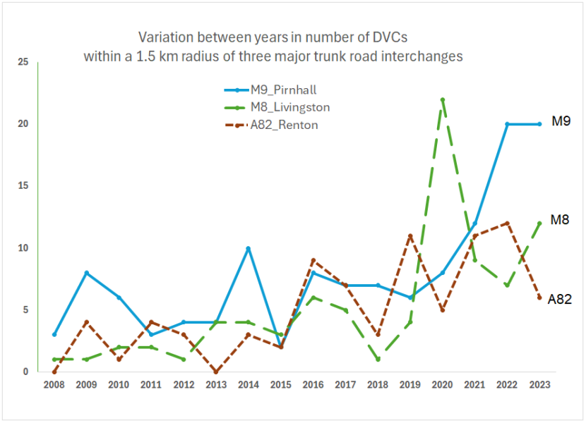
Figure 1. Variation in the number of DVCs reported between 2008 and 2023 inclusive within a radius of 1.5 km of a central point at each road interchange.
Click for a full description
Line graph showing numbers of DVCs recorded per year for three trunk road interchanges in the Central Belt between 2008 and 2023 inclusive. Separate lines are shown for the M9 site (blue, continuous), M8 (green, long dashed) and A82 (dark red, short dashed). Totals shown include DVCs mapped on all trunk roads and slip roads, as well as other roads where they fall within the assessment radius.
Reviewing annual variation of DVCs over an extended historical period was considered important here, particularly for the above areas in the Central Belt, where roe deer predominate with only occasional sightings of other deer species. Roe deer DVCs and indeed roe deer numbers overall have previously been found to show significant inherent variation across years (Voss, 2007; Putman and Langbein, 2024). Their overall population density and development will commonly reflect changes in habitat conditions, with e.g. a build-up of high numbers in thicket stage plantation woodlands followed by a decline when plantations mature, are thinned and scrub removed. In addition to such habitat effects, however, as a result of home ranges of roe deer being relatively small (averaging 70 ha year-round in mixed farm and woodland landscapes but smaller still within each season, Hewison and Staines, 2008), in areas of moderate roe deer density a high localised incidence of DVCs in one year (that may remove a whole family group, either through does and kids being hit, or early kid mortality after a doe being killed) may lead directly to lower DVC incidence near that locality for the following year or two.
Given the high level of variation in the number of roe deer DVCs between individual years, consideration should be given to basing future identification of hotspots, especially within the Central Belt, on a longer period of DVC data; say five or maybe even six years, rather than just three years. In areas where red or fallow deer predominate this may be of lesser importance. However, as roe are present throughout all of Scotland, it may be appropriate using data for more than three years for DVC hotspot analysis throughout the country.
A9 Lothbeg to Ord of Caithness
The above cyclical trends in DVCs apparent when considering several years tend to be less notable in areas with non-territorial herding deer species (fallow, red, sika) that have larger home ranges as well as larger social group sizes than territorial species (roe, muntjac).
Figure 2 for the A9 site, where red deer are by far the predominant deer species, shows that since a peak in numbers of DVCs recorded in 2013 (20) and 2014 (15), numbers have been much more stable at six to 12 per year over the past nine years. Discussion with the regional NatureScot WMO indicates that the relative decline since 2015 may be attributed partly to targeted culling of deer in the vicinity of the A9 as well as the erection of deer fencing in the Lothbeg to Crakaig section around 2014.
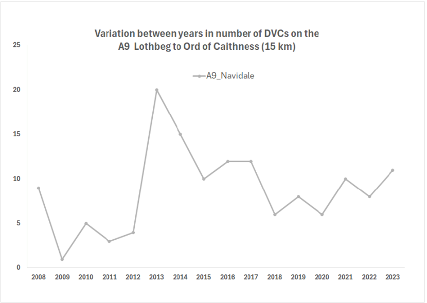
Figure 2. Annual variation in the number of DVCs from 2008 to 2023 inclusive reported within the 15 km section of the A9 from Lothbeg to Ord of Caithness.
Click for a full description
Line graph displaying numbers of DVCs recorded per year for the A9 site between 2008 and 2023 inclusive. Fewer than ten were recorded per year until 2012, but DVCs sharply increased in 2013 to over twenty. Thereafter numbers declined and have been more stable at between seven to 12 per year ever since 2015. The reason for the large increase in 2013 is unclear, but improvements to fencing near Lothbeg, combined with higher culls taken by landholders in that area are likely to have contributed to the more stable figures since.
Deer-Train collisions
Enquiries were also made with ScotRail regarding numbers of incidents of deer hit or found dead along the railway line that runs parallel to the road between Lothbeg to Helmsdale on the seaward side. The railway line runs within around 0.5 km of the road from Lothbeg to Portgower, but then comes to within about 20 m between Portgower to West Helmsdale, before turning inland away from the A9. The railway line does not have deer proof fencing here but was not physically inspected for signs of deer crossing activity during the A9 site visit. Preliminary feedback from local staff at ScotRail indicated that on the stretch from Golspie to Helmsdale (c.25 km), in recent years around two deer per year are hit by trains; train/deer incidents further north after the railway line leads inland (away from the A9) at Helmsdale are believed to be higher, with sometimes several noted per month. Further details on records of deer casualties on this trainline are being sought from ScotRail.
Site-specific seasonal variation in DVCs
To investigate variation in the proportion of DVCs recorded in differing seasons, initially all incident data available from 2008 to 2023 was considered. In the case of the three sites in the Central Belt more than twice as many DVC incidents were recorded annually in the last five years compared to average rates in the 11 preceding years (Figure 1). At the A9 site, averaged numbers of incidents logged do not show a comparable rise compared to earlier years (Figure 2).
Figures 3.a to 3.d provide a summary of findings focussed down on the most recent five years for which complete data were available at the time of study. During that period the most prominent annual peaks in DVCs at both the M9 Pirnhall and M8 Livingston occurred during late spring to early summer. For the M9, DVCs in May and June combined alone made up >40% of the annual total, while for the M8 incidents in May alone made up >25%; in both cases this is 2.5 to three-fold higher than would be expected if DVCs were evenly distributed across all months. Smaller peaks in late summer are also notable in both sites.
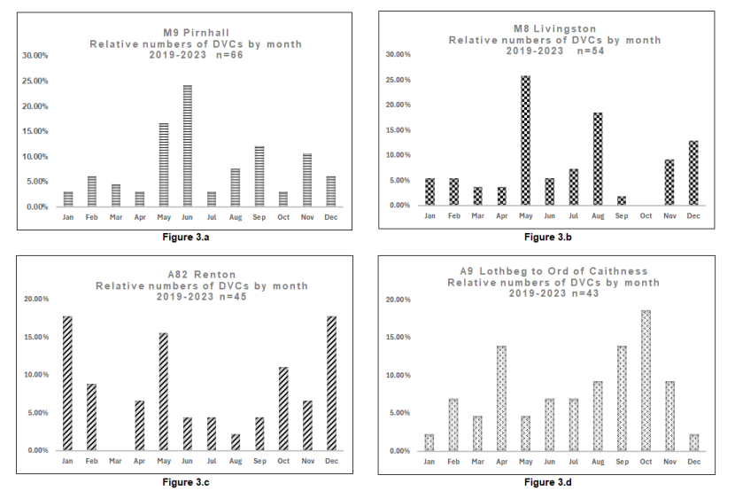
Figure 3. Variation of the proportion of DVCs recorded in differing months of the year at four trunk road DVC hotspots based on data from 2019 to 2023.
Click for a full description
Four bar charts showing the percentage of DVCs recorded during different month of the year over a five year period (2019 to 2023 inclusive) at four different DVC hotspots: Figure 3.a, M9 Pirnhall (top left); Figure 3.b, M8 Livingston (top right), Figure 3.c, A82 Renton (bottom left); Figure 3.d, A9 Lothbeg to Ord of Caithness (bottom right). Months are shown along the x axis, and percentage of DVCs on the y axis. Sample sizes ranged from 43 to 66 per site.
The most prominent peaks in DVCs at M9 Pirnhall and M8 Livingston occurred during late spring or early summer. For the M9, DVCs in May and June combined alone made up >40% of the annual total; for the M8, incidents in May alone made up 25%; in both these cases this is >2.5-fold higher than would be expected if DVCs were evenly distributed across all months (8.25%).
The monthly bars for A82 Renton show a different pattern with most prominent peaks in December and January, followed by May and October. For the A9 site, highest numbers of DVCs occurred between September to November.
View larger version of this image.
By contrast, on the A82 Renton, Figure 3.c shows a quite different pattern with the highest DVC peaks here in December and January, followed by May and October.
In the case of the A9, where red deer rather than roe deer are the predominant species, highest numbers of DVCs occur between September to November. This encompasses the red deer rut (peak of mating season) when red deer are more actively crossing roads, having spent much of the year in separate male or female dominated ranges, and moving to and from autumn mating grounds. Shorter day length and the end of BST also leads to dawn and dusk (when deer are often most active) to coincide with daily peaks in road traffic from late October. An additional peak in DVCs at the A9 is notable in April, possibly associated with deer crossing more as they seek out early new growth of grass on the low-lying pastures on the southbound (coast side) of the road.
When considering data available for the earlier years (2008-2018) for all four sites, based mostly on lower sample sizes (see Figure 1), patterns of seasonal variation remained broadly consistent with those shown in Figure 3.
Further information on seasonal variation in DVCs for the three Central Belt sites is provided in Map Figures 4a. to 4.d. Black numerals on each map show the primary land parcels included during walk-over site visits in August and referred to in Table 1.
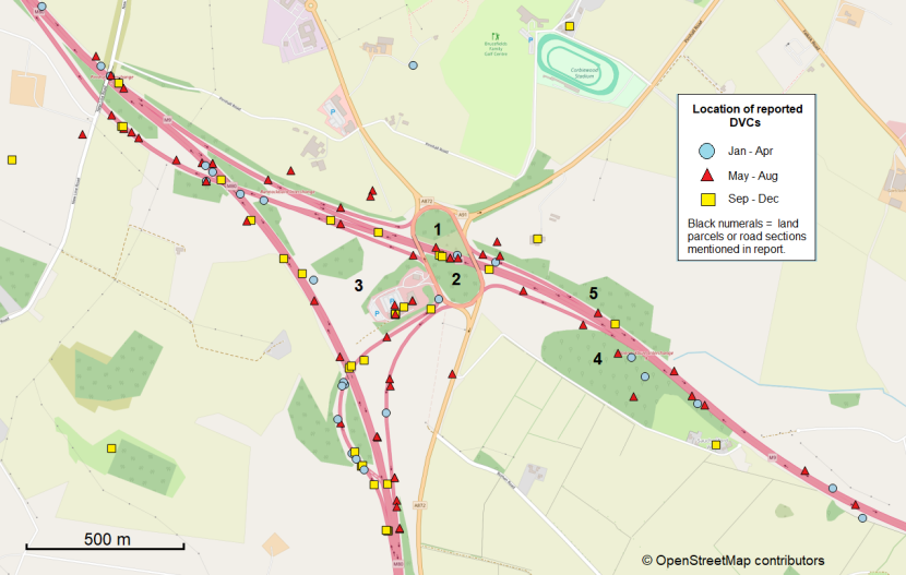
Figure 4.a. Distribution of DVCs reported in differing four-month periods of the year near M9 Pirnhall interchange based on data for 2008 to 2023 inclusive.
Click for a full description
Map of M9 Pirnhall interchange showing the distribution of DVCs reported between 2008 to 2023 inclusive. Coloured symbols differentiate DVCs reported in January to April (blue circles), May to August (red triangles) and September to December (yellow squares). Black numerals indicate land parcels included during walk-over site visits.
DVCs in May to August are most abundant overall, both at the centre of the interchange (close to land parcels 1 and 2), as well as in areas up to 1500 m to either side. Fewest DVCs are recorded here during January to April, and only a very low proportion of these occur close to the centre of the interchange. DVCs for September to December show an intermediate pattern.
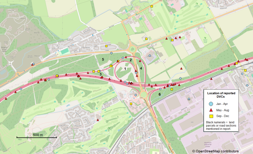
Figure 4.b. Distribution of DVCs reported in differing four-month periods of the year near M8 Livingston interchange based on data for 2008 to 2023 inclusive.
Click for a full description
Map of M8 Livingston interchange showing the distribution of DVCs reported between 2008 to 2023 inclusive. Coloured symbols differentiate DVCs reported in January to April (blue circles), May to August (red triangles) and September to December (yellow squares). Black numerals indicate land parcels included during walk-over site visits.
DVCs in May to August are most abundant overall, both at the centre of the interchange (close to land parcels 1 and 2), as well as in areas up to 1500 m to either side. Fewest DVCs are recorded here during September to December, with a low proportion of those located at the centre of the interchange. DVCs for January to April show an intermediate pattern.
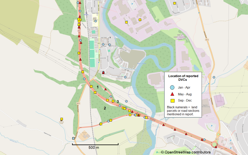
Figure 4.c. Distribution of DVCs reported in differing four-month periods of the year near A82 Renton junction based on data for 2008 to 2023 inclusive.
Click for a full description
Map of A82 Renton junction showing the distribution of DVCs reported between 2008 to 2023 inclusive. Coloured symbols differentiate DVCs reported in January to April (blue circles), May to August (red triangles) and September to December (yellow squares). Black numerals indicate land parcels included during walk-over site visits.
Numbers of DVCs for each of the three periods are of similar magnitude. By contrast to Figures 4.a and 4.b (for M9 and M8) DVCs near the ‘islands’ of land at the centre of the A82 Renton junction are most common during September through to April, rather than during late spring and summer.
M9 Pirnhall and M8 Livingston interchanges
For both the M9 and M8 site over the last five years more DVCs have been recorded close to the interchange during May to August than in the other eight months of the year combined (see also Figure 3.a and 3.b.). The reason for this is likely to be increase in attractiveness to deer of habitats within roundabouts and between the main carriageways and slip roads at that time of year, when ground and shrub layers develop from spring. Despite their quite limited size, the rise in food availability and cover offered by such islands of habitat, as well as very low direct disturbance by pedestrians or dogs, will lead to deer not only to visit but often to settle in such areas for several months. This will be explored further in Discussion of site visit findings below.
A82 Renton junction
By contrast to the above two sites, reported DVCs at the A82 Renton show no clear indication of significant seasonal (summer) movement of deer into or out of the ‘island habitats’ within this road interchange. Here only 26% of DVCs occurred during May-August, with a greater proportion of DVCs during the months of longest hours of darkness especially December and January (see also Figure 3.c). A secondary peak occurs here during May; this spring-time peak occurs in most areas throughout the country, partly related to dispersal of young males born the previous year. A high proportion of incidents at the A82 site occur along a slip road, and these maybe be due more to daily feeding movements as deer move from cover to more open farmland across that road, than a seasonal shift in home ranges.
A9 Lothbeg to Ord of Caithness
Review of maps of the distribution of DVCs along the A9 site (see Annex 1) showed little difference in the pattern of the seasonal proportion of incidents for different sections within the study area; one small exception being the most northerly km near Ord of Caithness, where all the six incidents logged occurred between September to October.
Landholder discussions
Central Belt sites
Prior to the inception of the current project, NatureScot staff engaged in discussions with landowners of substantial areas of woodland or other potential deer habitats near the three study sites in the Central Belt. The main objectives were: (i) to increase awareness among neighbouring landholders about the relatively high local levels of deer-vehicle collisions (DVCs), (ii) to gather preliminary insights into existing deer management activities surrounding the DVC 'hotspots', and (iii) to explore opportunities for enhanced collaboration and information sharing on deer management in the future.
The findings indicated that annual control of deer populations was already being implemented on some properties close to each of the three hotspots. However, approaching the landowners and specifically discussing DVCs resulted, in some cases, in a willingness to initiate or increase deer control efforts on their land, and in an interest in information sharing, with use of a WhatsApp group for facilitating information exchange raised at one of the locations.
It is recommended that landholders adjacent to these Central Belt sites be kept informed of any plans for the implementation of DVC mitigation measures, and that discussions are held with them regarding additional measures they may be able to take on their holdings within the context of a collaborative mitigation strategy.
A9 Lothbeg to Ord of Caithness
For the A9, while no direct discussions have as yet been held with adjacent landholders regarding further future mitigation measures, the present study was itself extended to incorporate a longer section of the A9 following local feedback to the recent use of temporary mobile Variable Message Signage (see press release NatureScot, 2024) to help forewarn road users of the DVC risk near the main Navidale hotspot identified by NatureScot’s DVC project. It is envisaged that here too discussions with adjacent landholders would form a key part for any potential options of future roadside mitigation, as not only management of local deer numbers but also other factors including layout and condition of nearby deer fencing (which in majority of cases near the A9 here is not owned or located on land managed by Transport Scotland) are likely to influence their effectiveness.
Site visit findings
Whilst the desktop study provided essential background and contextual information, it was recognised that site visits would be invaluable to the consideration of site-specific mitigation measures.
Central Belt sites
In the case of the Central Belt locations, site visits provided an opportunity to obtain an impression of both i) the suitability and attractiveness for deer of vegetation in the island habitats within the interchanges, ii) the local constraints and challenges posed by these complex high speed and traffic volume sites, and iii) the likely feasibility for implementation of differing potential mitigation measures. The Central Belt visits took place on the 22nd (M8 and M9) and 23rd (A82) of August 2024, with up to three hours spent at each site (accompanied by staff from the relevant trunk road operating company, NatureScot and or Transport Scotland). In addition, some adjacent areas off the trunk road network accessible via public footpaths near M9 Pirnhall were visited by the DVC consultant later in day. The main parcels of land inspected on foot at each site are shown in Figures 4.a-c (see black numerals).
For the 15 km stretch of the A9 from Lothbeg via Navidale to Ord of Caithness a longer period of three days was allocated to enable (i) walk-over site visits and assessment of notable signs of deer activity along the great majority of that area, plus (ii) a night-time thermal imaging survey to gain additional confirmation of deer activity in open areas to either side of the road at night.
A summary of key features of the main parcels of land visited at each site is provided in Table 1, with cross-references to a sample of images (Annex 2) of the woodland understorey and other typical vegetation cover in more open areas, and signs of deer activity encountered during each of the site visits.
In all the Central Belt sites, which were each visited in late August, the amount of cover, shelter and availability of suitable browsing and grazing for deer within the ‘islands of habitats’ surrounded by tarmac at the time of survey was judged to be at least moderately or very highly suitable for roe deer. Direct evidence of recent (summer) presence of roe deer from signs such as droppings, browsed saplings, bed sites and tracks was also noted in at least some parcels of land visited at each of the three Central Belt sites, as noted in Table 1(a-c).
A9 Lothbeg to Ord of Caithness
By contrast to the above, the A9 site in East Sutherland was visited during late January. Here, movement of deer across the A9 is known to occur at variable but significant levels throughout all seasons. Emphasis during site visits was on gaining an impression of the relative level of deer activity and potential for differing mitigation measures along different sections along the route.
Walk-over along verges
During walk-over visits along the verges of the A9, evidence for red deer road crossing activity was readily apparent in many sections. As result of their commonly three-fold or greater body weight than roe deer, trails through vegetation made by the frequent passage of red deer tend to be readily identifiable as such. Often the same trails will be used by several deer day after day, as they tend to seek out and exploit the weakest points where stock fences or even deer fences are most readily breached, whether by jumping over at low points or exploiting holes or gaps at ground level. Samples of typical trails left by red deer alongside the A9 are shown in site photos A9_4f, A9_4g (Annex 2.d). A summary of findings of the walk-over survey, including relative numbers of prominent red deer trails and other signs of deer activity noted, is shown in Table 1.d below.
A complete walk-over and inspection of all boundary fencing was beyond the scope of the present site visits. Nevertheless, fencing present in the vicinity of the A9 verge was inspected at various points. It was found to be highly variable in type and condition (see photos A9_1a, 6f, 7a, Annex 2.d), as well as its position in relation to the trunk road. In most cases, boundary fencing present consists of stock fencing, which in some areas due to topography and height does also deter red and roe deer from crossing. However, fencing of adequate (>1.8 m) height and condition to prevent any passage by red deer onto the A9 verges was found to be limited to a minority of sections; this includes a section of about 500 m along the northbound side south of Crakaig Farm, and a similar length section also along the northbound side just south of Ord of Caithness. However, even where such ‘deer’ type fencing is present within less than 50 m of the road near Crakaig, several locations were noted where deer do currently get through or under at gateways (Annex 2.d). Also, deer fencing present on just the northbound side of the road inevitably does not prevent deer from entering the carriageway from the other side, which may then be unable to leave the vicinity of the road until finding a gap further along this side or else crossing back over the road to the coast side. Where deer fencing is currently present it thus mainly acts to divert deer movements to other sections rather than preventing them crossing the A9. This can nevertheless be useful provided it leads to deer crossing in areas with better visibility
Based on inspection of locations where recent operations to cut back and remove gorse scrub that had been encroaching very closely onto the verges has occurred, especially between Culgower to Portgower, it is likely that deer collision risk there will be significantly lowered in the short term as a result. A number of additional, much shorter sections where scrub encroaching closely onto the road was noted along the northbound verge near Lothbeg, and approaching the Helmsdale viewpoint near Ord of Caithness (see site photo A9_6d, Annex 2.d) would similarly benefit from cutting back to improve visibility.
Nighttime Thermal survey A9
The nighttime vehicle-based thermal imaging survey was conducted between 21:00 hrs. and 23:30 hrs. on January 21st. This was initially scheduled for the following night but was brought forward due to sea mist and rain forecast later in the week. Visibility on the night of the survey was very good. The survey was led by the regional NatureScot WMO accompanied by the DVC consultant and NatureScot’s DVC project lead. The thermal-imaging binoculars used enabled detection and identification of medium to large mammals during darkness based on their heat signature at up to approximately 1000 m, provided views were unobstructed by dense vegetation. In practice, patches of high gorse, wood, or other vegetation close to the roadside, particularly near the northern end of the route and on the hillside between West Helmsdale to Lothbeg, reduced coverage obtained in those areas.
The survey was conducted with the WMO driving along the route at moderate speed, while both passengers scanned for animals using the equipment from within the vehicle, stopping to confirm sightings and scan over wider areas from laybys or other safe parking spots along the route. The survey covered the full 15 km of the A9 site and utilised side roads to gain closer views over land along some parts of the route.
A total of 88 different red deer were observed during the 2.5-hour survey, split among various groups. Maps showing the distribution and size of deer groups are provided in Annex 3. Sightings included several groups of deer on the low-lying pastures on the southbound (coast side) of the A9, as well as several others within 50 to 500 m of the northbound side of the trunk road, including a number of deer near the A9 Navidale roundabout. Other animals observed included foxes, rabbits, and numerous sheep and cattle, all of which could be identified readily at night. Sample still photos of deer recorded with the thermal binoculars are provided in Figure 5.a and Figure 5.b.
While results from this one-off thermal survey present only a snapshot of the minimum numbers of deer near the road on one night, they provide useful confirmation that deer frequently cross the A9 in substantial numbers from areas of cover on the hillside to more open land on the seaward side of the road. Information from a landholder on the low ground suggests that during the autumn mating season, it is not uncommon for over 100 red deer to be seen within a single field.
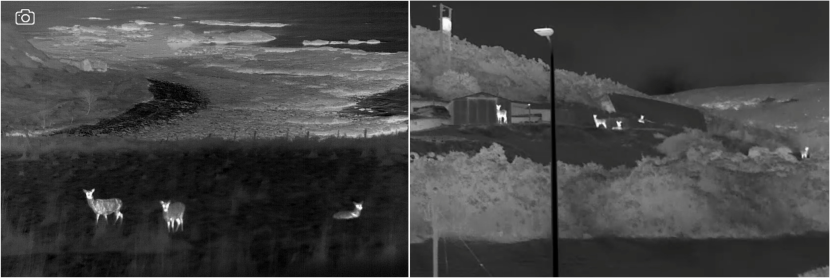
Figure 5. Sample images illustrating views of red deer obtained during thermal camera deer survey undertaken along the A9 Lothbeg to Ord of Caithness on 22nd January 2025.
Click for a full description
Two thermal images of red deer taken during almost complete darkness in January 2025. The left image shows three red deer within 50 m of the road in the foreground and the sea in the background. The right image shows five red deer within 150 m of the A9 Navidale roundabout. In both cases the animal outlines are readily identifiable as deer. The heat signature of deer is quite even for most of the body, whereas for sheep (not shown) much greater contrast tends to occur between the head and wool covered body.
Table 1. Summary of differences in habitats, likely attractiveness to deer and extent of evidence of deer use noted in different land parcels during site visits. Numerals in column one refers to site-specific land parcels or road sections as shown in Figures 3.a to 3.d; numbers in square brackets refer to site photos presented in Annex 2.a-d.
| Land parcel | Approximate tree canopy cover (%) | Extent of woodland understorey | Vegetation in open or scrub areas | Overall suitability for roe/ in spring / summer |
|---|---|---|---|---|
| (1) | 60% Mixed deciduous with also significant stands of conifers. | Medium Some patches open based [M9_1a], but majority with significant understorey [M9_1b]. | Large expanse of high (1 to >1.5m) mixed grass, herbs, bracken, bramble, mixed scrub, as well as recent tree planting [M9_1c]. | High Positive recent signs of roe dung, browsing and bed sites during August visit [M9_1d]. |
| (2) | 70% (as at 1 above). | High Most wooded areas with extensive understorey [M9_2a,b]. | As for (1) above [M9_2c]. | High Positive recent signs of roe at August visit [M9_2d]. |
| (3) | 35% Area of self-seeded and plantation trees. | Mixed Some relatively open, other parts dense understorey. | Mix of high grasses, herb and shrubs during August [M9_3a]. | High Patch not inspected fully due to dense scrub and terrain. |
| (4) | 90% Majority deciduous. | Low Comparatively open wood pasture [M9_4a]. | High grass and bracken inside roadside of boundary fence [M9_4b]. | Medium / low (part cattle grazed]. |
| (5) | 80% Mainly long narrow strip of trees. | Medium [M9_5a]. | High bracken, grass and self-sown saplings [M9_5b,5c]. | Medium to low Roe likely transitory. |
| Land parcel | Approximate tree canopy cover (%) | Extent of woodland understorey | Vegetation in open or scrub areas | Overall suitability for roe/ in spring / summer |
|---|---|---|---|---|
| (1) | 50% Mixed deciduous and stands of conifers. | Medium Variable; grassy beneath high conifers [M8_1a], shrubby under younger trees. | Open areas with high herbs and ferns with woody scrub developing [M8_1b]. | High Positive recent signs of roe presence at August visit. |
| (2) | 70% (as at 1 above). | Medium (as at 1 above). | (as at 1 above) [M8_2a]. | High – ready access from ‘5’ over east-bound slip- road [M8_2b]. |
| (3) | 75% (as at 1 above). | Medium (as at 1 above). | (as at 1 above) See left side of [M8_3a]. | High As above [M8_3a]. |
| (4) | 80% (as at 1 above). | Medium (as at 1 above). | (as at 1 above) See [M8_4a]. | Medium Similar to above but less secluded. |
| (5) | 85% Majority high broadleaved and conifer mix. | Medium Low scrub and grassy rides [M8_5a]. | Open areas mostly high grass and new planting [M8_5b]. | High Public access wood but well used by roe. |
| (6) | 25% Part felled but some remaining [M8_6a]. | Medium High proportion recently clear-felled. | Mixed low herbs with patches of higher scrub [M8_6a]. | High Not entered on foot, but relatively secluded. |
| Land parcel | Approximate tree canopy cover (%) | Extent of woodland understorey | Vegetation in open or scrub areas | Overall suitability for roe/ in spring / summer |
|---|---|---|---|---|
| (1) | 90% Broadleaf secondary wood. Uneven terrain [A82_1a]. | Medium to High Bare in some, dense in other areas [A82_1b, c]. | Few open areas, some fly-tipping debris [A82_1d]. | Medium Dense scrub but limited herb layer. No fresh roe signs noted. |
| (2) | 75% Similar to (1) but higher canopy [A82_2a]. | Medium to High (variable as above [A82_2b, c, d]. | Few open areas. Wooded right to slip road verge [A82_2e]. | High More extensive herb and browse than (1). |
| (3) | 90% Broadleaved strip along verge, sloping to river. | Low High tree line with scrubby edge [A82_3a]. | Tree line abuts extensive cattle pasture [A82_3b]. | Low Tree line narrow, roe likely transitory. Also underpass [A82_3c]. |
| Section | Location (and approx. length in km) | Main habitats on hillside (northwest) in vicinity of A9 | Main habitat on coast side (southeast) vicinity of A9 | Relative extent of clear signs of deer activity at verges |
|---|---|---|---|---|
| (1) | Lothbeg to Crakaig (1.5). | Gorse / bracken / heath; some pasture. | Livestock pastures. | Low - but some clear trails [A9_1b]. |
| (2) | Crakaig to Culgower (2.0). | Pasture / crofts; turning to gorse >100 m from road. | Livestock pastures; small amount of scrub. | Medium. Several clear trails [A9_2a]. |
| (3) | *Culgower to Westgarty (1.5). | Mostly gorse / bracken scrub; some woodland & pasture [A9_3b]. | Livestock pastures, some wood and scrub along burns. | High Many clear trails, + 2x carcass remains [A9_3a]. |
| (4) | *Westgarty to Portgower (1.5). | Mostly gorse / bracken scrub; some woodland & pasture [A9_4a]. | Livestock pastures, some wood and scrub along burns. [A9_4b,c]. | High Many clear trails, + 3x carcass, 1x live injured deer [A9_4b,c,d,e,f,g,]. |
| (5) | Gartymore to Helmsdale (1.5). | Pastures / crofts, wooded river valleys, more limited scrub [A9_5a]. | Narrow (<50 - 100 m) strip with railway line and limited pasture [A9_5b]. | Low, but some clear trails [A9_5c]. |
| (6) | South of Navidale roundabout – to Helmsdale Bay viewpoint (2.5). | Mainly gorse scrub & pasture; wood & scrub last 500 m [A9_6f]. | Mix of pastures, patches of wood, and gorse dominated scrub. | Medium Some clear trails 1x carcass remains [A9_6e]. |
| (7) | Helmsdale viewpoint to Ord of Caithness (2.0). | Mainly wooded and / or moorland. [A9_7a,b]. | Moorland with patches of gorse and woodland. | Low, but some clear trails. |
*Notable recent gorse and scrub clearance along verge on both sides along these road sections.
Discussion of site visit findings
Central Belt sites
When undertaking site visits to the three locations in the Central Belt in mid-August, ground and shrub layer cover on land within each of the interchanges was very dense and almost impenetrable in parts. Further details of site visit findings are provided in Table 1, cross referenced to sample images of typical vegetation cover for differing land parcels inspected provided in Annex 2. Comparison of some of the images with online Googlemap Streetview imagery where that is taken during March or April at sample locations confirmed that earlier in the year some of the same sites appear far more open and offer less visual cover from the road traffic. The increased cover during late spring and through summer provides more visual shelter from the road traffic as well as abundant food supply for the deer, which is likely to lead to deer not only seeking-out but settling within many of the islands of habitat within the interchanges over that period.
In the case of M9 Pirnhall (Figure 3.a) and M8 Livingston (Figure 3.b) the predominance of DVCs during the period from May through to August (shown by triangles) is very apparent. The high proportion of incidents during that period is likely to be associated with seasonal movement of deer from surrounding areas into the islands of habitat surrounded by tarmac within the interchanges during late spring; and when leaving again at the end of summer. At this time, denser understorey vegetation develops making animals feel more secure, and will then also provide much more browse and grazing than during the rest of the year. Despite the surrounding traffic noise, deer will seek out such areas, where there is almost no direct disturbance by people on foot or dogs, especially when about to give birth in early summer. Additional movement into and out of the interchanges may occur at the time of the roe deer rut in late July and into August.
A good example of an instance of such behaviour from within islands of habitats surrounded by trunk road carriageways in England (Langbein, 2018, in Kier 2018) is shown in this video clip (Born in the fast lane). Here, both roe and fallow were observed to settle within a strip woodland in a wide central reservation located between two dual lanes of traffic. During that time a fallow doe was even captured on film giving birth in late June and then still regularly filmed with its fawn in the same central reservation habitat until the end of summer. At the end of summer, when vegetation dries out and leaf fall begins, food availability and cover for deer will start to diminish, leading once more to higher levels of deer road crossing activity as they move out. At the end of summer, female roe deer are particularly prone to involvement in DVCs, not least when crossing high speed roads for the first time with young at heal.
However, the above pattern is not necessarily repeated in a similar manner at all major interchanges, and this underlines the importance of site-specific investigations of both the seasonal pattern of DVC occurrence and the habitats present within and outside of each site considered. By contrast to the above two sites, reported DVCs at the A82 Renton showed no clear indication of significant seasonal (summer) movement of deer into or out of the ‘island habitats’ within this road interchange. Here only 26% of DVCs occurred during May-August, with a greater proportion of DVCs during the months of longest hours of darkness in December and January (see also Figure 3.c). A high proportion of incidents at the A82 site, including the main hotspot identified by previous analysis, have been recorded along the northbound off-slip road. The high incidence of DVCs here maybe due more to daily feeding movements of deer from cover on one side of this road to more open farmland on the other side, especially at twilight or during the night. In this respect, this site may be more comparable to DVC hotspots along single carriageway roads, akin to the fourth site considered at the A9 Lothbeg.
Overall, whilst some signs of recent deer activity were noted within all the three sites (such as fresh pellets, hoof prints, or characteristic deer browsing marks on tree saplings or bramble), the levels of such signs were not judged to be present at levels indicative of very high densities of deer. While the brief nature of the site visits does not enable confident estimation of actually numbers, it is likely that, in many cases the largest of the various habitat islands surrounded by tarmac at each site will be adopted as the seasonal home range by one or two small family groups of roe (that will commonly include a mature doe, a yearling and the current year’s offspring) and likely joined by a mature buck for parts of the summer.
A9 Lothbeg to Ord of Caithness
Extensive evidence of frequent red deer road crossing activity was recorded during the A9 site visits, both through indirect signs (deer trails, hoof prints) as well as sightings of live deer at night using thermal imaging equipment, and some seen during the day. The relative ease with which signs of deer could be recorded compared to the sites in the Central Belt is in part attributable to the presence of predominantly red deer. Apart from their much larger size and weight (>three-fold compared to roe), as a non-territorial herding species, red deer may occur at much greater localised density than roe and leave more distinctive evidence of their movements. Despite the fact that there are almost certainly higher deer densities per km2 in this location, annual numbers of DVCs recorded do not differ greatly in magnitude compared to those in the Central Belt. This may to a large part be attributed to having far lower annual average traffic flows (c.3000 vehicles per day on the A9 in East Sutherland compared to upwards of 30,000 per day for all the Central Belt sites (DfT Road Traffic Flow Statistics, 2023)).
Information from a thermal imaging survey at night, as well as daytime survey along the route, indicates that most deer movements across the A9 during winter occur at night. Deer in general tend to be most active, and hence most likely to cross roads, between dusk and dawn. They are also likely use the low-lying pastures on the east side (coast) of the A9 in other seasons mostly from late evening to the early morning, but not necessarily just during the hours of darkness.
Deer fencing of adequate height and condition to deter or deflect deer crossing activity to other areas is currently only present close to the road along two short (<500 m) sections on the northbound side of the A9 site. In addition, some other sections of deer fences are present at a distance of 200 m or more from the road, again mostly on the northwest side of the road. These fences have generally been installed to protect woodland plantations rather than to deter deer road crossing activity. Where such plantation or other estate deer fences are present, in many cases substantial areas of gorse or other scrub have developed between the fencelines and the road providing lying-up cover used by deer during the day. It is not intended to imply here that longer complete sections of deer fencing close to the road on just one side would necessarily be desirable, as this could potentially entrap deer on the low-lying areas with limited safe locations where they can return to the hillside. The potential benefits and disadvantages of long lengths of deer fencing on one or both sides of the A9 will be explored further when considering mitigation options.
It is noteworthy that where the greatest numbers of longstanding, well used deer trails and other signs were found (see Table 1.d, Culgower to Portgower), high gorse scrub that had been encroaching very close onto the verges had been extensively cut back about two months prior to the site visit (see photos A9_3b, A9_4a, Annex 2d). Forward visibility for drivers and animals alike has been much improved along this stretch as a result and is likely to have a significant positive effect in terms of reducing risk of DVC here. Some further quite short sections of scrub encroachments onto the verge that would similarly benefit from cutting back were noted on the northbound side near Lothbeg and the Helmsdale viewpoint. This and other existing measures will be discussed further in the next section in the context of potential mitigation strategies.
Potential mitigation options
Constraints and opportunities in the trunk road environment
The Trunk Road Network connects Scotland's major cities, towns, airports and ports, enabling the movement of people, goods and services. This strategic network consists of over 3750 km of mostly high-speed roads (motorways, dual carriageway A-roads and single carriageway A-roads). Over 93% of the network has speed limits of 40 mph or above. Limits for the majority of dualled sections are set at 70 mph and for single-A roads at 60 mph. To ensure road safety in this high-speed environment, as well as its aim to maintain traffic flowing, any mitigation measures considered must meet the higher design standards and demands of trunk roads.
For example, more stringent road safety standards will tend to limit the feasibility of use of deer fencing or other road furniture close to the edge of the carriageway. On the other hand, the need to maintain traffic flows and consistent messaging for motorists must be taken into account when considering the appropriateness of options such as speed limit reductions or other traffic calming measures as part of potential DVC mitigation. From discussions earlier in the report, removal of high scrub or other dense roadside vegetation may be required to reduce DVC risk in many instances. This must however be evaluated case by case against the benefits of tree cover and other vegetation for noise abatement, landscaping, as well as biodiversity.
The complex lay-out of many interchanges at motorways and dual trunk roads, as at the three sites considered in the Central Belt, pose additional challenges for vegetation management of steep and highly variable terrain, where roundabouts, bridges and slips roads are often located well above or below the main dual carriageways.
Furthermore, with any new measures of mitigation, careful consideration must be given not only to their likely effectiveness at reducing risk of deer collisions at a given locality, but also to any potential negative effects that may arise; such as, for example, how installation or upgrade of localised wildlife fencing may influence future deer movements across roads at another location; or how vegetation removal or an increase in pressure on deer through culling in one area, may lead to them seeking out other areas close to the road.
The above and other factors have been taken into consideration in making the initial suggestions for potentially suitable mitigation strategies outlined in the following sections. However, in each case further feasibility and road safety assessments are likely to be required, including of any likely side effects, to decide which, if any, combination of measures will be possible to take forward.
Approaches to mitigation: Major interchanges and roundabouts
With respect to major junctions and motorway interchanges, in their recent review (Putman and Langbein, 2024) suggested a number of principal categories of potential measures from which to select and combine the most appropriate for developing a site-specific strategy for each individual situation. These principal categories are re-summarised below with some amendments:
- Selective removal of dense understorey in canopy woodland, and of scrub and other high standing vegetation attractive as cover for deer in more open areas within habitat islands within interchanges, and along verges.
- Temporary siting of mobile Variable Message Signs (VMS) to cover locally identified locations and peak months of past and predicted DVCs; or alternatively enhanced (digital) wildlife signage activated by roadside animal detection systems (RADS) for slip roads, and/or main carriageway.
- Use of digital speed activated signage or alternative traffic calming on slip roads (reduced speed limits, rumble strips, lighting, flashing signage).
- Selective use of fencing targeted at relevant ‘wooded islands’ established between slip roads and the main carriageway, or within roundabouts, where adequate clearance of understorey vegetation is not feasible. Alternatively, consider fencing-in entire road interchanges, although this is only rarely likely to be feasible due to difficulty of securing all fence end points against re-entry by deer.
- Where present, enhancing the use of existing road underpasses / viaducts or overpasses for deer use with selective lead-in fencing.
- Engagement and liaison with neighbouring landholders, to exchange information on local deer numbers and activity, DVC issues, discuss options for mitigation and their potential implications, and to consider how the scale and timing of any deer management undertaken on nearby holdings may assist with overall DVC risk reduction strategies.
Approaches to mitigation: Single carriageway trunk roads
For single-carriageway A-class trunk roads of lower traffic volume and vehicle speeds (generally 60 mph or below), several of the above measures also remain relevant, but with likely greater emphasis on:
- Verge maintenance to prevent scrub encroachment close to the carriageway to maintain good forward visibility for drivers to spot animals emerging from the roadside and vice versa.
- Temporary deployment of mobile Variable Message Signs (VMS) to cover locally identified locations and peak months of past and predicted DVCs; or alternatively enhanced (digital) wildlife signage activated by roadside animal detection systems (RADS) for shorter high-risk sections.
- Use of digital speed activated signage, if RADS not considered appropriate or feasible locally. Whilst standard static wildlife warning signs have been shown to be of very limited effectiveness at reducing DVCs, digital speed activated versions may have some utility, even when combining with RADS is not feasible.
- Selective use of partial wildlife fencing to protect high risk sections and divert deer movements to safer crossing structures (existing bridges or underpasses), if available, or to areas with better visibility (e.g. deterring animals crossing at blind bends).
- Preventing escalation of deer number close to the road through habitat management and working with surrounding landholders to maintain deer populations at lower levels.
One recommendation likely to feature to some extent in any DVC mitigation strategy (i.e. for major or minor roads) is to reduce as far as practicable areas of scrub vegetation encroaching onto verges, or within parcels of land within interchanges; both to reduce the attractiveness of such areas for deer to settle, and to maintain forward visibility for driver. However, a drawback of scrub and other vegetation clearance aside from its initial cost, is the regular future maintenance required to maintain a more open habitat. The re-growth of scrub and shrubby vegetation can lead to the habitat quickly becoming suitable as cover for deer again. In some locations it may be possible to utilise livestock to provide conservation grazing as an alternative to regular clearance of vegetation by mechanical means. This would require secure livestock fencing to ensure there was no danger of animals straying onto the carriageway.
Previous reviews of mitigation measures suitable in differing contexts, Putman & Langbein (2024) and Langbein et al. (2011) concluded that “in practice there will be very few situations where any one mitigation measure will be effective at leading to a significant and sustained reduction in collisions with deer or other animals when applied in isolation. Instead, in general, best results are likely to be achieved through use of a range of complementary measures, rather than reliance on any one individual approach”. For example, traffic calming for slip roads or single carriageway A-roads, or seasonal VMS deer warnings, are likely to be more effective if also supported by reducing scrub cover along verges, where relevant, to provide enhanced driver visibility and therefore longer breaking distances. Other reviews (e.g. Seiler et al., 2016, Huijser et al., 2021) also emphasise that “… there is no single magic tool that prevents WVC; instead, prevention needs a combination of approaches that target differing factors on different scales”.
Evaluation of suitability of measures in a local context
As introduced in the preceding section Discussion of site visit findings, a major factor likely to contribute to the higher frequency of collisions at major junctions and interchanges, such as those considered in the Central Belt, is that they commonly include ‘islands’ of habitat surrounded by tarmac on all sides, creating an area within which there is very limited public disturbance, not least by dog walkers or other people on foot. These areas are commonly planted for landscaping and noise abatement which, if not regularly cut back, often develop a cover of woody shrubs and trees by natural colonisation. With the combination of good cover and lack of human disturbance such ‘wooded’ islands unintentionally develop into refuges that deer and other wildlife seek out for shelter and, in some cases, as a location in which to reside for parts of, or throughout the year.
In the case of the M8 Livingston and M9 Pirnhall interchanges, past DVC reports do suggest that the islands of habitat within the interchanges become occupied by deer mainly from late spring through to early autumn. Site visits, too, confirmed that during this period the suitability and expanse of cover, together with a plentiful supply of suitable food in adjacent, more open areas, and the lack of direct disturbance by people or dogs, makes land within the interchanges very attractive to and suitable for roe deer. Provided deer numbers remain at their current, moderate levels, there may be little need for any deer settled in these locations during the summer to leave to find food elsewhere for several months. The deer are unlikely to leave these areas until vegetation dries out and cover dies back, providing far less shelter and visual screening from road traffic.
By contrast the road layout and habitats at A82 Renton are quite different, as is the seasonal pattern of reported DVCs. Here, areas within or close to the road junction are less isolated by dual carriageway or high-speed roads; the habitats are also more dominated by mature or near mature canopy woodland, with somewhat fewer areas of dense shrub and a less diverse herb layer for feeding. The pattern of DVC reports indicates less seasonal to-and-fro movement here, with most incidents in winter and during May, coincident with the periods of least daylight and the time of juvenile deer dispersal, respectively. It would appear more likely that deer use these areas as just one part of their daily home ranges, probably moving in and out to feed across slip roads, rather than necessarily crossing the main trunk carriageways, on a daily or weekly basis.
The above scenario at the A82 Renton is more similar to that at the A9 Lothbeg to Ord of Caithness site. Here, too, during the day deer appear to utilise the cover afforded by areas of woodland, gorse, and other scrub on the northbound side of the A9 and then cross the trunk road after dusk to feed on low lying pastures on the east (coast) side of the road.
Combinations of potential mitigation measures by site
For each of the sites under consideration, the sections below outline the potential mitigation measures that are felt most appropriate at this time for each site as a whole or at specific parcels of land within each location. In all cases, it is suggested that several of the measures outlined, if not necessarily all, should be considered for implementation in combination.
In making these site-specific suggestions, it is worth noting that other measures that might be thought to be equally or more effective in theory (such as concrete green bridges and wildlife underpasses), will in many cases be more feasible if incorporated at the road design and construction phase than if implemented retrospectively. Having said that, fitting lower cost wildlife crossing structures of wooden or metal construction is becoming more widely used also for existing roads (see e.g. Rosell et al., 2022), but their feasibility will nevertheless be very site-specific and dependant on local topography as well as economic considerations.
Other mitigation measures that have not been included below among the measures outlined as part of the mitigation strategy for each of the sites below, and brief reasons as to why they are considered unsuitable, are outlined at the end of the section.
M9 Pirnhall interchange
The suggested primary measures felt appropriate for inclusion as part of a DVC risk reduction strategy at M9 Pirnhall include:
- Vegetation clearance of woodland understorey, scrub and other high vegetation a) within 10 to 20 m of the tarmac along selected verges, and b) within selected larger islands of land within the interchange.
- Seasonal use of mobile VMS to alert drivers during months of heightened risk of DVCs on the approaches to the interchange, located some distance [500 to 1000 m] prior to the motorway off-slips. More specifically, it is suggested mobile VMS be deployed here from early-May to mid-June, activated from 30 minutes before sunset until 30 minutes after sunrise each day to target the daily period when deer are generally most active.
- Liaison with neighbouring landholders regarding deer management, especially its timing1 where lethal deer management is undertaken.
1In particular for the three Central Belt sites, it is suggested that any culling of deer on neighbouring land close to the interchanges should as far as possible be undertaken in late autumn and early winter, as disturbance to deer residing outside of the interchanges during early spring may further increase the pressure on deer to seek out less-disturbed areas, such as offered by islands of habitat within interchanges once vegetation there becomes denser again in spring.
Further considerations to explore for individual parcels land:
- If it is not thought feasible or appropriate to undertake and then maintain in future years an extensive level of vegetation clearance, alternatively consider selectively fencing off a significant portion of land within parcel ‘1’, and separately in parcel ‘2’. The aim here would effectively be to create deer-fenced enclosures in each of these parcels of land that could be left to develop into high canopy woodland. This would require careful planning and on-going fence maintenance to ensure minimal risk of any deer entering such enclosures. These areas, when developed into mature woodland, would be less attractive to deer settling there in view of reduced cover and food availability and, once established, the fencing could potentially be removed.
- As an alternative to extensive mechanical clearance of high vegetation for the relatively open parts of land parcel 3 (which would likely require annual or bi-annual maintenance; see images M9_3a,3b in Annex 2), explore the feasibility of using (conservation) grazing. This would be dependent on assessment as to whether the area could be securely stock fenced (considering the land is located between M9 and M80, but with good access).
- Bannockburn Wood (parcel 4) on private land bordering the motorway is currently grazed by cattle for part of the year. This has created a quite open woodland structure with only limited dense cover (see images M9_4a,4b in Annex 2), making it less attractive for roe deer to settle there. Clearing any woodland understorey and other scrub on the adjacent trunk roadside of the boundary fencing should enhance this effect.
The suggested areas for potential application of the above measures at the M9 site are outlined in Figure 6.a.
Figure 6.a. Map showing the approximate locations of primary measures considered appropriate for inclusion in a DVC risk reduction strategy at M9 Pirnhall interchange.
Click for a full description
Map showing the approximate locations of suggested primary measures to form part of a DVC risk reduction strategy for the M9 Pirnhall interchange. Black numerals indicate differing land parcels mentioned in Table 1 and main text of the report.
Blue rectangles labelled VMS show suggested locations for temporary, mobile variable message signs on the approaches to the interchange on the M9 from the north and south, and M80 from the south, positioned in each case prior to off-slips.
‘HM’, shown in yellow lettering, indicates the main parcels of land surrounded by carriageways, where habitat management, through removal of understorey in wooded areas and cutting of scrub in more open areas, is suggested to make them less attractive for deer to settle in. Additional verge vegetation management is not specifically identified on the maps as regular cutting back of scrub and reducing understorey within 10 m of the carriageway applies to all road verges.
‘SF’, in red lettering and dotted red lines, indicates (for land parcel 1 and 2) approximate areas where selective deer fencing to create exclosures, as an alternative to the need for annual or bi-annual cutting back of understorey. In the case of land parcel 3 only, secure stock fencing and grazing may be an alternative option.
‘LL’, in blue lettering, indicates the main areas of land where liaison with landholders neighbouring the trunk road estate is suggested, to help develop greater collaboration and exchange of information on DVCs and deer management.
Only primary measures proposed are mapped. For additional potential measures suggested as worth exploring for individual parcels of land see main text.
M8 Livingston interchange
The suggested primary measures felt appropriate for inclusion as the basis of a DVC risk reduction strategy at M8 Livingstone include:
- Vegetation clearance of woodland understorey, scrub and other high vegetation a) within 10 to 20 m of the carriageway along selected verges, and b) within selected larger islands of land withing the interchange.
- Seasonal use of mobile VMS to alert drivers to heightened risk of DVCs on approaches to the interchange, located some distance [500 to 1000 m] prior to motorway off-slips. More specifically, it is suggested VMS be deployed here from early-May to mid-June, activated from 30 minutes before sunset until 30 minutes after sunrise each day to target the daily period when deer are generally most active.
- Liaison with neighbouring landholders regarding deer management, especially its timing where lethal deer management is undertaken.
Further considerations to explore for individual parcels of land:
- As with M9 Pirnhall (see above) consideration could be given to selective fencing of a significant part of land parcel 1, to create a deer-fenced enclosure, which could be allowed to develop into canopy woodland without further need for annual scrub clearance. This would require careful planning and on-going fence maintenance to ensure minimal risk of any deer entering the enclosure.
The suggested areas for potential application of the above measures at the M8 site are outlined in Figure 6.b.

Figure 6.b. Map showing the approximate locations of primary measures considered appropriate for inclusion in a DVC risk reduction strategy at M8 Livingston interchange.
Click for a full description
Map showing the approximate locations of suggested primary measures to form part of a DVC risk reduction strategy for the M8 Livingston interchange. Black numerals indicate differing land parcels mentioned in Table 1 and the main text of the report.
Blue rectangles labelled VMS show suggested locations for temporary, mobile variable message signs along the eastbound and westbound approaches to the interchange, positioned in each case some prior to off-slips.
‘HM’, shown in yellow lettering, indicates the main parcels of land surrounded by carriageways, where habitat management, through removal of understorey in wooded areas and cutting of scrub in more open areas, is suggested to make them less attractive for deer to settle in. Additional verge vegetation management is not specifically identified on the maps as regular cutting back of scrub and reducing understorey within 10 m of the carriageway applies to all road verges.
‘SF’, in red lettering and dotted red lines, indicates an area within land parcel 1 at the centre of the interchange, where selective deer fencing to create an exclosure could provide an alternative to the need there for annual or bi-annual cutting back of understorey.
‘LL’, in blue lettering, indicates the main areas of land where liaison with landholders neighbouring the trunk road estate is suggested, to help develop greater collaboration and exchange of information on DVCs and deer management.
Only primary measures proposed are mapped. For additional or alternative potential measures suggested as worth exploring for individual parcels of land see main text.
A82 Renton junction
The suggested primary measures considered appropriate for inclusion as the basis of a DVC risk reduction strategy at A82 Renton include:
- Provision of selective deer-fencing along either one side of land parcel 2 on the existing motorway boundary (mostly Scottish Ministers’ land); or else more extensively on all three sides. Upgrading the present trunk road boundary fence for this section (c.700 m) to deer-proof fencing and extend to loop back to finish a short way along the slip road (see Figure 6.c) would reduce access of animals from the southside of the main dual-carriageways. The proposed fence line should also improve the feasibility of undertaking safe deer control within land parcel 2 south of the A82. The above measure on its own has potential to address a high portion of the current DVC risk at this interchange.
- Vegetation clearance of woodland understorey, scrub and other high vegetation a) within 10 to 20 m of the carriageway along selected verges, and b) within selected larger islands of land withing the interchange.
- Liaison with neighbouring landholders regarding deer management, especially its timing*1 where lethal deer management is undertaken.
Further considerations to explore for individual parcels of land:
- The eastern side of land parcel 2 is already fenced along the railway line and, with minimal upgrading, could prevent deer crossing also in that direction. In addition, consideration could be given to also fencing the third side of the triangle, either along the north-side of the A82 off-slip road, or alternatively for part of the south-side to lead onward to divert deer movements to the River Leven A82 underpass. However, if any deer-fencing were to be installed also on the south-side of the slip-road, installation of a deer-grid may be necessary depending where deer fencing ends on either side of the slip road.
- Whether or not fencing along one or more sides of the largest ‘island’ is progressed, consideration could be given to introducing livestock (conservation grazing) for larger parts of land parcel 2 to convert it to more open wood pasture. A small portion of that area, not owned by Scottish Ministers, is already grazed by cattle, and there may be some potential to expand this to help reduce cover and the attractiveness of the area to deer. However, with a more detailed survey the topography within the plot may well turn out to be too challenging for this to be a realistic option for much of that plot.
The suggested areas for potential application of the above measures at the A82 site are outlined in Figure 6.c.
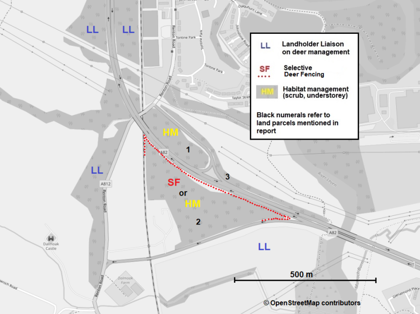
Figure 6.c. Map showing the approximate locations of primary measures considered appropriate for inclusion in a DVC risk reduction strategy at A82 Renton junction.
Click for a full description
Map showing the approximate locations of primary mitigation measures to form part of a DVC risk reduction strategy for the A82 Renton junction. Black numerals indicate differing land parcels mentioned in Table 1 and main text of the report.
‘HM’, shown in yellow lettering, indicates the main parcels of land surrounded by carriageways, where habitat management, through removal of understorey in wooded areas and cutting of scrub in more open areas, is suggested to make these areas less attractive for deer to settle in. Additional verge vegetation management is not specifically identified on the maps as regular cutting back of scrub and reducing understorey within 10 m of the carriageway applies to all road verges.
‘SF’, in red lettering and dotted red line, indicates where provision of deer fencing is proposed along the line of the exiting highway boundary fence within land parcel two, with a short extension westbound along the slip road to divert any deer movements along the fence away from the main road.
‘LL’, in blue lettering, indicates the main areas of land where liaison with landholders neighbouring the trunk road estate is suggested, to help develop greater collaboration and exchange of information on DVCs and deer management.
Only primary measures proposed are mapped. For additional potential measures suggested as worth exploring for individual parcels of land see main text.
A9 Lothbeg to Ord of Caithness
The suggested primary measures considered appropriate for inclusion as the basis of a DVC risk reduction strategy at A9 include:
- Cutting back gorse and other scrub encroachment where dense, high vegetation directly abuts verges or obscures visibility for drivers and animals. Regular maintenance would be required to cut regrowth (likely at intervals of two or more years depending on scrub type).*1
- Seasonal use of mobile VMS to alert drivers to heightened risk of deer. This measure has previously been employed at the A9 near Navidale during November. In November 2024, before, during and after placement of the VMS, BEAR also recorded traffic-related information, including average vehicle speed in order to measure changes in driver behaviour. Results indicated only a modest reduction in average speed throughout the day (for more detail see point iv. in Monitoring). If repeating application of VMS here, based on past seasonal distribution of incidents it is suggested to a) start this earlier in the autumn (from mid-September) through to mid-November, and b) restrict activation of VMS to the period from 30 minutes before sunset until 30 minutes after sunrise each day, to target the daily period when deer are generally most active.*2
- Roadside Animal Detection System (RADS) networked to digital warning signs, proposed as a trial likely focussed initially on the Westgarty to Portgower section.*3
- Review and inspection of existing lines of deer fences that run close to the road, and mend / upgrade where fencing considered useful to divert deer crossings to relatively safer areas of better visibility (e.g. straight stretches with ‘open’ verges).
- Consider likely effects on future deer movements across the A9 of any new fencing proposed as part of nearby woodland creation schemes.*4
- Management of local deer population numbers at lower levels; via discussion of overall strategy with the main landholding estates and regional deer management sub-groups.
*1 BEAR has recently already completed verge scrub removal for a substantial section of the A9 site (as noted on Figure 4.d), with only some limited additional locations suggested for similar treatment at present.
*2 Consideration should be given to once more deploy mobile VMS on southbound approach to Navidale roundabout for two to three months in autumn. However, in order to highlight increased deer risk at this time for the full section from Lothbeg to Ord of Caithness rather than merely at Navidale, it is proposed that the permanent VMS gantry on the northbound side (located 0.75 km south of Lothbeg at OS 293877,909636) should also be used when not required for other purposes during the same period.
*3 RADS systems of differing types are based on either radar units or small roadside devices with thermal motion sensors to detect deer on the carriageway or approaching the verges. The presence of any live animals detected may be relayed to digital warning signs at their end of the protected sections; and in some cases, the roadside devices themselves can also emit flashing signals direct to forewarn drivers. If considered further, it is suggested that NatureScot and Transport Scotland should explore the possibility of visiting some existing RADS sites in Europe to help decide which type(s) if any may be worth trialling in Scotland.
*4 If installation of RADS is considered further, the layout of new deer fencing that may or may not be installed nearby depending on the outcome of a nearby woodland creation application will need to be taken into account when deciding actual location of such a trial.
The suggested areas for potential application of the above measures at the A9 site are outlined in Figure 6.d.
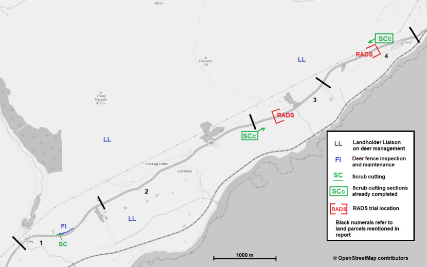
Figure 6.d (part 1). Map showing the approximate locations of suggested primary measures considered appropriate for inclusion in a DVC risk reduction strategy at A9 Lothbeg to Portgower.
Click for a full description
Map 1 (of 2) showing the approximate locations of potential mitigation measures to form part of a DVC risk reduction strategy for the A9 Lothbeg to Ord of Caithness. This first map, to be viewed alongside Figure 4.d (part 2) below, shows the section between Lothbeg to Portgower. Black numerals indicate differing sections of the road mentioned in Table 1 and main text of the report.
‘LL’, in blue lettering, indicates the main areas of land where liaison with landholders neighbouring the trunk road estate is suggested, to help develop greater collaboration and exchange of information on DVCs and deer management.
‘SCc’, shown in green lettering, shows the start and end points of the main section where extensive cutting back of gorse and other scrub that had been encroaching close to the carriageway was already completed by December 2025.
‘SC’, in green lettering, shows a short additional section where scrub cutting is suggested along the northbound side, to improve forward visibility for drivers approaching a bend.
‘FI’, in blue lettering, indicates fence inspection and maintenance to close any gaps in the deer fence that runs close to the road in this area, to ensure that fencing is secure especially in the section around the bend in the road.
‘RADS’, in red lettering within square brackets, indicates a section of approximately two km of the A9, which is thought to provide good opportunities for a trial of a roadside animal detection system.
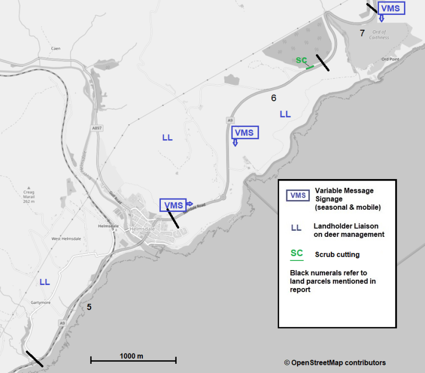
Figure 6.d (part 2). Map showing the approximate locations of suggested primary measures considered appropriate for inclusion in a DVC risk reduction strategy at A9 Gartymore to Ord of Caithness.
Click for a full description
Map 2 (of 2) showing the approximate locations of potential mitigation measures to form part of a DVC risk reduction strategy for the A9 Lothbeg to Ord of Caithness. This first map, to be viewed alongside Figure 4.d (part 2) below, shows the section between Gartymore to Ord of Caithness. Black numerals indicate differing sections of the road mentioned in Table 1 and main text of the report.
Blue rectangles labelled VMS show suggested locations for temporary, mobile variable message signs. For southbound traffic, temporary VMS signage is proposed near Ord of Caithness layby, and second position on the approach to Navidale roundabout. For northbound traffic, temporary deployment of VMS is proposed near the northern edge of Helmsdale. In addition, it is suggested the permanent VMS gantry (not shown) located on the northbound side approximately 0.75 km south of Lothbeg, should be utilised to display messages of high risk of deer crossings, when the mobile systems are deployed at the sites shown.
‘LL’, in blue lettering, indicates the main areas of land where liaison with landholders neighbouring the trunk road estate is suggested, to help develop greater collaboration and exchange of information on DVCs and deer management.
‘SC’, in green lettering, shows a short section where additional scrub cutting on the northbound side would help to improve visibility coming into a bend approaching the Helmsdale viewpoint (see site photo A9_6d in Annex 2d).
Measures not thought suitable for the selected locations
In their recent review of DVC mitigation measures and their potential effectiveness, Putman and Langbein (2024) outlined the main categories of measures that tend to be most suitable for major roads (re-summarised in Approaches to mitigation: Major interchanges and roundabouts section); and others likely suitable only for relative minor roads, or indeed not likely to be effective at all.
The suggestions in the previous section for combinations of measures that may be suitable for the four specific sites considered in this report, are primarily drawn from measures which in Table 1 of the earlier review were considered a) suitable for major roads, b) to have at least medium to high potential levels of effectiveness, as well as c) likely to be worth further consideration at the selected sites in question.
There are nevertheless also other mitigation measures that might be thought useful in similar situations, and these are listed below with a brief reasoning as to why they were not included; or else only considered for the A9 single carriageway site, but not for the major motorway or dual carriageway interchanges.
- Roadside wildlife deterrents: Multiple differing light-reflecting as well as actively signalling light and audio devices claiming to deter deer from crossing roads while traffic is present are available on the market. Almost none to date have proven lasting effectiveness, even on roads of relatively low traffic flow. On roads with high traffic volumes, such devices would be activated so often that animals are likely to habituate to signals emitted even faster, and hence none of the current offerings are at present worth considering in the trunk road environment.
- Fencing of entire road interchanges. Consideration was given also to whether deer fencing could be installed to deter deer from entering any parts of the major road interchanges inspected. This is only rarely likely to be feasible due to the difficulty of securing all fence end points against re-entry by deer, and was not felt worth considering for any of the three Central Belt sites at present. In the case of the A9 site too, a solution based on provision of deer fencing along both sides of the entire 15 km stretch from Lothbeg to Ord of Caithness seems neither justifiable, in view of the high costs of installation and maintenance, nor desirable from the perspective of landscape impact and lack of opportunities to use the fencing to lead deer to existing safe crossing structures, such as underpasses or bridges over the road. Long lengths of fencing close to the road on just one side also do not seem appropriate for this site.
- Leading deer to safer passages: Using short lengths of fencing to lead deer to cross using safer passages can be very useful in some situations, but few opportunities for this exist at any of the sites inspected. One exception here is that if partial fencing along the highway boundary in land parcel 2 (at A82 Renton) is undertaken, consideration could be given to extending that fencing onward to the existing underpass alongside the River Leven. However, in that case a deer-grid (similar to a cattle grid) would be recommended where fencing ends on either side of the A82 northbound off-slip.
- Lethal deer control. Culling of deer in the immediate vicinity of trunk roads to reduce numbers presents many challenges, and even where it can be undertaken safely it needs to consider carefully the potential for deer to run onto a carriageway. For most of the sites it is unlikely that lethal control of deer directly on Scottish Ministers’ land would be practicable. A possible exception to this may be at land parcel 2 at A82 Renton, where it is suggested that deer fencing should be provided along the existing boundary fence on the motorway side, as part of other mitigation. As a secondary effect, that may also make it more feasible for direct deer control to be undertaken safely there on land outside of the boundary fence. In the case of the A9 site, Scottish Ministers’ land extends merely to a very narrow strip to either side of the road, where direct deer control would not be feasible. While lethal control of deer on Scottish Ministers’ land close to trunk roads will only be feasible in a minority of cases, collaboration on safe deer control with neighbours with land further from the carriageways can be valuable as part of the overall mitigation strategy.
- Speed reduction: The feasibility of using permanent speed reductions as part of DVC mitigation for the main carriageways of major roads tends to be limited by the need for consistent speed-related messaging and keeping traffic flowing. Motorists often drive to the conditions in front of them, and if the road looks and feels to them as though it should have a higher speed limit, they will get frustrated with a requirement to travel more slowly if there is no obvious reason for the reduced speed limit. Rather than varying speed limits, strategic use of temporary mobile VMS at times of the year when deer crossing activity is greatest is suggested for increasing awareness of heightened DVC risk among road users. The possibility of other traffic calming measures on slip roads at interchanges where a high risk of DVCs has been identified might nevertheless be worth exploring further.
- RADS: Animal activated road-side detections systems. In contrast to wildlife deterrents, RADS systems focus on alerting drivers to the actual presence of deer or other animals near the road. Such systems, based on roadside detection of animals using either radar or roadside devices with thermal motion sensors, may well be suitable for some trunk road situations. For the three Central Belt sites, consideration was given to whether RADS systems might have potential for application on slip roads with high DVC risk. However, having inspected the Central Belt sites, as well as local DVC records, it was considered that RADS were unlikely to be worth pursuing at those locations at this stage, as few sections of the slip roads offer wide verges where such systems are likely to be most effective. The frequency of expected regular deer movements at those sites is also relatively low and would give limited confidence that the effectiveness could be demonstrated overtime if undertaken as a trial. The A9 site, on the other hand, has a number of long, relatively straight road sections with very high deer activity and also suitably wide verges. Potential for a trial with a RADS system is much greater here and a RADS system is therefore suggested as worthy of further exploration as an option for future DVC mitigation on this part of the A9.
Monitoring the effectiveness of a DVC strategy
A key aspect of the suggested approach to mitigation at each of the specific sites considered, which is also likely to apply to DVC mitigation in most other areas, is that several complimentary measures should be used in combination rather than reliance on any one individual measure. One downside of such combined strategies is that assessment of the extent to which any future changes in DVC frequency are attributable to one particular measure will be more difficult at a site level; although insights on the contribution of a particular measures may be gained from comparing between sites, where a given measure is included or not. In terms of monitoring effectiveness, however, the main emphasis should probably focus mostly on assessing whether significant changes in DVCs can be attributed to the overall strategy, rather than changes in other external factors (such as increased/reduced traffic volumes, fluctuations in deer population size or variability in DVCs considered over too few years). Some general suggestions for monitoring effectiveness of the overall strategy, and others for individual measures are summarised below. Any specific monitoring schemes put in place would clearly need to be adapted based on local conditions and the nature of the particular mitigation measures progressed.
For monitoring the effectiveness of the DVC overall strategy at each site, consider the following:
- Before and after monitoring of DVC reports within a defined distance (or radius if an interchange) in as consistent a manner year to year as possible. Ideally, the aim would be to use no less than three years or, preferably five years of DVC data before and after implementation of new measures.
- Where extensive vegetation clearance and/or reduction of deer numbers on neighbouring landholdings forms part of the strategy, changes of the extent of deer occupancy within island of habitats (e.g. on roundabouts or between slip roads and main carriageway) should be assessed systematically. Ideally, this would commence before or else as early as possible when it is known that mitigation measures are to be implemented. This could probably be done most efficiently by setting up a small number of wildlife / trail cameras within selected sites to take still photos triggered by deer or other animals passing. Such cameras can often be left in situ for three to six months without need for battery changes, and if using cameras with wireless or internet capability these can be monitored remotely to check that they remain functioning, without being blocked or stolen, whilst helping also to avoid numerous false triggers from moving vegetation.
- Collation of information on any deer control measures undertaken on adjoining land where neighbouring landholders are willing to provide these.
- Where mobile or static seasonal VMS deer warnings are in place, parallel assessment of changes in average traffic speed can be useful as an indicator of significant changes in driver behaviour. However, the aim of suggested signage in this context is raising driver awareness of increased risk of deer presence, rather than necessarily speed reduction per se. Recording of vehicle speeds was undertaken before, during and after the VMS DVC initiative at the A9 Navidale in autumn 2024. The data indicated that the VMS resulted in only a minor reduction in seven-day average speeds of approximately 1 mph. A reduction of closer to 5 mph was recorded during one of the four weeks with the VMS, but this coincided with a week of snowy conditions that is likely to have had a greater or additional effect. Targeting deer-related VMS on the period from sunset to sunrise, rather than messages being displayed throughout the day, could help both a) focus mitigation on the period when deer are most likely to be actively crossing roads, and b) for monitoring by enabling comparisons of effects on driver behaviour between times of the day when VMS are active and inactive.
- Wherever new deer fencing is installed, or already present, a plan for regular inspection should be in place (at least annual or six-monthly) to ensure it remains secure. While annual inspections of fences on Scottish Ministers’ land will be part of trunk road maintenance contracts, this is also of importance for deer fencing on nearby land outside of the trunk network. It is crucial that any new deer fencing installed is of appropriate specification for all the deer species likely to be encountered at the location, the fencing contractors are experienced at installing deer fencing, and the works are overseen by a suitably experienced individual with good knowledge of deer. Particular care needs to be taken to avoid leaving any weak points that deer (or often initially badgers) can exploit to push through beneath the fencing, and to ensure that the lay-out of fencelines is designed to avoid any high ground close to the outside of the fence; such high ground reduces the effective height of the fence and may be used by deer to jump over it.
- If a trial of RADS is taken forward, monitoring of its impact should include a plan for roadside video monitoring of actual deer and other wildlife activity along the trial section of road. This will allow validation of the numbers of times sensors detect wildlife against the frequency that networked digital signage is activated. Changes in driver speed at times when signage indicates presence of wildlife should also be assessed.
- In addition, especially where novel, unproven measures are used (e.g. RADS) monitoring should if possible be replicated at one or more comparable control sites to assess their actual effectiveness.
Conclusions
Background
NatureScot and Transport Scotland together previously commissioned a report (Putman and Langbein, 2024) that reviewed available deer-vehicle collision (DVC) mitigation measures at an international scale, including their costs and effectiveness in various situations. The review discussed the merits, limitations, and potential negative effects of more than twenty major measures and numerous further sub-categories and types of measures within each. With such an array of measures, selecting the most appropriate mitigation for any given scheme is challenging for road safety teams (aiming to reduce risk to road users) and conservationists (concerned about roadkill and animal welfare) alike, not least as the costs of measures vary greatly and their effectiveness in specific situations is often uncertain.
A key conclusion arising from the 2024 review, as well an earlier mitigation review (Langbein et al., 2011) is that, in practice, there will be very few situations where any one mitigation measure will be effective at leading to a significant and sustained reduction in collisions between vehicles and deer or other animals when applied in isolation. Instead, in general, best results are likely to be achieved through use of a range of complementary measures, designed to suit the particular circumstances of the relevant location.
The aim of this extension to the earlier project was to explore what might be the most suitable combination of mitigation measures at a site-specific scale for a range of locations. The four sites chosen for assessment were selected from the list of the ten most prominent DVC hotspots identified by the DVC 2019–2021 analysis report. Three of the sites are located at multi-lane trunk road interchanges in Central Scotland, and a fourth located along a single-lane trunk road in the Highlands. The aim of the assessments was to identify suitable mitigation options for potential implementation at these specific sites and provide insights that might be transferable to other comparable locations on the Scottish road network.
Assessments for each of the four locations included reviews of the annual scale, seasonality, and distribution of past DVC records, as well as site visits to understand the road environment, habitat availability, and signs of deer activity. All four visits reinforced the view that a combination of complementary approaches is likely to be most effective rather than focusing on a single measure.
Devising mitigation strategies
The principle of applying a combination of measures might be compared to devising a medical treatment plan, which will usually involve an initial diagnosis of symptoms, physical examination, health advice, medication and, if appropriate and proportionate to the issues, direct physical intervention. Taking this analogy further, measures taken will rarely provide complete solutions, and many actions taken may also have foreseeable or unknown side effects. It is therefore crucial to have realistic expectations, monitor effectiveness, and adapt plans accordingly.
In a meta-analysis using data from 50 studies that quantified the relationship between wildlife road-kill and a mitigation measure designed to reduce road-kill, Rytwinski et al. (2016) found that, overall, mitigation measures reduced road-kill by 40% compared to controls. They also concluded that comparatively expensive mitigation measures tend to reduce large mammal road-kill much more than inexpensive measures. Combinations of fencing and safe crossing structures (bridges or underpasses) led to an 83% reduction in road-kill of large mammals. Overall, fences with or without crossing structures averaged 54% reductions, compared to a 57% reduction for animal detection systems, and only a 1% reduction for wildlife reflectors.
Based on the above, relatively inexpensive wildlife reflectors or other roadside deer deterrents, most of which have no proven or at best very short-term effects, might be compared to a sticking plaster. On the other hand, provision of high wildlife fences for long sections on both sides of the road, that also lead animals to suitable alternative safe passage at regular intervals might be thought of as the ‘gold-standard’. However, even in the limited situations where the high cost associated with installation and maintenance of long lengths of deer fencing can be justified, and such mitigation is also acceptable in terms of landscape considerations, potential side effects may require additional mitigation measures. In areas with high potential for bird strikes (particularly with capercaillie or other grouse species), for example, the installation of fence strike markers may be necessary, or if deer fencing is provided on both sides of the road, deer-leaps may need to be installed to allow deer that do manage to access the road corridor to escape from the roadway.
At present, information on the actual effectiveness of measures aimed at raising driver awareness of the risk of deer on roads remains limited. Most studies into the effectiveness of standard static wildlife warning signs in reducing collisions with deer conclude that they are ineffective (e.g. Meyer, 2006; Bullock et al., 2011). However, research by Hardy et al. (2006) in Montana, showed that wildlife advisory messages posted on permanent and mobile VMS were generally effective in reducing average motorist speeds. Their results also suggested that the advisory messages are more effective at reducing speeds during dark conditions. Furthermore, Hardy et al. found that messages on the mobile VMS had a more significant impact on average speed than the messages on the permanent VMS. Less is known about the effectiveness of more general public awareness campaigns, such as used also in Scotland, during the season(s) when the risk of deer crossing roads is highest.
In most road-based scenarios, however, use of several measures that help to reinforce each other are likely to be appropriate. For example, traffic calming for slip roads or single carriageway A-roads, or seasonal VMS deer signage, are themselves likely to be more effective at reducing risk of collisions with wildlife if supported by reducing scrub cover along verges to provide also enhanced driver visibility and therefore, in theory at least, longer breaking distances.
Site-specific combinations of measures
For each of the four sites assessed during the present project it is suggested that a combination of several mitigation measures is likely to be most effective.
For both the M8 and M9 interchanges, where DVCs and deer activity on land within the interchanges appear very seasonal, it is suggested that focus should be on i) reducing scrub understorey on islands of habitats within the interchanges to make them less seasonally attractive to deer, ii) other vegetation management to prevent dense vegetation encroaching onto verges of the main carriageways and slip roads, iii) seasonal use of mobile VMS focussed on late spring and early autumn, and iv) liaison with neighbouring landholders regarding the extent and timing of deer control.
For the A82 Renton interchange, where seasonality of DVCs and deer occupancy is less apparent, an alternative to seasonal use of mobile VMS is to include fencing in selected locations, as well as elements of vegetation management and control of deer numbers, as above.
For the A9 single carriageway site, where red deer rather than roe deer predominate, the combination of measures suggested again includes i) scrub vegetation clearance where it encroaches onto the verge and ii) seasonal use of mobile VMS, but focussed mostly on autumn. In addition, this site has potential for iii) installation of a road animal detection system (RADS) to forewarn drivers when animals are in or near the roadside along one of the highest risk sections, which would work in conjunction with iv) a review and improvement of partial existing or planned fencing.
The details and level of emphasis on each of the measures will clearly differ between the sites and, if taken forward, will require further road safety and feasibility assessments on site as well as liaison with adjoining landholders.
Transferability
Some elements from the overall approach taken during the present assessments may well also be transferable to other comparable multi-lane interchanges, or other single-carriageway sites.
None of the selected sites in this study were located on long lengths of dual-carriageway road which do not incorporate major junctions or slip roads. However, some aspects of the findings from the major interchanges, where DVC issues arise from high seasonal deer use of islands of habitat on roundabouts and between slip roads, may be comparable to sections of split dual-carriageways that have extensive woodland or scrub cover on wide central reservations. In addition, the seasonal movement of deer from late spring into areas of linear scrub or woodlands alongside trunk roads, where this provides more cover and food is likely to be a general phenomenon across the network. On the other hand, major dual carriageway roads on the trunk network often have relatively wide verges where RADS systems, for example and as suggested for trialling at the A9 site, may be a more feasible option than for the major interchanges inspected.
Importance of monitoring
A significant challenge affecting the choice of mitigation options is that for many measures detailed studies of their true effectiveness are lacking, or else not available in the context of comparable site conditions. Studies necessary for objective assessment require comprehensive and directly comparable series of data both ‘Before and After’ installation of mitigation, ideally including records not only of annual levels of DVC incident reports but also changes in local deer population numbers and management.
One advantage in this respect is the longstanding NatureScot and Transport Scotland DVC collation project, which since 2008 has collected comparable information on reported deer collisions, with data collected most consistently for roads making up the Scottish trunk road network. Identification of the DVC hotspots chosen as the focus for the present project was also based on analysis of the existing database. Within that database of incidents there is likely to be significant variation in the proportion of under-reporting of DVCs (see also DCS carcass surveys, in Langbein, 2011, pp. 25-28) between differing road types (motorways, dual and single carriageway roads) as well as between regions of high and lower traffic flows (and hence the likelihood of an incident being reported). However, within a given region and road type, that database can provide a very valuable resource for monitoring changes where mitigation is considered or undertaken.
Nevertheless, it is suggested that differences in levels of reporting between road types and between regions may bias identification of hotspots towards regions of higher population density, even when differences in traffic flows are considered. It may therefore be useful for future DVC hotspots analysis to a) look further into differences in levels of reporting between road types and regions, and b) consider introducing a level of stratification to identify the main hotspots by region, and separately for multi-carriageway and single carriageway trunk roads.
In addition, on the basis of the commonly wide variation in DVCs from one year to the next (see Figure 1a-c), especially in areas where roe deer predominate, it may be useful to investigate the top hotspots identified, and how consistent they remain across years. This would be supported by extending the number of past years of data included in the analysis from three years to five or six years.
Monitoring of mitigation schemes should not, however, be restricted to assessing DVC records. Approaches to monitoring will inevitably vary depending on the types of measures introduced, as outlined in greater detail in an earlier section. For measures aimed at raising driver awareness, this may for example include assessments of resulting changes in average traffic speed. How localised habitat management affects deer in practice may be assessed using trail cameras or other surveys methods to determine changes in deer occupancy by season. Similarly, video recording with trail cameras can help confirm the use of wildlife passage and deer leaps, or their behaviour at fences.
It may be beneficial also to establish a centralised Deer/Wildlife Mitigation Register within NatureScot or Transport Scotland. This register would consolidate existing and future data on Deer Vehicle Collision (DVC) or Wildlife Vehicle Collision (WVC) mitigation schemes across Scotland and would include details on physical mitigation measures such as fencing, wildlife passages, and habitat management, as well as Variable Message Signs (VMS) and other driver and public awareness campaigns.
To some extent a similar initiative might already be in place within individual trunk road operating companies. However, information on wildlife mitigation is often recorded only within major road scheme construction reports. Previous reviews of mitigation efficacy and the current project have largely relied on data from trials conducted in other countries. While this information is often transferable to a degree, variations in deer species and their management, and the differing landscapes and road environments will result in unique, country-specific scenarios. Compiling as much monitoring information as possible on past and present DVCs and other wildlife road-kill mitigation efforts undertaken specifically within Scotland would be invaluable for informing future mitigation strategies.
References
Department for Transport, 2023. Road Traffic Statistics
Bullock, K.L., Malan, G. and Pretorius, M.D. 2011. Mammal and bird road mortalities on the Upington to Twee Rivieren main road in the southern Kalahari, South Africa. African Zoology, 46, 60-71.
Enterprise Mouchel, 2013. Enterprise Mouchel Area Wide [HA Area 3] Deer Collision Study. Contract Report to the Highways Agency. Enterprise Mouchel, Basingstoke.
Hardy, A., Lee, S. and Al-Kaisy, A.F. 2006. Effectiveness of animal advisory messages on dynamic message signs as a speed reduction tool Transportation Research Record, 1973, 64-72.
Hewison, A.J.M. & Staines, B.W. 2008. Genus Capreolus European roe deer Capreolus capreolus. In: Harris, S. & Yalden, D.W. (eds.) Mammals of the British Isles: Handbook. Mammal Society, Southampton.
Huijser, M.P., Ament, R.J., Bell, M., Clevenger, A.P., Fairbank, E.R., Gunson, K.E. and McGuire, T. 2021. Animal Vehicle Collision Reduction and Habitat Connectivity – Literature Review Report 701-18-803 TO 1 to the Nevada Department of Transportation, Carson City, NV 89712.
Langbein, J. 2005. M80 Stepps to Haggs Pre-construction Deer Impact Study (unpublished) For Jacobs Babtie Ltd. M80 Environmental impact assessments.
Langbein, J. and Putman, R.J. 2006. National Deer-Vehicle Collisions Project: Scotland, 2003-2005. Report to the Scottish Executive, June 2006.
Langbein. J. 2011a. Deer Vehicle Collisions in Scotland Monitoring Project 2008-2011: Final Report to Scottish Natural Heritage.
Langbein, J. 2018. Pre-Construction Phase Haldon Green Bridge: A38 Large Mammal monitoring project. Interim Report to Kier Services Ltd. 2018 (unpublished).
Langbein, J., Putman, R.J. and Pokorny, B. 2011. Road traffic accidents involving ungulates and available measures for mitigation. In: Langbein, J. 2017. Deer-vehicle collisions in Scotland: data collection and collation to end 2015 Scottish Natural Heritage Commissioned Report 950.
Langbein, J. 2019. Deer Vehicle Collisions (DVC) data collection and analysis 2016 - 2018 Scottish Natural Heritage Research Report 1158.
Lush, M.J. and Lush, C.E. 2023. Deer Vehicle Collision analysis 2019-2021. NatureScot Research Report 1329.
Meyer, E. 2006. Assessing the effectiveness of deer warning signs. Final report. Report no. K-TRAN: KU-03-6. The University of Kansas, Lawrence, Kansas, USA.
NatureScot, 2024. Deer awareness campaign targets high-risk stretch of A9 | NatureScot (November 2024).
Nelli, L., Watson, P., Langbein, J. and Putman, R.J. 2018. Mapping Risk: Quantifying and predicting the risk of deer-vehicle collisions on major roads in England Mammalian Biology 91, 71-78.
Putman, R.J. and Langbein, J. 2024. Deer Vehicle Collisions - a review of mitigation measures and their effectiveness NatureScot Research Report 1354
Rosell, C. et al. 2022. Wildlife and Traffic:Section 7 Solutions to reduce transport infrastructure impacts on wildlife [The linked introductory section provides links to further sections].
Rytwinski T, Soanes K, Jaeger, J.A.G., Fahrig, L., Findlay, C.S., Houlahan, J. 2016. How Effective Is Road Mitigation at Reducing Road-Kill? A Meta-Analysis PLoS ONE 11(11): e0166941.
Seiler, A., Olsson, M., Rosell, C. and van der Grift, E. 2016. Cost-benefit analyses for wildlife and traffic safety. CEDR Transnational Road Research Programme Call 2013: Roads and Wildlife Technical report No. 4
Transport Scotland, 2020. Scottish Transport Statistics No. 39-2020 edition. Chapter 4: Road Network
Transport Scotland, 2024. Transport Scotland web-site: The trunk road network
Voss, H. 2007. Unfallhäufungen mit Wildunfällen - Modellversuche im Oberbergischen Kreis. [In German] Gesamtverband der Deutschen Versicherungswirtschaft e. V. Unfallforschung der Versicherer, Berlin.
Annexes
Annex 1 - DVC Distribution Maps for A9 Lothbeg to Ord of Caithness
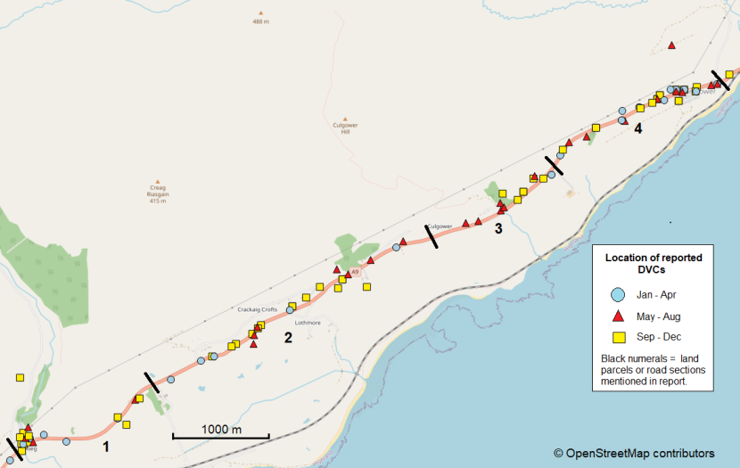
Figure 4.d (part 1). Distribution of DVCs reported in differing four-month periods of the year along the A9 from Lothbeg to Portgower based on data for 2008 to 2023 inclusive.
Click for a full description
Map showing the distribution of DVCs reported between 2008 to 2023 inclusive in the southern half (Lothbeg to Portgower) of the of the A9 study site. Coloured symbols differentiate DVCs reported in January to April (blue circles), May to August (red triangles) and September to December (yellow squares). Black numerals indicate land parcels included during walk-over site visits.
DVCs for September to December are most abundant overall. However, no clear differences in the distribution of DVCs are apparent here between the three different periods of the year.
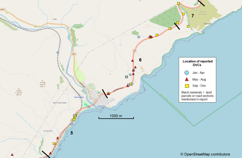
Figure 4.d (part 2). Distribution of DVCs reported in differing four-month periods of the year along the A9 from Gartymore to Ord of Caithness based on data for 2008 to 2023 inclusive.
Click for a full description
Map showing the distribution of DVCs reported between 2008 to 2023 inclusive in the northern half (Gartymore to Ord of Caithness) of the of the A9 study site. Coloured symbols differentiate DVCs reported in January to April (blue circles), May to August (red triangles) and September to December (yellow squares). Black numerals indicate differing road sections covered during walk-over site visits referred to in the report.
The highest numbers of DVCs overall at the A9 are recorded in September to December, but these months predominate to a lesser extent here than in the southern half (Figure 4.d part 1 above) of the study site. However, all of the six incidents located within the most northerly two km. occurred during September to December. DVCs within road section 6 (which includes Navidale roundabout) have been reported in similar proportion in each of the four-month time periods.
Annex 2 - Catalogue of sample photographic images taken during site visits
Selection of photographs taken during site visits to M9 Pirnhall interchange (Annex 2.a), M8 Livingston interchange (Annex 2.b) and A82 Renton junction (Annex 2.c) during August 2024, and along the A9 Lothbeg to Ord of Caithness (Annex 2.d) in January 2025.
Numbering of photographs in each case gives first the road number, followed by the number of the site-specific land parcels (as shown in Figures 4.a-d and Figures 6.a-d in the main body of the report), plus a letter to identify different images taken within the same land parcel.
Annex 2.a - M9 Pirnhall interchange (August 2024)
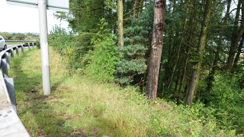
M9_1a. Image of scrub and woodland vegetation inside safety barrier at land parcel 1.

M9_1b. Image of woodland with dense ground vegetation in land parcel 1.

M9_1c. Image showing typical patchwork of high mixed herb, grass and ground vegetation, recent tree planting and mixed self-seeded shrubs and trees outside of woodland areas at land parcel 1.
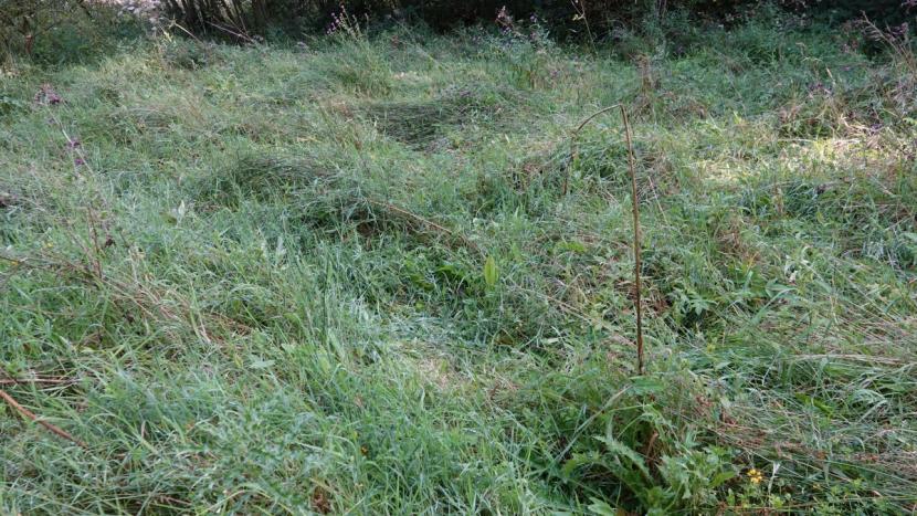
M9_1d. Image of ‘deer-beds’, i.e. depression in high grass where deer have been lying-up recently.
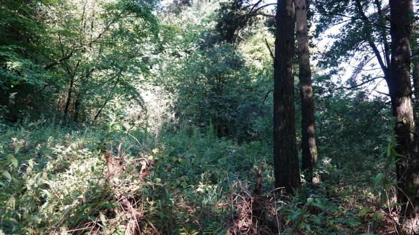
M9_2a. Image showing typical extent of understorey vegetation in areas of woodland at land parcel 2.
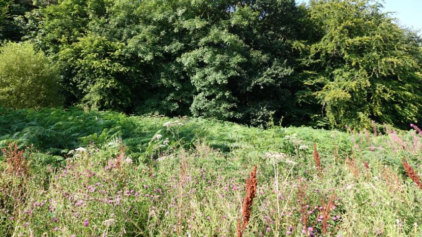
M9_2b. Image of typical high ground vegetation of herbs, bracken and shrubs in areas outside of canopy woodland in land parcel 2.
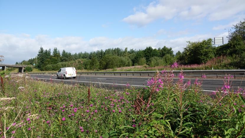
M9_2c. View from land parcel 2 across the M9 to land parcel 1, showing a diverse range of vegetation types.
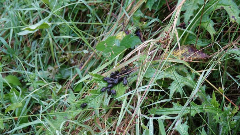
M9_2d. Fresh roe deer dung pellets providing evidence of recent deer presence.
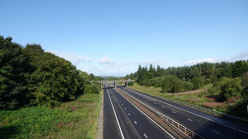
M9_2e. View from roundabout overbridge showing the M9 and land parcel 1 to the right, and land parcel 2 on the left.

M9_2f. View of M9 from roundabout overbridge showing southbound on-slip in the distance.
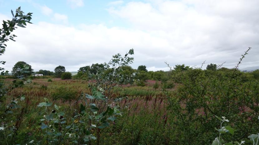
M9_3a. Image showing the height and wide range of herbs, grasses, shrubs and developing woodland within land parcel 3, providing ideal habitat for deer during summer.
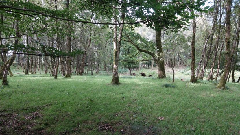
M9_4a. Image showing typical structure of wood pasture woodland in land parcel 4.
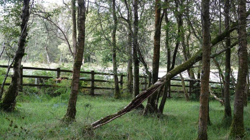
M9_4b. View of same woodland area as previous image, showing also the trunk road boundary fence and verge vegetation.
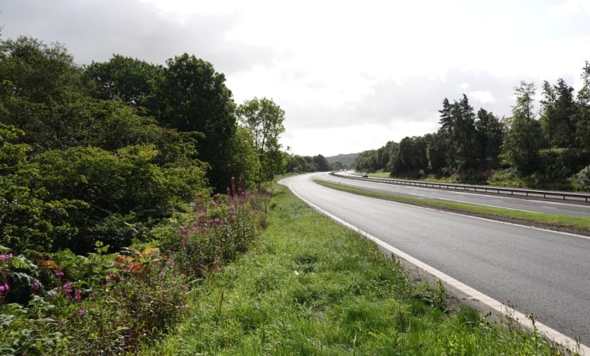
M9_5a. Image of southbound on-slip viewed from the North, with land parcel 5 on the left.
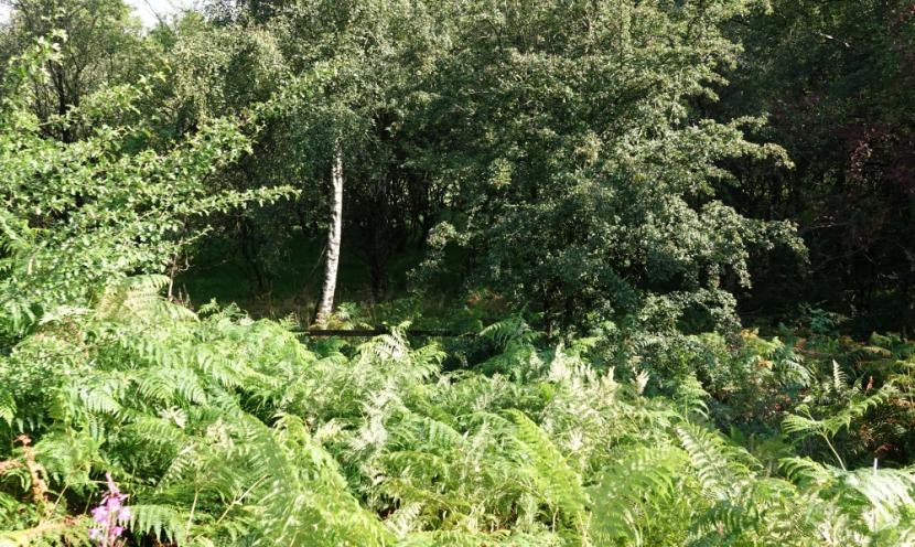
M9_5b. View of high bracken and shrub growth in summer between carriageway and highway boundary fence.
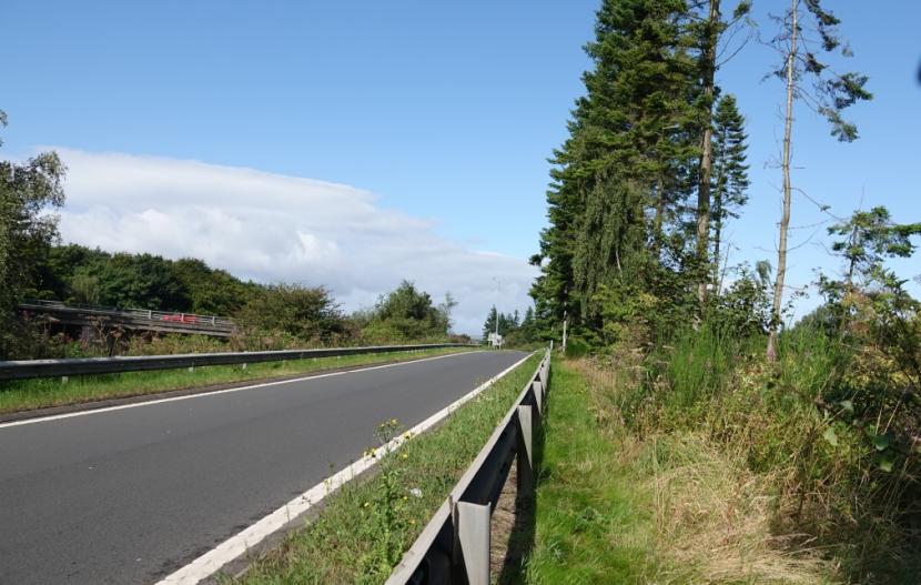
M9_5c. Image of southbound on-slip viewed from the South, showing narrow linear tree belt outside safety barrier.
Annex 2.b - M8 Livingston interchange (August 2024)
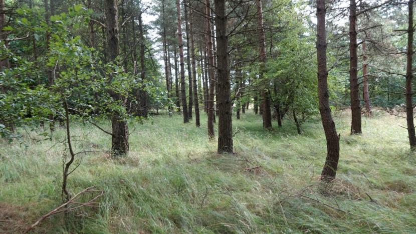
M8_1a. Example view of parts of mixed broadleaved and conifer wood in land parcel 1, with sparse canopy, mainly grassy ground cover and limited other woody understory.
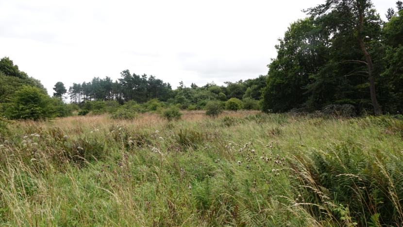
M8_1b. Image showing typical mix of high herb and grass vegetation outside of areas of woodland within land parcel 1, with also extensive developing scrub woodland.
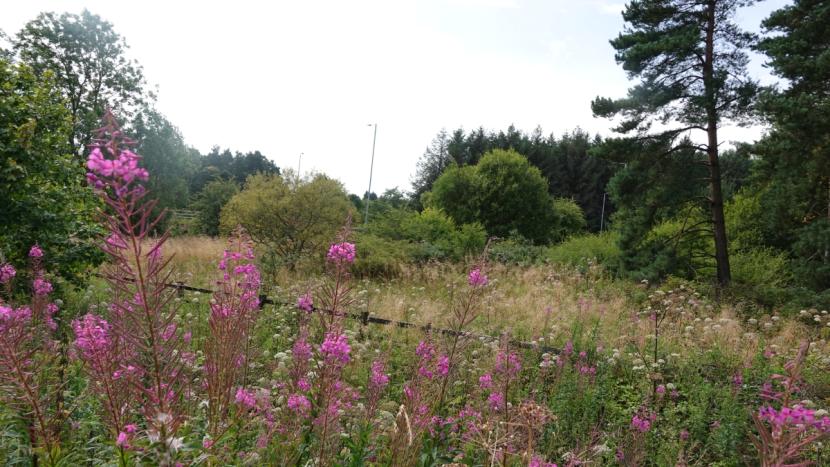
M8_2a. A further view of the diverse high ground vegetation providing ideal hiding cover and food availability for roe deer during spring and summer.
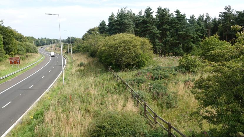
M8_2b. View of the eastbound M8 off-slip, and showing typical mix of high woodland, developing scrub and mix of ground vegetation in more open patches within land parcel 2 (on the right).
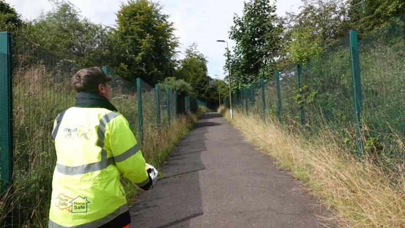
M8_2c. Image showing a public footpath from slip road overbridge, with high security fencing separating land parcels 2 and 3.
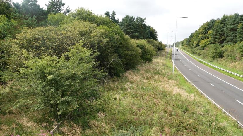
M8_3a. View from footbridge looking west along eastbound off-slip, with view of land parcel 3 on the left and land parcel 5 on the right.
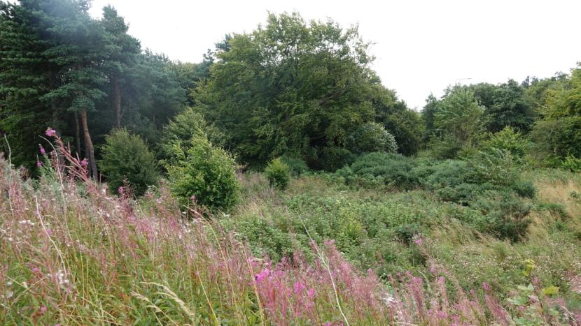
M8_4a. Image showing the height and wide range of herbs, grasses, shrubs and developing woodland within land parcel 4, providing ideal habitat for deer during summer.
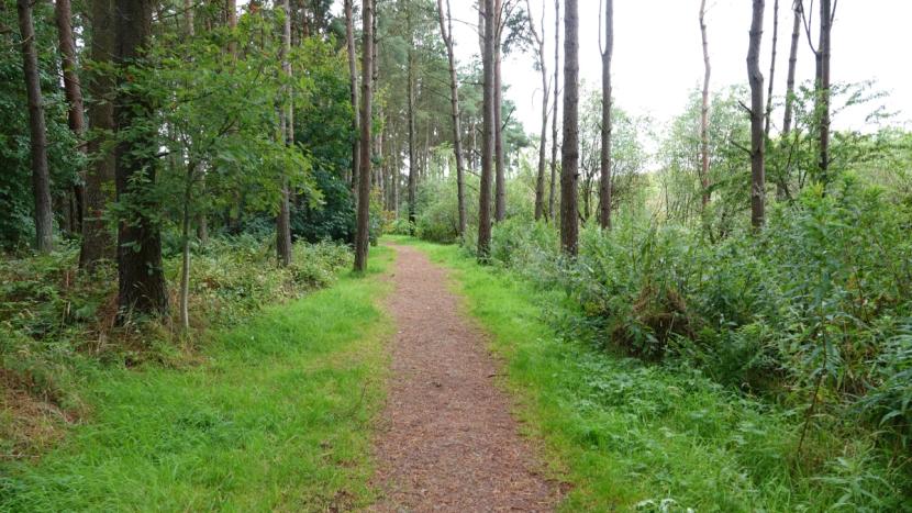
M8_5a. Sample image of woodland and understorey from footpath through North Woods (land parcel 5), which abuts the M9 to the north but is not on Scottish Ministers’ land.
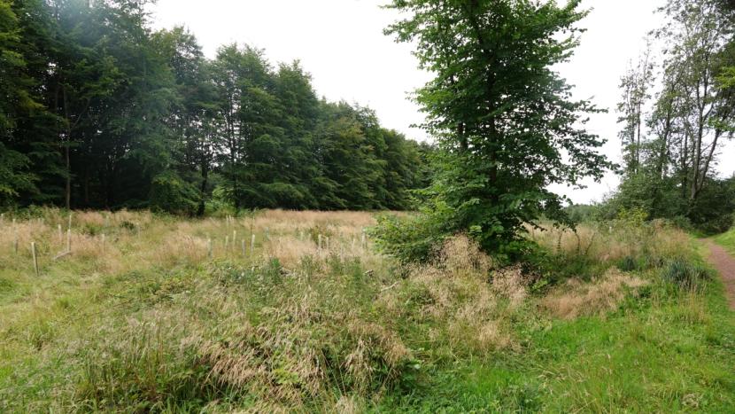
M8_5b. A further image within land parcel 5, showing vegetation in currently more open areas.
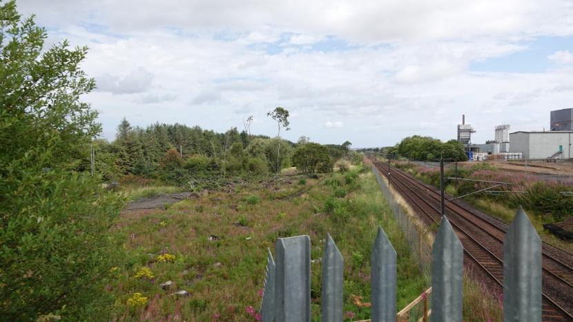
M8_6a. View from bridge over the railway line running parallel to the M8, showing recently part clear-felled areas of land parcel 6 (which is not in Scottish Ministers’ land).
Annex 2.c - A82 Renton junction (August 2024)
A82_1a. Renton road (B857) underbridge beneath the A82, and land parcel 1 on the left.
A82_1b. Image showing dense understorey in mixed secondary woodland at land parcel 1.
A82_1c. Example view of an area of mixed secondary woodland in land parcel 1 with less understorey and more bare ground than in the previous image.
A82_1d. View showing steeply sloping terrain in one of few patches of open ground in land parcel 1.
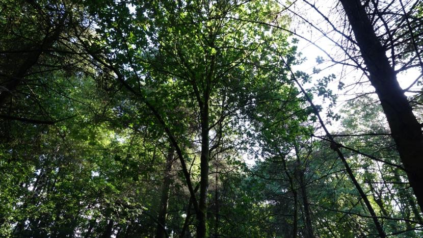
A82_2a. Sample view of tree canopy in mixed woodland of land parcel 2.
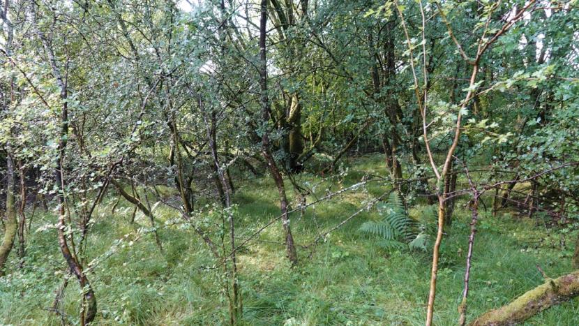
A82_2b. A patch of woodland with extensive self-seeded woody undergrowth in land parcel 2.
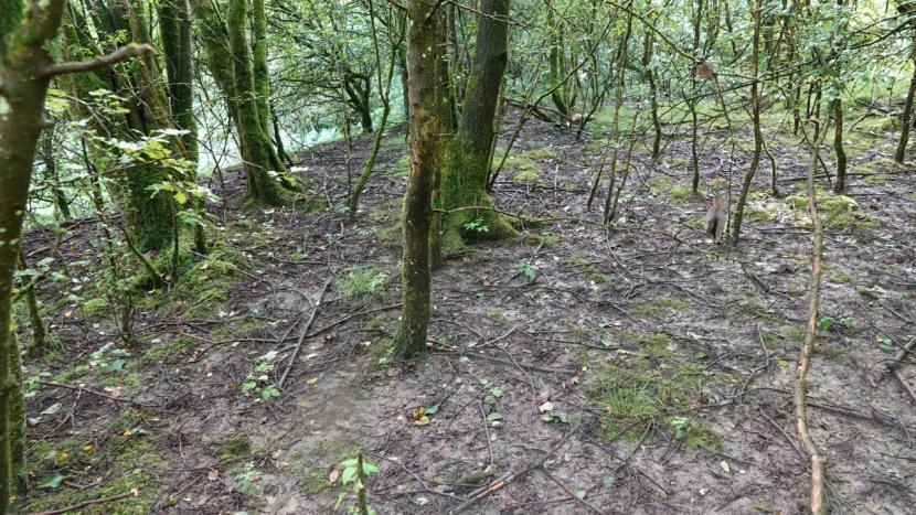
A82_2c. A patch of more mature wood than the previous image with less dense understorey.
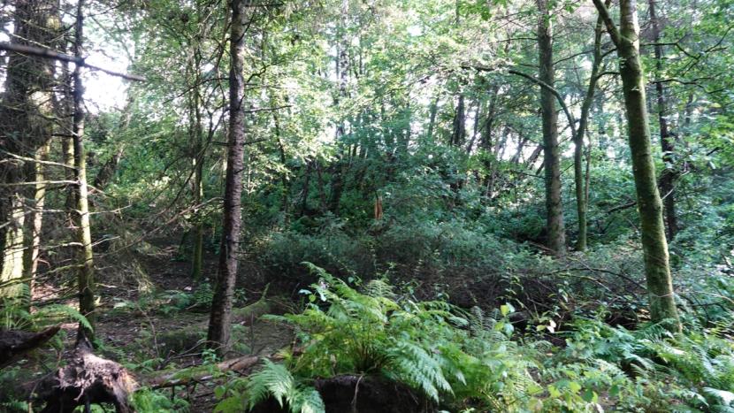
A82_2d. Image showing diverse understorey vegetation within mixed woodland at land parcel 2.
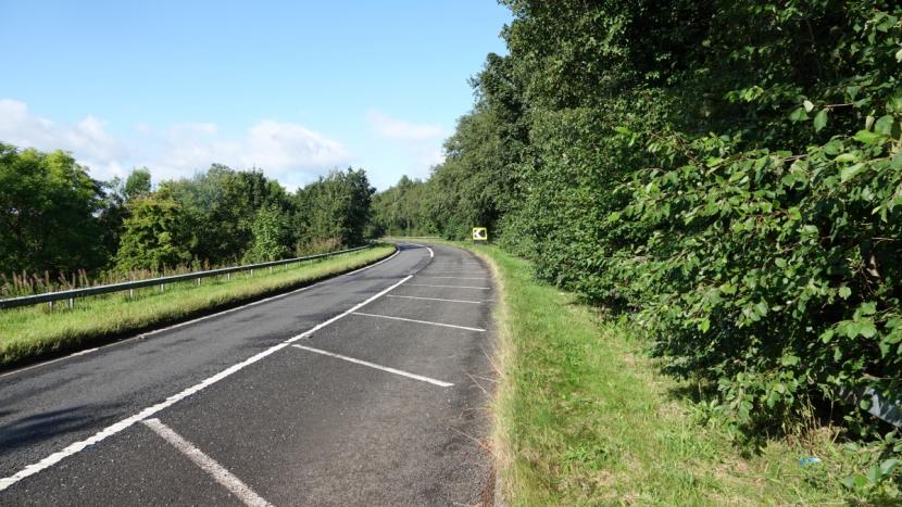
A82_2e. Single-lane A82 northbound off-slip with narrow grassy and woodland edge of land parcel 2 on the right.
A82_3a. View of access road leading to A82 southbound on- and off-slips with land parcel 1 on the right and land parcel 3 on the left.
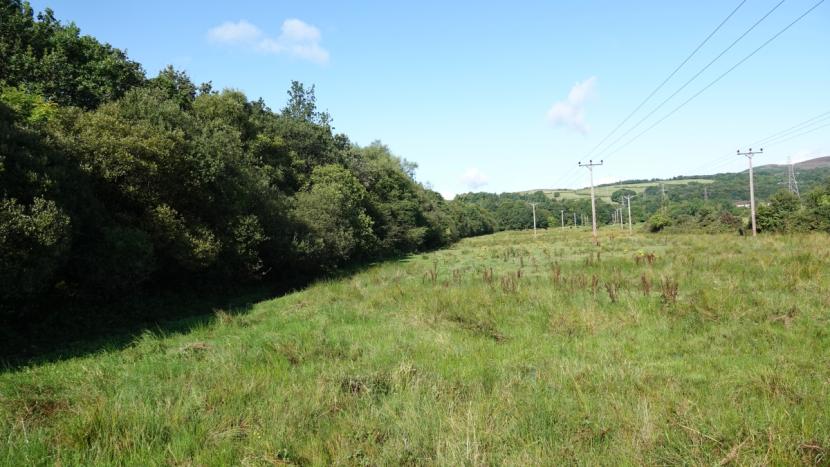
A82_3b. Linear woodland (left) alongside A82 in land parcel 3 viewed from edge of River Leven.
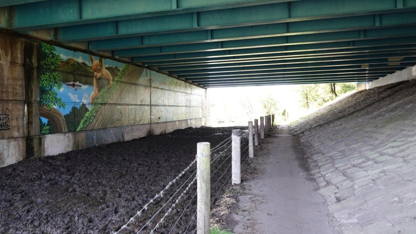
A82_3c. Underpass beneath A82 alongside River Leven used by cattle and equally useable by deer.
Annex 2.d - A9 Lothbeg to Ord of Caithness (January 2025)
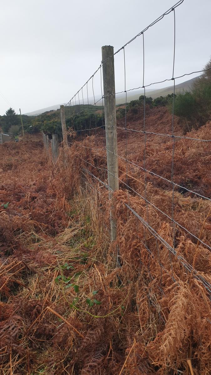
A9_1a. Deer fencing situated within 20 m. of the northbound carriageway near Crakaig.
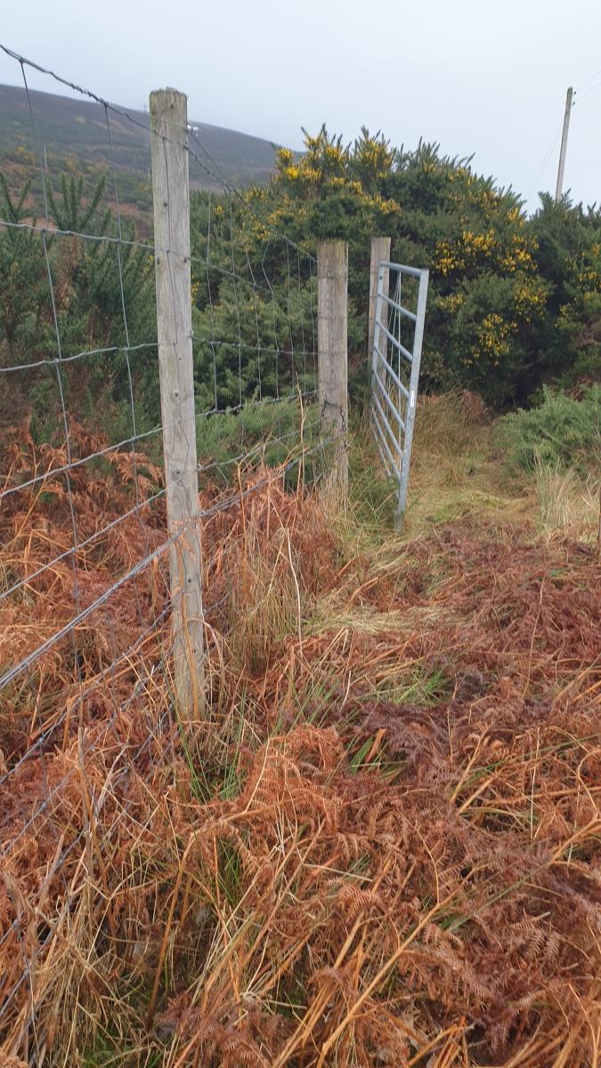
A9_1b. Deer fencing in good condition close to the road near Crackaig. A gate stuck in open position showed signs left by deer passing through.
A9_2a. Example boundary stock fencing along highway boundary at A9 northbound.

A9_3a. Example of red deer slots in mud along northbound verge of A9; also recorded in many other areas of road sections 2, 3 and 4.
A9_3b. View southbound from layby near Westgarty Lodge road junction. Note recently cut back gorse scrub to improve visibility along northbound side.
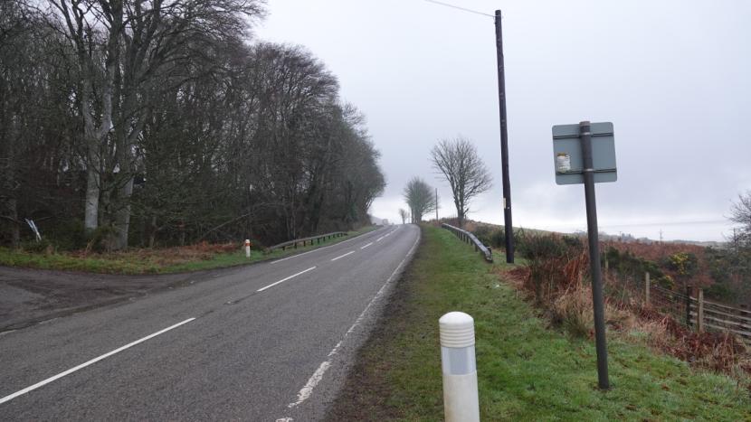
A9_3c. View of A9 facing north by West Gary Lodge.
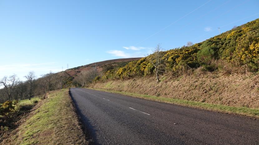
A9_4a. View of A9 facing south showing extensive, recent cutting back of gorse and other scrub along both northbound (right) and southbound verges.
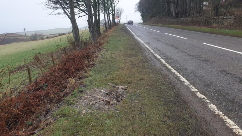
A9_4b. Deer carcass remains on verge near West Garty Lodge junction, close to a prominent, regularly used deer trail. For further images of the trail, see A9_4.d and 4.e below.
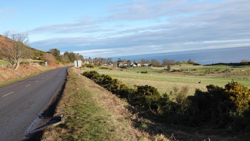
A9_4c. View north along A9 from Westgarty to Portgower showing further examples of the extent to which scrub has been cut back recently here along both verges. Note also on the right of the picture a live deer that was carrying a leg injury.
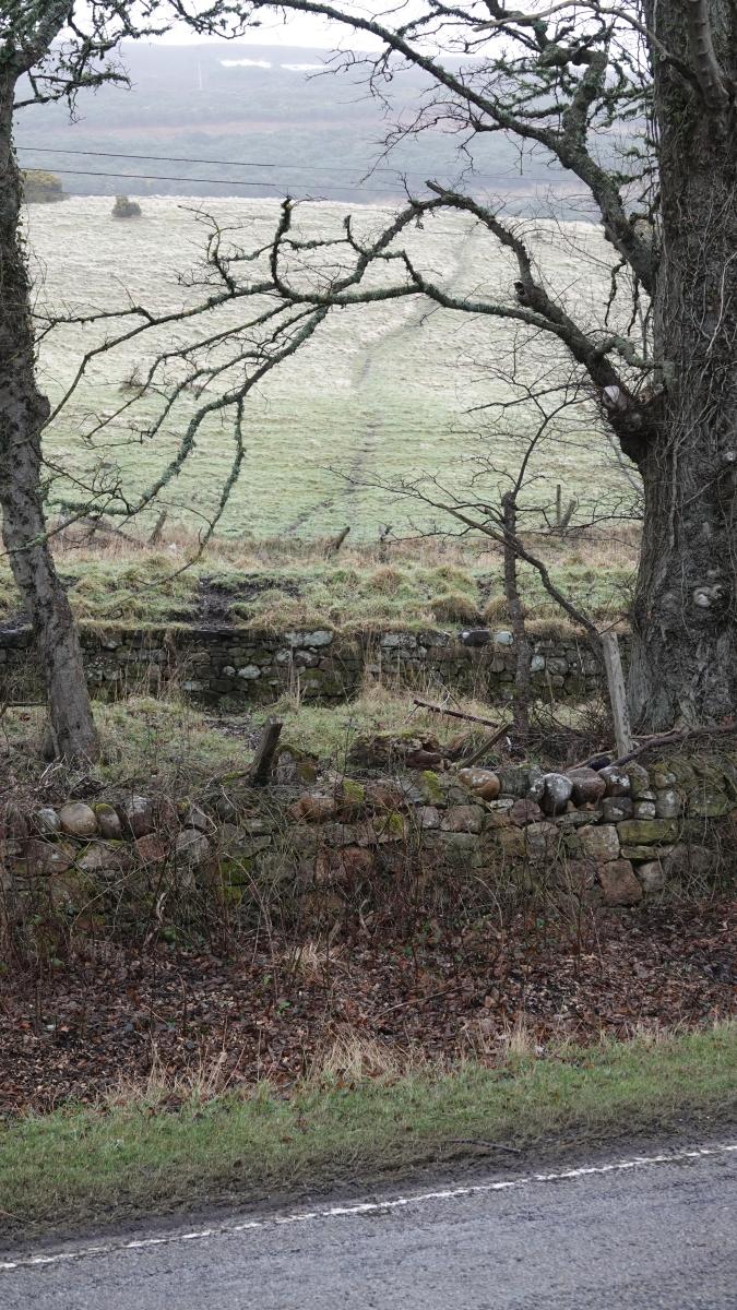
A9_4d. Example of a prominent, regularly used deer trail leading from the hillside to the northbound edge of the A9. See also 4e (right) showing continuation of the same trail on the opposite side of the road.
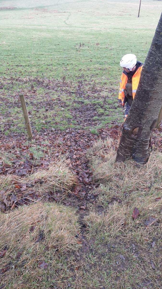
A9_4e. Continuation of the deer trail shown in the previous image (4d) from the A9 into low-lying pastures on the coastside of the A9.
A9_4f. Sample close-up view of a well-used red deer trail leading down a slope to stock fencing on the southbound side of the A9.
A9_4g. Sample close-up view of a prominent red deer trail on an embankment close to the northbound side of the A9.
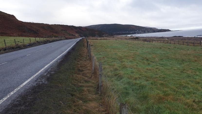
A9_5a. View of A9 northbound between Portgower to Helmsdale, with railway line and coast to the right.
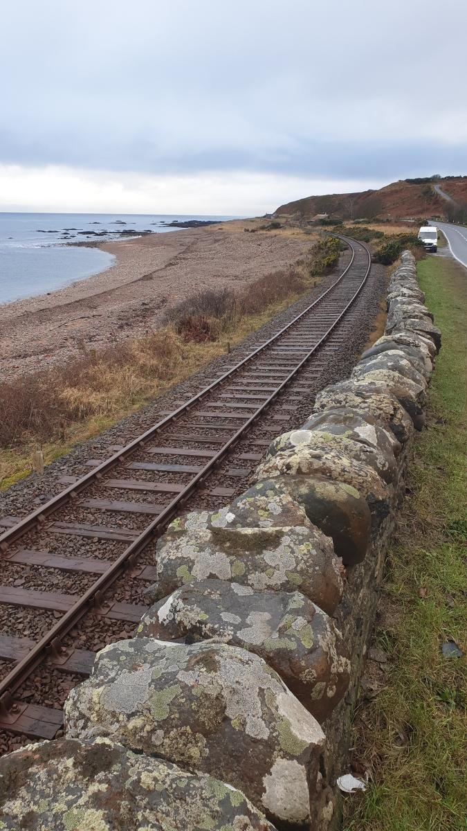
A9_5b. South-facing view of railway line where it runs closely alongside the A9 approaching West Helmsdale.
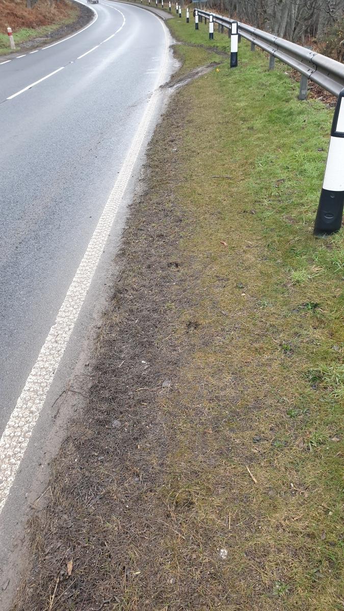
A9_5c. Deer slots noted for >100m along southbound verge of the A9 between Gartmore and West Helmsdale.
A9_6a. View of A9 Navidale roundabout.
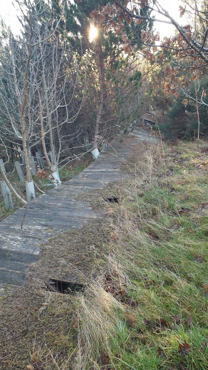
A9_6b. Derelict wooden boundary fencing on southbound approach to Navidale roundabout.
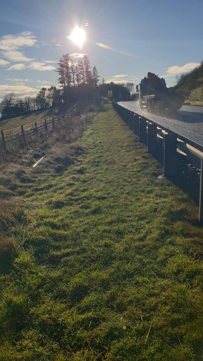
A9_6c. View of stock fencing and safety barrier on southbound approach to Navidale roundabout.
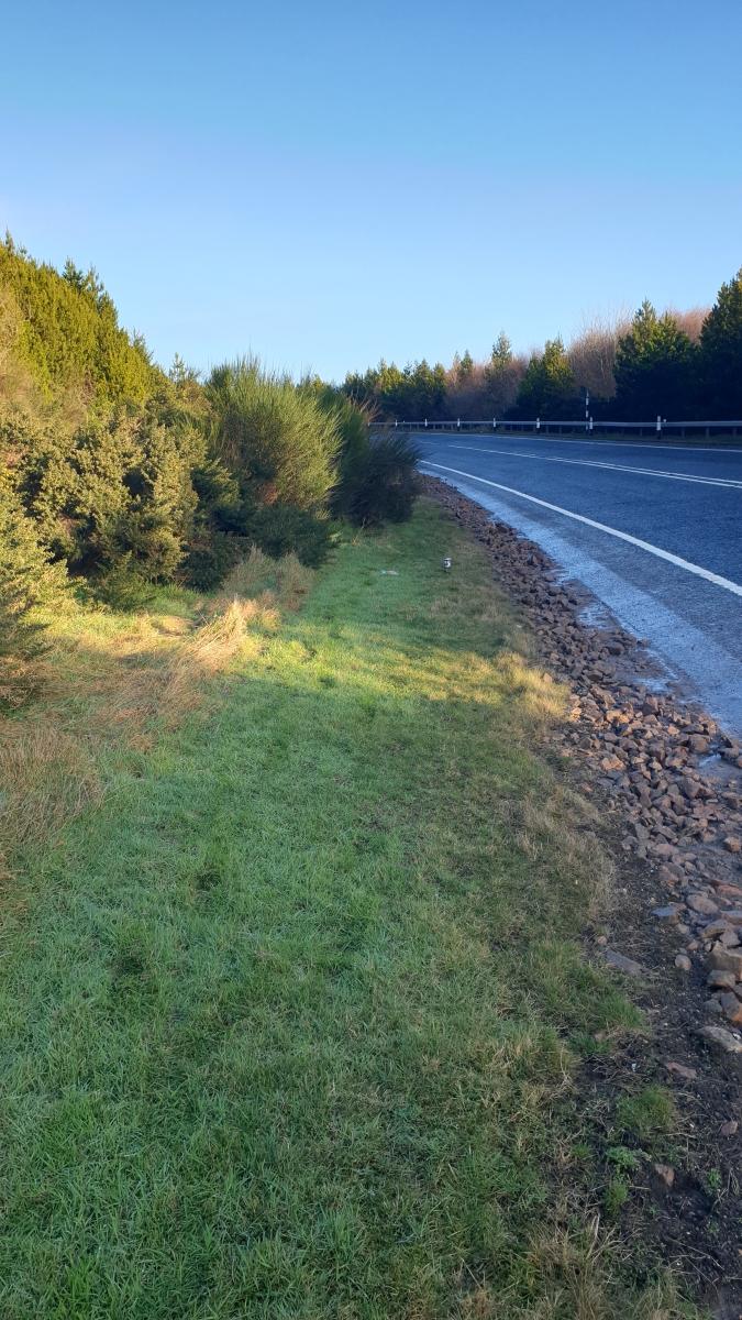
A9_6d. Northbound approach to Helmsdale viewpoint, showing scrub encroachment and reduced visibility at bend in road.
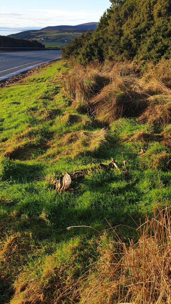
A9_6e. Deer carcass remains on northbound verge near Helmdale viewpoint. Located about 100 m. further north from image 6d.
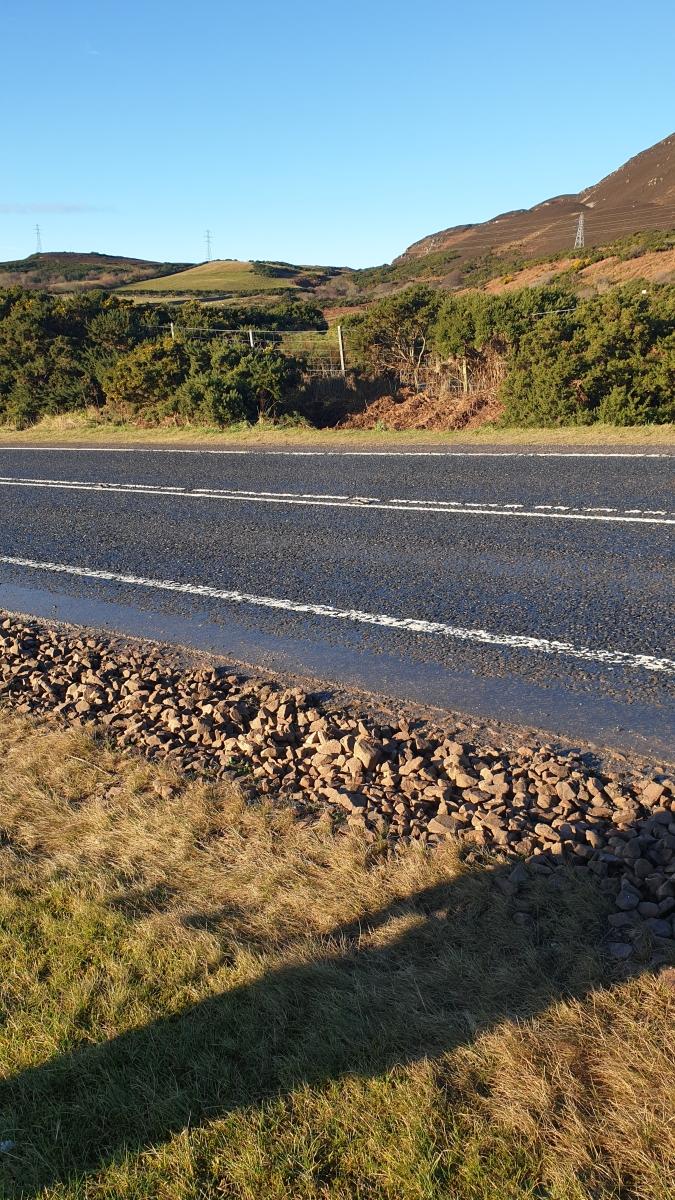
A9_6f. View across the A9 to boundary fencing overgrown with gorse scrub.
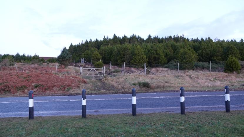
A9_7a. Plantation deer fencing close to northbound side of A9. Note that areas where deer breach this fence were noted, including beneath the gate shown.
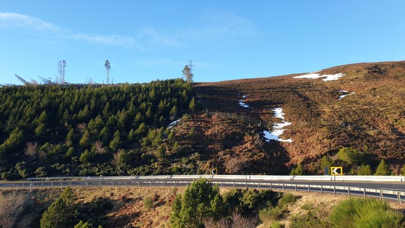
A9_7b. View of A9 at Ord of Caithness, showing line of plantation deer fencing at very variable distances from the road.
Annex 3 - Maps showing distribution of deer groups recorded during A9 thermal survey
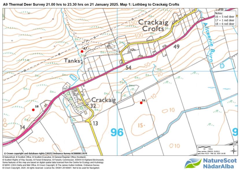
Map 1. Map 1 of 4 showing locations and size of deer groups seen during A9 thermal survey to either side of the Helmsdale to Ord of Caithness section.
Click for a full description
Map showing, by means of filled red circles, the approximate location of separate groups of red deer spotted during the survey. Three groups of deer were seen within the confines of this map. Of these one group numbering five deer was located within 400 m. south of the A9, and two groups totalling of seven deer within 100 to 300 m. north of the road.
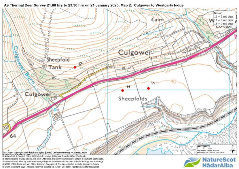
Map 2. Map 2 of 4 showing locations and size of deer groups seen during the A9 thermal survey to either side of the Westgarty to Gartymore section.
Click for a full description
Map showing, by means of filled red circles, the approximate location of separate groups of red deer spotted during the survey. Three groups of deer were seen within the confines of this map. Of these two groups totalling 17 deer are shown located within 200 m. to the south of the A9, and one group of two deer within 300 m. north of the road.
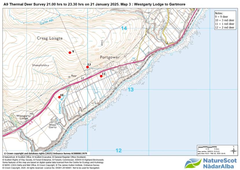
Map 3. Map showing locations and size of deer groups seen during the A9 thermal survey to either side of the Culgower to Westgarty section.
Click for a full description
Map showing, by means of filled red circles, the approximate location of separate groups of red deer spotted during the survey. Four groups of deer were seen within the confines of this map. Of these, two groups totalling four deer are shown located within 100 m. to the south of the A9, and two groups at 200 to 500 m. north of the road.
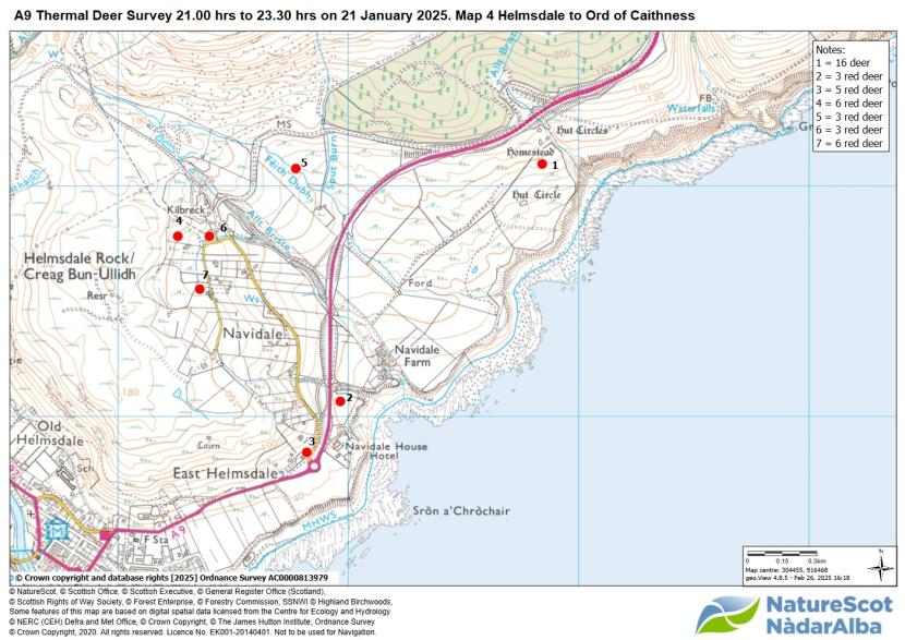
Map 4. Map showing locations and size of deer groups seen during A9 thermal survey to either side of the Lothbeg to Crackaig Crofts section.
Click for a full description
Map showing, by means of filled red circles, the approximate location of separate groups of red deer spotted during the survey. Seven groups of deer were seen within the confines of this map. Of these, two groups were seen south of the road, including one group of 16 within 200 m. of Helmsdale viewpoint, and one of two deer close to the Navidale roundabout. Groups of deer north of the A9 included another group of three close to the roundabout, and four groups totalling 20 deer spotted at 300 to 700 m. from the road.
Last updated:
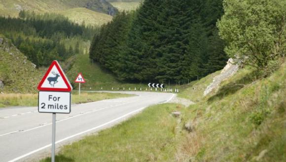


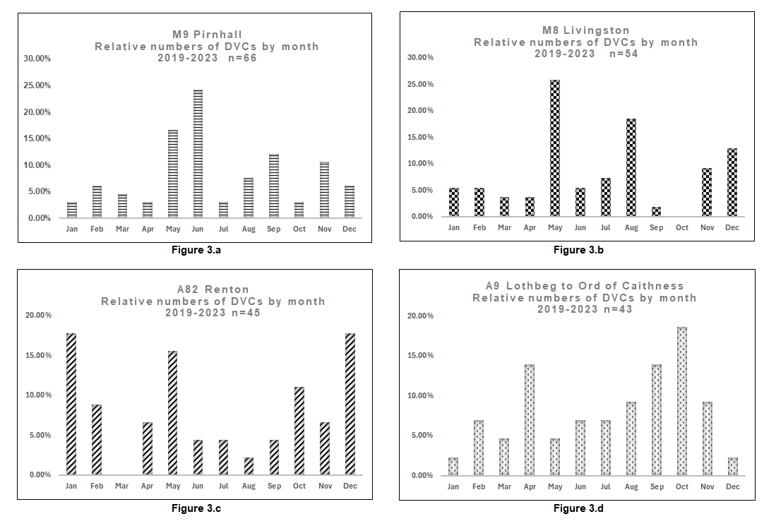