Peatland ACTION Partnership Monitoring Strategy
Peatland ACTION Partnership Monitoring Strategy 2024-2030
The Peatland ACTION Partnership Monitoring Strategy sets out our guiding principles for all our restoration monitoring.
About Peatland ACTION
Peatland ACTION is the national programme to restore Scotland’s degraded peatlands. It is an important part of Scotland’s response to the climate and biodiversity crises and is supported by several land use planning and management policy commitments.
Peatland ACTION is led and funded by Scottish Government and delivered in partnership with NatureScot, Cairngorms National Park Authority, Loch Lomond & The Trossachs National Park Authority, Scottish Water, and Forestry and Land Scotland.
Peatlands in good condition are major stores of carbon, host unique biodiversity, improve water quality and regulate water flow. These benefits are reversed when peatlands are degraded, so restoration aims to promote improved habitat condition and function.
Monitoring strategy vision and priorities
Monitoring strategy vision
Our vision for the Peatland ACTION Partnership Monitoring Strategy is “to assess the effectiveness of the Peatland ACTION partnership’s work to restore Scotland’s degraded peatlands”.
The Peatland ACTION programme needs robust monitoring to evaluate outputs and outcomes. This Monitoring Strategy embodies the collective commitment between delivery partners to achieve this goal and outlines key and supportive monitoring priorities. Regular meetings of partner representatives on the Monitoring and Data subgroup will coordinate efforts and track progress to ensure success. The Monitoring Strategy will be regularly reviewed to ensure continued relevance.
Our priorities
Delivery partners have agreed four key priorities for Peatland ACTION monitoring as follows:
- Validate peatland restoration delivery outputs.
- Inform best practice to gain the maximum potential benefits from peatland restoration.
- Evaluate overall effect on peatland recovery.
- Strengthen the evidence for the wider benefits of peatland restoration.
Two supportive priorities are to:
- Share data and communicate results.
- Develop new tools to improve peatland monitoring.

Peatland ACTION - Restoration Monitoring Strategy - 2024 - Figure 1
Click for a full description
Figure 1 Radial Venn diagram used to illustrated the vision and priorities of the Peatland ACTION Partnership Monitoring Strategy.
[Radial Venn diagram used to show both overlapping relationships and the relationship to a central idea in a cycle].
In this case the central idea is : "To assess the effectiveness of the Peatland ACTION partnership's work to restore Scotland's degraded peatlands" which includes the following priorities:
The overlapping relationships are 3 key priorities and two supporting priorities. These are as follows:
Key priorities
1. Validate peatland restoration delivery outputs
2. Inform best practice to gain the minimum potential benefits from peatland restoration.
3. Evaluate overall effect on peatland recovery
4. Strengthen the evidence for the wider benefits of peatland restoration
Supporting priorities:
5. Share data and communicate results
6. Develop new tools to improve peatland monitoring.
Putting policy into practice
Government policies emphasise that Scotland values managing, protecting and restoring its peatlands. The 2015 National Peatland Plan was a coordinated goal to revive these iconic landscapes with a vision to encourage "a new focus on positive management, supported by evidence and research”. This Plan has moved forward through the pledge by Scottish Government to restore 250,000 hectares of degraded peatland by 2030 with funding of £250 million (see the Climate Change Plan 2018–2032 and the Infrastructure Investment Plan for Scotland). The commitments were reiterated in the First Minister’s policy prospectus published in April 2023 setting an interim target of 110,000 hectares by 2026.
Peatland ACTION – delivering in partnership
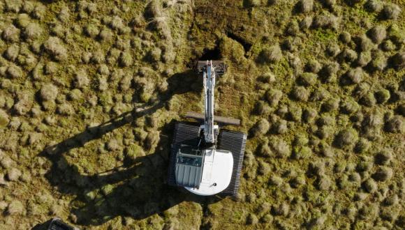
The delivery partnership has put over 51,000 hectares of degraded peatland on the road to recovery through Peatland ACTION funding. Other sectors (e.g. onshore renewables, agricultural environment and climate change support scheme) are also contributing peatland restoration to the national target of 110,000 ha by 2026 and Scottish Government is monitoring this progress. Peatland restoration efforts need to accelerate rapidly in the coming years to help address the climate emergency and biodiversity loss.
Peatland ACTION’s six delivery partners ensure a national programme of peatland restoration through the One Plan (the Partnership’s single plan of priorities) all funded through Scottish Government. Whilst sharing common priorities in monitoring the outcomes and outputs of peatland restoration, each delivery partner has a specific focal area and key responsibilities:
- Scottish Government – leads on research and policy. Research is the systematic investigation of a subject to acquire new knowledge.
- NatureScot – undertakes national restoration (outwith the partner areas), partnership coordination, work force development, communication, green finance and monitoring. Monitoring uses standard methods to collect data over time for evaluation against targets [1].
- Loch Lomond & The Trossachs National Park Authority – carries out restoration within the national park boundary.
- Cairngorms National Park Authority – carries out restoration within the national park boundary.
- Scottish Water – carries out restoration within the Scottish Water catchments.
- Forestry and Land Scotland – carries out restoration within Scotland’s National Forests and Land, and leads in forest-to-bog restoration techniques.
[1] Holl, K. D. and Cairns, J. 2002. Monitoring and appraisal. In Perrow, M. R. and Davy, A. J., eds. Handbook of Ecological Restoration. Cambridge: Cambridge University Press, pp. 411–432; Lunt, P., Allott, T., Anderson, P., Buckler, M., Coupar, A., Jones, P., Labadz, J., and Worrall, P. 2010. Peatland Restoration. Report to IUCN UK Peatland Programme, Edinburgh.
Monitoring Strategy purposes
The Peatland ACTION Partnership Monitoring Strategy purpose is to:
- Monitor the effectiveness of peatland restoration completed across the delivery partners under the Peatland ACTION programme.
- Monitor outputs: record indicators that measure progress of peatland restoration activities (Priority 1) and inform best practice development (Priority 2).
- Monitor outcomes: record indicators that measure the effectiveness of those restoration activities (Priorities 2-4).
- Communicate results (Priority 5) and adopt new tools to improve peatland monitoring (Priority 6).
Its purpose is not to:
- Actively monitor outcomes at every Peatland ACTION site (e.g. to identify need for remedial work or report wider benefits at site-level) as this would be unworkable due to the number of Peatland ACTION sites.
- Monitor compliance with restoration funding grant conditions (this work is undertaken through a separate process within NatureScot).
- Fulfil the requirements of site condition monitoring on designated sites (this work is undertaken through a separate process within NatureScot).
- Cover monitoring on non-Peatland ACTION sites e.g. development on peatlands, monitoring of Scotland’s wider peatland resource.
- Lead on peatland restoration research questions (since this is led solely by Scottish Government).
Achieving our priorities
The Partnership uses multiple pathways to achieve monitoring priorities. These include:
- Peatland ACTION led projects – work carried out or commissioned directly by delivery partners.
- Collaborative projects – work in partnership with research institutes and other external organisations.
- Monitoring project fund – application process to fund external organisations to undertake their own monitoring projects.
This flexible approach maximises what can be achieved against each of the priorities by drawing in resource and expertise from outside the delivery partnership.
Key priorities
Validate peatland restoration delivery outputs
Peatland ACTION has:
- Developed standard templates to record spatial data from restoration activities.
- Established a spatial database to store and manage data on all delivery partnership restoration activities.
- Collated and verified over 51,000 hectares of peatland put on the road to recovery up to March 2024.
Peatland ACTION continues to need reliable spatial data of planned and completed peatland restoration activities. This data helps in reporting the hectares restored to the Scottish Government under the Climate Change Plan 2018-2032 using a standardised verification process including quality assurance of submitted data. The data also enables us to report associated greenhouse gas (GHG) emissions reductions for the UK GHG Inventory. Additionally, it is useful for restoration design, cost assessment, supporting the assessment of grant compliance, monitoring outcomes and supporting peatland research.
Peatland ACTION will:
- Adapt data management processes as restoration evolves at pace and scale.
- Adopt novel technology to increase accuracy and speed of mapping.
Inform best practice to gain the maximum potential benefits from peatland restoration
Peatland ACTION has:
- Published the Technical Compendium based on collective industry knowledge.
- Supported forest-to-bog monitoring at RSPB Forsinard Flows.
Peatland restoration practitioners, landowners and land users are an invaluable source of knowledge to develop best practice through experience. In some instances, we need targeted monitoring to assess the effectiveness of specific restoration techniques in different settings. While monitoring the overall effect of Peatland ACTION (Priority 3) encompasses various project types, we must adapt our approach when assessing differences between techniques or settings. This is crucial for comparing methods, applying techniques in new areas, or testing novel approaches and will help identify best practices for future restoration projects.
Peatland ACTION will:
- Continue to review and improve the Technical Compendium as our understanding expands.
- Trial novel techniques led by the NatureScot Peatland ACTION Technical Advice Team, including application of sheep wool in bare peat restoration.
- Develop an approach to monitoring the processes impacting upon individual restoration sites to help inform trajectories within the Cairngorms National Park. This includes the monitoring of restoration outcomes where herbivore numbers are at a level considered to be high.
- Fund projects addressing the listed priorities under the new monitoring project fund.
Evaluate overall effect on peatland recovery
Peatland ACTION has:
- Launched the Restoration Monitoring Network (RMN) in 2023 (an approach to applying standardised, cost-effective, repeatable, long-term monitoring across a representative sample of Peatland ACTION sites).
- Maintained a national network of hydrology loggers across multiple sites since 2014.
- Published research reports on previous vegetation monitoring completed in 2014/15 (Research Report 1278) and repeated in 2021 (Research Report 1301).
Peatland ACTION needs to understand the overall effectiveness of the Peatland ACTION programme in delivering peatland recovery across the broad range of restoration projects. The projects cover different peatland types, starting conditions, sources of degradation, restoration techniques, geographical locations and other environmental factors. Consistent monitoring methods must be applied across multiple sites in order to capture this variation and replicate findings. Key indicators of peatland recovery include vegetation, hydrology and bare peat extent. Demonstrating the impact of our combined effort is essential to communicating results (Priority 5), engaging with stakeholders and securing continued support and interest in future restoration work.
A 2022/23 review of Peatland ACTION hydrology monitoring found it was not possible to determine the effect of restoration on water levels at a national scale due to a lack of pre-restoration data or comparison control loggers on unrestored sites. However, the dataset is unique in its spatial and temporal coverage of peatlands in Scotland and has proved valuable to researchers. Repeated vegetation surveys carried out in 2014/15 and 2021 showed the positive impact of tree removal on most forest-to-bog sites, while on restored drained sites, the majority of dams were retaining water. However, on restored eroding bogs, there was no discernible impact of mulch application on bare peat but greater success with application of vegetation turves and hag/gully reprofiling. Overall, vegetation change appears slow and the starting habitat and condition seem to be important factors in the potential for peatland recovery and the rate of change. Change continues to be investigated as the RMN evolves and expands.
Peatland ACTION will:
- Continue adding sites to the RMN from across the delivery partners.
- Streamline the network of hydrology loggers, redistributing loggers to best effect.
- Integrate remote sensing techniques to expand monitoring efforts.
Strengthen the evidence for the wider benefits of peatland restoration
Peatland ACTION has:
- Funded the purchase of eight eddy covariance flux towers for ecosystem-level monitoring of peatland GHG emissions across Scotland.
- Supported before and after restoration water quality monitoring with Galloway Fisheries Trust.
- Coordinated research and monitoring with Scottish Government’s Rural and Environment Science and Analytical Services (RESAS) Division.
- Collaborated with the CentrePeat project under the Strategic Research Programme.
Peatland ACTION continues to increase evidence on the wider benefits of peatland restoration for nature, people, and climate. Through our data and supporting the work of others we will highlight the impact of restoration on outcomes such as greenhouse gas emissions, biodiversity and water quality. This effort often extends beyond monitoring into research requiring specialist input and costly methods, so collaboration and external funding are essential.
The flux towers Peatland ACTION has purchased are affiliated with the SCO2FLUX Network which fills gaps on GHG budgets across the range of peatland types/conditions and will improve emissions factors for UK GHG Inventory reporting. It will also improve understanding of GHG emissions before, during and after restoration.
Peatland ACTION will:
- Continue to coordinate with RESAS and Scottish Government to determine and address research priorities in agreement with the peatland Science and Technical Advisory Group (STAG).
- Fund projects addressing the listed priorities under the new monitoring project fund.
- Communicate relevant research developments across Peatland ACTION.
Supportive priorities in detail
Share data and communicate results
Peatland ACTION has:
- Shared spatial data on restoration projects via our spatial data mapping portal.
- Shared monitoring datasets on our open data webpage and the Peatland ACTION hydrology explorer.
- Shared peatland erosion and drainage spatial data for Cairngorms National Park.
- Published research reports on bog breathing and vegetation monitoring.
Peatland ACTION continues to strive to communicate the results from all our monitoring including through published reports, open datasets and online dashboards. We make monitoring datasets and results accessible and freely available under the Open Government Licence wherever possible to support restoration practice and research across the UK and beyond. Sharing key outputs with stakeholders and the public will also be important to improve understanding of the wider benefits of peatland restoration (Priority 4).
Peatland ACTION will:
- Publish protocols, datasets and reports from the RMN.
- Expand the spatial data mapping portal to include more detailed spatial data from restoration projects and integrate monitoring data.
- Publish the bog breathing spatial datasets.
- Continue to publish research reports from funded projects.
- Increase the availability of data from funded projects on our open data website and other data repositories.
- Publish stakeholder-focused outputs to communicate monitoring results.
Develop new tools to improve peatland monitoring
Peatland ACTION has:
- Collaborated with the University of Nottingham and the University of the Highlands and Islands on the bog breathing project to develop methods which allow the mapping of peatland condition and change from satellite radar data. The use of the radar data to assess peat slide susceptibility has also been explored.
- Supported the University of Stirling to develop a toolkit for monitoring peatland restoration projects using remote sensing as part of the Forth-ERA project.
- Trialled Internet of Things technology to monitor peatland hydrology on the Isle of Lewis.
We need new tools to reduce costs and improve the effectiveness of our monitoring. Benefits of new technologies include more frequent monitoring, greater coverage, better access to remote areas, less habitat disturbance, reduced bias, and increased replicability. As peatland restoration in Scotland expands, these tools will become essential. Coordination with the Scottish Government and RESAS (the lead on Research in the One Plan) is crucial for smart project investment.
Peatland ACTION will:
- Publish bog breathing research reports building on initial research findings (Research Report 1269).
- Publish a research report on Forth-ERA.
- Move from research into application of satellite-based approaches for monitoring peatland condition.
- Explore applications of other new technologies such as bioacoustics and environmental DNA for biodiversity monitoring.
- Continue to coordinate with RESAS and Scottish Government in agreement with peatland STAG to determine and address research priorities.
- Continue to support the Internet of Things technology trial on the Isle of Lewis to monitor hydrology through the post-restoration phase.
- Fund projects addressing the listed priorities under the new monitoring project fund.
Strategic Linkages
This Monitoring Strategy is linked to several other strategies and programmes detailed in the table below. NatureScot Peatland ACTION coordinate peatland research with RESAS and peatland STAG. The delivery partnership will ensure alignment across policies on land use, agriculture, wildlife, healthy soils, and protected areas. The development sector's experience in peatland monitoring, shared through the Peatland Expert Advisory Group, will be important in achieving our priorities.
| Area | Peatland ACTION lead delivery partner and primary role |
|---|---|
| The Strategic Research Programme including CentrePeat | NatureScot – support projects under the Scottish Government Strategic Research Programme and promote coordination of wider peatland research. |
| Climate Change Plan | NatureScot – contribute to Scottish Government statutory reporting requirements, including coordination across the delivery partners. |
Climate Ready Scotland: climate change adaptation programme 2019-2024
| NatureScot – contribute to Scottish Government statutory reporting requirements, including coordination across the delivery partners. |
| Scottish Biodiversity Strategy, Delivery plans | NatureScot – support development of policy, guidance and best practice. Contribute to reporting requirements under the delivery plans where appropriate. |
| IUCN Peatland Code | NatureScot – where possible and appropriate, facilitate alignment of monitoring protocols and support further development of the Peatland Code (e.g. biodiversity crediting). |
| Cairngorms National Park Partnership Plan 2022-27 | Cairngorms National Park Authority – ensure consistency of reporting against targets (e.g. hectares of restoration) set out in the national park plan and Climate Change Plan. Coordinate data and monitoring linkages between objectives (e.g. Cairngorms Nature Index) of the national park plan and Peatland ACTION Partnership Monitoring Strategy projects. This role encompasses the various mechanisms for delivery of the national park plan such as Cairngorms 2030. |
| National Park Partnership Plan (NPPP) 2024-2029 | Loch Lomond & The Trossachs National Park Authority – ensure consistency of reporting against targets (e.g. hectares of restoration) set out in the national park plan and Climate Change Plan. Coordinate data and monitoring linkages between objectives of the national park plan and Peatland ACTION Partnership Monitoring Strategy projects. This role encompasses the various mechanisms for delivery of the national park plan such as the Future Nature Programme. |
This Monitoring Strategy and consultation with Scottish Government (One Plan, Research lead) act as the framework within which Peatland ACTION makes decisions to support financial or resource investments into academic research, student and PhD projects.
Annexe - Monitoring Strategy project updates
We will update this section regularly with details of monitoring we have started, continued or completed. In addition, actions for the current year are outlined. Progress is presented by financial year (1 April – 31 March). A summary for the most recent financial years is given below, followed by individual descriptions of key past and present projects. References to any technical reporting or interpretation of results will be provided.
2025-2026
- We have validated projects that collectively put 66,000 hectares of peatland on the road to recovery. Peatland ACTION spatial data has been added to ArcGIS Online (AGOL) to provide an interactive map-based view of spatial data related to peatland restoration efforts across Scotland. We continue to collate and verify peatland restoration spatial data, including creating spatial templates to record spatial data from restoration activities.
- The Restoration Monitoring Network now consists of 20 sites surveyed prior to restoration representing approximately 400 pre-restoration vegetation quadrats and feature status assessments as well 166 pre-restoration fixed point photos. Seven of the RMN sites have been surveyed 1-year post restoration survey. Of these sites, nine are within the actively eroding blanket bog category, seven within the drained blanket bog category, three within the forest to bog category and one within the drained raised bog category. We are currently aiming at 10 in each category.
- The Monitoring Project Fund continues to increase the impact of our external monitoring funding. Five projects were assessed and funded in 2025/26 including projects to look at restoration effects on water quality, biodiversity (above and below ground) and developing geophysical tools for peat assessments.
- We continued the maintenance of our water level logger network, the loggers at 15 sites were maintained in 2025/26.
- We continued working with FarrPoint to monitor pre-restoration hydrology using Internet of Things (IoT) technology at Loch Orasaigh on the Isle of Lewis. Data are available via an online dashboard and we aim to continue monitoring post-restoration.
- Four contracts awarded and completed for UAV surveys procured for PAO-led projects in development on Shetland. Fifth UAV survey contract for Highlands site pushed to March 2026 with confirmation from supplier of contract timeline expected imminently. Further development and use of PA's Amazon Web Services (AWS) cloud storage S3 bucket system for PA UAV data storage and management.
- We continued our peatland surface motion work with University of Nottingham and University of the Highlands and Islands developing methods to monitor peatland condition and its change at the landscape level using satellite radar data. The three outstanding bog breathing reports (RR1308, RR1355, RR1356) were all published on - all reports are related to development and testing of radar (InSAR) mapping of peat condition. Data from the large area report (RR1356) was also made publicly available for download, on a webpage accessed through NatureScot website. This allows scientists and others in the peatland field to explore the outputs in their own GIS.
Ongoing Peatland ACTION monitoring projects.
Expand the accordions below to find out more about our active monitoring projects.
Greenhouse gas monitoring on peatland sites – Forsinard flux towers
Priority
4 - Strengthen the evidence for the wider benefits of peatland restoration.
Lead organisations
RSPB
Environmental Research Institute (ERI)
JHI
UKCEH
Project details and progress update
Timescale: Data capture ongoing.
Peatland ACTION has provided funding to purchase one eddy covariance flux tower (Dyke) and maintain or repair several existing ones (Cross Lochs, Lonielist, Talaheel, Dyke-FIRE) at Forsinard in the Flow Country.
2022/23: Funding was provided to RSPB to maintain or repair existing flux towers at Forsinard (grant reference 502163).
2021/22: Funding was provided to RSPB to maintain or repair existing flux towers at Forsinard (grant reference 501895).
2020/21: Funding was provided to RSPB to maintain or repair existing flux towers at Forsinard (grant reference 501633).
2019/20: Funding was provided to RSPB to maintain or repair existing flux towers at Forsinard (grant reference 501266).
2017/18: Funding was provided to JHI to purchase a flux tower for installation on eroded bog that is intended to be restored at Balmoral and repair existing flux towers at Forsinard (grant reference 501059).
2014/15: Provided funding to ERI for purchase and installation of the Dyke flux tower at Forsinard (grant reference PA12445). This was installed on a peatland site planted for forestry that has now been restored.
Peatland ACTION input for 2026/27
Data capture ongoing, support as required.
Greenhouse gas monitoring on peatland sites – JHI flux towers
Priority
4 - Strengthen the evidence for the wider benefits of peatland restoration.
Lead organisation
The James Hutton Institute (JHI)
Project details and progress update
Timescale: Installation of equipment complete, monitoring ongoing.
As outlined below, Peatland ACTION has provided funding to JHI to purchase four eddy covariance flux towers for monitoring greenhouse gas (GHG) emissions on peatland sites. Funding has also been provided to maintain and repair existing flux towers.
2022/23: Installation of the two remaining JHI-managed flux towers was completed at eroded peatland sites that are intended to be restored on Shetland and the Isle of Lewis. Data capture is ongoing.
2021/22: Installation of one new flux tower was completed at a young second rotation forestry plantation on peatland in Moray. Data capture is ongoing.
2019/20-2020/21: Four flux towers were funded in 2019/20 in a joint effort with JHI, the UK Centre for Ecology & Hydrology (UKCEH), the Crichton Carbon Centre (CCC) and the National Peatland Research and Monitoring Group (NPRMG). The aim is to fill evidence gaps around peatland restoration and GHG (carbon dioxide and methane) emissions in Scotland. These towers are in addition to two flux towers previously funded by Peatland ACTION. Installation of the equipment was hindered in 2019/20-2020/21 due to Covid-19 restrictions. The NPRMG have been advising on the most suitable locations and JHI, CCC and UKCEH will manage the installation, data collation, processing and ongoing maintenance of the equipment. JHI own the equipment for three of the new towers and UKCEH for one (see South of Scotland forestry flux tower below). Given the complexity of processing and interpreting the data, Peatland ACTION does not use it directly but is kept up to date by the research partners involved.
2017/18: Funding was provided to purchase a flux tower for installation on eroded bog that is intended to be restored at Balmoral and repair existing flux towers at Forsinard (grant reference 501059). Initial findings from Balmoral have now been published in a scientific journal.
Peatland ACTION input for 2026/27
Data capture ongoing, support as required.
Greenhouse gas monitoring on peatland sites – Midlothian raised bog flux tower
Priority
4 - Strengthen the evidence for the wider benefits of peatland restoration.
Lead organisation
UK Centre for Ecology & Hydrology (UKCEH)
Project details and progress update
Timescale: Equipment installation completed at end of 2022/23. Final report due in 2025/26.
2022/23: The installation of an additional eddy covariance flux tower to be operated by UKCEH at a raised bog in Midlothian was funded by Peatland ACTION. This will provide measurements at this site before, during and after restoration, to determine changes in GHG emissions resulting from restoration. This will be further supported by comparison with long-term GHG flux tower data from the nearby UKCEH Auchencorth Moss research facility.
Peatland ACTION input for 2026/27
Data capture ongoing, support as required.
Greenhouse gas monitoring on peatland sites – South of Scotland forestry flux tower
Priority
4 - Strengthen the evidence for the wider benefits of peatland restoration.
Lead organisations
Crichton Carbon Centre (CCC)
UK Centre for Ecology & Hydrology (UKCEH)
The James Hutton Institute (JHI)
NatureScot
Project details and progress update
Timescale: Installation of equipment completed in 2023/24. Ongoing management led by project partners.
2023/24: Installation of the flux tower was completed at a maturing second rotation forestry plantation on peatland near Dumfries. Monitoring will be in place while the trees mature and will continue after felling when the site is restored back to open peatland.
2022/23: NatureScot commissioned a technical specification to enable installation of the South of Scotland forestry flux tower. A procurement exercise was then completed to identify a suitable contractor for installation of the tower, but installation was delayed to 2023/24.
2019/20-2021/22: Four flux towers were funded in 2019/20 in a joint effort with JHI, UKCEH, CCC and the National Peatland Research and Monitoring Group (NPRMG). The aim is to fill evidence gaps around peatland restoration and GHG (carbon dioxide and methane) emissions in Scotland. These towers are in addition to two flux towers previously funded by Peatland ACTION. Installation of the equipment was hindered in 2019/20-2020/21 due to Covid-19 restrictions. The NPRMG have been advising on the most suitable locations and JHI, CCC and UKCEH will manage the installation, data collation, processing and ongoing maintenance of the equipment. JHI own the equipment for three of the new towers (see above) and UKCEH for the South of Scotland forestry flux tower. Identifying a suitable site and confirming the technical specification required for installation of a tower in forestry on deep peat further delayed the installation of the forestry tower. Given the complexity of processing and interpreting the data, Peatland ACTION does not use it directly but is kept up to date by the research partners involved.
Peatland ACTION input for 2026-27
Data capture ongoing, support as required.
Peat depth and peat condition surveys
Priority
1 – Validate peatland restoration delivery outputs.
Lead organisation
NatureScot
Project details and progress update
Timescale: Ongoing surveys as part of restoration planning.
2017/18-present: Peat depth and peat condition surveys are undertaken on Peatland ACTION sites before restoration work starts and follow a standardised approach.
Peatland ACTION input for 2026/27
Continue to regularly publish as open data.
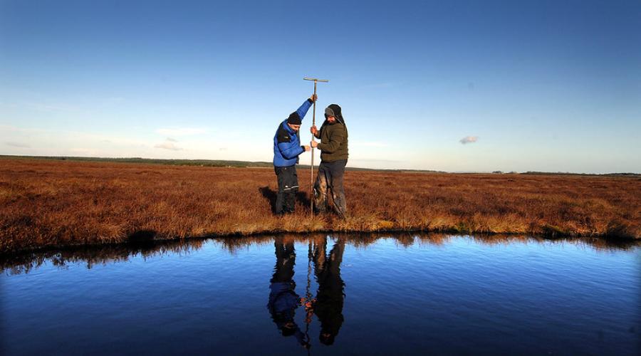
Peatland ACTION hydrological monitoring
Priority
3 - Evaluate overall effect on peatland recovery.
Lead organisation
NatureScot
Project details and progress update
Timescale: Ongoing data capture. Ongoing review of hydrological monitoring design as part of the review of Peatland ACTION hydrology data (see below).
2025/26: Maintenance of 15 sites completed. Options appraisal for the Loch Orasaigh IoT project drafted. Review of the entire hydrology network ongoing to consider options for the future ensuring it meets current priorities.
2024/25: Maintenance of three sites completed and all logger data from sites visited in 2023/24 and 2024/25 has now been processed and is available on the Peatland ACTION hydrology explorer website.
2023/24: A new round of maintenance of the existing Peatland ACTION hydrological monitoring network started at multiple sites. This included removal of rain gauges from all maintained sites and removal of loggers at sites with two or fewer loggers, following the review of hydrological monitoring started in 2022/23. Continued monitoring of pre-restoration hydrology using IoT technology at Loch Orasaigh on the Isle of Lewis.
2022/2023: Sensors connected via IoT technology were installed as part of a monitoring trial led by Scottish Government and implemented by FarrPoint at a site adjacent to Loch Orasaigh on the Isle of Lewis. This equipment was adopted by NatureScot Peatland ACTION in 2023 to continue the capture of baseline data through restoration and into the post-restoration phase.
2020/21-2021/22: A further round of maintenance of the existing Peatland ACTION hydrological monitoring regime was carried out to ensure continued operation of the equipment. No additional hydrological monitoring equipment (e.g. water table depth loggers or rain gauges) was added. Data from the loggers was published online in 2022/23. Data has also been provided directly to the James Hutton Institute (JHI) for their work on the RESAS Strategic Research Programme (SRP) CentrePeat. We funded additional repairs of water level rain gauges at Flanders Moss National Nature Reserve (NNR), which contribute to a long-term water level monitoring dataset.
2018/19-2019/20: Maintenance of the existing Peatland ACTION hydrological monitoring regime. No additional equipment was added. Data from loggers were downloaded and processed.
2014/15-2017/18: A scheme of Peatland ACTION managed hydrological monitoring was implemented in 2014, with 127 loggers spread over 38 sites measuring the hourly or half-hourly change in water table depth. This aimed to determine how the water table responded to restoration management: the depth to the water table should decrease (become closer to ground level) and stabilise after restoration, resulting in the water table staying within an idealised zone for an increased proportion of the year. Rain gauges were also installed at 25 sites where existing (publicly available) rainfall gauges were not available in order to provide some meteorological context to the water table data. A significant amount of data has been collected but a detailed review and associated analysis is required.
Peatland ACTION input for 2026/27
- Maintain equipment and download data as appropriate.
- Update the Peatland ACTION hydrology explorer with data from loggers visited in 2024/25 and 2025/26
- Finalise network review and next steps.
- Implement decision on the best option for the hydrological monitoring using IoT technology on the Isle of Lewis.
Peatland ACTION Monitoring Fund
Priorities
2 - Inform best practice to gain the maximum potential benefits from peatland restoration.
3 - Evaluate overall effect on peatland recovery.
4 - Strengthen the evidence for the wider benefits of peatland restoration.
6 – Develop new tools to improved peatland restoration.
Lead organisation
NatureScot
Project details and progress update
Timescale: Ongoing fund launched in 2024/25 to support external organisations to undertake their own monitoring projects. Individual projects can be funded for up to three years.
2025/26: Five Monitoring fund application assessed and awarded funding, several enquiries supported with advice.
2024/25: One monitoring fund application assessed and awarded funding, several enquiries supported with advice.
Peatland ACTION input for 2026/27
- Continue support for ongoing funded projects.
- Assess and fund as applicable new applications to the fund.
Restoration Monitoring Network (RMN)
Priority
3 - Evaluate overall effect on peatland recovery.
Lead organisation
NatureScot
Project details and progress update
Timescale: The long-term monitoring programme started in 2023/24 with ongoing data capture. Sites will be monitored pre-restoration and 1-, 5- and 10-years post-restoration.
2025/2026: Nine pre-restoration sites and three 1-year post-restoration sites completed, network up to 20 sites in total.
2024/2025: Five pre-restoration sites and four 1-year post-restoration sites completed, network up to 11 sites in total.
2023/24: Refined documentation and field protocols based on further consultation and statistical support. Launch of RMN with pre-restoration monitoring started on the first six sites.
2021/22-2022/23: Investigated potential study design, sampling approach and methodologies. Completed draft documentation and field protocols. Gathered internal and external feedback on the draft documentation and carried out pilot work on a range of sites to refine field protocols.
Peatland ACTION input for 2026/2027
- Budget dependent, continue to expand RMN with 1-year post-restoration monitoring on around eight sites and pre-restoration monitoring on five new sites.
- Further develop data management processes and analysis.
Strategic Research Programme (SRP) 2022-2027 – ‘CentrePeat’ project
Priority
4 - Strengthen the evidence for the wider benefits of peatland restoration.
6 – Develop new tools to improve peatland monitoring.
Lead organisation
JHI
Project details and progress update
Timescale: 2022-2027.
2023/24: Peatland ACTION input to the project remains ongoing via approximately quarterly meetings with JHI.
2021/22-2022/23: Peatland ACTION’s hydrological data is being used as part of the Strategic Research Programme (SRP) 2022-2027 CentrePeat project to contribute to the modelling of climate resilience of peatland restoration sites.
Peatland ACTION input for 2026/27
Provide input and strategic direction as required.
The cost of peatland restoration in Scotland
Priority
4 – Strengthen the evidence for the wider benefits of peatland restoration.
Lead organisation
Scotland’s Rural College (SRUC)
Project details and progress update
Timescale: Ongoing work on refining the database but costs have not updated since 2022.
2021/22: The data required from Peatland ACTION was supplied and the database has been updated with new cost figures. This database of costs has been published on SEFARI.
2019/20: Scotland’s Rural College (SRUC) have led on the creation and regular update of a database of costs related to Peatland ACTION restoration taken from the grant funding application datasets.
Peatland ACTION input for 2025/26
Continue to provide project support and data as needed to SRUC to keep database up to date.
Using peat surface motion (bog breathing) to monitor Peatland ACTION sites
Priority
2 - Inform best practice to gain the maximum potential benefits from peatland restoration.
3 – Evaluate overall effect on peatland recovery.
6 – Develop new tools to improve peatland monitoring.
Lead organisation
NatureScot
Project details and progress update
Timescale: We aimed to begin integrating remote sensing monitoring tools into the Restoration Monitoring Network and wider monitoring of peatland restoration by 2024/25. The development of tools and use of UAVs to support Peatland ACTION is ongoing.
2024/25 to 2025/26: The three outstanding bog breathing reports (RR1308, RR1355, RR1356) were all published in June 2025 - all reports are related to development and testing of radar (InSAR) mapping of peat condition. Data from the large area report was also made publicly available for download, on 13th June, on a webpage accessed through NatureScot website. This allows scientists and others in the peatland field to explore the outputs in their own GIS.
2023/24: Progress was made in a further two research reports developing and improving the methodology to use the InSAR technique in conjunction with time series analysis and statistical machine learning to map an aspect of peatland condition at the landscape to national scale. In addition, a further method has been developed which quantifies trajectories of change in peatland condition which is sensitive to the initial impacts of restoration, infrastructure development and drought. The following reports will be published in late 2024/early 2025:
- NatureScot Research Report 1308 - Analysis of an InSAR “bog breathing” based classification of peatland condition relative to field observations in Cairnsmore of Fleet National Nature Reserve
- NatureScot Research Report 1344 - Use of satellite measures of surface motion to improve the assessment of peat landslide susceptibility
- NatureScot Research Report 1355 - A summary of surface motion remote sensing methods for the monitoring of peatland”
- NatureScot Research Report 1356 – Application of surface motion remote sensing to quantify the condition and trajectory of change of c.680,000 ha of peatland
2022/23: Validation of the peatland condition classification developed in the Flow Country and applied at Bunloit Estate and Cairnsmore of Fleet NNR. A report will be published in association with related reports. This report proposes a revised classification fit for upscaling the technique across a wider range of peatland condition sites. . Twenty peatland sites were selected for a study which explores the use of InSAR-derived peat surface motion dynamics to map peat landslide susceptibility. This work was set up to act as an independent analysis to allow for comparison with the current desk- and field-based methods used by Peatland ACTION. The report will be published in 2024.
2021/22: The results from the 11 focus sites were published in the Research Report 1269. This yielded a lot of interest from environmental agencies and companies, and the press. Efforts are being undertaken to start collecting more validation data from the field, potentially in conjuncture with the Restoration Monitoring Network.
2020/21: A total of 11 focus sites were selected for further exploration, which yielded valuable insights into the limitations (research opportunities) and advantages of the technique to link peat surface motion to peatland condition.
2019/20: Use of Sentinel-1 satellite radar (open data) to develop a technique to monitor peat surface motion across large areas(at approximately 100 m spatial resolution). An InSAR (Interferometric Synthetic Aperture Radar) method developed by Terra Motion Ltd which increases data coverage of rural areas was used. Using this ISBAS-InSAR method the effects of restoration on peat surface motion were assessed and further explored across a wide range of sites.
Peatland ACTION input for 2026/27
Support the practical application of the tools developed.
Multispectral imagery capture at Peatland ACTION restoration sites
Priority
3 – Evaluate the overall effect on peatland recovery.
6 – Develop new tools to improve peatland monitoring.
Lead organisation
NatureScot
Project details and progress update
Timescale: ongoing.
2025/26: Procured UAV surveys at four sites to support PAO led project design. Further development and use of PA's Amazon Web Services (AWS) cloud storage S3 bucket system for PA UAV data storage and management.
2022/23: We published guidance on a common standard for UAV deployment and data products to enable effective use. This will inform further use of UAVs for both the capture of promotional material and in support of monitoring. The guidance is not entirely prescriptive as an adaptive approach is necessary to meet individual project requirements. The guidance provides examples of UAV platforms and sensors, and software for planning and processing.
2015/16: UAVs have been deployed at several Peatland ACTION restoration sites (Figure 2), including 21 sites using multi-spectral imagery (RGB and near-infrared) and two sites using LiDAR. The images were used in a variety of ways, two of which have potential as monitoring techniques. Firstly, semi-automated estimates of bare peat and Sphagnum cover could be used to track change over time on restoration sites. Although promising, more investment is needed, including ground-truthing data collection to improve accuracy. Secondly, digital terrain models, digital surface models and hill shade analysis can identify flow pathways over large areas. Flights before and after restoration could thus monitor change in water flow pathways. One way this could help is to identify areas that need extra work.
Peatland ACTION input for 2026/27
- Continued procurement of UAV surveys to support Peatland ACTION Officer-led project design.
- Continued exploration of geospatial tools that utilise UAV data to support project design.
- Review and update guidance.
Completed Peatland ACTION monitoring.
Expand the accordion to find out more about monitoring projects that have been completed.
Completed Peatland ACTION monitoring.
The following table provides a brief outline of monitoring projects that have been completed along with reference to the Monitoring Strategy Priority they support. Resources associated with the projects are provided where available. If you would like further information on any of the completed projects, please contact [email protected]
| Project title | Lead organisation | Grant ID | Monitoring Strategy Priority | Resources (where available) |
|---|---|---|---|---|
| Monitoring recovery of bog communities in the Flow Country after wildfire | RSPB | NA | 4 - Strengthen the evidence for the wider benefits of peatland restoration | Anderson et al., 2024 Blanket bog vegetation response to wildfire and drainage suggests resilience to low severity, infrequent burning |
| Forth-ERA – Developing a toolkit for monitoring the success of peatland restoration projects using remote sensing and wireless sensor networks | University of Stirling – Scotland’s International Environment Centre (SIEC) | NA | 3 – Evaluate overall effect on peatland recovery
6 – Develop new tools to improve peatland monitoring |
|
| Review of Peatland ACTION hydrology data | NatureScot | NA | 3 - Evaluate overall effect on peatland recovery | Peatland ACTION hydrology data |
| Effects of peatland restoration by deforestation on water quality – Torrachilty and Tannylaggie | Forest Research | 501061 | 4 – Strengthen the evidence for wider benefits of peatland restoration | No resources available |
| RSPB Forsinard peatland restoration monitoring | RSPB | NA | 2 – Inform best practice to gain the maximum potential benefits from peatland restoration.
3 – Evaluate overall effect on peatland recovery.
6 – Develop new tools to improve peatland monitoring. | RSPB Forsinard Flow Nature Reserve - water table depth and vegetation data |
| IUCN UK Peatland Programme Commission of Inquiry on Peatlands 2017-2020 | International Union for Conservation of Nature (IUCN) UK Peatland Programme | NA | 4 – Strengthen the evidence for wider benefits of peatland restoration |
|
| Monitoring bare peat and peatland erosion | NatureScot | NA | 2 - Inform best practice to gain the maximum potential benefits from peatland restoration
3 – Evaluate overall effect on peatland recovery
6 – Develop new tools to improve peatland monitoring |
|
| Monitoring of the water quality and discharge rates associated with restoration works at the Abernethy. | RSPB | 501285 | 4 – Strengthen the evidence for wider benefits of peatland restoration | No resources available |
| Peatland ACTION vegetation sampling | NatureScot | NA | 3 - Evaluate overall effect on peatland recovery |
|
| Raising awareness of the value of stores of organic carbon in peat soils | National Trust for Scotland / Crichton Carbon Centre | 500788 | 4 - Strengthen the evidence for the wider benefits of peatland restoration | No resources available |
| Upland peatland drone surveys at RSPB Abernethy | RSPB | NA | 4 – Strengthen the evidence for the wider benefits of peatland restoration | No resources available |
| Using remote sensing to inform restoration management | Environmental Research Institute | 500794 | 4 - Strengthen the evidence for the wider benefits of peatland restoration
6 – Develop new tools to improve peatland monitoring | No resources available |
Last updated: