NatureScot Research Report 1391 - A review of habitat classifications for their potential use in a Scottish planning biodiversity metric
Year of publication: 2026
Authors: Ben Averis and Alison Averis
Cite as: Averis, A.B.G. and Averis A.M. 2026. A review of habitat classifications for their potential use in a Scottish planning biodiversity metric. NatureScot Research Report 1391
Contents
- Keywords
- Summary
- Acknowledgements
- 1. Introduction
-
2. Habitat classifications available for use with the Scottish planning biodiversity metric
- 2.1 NVC as a potential habitat classification for use with the Scottish planning biodiversity metric
- 2.2 UKHab as a potential habitat classification for use with the Scottish planning biodiversity metric
- 2.3 Possible alternative classification systems (other than NVC and UKHab) for use with the Scottish planning biodiversity metric
- 2.4 The meaning of ‘upland’ and ‘lowland’ in different habitat classifications
- 3. UKHab and a Scottish planning biodiversity metric
- 4. Habitat mosaics
- 5. Scottish habitats not adequately considered in the English statutory biodiversity metric
-
6. Correspondence between classification systems
- 6.1 Conversion between UKHab and English statutory biodiversity metric habitats
- 6.2 Conversion between UKHab and NVC
- 6.3 Conversion between English statutory biodiversity metric habitats and NVC
- 6.4 Conversion between UKHab and Phase 1
- 6.5 Conversion between English statutory biodiversity metric habitats and Phase 1
- 6.6 Conversion among NVC, Phase 1, UK BAP, Annex 1 and EUNIS
- 7. Conservation Value
- 8. Habitat condition
- 9. Summary of classifications and their suitability for use within a biodiversity metric
- 10. References
NatureScot has been commissioned by the Scottish Government to develop a biodiversity metric for Scotland's planning system, that can be used to support delivery of NPF4 Policy 3b.
To inform this work, in January 2025 NatureScot commissioned an independent review of established terrestrial habitat classification systems that could possibly be used in the Scottish planning biodiversity metric (freshwater and marine habitats were outwith the scope of this commission and are being considered separately). This review was undertaken by experienced botanical consultants Ben and Alison Averis. All recommendations and views expressed in the review report below are those of the authors and do not necessarily reflect the official stance of NatureScot.
Keywords
Scottish planning biodiversity metric; Scottish metric; NPF4; habitat classification; UKHab; NVC
Summary
This report reviews and makes recommendations for systems of vegetation classification to be used to provide data for a Scottish planning biodiversity metric (“the Scottish metric”).
The UK Habitat Classification system (UKHab) is the main classification used with the English statutory biodiversity metric (“the English metric” or “the Defra metric”). As it currently stands, UKHab is the most comprehensive classification system for urban and brownfield habitats, for which it has a wide and comprehensive array of categories. It also has good coverage of the modified vegetation types common on potential development sites in the lowlands, such as arable fields and agriculturally improved pastures. However, its coverage of semi-natural vegetation, especially in the uplands, needs to be improved by adding more categories in order to provide data for a biodiversity metric in Scotland. Suggested sub-divisions are given in this report. Likewise, the English metric’s habitat categories, which are generally broader than those of UKHab, can be significantly improved for Scottish use by subdivision in many places; a suggested set of such subdivisions is presented in this report.
We recommend the use of the National Vegetation Classification (NVC) as the primary means of classification of vegetation on rural sites, especially where most of the vegetation is semi-natural. NVC types can subsequently be aggregated into revised UKHab and metric categories. Although a revised version of UKHab could be used as the primary classification, there is a danger of missing information that subsequently would be needful to know.
We recommend that the term ‘Conservation Value’ is used to replace the English statutory biodiversity metric’s ‘Distinctiveness’.
The UKHab mapping protocol currently precludes the use of mosaic polygons. This protocol needs further work if the system is to function as a mapping tool in semi-natural vegetation, particularly but not exclusively in the uplands. Vegetation should be mapped in the field as mosaics where necessary, with an estimate of the percentage contribution of each component to the whole. Surveyors should submit maps and reports that include reference to all of the plant communities found on the site in question.
As requested, we have suggested a list of pairs of vegetation types that commonly occur in approximately equal quantities as mosaics. However, this is not a satisfactory solution for stand-alone categories in a biodiversity metric, because of the large number of possible combinations and the fact that it is common to find mosaics of more than two types of vegetation.
Another suggestion is that in polygons mapped as mosaics, the component vegetation type with the highest conservation value should be the one used to determine the conservation value score for that polygon in the metric, even if that component covers only a small proportion of the total polygon area.
UKHab has adopted the separation of upland and lowland habitats used in Annex 1 and UK Biodiversity Action Plan (UK BAP) categories, with the upland/lowland boundary stated as the upper edge of enclosed agricultural land. This is often ill-defined in the field, especially around upland margins and through large areas of Scotland where an upland type of environment with a cooler/wetter climate, reflected in the semi-natural vegetation, occurs right down to sea level. Assigning different conservation values to ‘upland’ and ‘lowland’ examples of the same type of vegetation can be misleading and is best avoided.
Acknowledgements
This contract was commissioned by NatureScot.
We are very grateful to Craig Smith (NatureScot Scottish Biodiversity Metric Officer), Paul Taylor (NatureScot Strategic Planning Manager) and Stuart Bence (NatureScot Operations Officer) for arranging for the contract to be put in place, for providing background information, for very useful discussions about this work and for feedback on an earlier draft of this report.
We also thank Bob Edmonds of UKHab Ltd for passing on a draft of the UKHab Correspondence Tables (draft) Feb 2025.xls spreadsheet.
1. Introduction
The statutory biodiversity metric system developed in England (“the English metric” or “the Defra metric”) in recent years (Natural England 2023a, 2023b) classifies terrestrial habitats primarily using the UK Habitat Classification (UKHab) system (UKHab Ltd 2023). A Scottish planning biodiversity metric (“the Scottish metric”) is currently being developed to support delivery of National Planning Framework 4 Policy 3b. With this in mind, we have been commissioned by NatureScot to review the main habitat classifications in current use in Britain for their suitability for use with the Scottish metric.
The report discusses the strengths and weaknesses of the available classification systems in relation to their potential for use in a Scottish metric and presents summaries of thoughts and recommendations in tabular form.
In this review we have concentrated more on vegetated terrestrial habitats than on urban and other artificial habitats. We have not assessed freshwater or marine habitats because those are outside our area of expertise.
With UKHab our focus is mainly on primary habitats in rural areas because in Scotland these are so much more extensive than urban habitats and they contain the plant communities of most notable botanical interest. We have discussed some UKHab secondary codes but have not gone through the very long list of these in a systematic way.
2. Habitat classifications available for use with the Scottish planning biodiversity metric
The habitat classifications currently in use or available for use are the National Vegetation Classification (NVC), UKHab, Phase 1, the European Nature Information System (EUNIS), UK Biodiversity Action Plan (UK BAP) categories and, for plant communities considered of special value for nature conservation, Annex 1.
2.1 NVC as a potential habitat classification for use with the Scottish planning biodiversity metric
The NVC (Rodwell 1991 et seq.) is the most comprehensive system of classification for British vegetation in both range and detail. In use since the early 1980s, it is widely employed in vegetation surveys for all purposes from conservation management to environmental assessments for proposed developments.
Responses from NatureScot’s public consultation on key issues to be addressed when adapting the English metric to develop a Scottish tool included the following summarised comments relating to NVC:
Positive feedback
- Good understanding in Scotland
- Consistent with other planning requirements (avoids multiple surveys)
- Provides a better proxy for biodiversity
Negative feedback
- Too detailed/complex for most sites
- Limited capacity of NVC surveyors
- Translation issues to other systems
- Weaker in urban context
We agree with the positive feedback comments.
It is true that the NVC is weaker than other classifications in urban environments and might not be the best system to use in brownfield sites, but for semi-natural vegetation it is by far the best system.
The NVC is not too detailed or complex for most sites. Like any habitat classification it is a simplification of the reality but has the best balance of level of detail and level of simplification. While it is true that there are 286 NVC communities and many more sub-communities, the number likely to be encountered at any one site is far less than this.
We don’t think there is a problematically limited number of NVC surveyors. We are aware that many people have been doing NVC surveys in Scotland since the 1980s and including recent years. There is also a lot of ongoing demand for NVC training to members of staff of various organisations, especially ecological consultancies who do most of the type of survey work that would feed into the Scottish metric. We have been commissioned to provide NVC training to many people in recent years, and already have several NVC courses booked for the 2025 field season.
Regarding translation issues to other systems, the reason why we do not agree with this is that in our experience, the NVC provides the best common currency for translation between classifications and is also very useful (or, indeed, essential) for gaining a detailed understanding of the definition of many habitat categories in other classifications. It would be hard (or, more likely, impossible) to do surveys using other classifications without making reference to NVC as part of the procedure for classifying at least some habitats to categories in Phase 1, UKHab, UK BAP, Annex 1 or EUNIS.
It is reasonable to expect surveyors doing botanical survey work for proposed developments to be able to use the NVC at least for the range of habitats in which they are contracted to work, as they need to have sufficient botanical knowledge to be able to recognise areas of high botanical interest, and to make a correct assessment of existing biodiversity. It is a responsible job that needs to be done by qualified, experienced persons. There are dangers in ‘dumbing down’ survey methodology, as this plays into the hands of developers looking for loopholes in the system.
Another negative point not mentioned in the public consultation is that although the NVC is reasonably comprehensive, there are gaps in coverage, even for semi-natural vegetation. Some of these are well known. Other gaps are for more artificial habitats, which is not surprising because the NVC focuses mainly on semi-natural habitats. Whether they are semi-natural or artificial, these gaps are not really a problem. When doing NVC survey work and finding something that doesn’t fit into any NVC category, one can map it with a non-NVC code and describe it under that code heading in the report, so the habitat is treated in the same way as an NVC community or sub-community. Some mapped non-NVC communities are very specific in such a way that they are more or less on a similar level of detail to NVC communities or even sub-communities. This can be expected because the NVC surveyor will, just by using the NVC, be in the habit of recognising homogeneous stands of vegetation on a relatively detailed level.
Our advice would always be to use the NVC as the classification system in rural habitats, in order to have the most accurate record of the existing vegetation. However, for the purposes of the Scottish metric it makes sense to aggregate NVC communities (and some of the sub-communities) into larger units with shared ecological needs and biodiversity value. For this purpose, UKHab would seem to be the first option to explore. It has already been selected for use with the statutory biodiversity metric in England because of its broad categories, combining vegetation types of similar ecological requirements and value for biodiversity and nature conservation. It is thus a simpler system than the NVC, more like Phase 1 but with greater emphasis on biodiversity value.
2.2 UKHab as a potential habitat classification for use with the Scottish planning biodiversity metric
UKHab has a reasonable logic. Principally derived from the previous UK BAP habitat classification, it has an especially comprehensive coverage of urban habitats. However, some of its categories for semi-natural vegetation are too broad to be useful, as they encompass such wide floristic and ecological variation. Some categories lump species-poor, much-modified vegetation in with more diverse, near-natural, species-rich vegetation, which means that they do not give an accurate picture of botanical or biodiversity interest. Because of this, UKHab (along with Phase 1, UK BAP, EUNIS, etc.) falls well behind the NVC as a classification to provide a good and detailed understanding of the vegetation of a site. Also, having been developed in England, UKHab does not adequately capture the range of variation and biodiversity in Scottish vegetation.
Some vegetation types found in Scotland that are not mentioned in the UKHab v2 guidance:
NVC types:
- U15 Saxifraga aizoides-Alchemilla glabra banks
Main or notable non-NVC vegetation or habitat types:
- Avenella flexuosa snowbed/montane grassland
- Pohlia ludwigii snowbed
- Mixed bryophyte snowbed
- Herb-rich north-western form of U4 acid grassland
- Species-poor neutral grassland dominated by mixtures of Holcus species &/or Festuca rubra
- Elytrigia repens grassland
- Vegetation dominated by Dryopteris/Athyrium ferns
- Neutral small sedge mire (commonly mapped as MX)
- Juncus effusus acid grassland vegetation (mapped by us and others as Je)
- Juncus acutiflorus acid grassland vegetation (mapped by us and others as Ja)
- Herb-rich Juncus squarrosus flush (a form of U6)
- Equisetum palustre-dominated wetland
- Carex disticha-dominated wetland
- Ranunculus lingua swamp
- Menyanthes trifoliata swamp/bog pool vegetation
- Woodland with Luzula sylvatica-dominated ground layer (WLz)
- Dry woodland with a species-poor nettle-dominated ground layer
- Elder scrub
- Broom scrub
- Raspberry underscrub
- Damp non-montane Vaccinium-Sphagnum heath
- Calluna heath with rich flora of mesotrophic herbs
- Calcicolous Arctostaphylos uva-ursi heath
- Wet heath with abundant dwarf juniper
- Montane fell-fields
- Montane Racomitrium ericoides heath
- Schoenus nigricans-Eupatorium coastal cliff community
- Catabrosa aquatica coastal community
- Polytrichum commune-dominated vegetation
- Ivy-dominated vegetation (e.g. on cliffs)
- Rumex obtusifolius-dominated vegetation
- Petasites hybridus-dominated vegetation
- Impatiens glandulifera-dominated vegetation
These can all be accommodated within existing UKHab categories, at varying UKHab levels. In Britain U15 is almost confined to Scotland (there are fragments in the Lake District) and the Avenella flexuosa, Pohlia ludwigii and mixed bryophyte snowbeds are unique to Scotland. The others are found in England, Wales and Ireland as well as Scotland. Some NVC communities such as U9, U11, U12, U14 and H17 are unique to Scotland but are included in NVC listings in the UKHab guidance. It seems unlikely that there are any British vegetation types, Scottish or otherwise, that are completely outside the total range of UKHab categories, if only because the total coverage of all UKHab categories should include everything in Britain.
2.2.1 How UKHab could be improved for use in Scotland
Improvements could be made by subdividing some of the existing UKHab categories and by adding extra categories. Suggested subdivisions of certain UKHab categories are shown in Appendix 1. Many of these are based on NVC communities.
The NVC-UKHab conversion table (the most recent version available to us was in the UKHab Correspondence Tables (draft) Feb 2025 spreadsheet) is not fully reliable – see section 6 of this report.
Given that UKHab categories and English metric habitat categories are generally broad compared with the NVC, it is surprising that among the wetlands there are three categories that are relatively narrow, but still broader than those of the NVC:
- Transition mires and quaking bogs: UKHab f2a8/f2c8 and a separate category in the English metric.
- Oceanic valley mire (EUNIS D2.1): No corresponding UKHab code, included as a separate category in the English metric.
- Depressions on peat substrates (Annex 1 H7150): UKHab Secondary Code 56 and a separate category in the English metric.
These three categories are all quite close together in relation to the whole range of variation among British wetland types: they are very wet, variably peaty habitats, mostly with abundant sedges and mosses; and with the species composition in many cases reflecting a small amount of lateral water movement and in some cases at least mild base-enrichment. They all tend to occur as small patches among larger extents of other types of wetland. The small extent of many of these patches can make their classification to one of these three categories rather unclear. In the light of this it is surprising that they are each given separate categories in UKHab and the English metric while some other individual UKHab/English metric categories are so broad as to encompass variation from springs through flushes and fens to swamps. In Appendices 1 and 2 we have suggested replacing these three categories with a single one called ‘Acid soakway’, which would take in NVC M21 and M29, while the remaining NVC types listed for these three categories would be better placed in other wetland and wet heath UKHab categories (details in Appendices 1 and 3).
Some UKHab categories are not found in Scotland:
- g2a6 Dry grassland/scrub on chalk/limestone; important orchid sites (Annex 1 H6210)
- g3a5 Lowland hay meadows (Annex 1 H6510) (but something rather similar has been seen near Selkirk)
- w1c Lowland beech and yew woodland UK BAP priority habitat
- w1f6 Oak-hornbeam forests (Annex 1 H9160)
- h1a6 Dry coastal heaths with Cornish heath (Annex 1 H4040)
- h1a8 Wet heathland with Dorset heath and cross-leaved heath (Annex 1 H4020)
- h3c5 Dunes with sea buckthorn (Annex 1 H2160). (The sea buckthorn on dunes and other coastal habitats in Scotland is in UKHab h3c6; it doesn’t count as h3c5 as it is not native here, and the scrub is often regarded as a problem rather than an asset as it colonises habitats that are more natural and more floristically diverse.)
And possibly also:
- g2a5 Dry grasslands and scrub on chalk or limestone; lowland (Annex 1 H6210)
- f2a5 Calcium-rich fen dominated by Cladium mariscus (Annex 1 H7210) in lowlands*
- f2a6 Hard-water springs depositing lime (Annex 1 H7220) in lowlands
- f2a7 Calcium-rich springwater-fed fens (Annex 1 H7230) in lowlands
- c1d5 Miscanthus energy crops
*Cladium mariscus is scarce in Scotland. Most records are from the west Highlands and Hebrides, which are upland areas. In upland environments in Sutherland and Wester Ross we have seen wetland that fits the description of f2a5. There is no separate level 5 UKHab category for upland occurrences of this vegetation, so it is to be classed as f2c (= UK BAP priority habitat Upland flushes, fens and swamps) at level 4.
2.3 Possible alternative classification systems (other than NVC and UKHab) for use with the Scottish planning biodiversity metric
2.3.1 Phase 1 as a potential habitat classification for use with the Scottish planning biodiversity metric
Phase 1 is broadly similar to UKHab in its general level of detail but has a different structure, and does not include the UK BAP Priority and Annex 1 habitats that give UKHab a slightly greater level of resolution.
The absence of UK BAP Priority and Annex 1 habitats as separate categories in Phase 1 means that many of the English metric habitat categories cannot be identified from existing Phase 1 mapping. Broadleaved woodlands are a good example: several separate English metric categories corresponding with UK BAP priority habitats are all subsumed within Phase 1 A1.1.1 semi-natural broadleaved woodland. Different English metric categories of scrub, based on the dominant shrub species, are all classed in Phase 1 as A2 continuous scrub. Oceanic valley mire and Transition mires & quaking bogs are two English metric wetland categories that cannot be identified from broader Phase 1 wetland types, though Phase 1 actually has more wetland categories than does the English metric. Among the grasslands, the Lowland dry acid grassland UKHab type g1a, which equates with a single English metric category, cannot be separated from Other lowland acid grassland (UKHab g1d = another English metric category) in Phase 1 mapping. There are also many artificial habitats that are separate English metric categories not identifiable from Phase 1 maps.
These limitations of Phase 1 relate to existing Phase 1 mapping, much of which pre-dates the development of biodiversity metrics. There is, however, some potential for using Phase 1 in a way that attempts to integrate with the Scottish metric. This would be a case of mapping in Phase 1 and noting whatever additional information is needed (e.g. UK BAP priority habitats, etc.) for conversion to Scottish metric categories that cannot otherwise be identified in Phase 1.
Appendix 2 shows where additional information is needed (i.e. in addition to standard Phase 1 mapping) for use with metric habitat categories. In most cases some additional information is required for Phase 1 habitats to be assigned to their metric habitat categories, though the additional information necessary is usually not very complex.
2.3.2 EUNIS as a potential habitat classification for use with the Scottish planning biodiversity metric
The EUNIS habitat classification covers all semi-natural and artificial habitats and can help to give a European perspective to survey results, but we think it is not a realistic choice of habitat classification to use with a biodiversity metric in Scotland. This is because (1) EUNIS has been used here much less than NVC, Phase 1, UK BAP and Annex 1, and probably less than UKHab too, so field expertise in Scotland is therefore less for EUNIS than for those other classifications, and (2) most of the available descriptions of EUNIS habitat categories are not very detailed.
2.4 The meaning of ‘upland’ and ‘lowland’ in different habitat classifications
Many UK BAP priority habitats are defined as being either upland or lowland. This has fed through into the naming of categories in UKHab and the English statutory biodiversity metric. This separation of upland from lowland is based on location in relation to enclosed agricultural land: within the limits of enclosed agricultural land is classed as lowland; above those limits is classed as upland.
Throughout much of England this is a meaningful distinction. The vegetation within the bounds of agricultural enclosure typically reflects the warmer, drier end of the British climatic range, and the NVC communities in such places are mostly those whose distributions are mainly southern and eastern in Britain. However, through much of the enclosed agricultural land in northern and western Britain, especially in Scotland, the species composition of semi-natural vegetation reflects the cooler and wetter upland type of climate and belongs to NVC communities with northern and western distributions. In terms of climate and vegetation there is a noticeable difference between the south/east and the north/west of Britain. Enclosure and agricultural modification of land in the Scottish Highlands and islands does not change the environment to a lowland one; where the vegetation in such places is modified by agriculture it can be better understood not as lowland but as modified upland.
The map below (Figure 1) shows the distribution of an index of climatic severity in Britain and Ireland. This is calculated as annual precipitation (cm) divided by annual mean temperature (°C). Areas with an index value of 12 or more (i.e. the coloured areas) show a reasonably good fit with those in which semi-natural vegetation is mainly of upland/north-western NVC communities. In this map, most of Scotland is seen to have an upland type of climate, and a drier/warmer lowland climate occupies relatively small areas, mostly along the east coast but never far from the boundary with an upland type of climate.
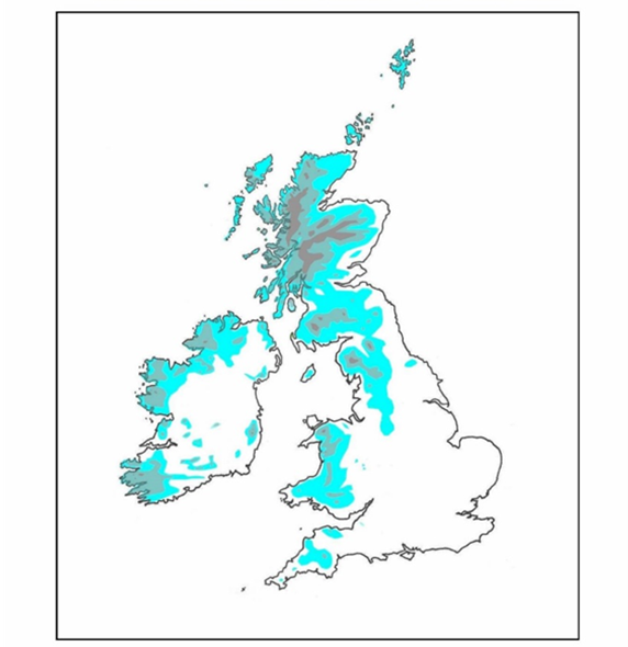
Figure 1: Map displaying an index of climatic severity in Britain and Ireland, calculated as the annual precipitation (cm) divided by the annual mean temperature (°C). Areas coloured in Blue = index value of 12-24; Grey = index value of 25-49
Click for a full description
Red = index value of 50+. Data sources (climate data for the period 1981-2010): Blockeel at al. (2014); A SUMMARY OF CLIMATE AVERAGES FOR IRELAND and Met Office
Another difficulty with a definition of upland and lowland based on land enclosed for agriculture is that in many areas there is no clear boundary according to this definition. For example, there may be a series of fences enclosing vegetation that has been modified to various degrees, or there may be areas of semi-natural vegetation within a low-altitude landscape that consists largely of conifer plantation.
A benefit of the Phase 1 classification is that it does not require the surveyor to place the habitat into an upland or lowland category. Neither does the NVC, though with the NVC the species composition of the vegetation and, therefore, the classification to NVC community or sub-community, can reflect an upland or lowland type of climate in a way that is clearer than the UK BAP upland/lowland definition. The NVC can give a more detailed picture of variation in this regard too. For example, within the eastern Scottish Lowlands there are low hills whose northern slopes have northern/western NVC communities reflecting cooler, wetter and more ‘upland’ conditions than the southern slopes which can have more southern communities with a flora reflecting a warmer/drier environment.
Despite the incorporation of upland and lowland UK BAP categories in UKHab, one such splitting is abandoned in the current English metric: within the wetland section, Lowland fens (UKHab f2a) and Upland flushes, fens and swamps (UKHab f2c) are merged into a single English metric category called Fens (upland and lowland).
Vegetation classifications are more meaningful without categories named ‘upland’ and ‘lowland’, unless this is based, less ambiguously, on floristics, as in the NVC.
3. UKHab and a Scottish planning biodiversity metric
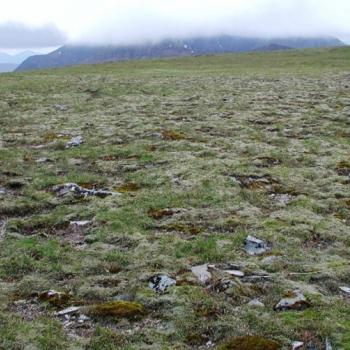
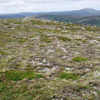
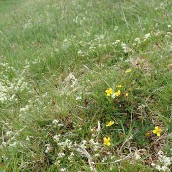
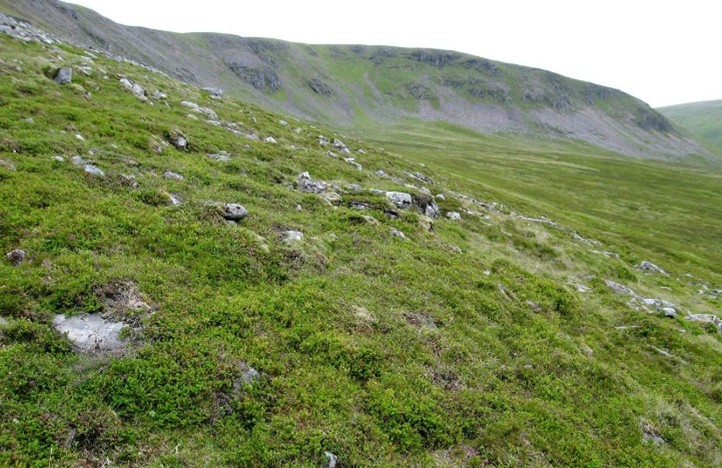
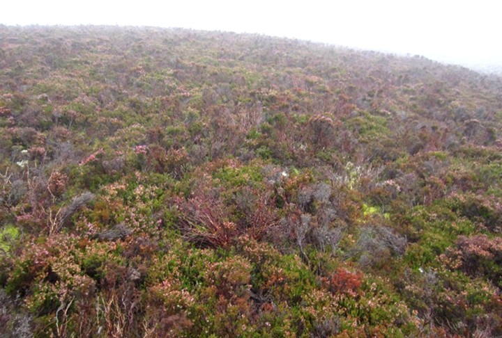
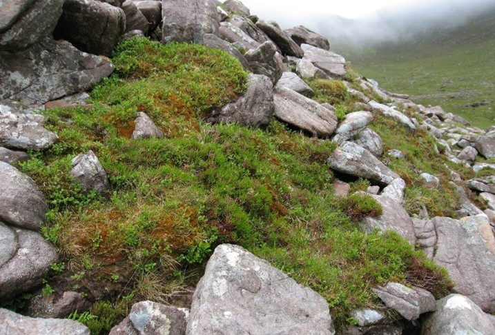
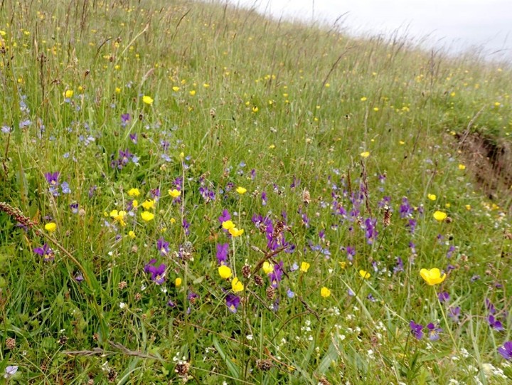
The current English metric is based largely on UKHab but involves simplification: it has fewer habitat categories than UKHab itself. Some of the English metric habitat categories correspond with two or more UKHab categories combined, or with a single UKHab category that is subdivided further in UKHab but with those subdivisions not separated out in the metric. This means that habitat classification is simpler in the metric but loses some detail that would be helpful for the understanding and evaluation of the vegetation of a site. There is therefore scope for better integration of UKHab into a Scottish metric by making use of more of the existing UKHab categories and with the addition of other categories that could be added to UKHab. A suggested expanded form of habitat categories that could be useful in a Scottish metric is shown in Appendix 3. Photographs at the end of this section show examples of some of the additional metric categories delineated in Appendix 3 (Figure 2). In this appendix we have retained the current ‘upland’ and ‘lowland’ terminology, but, it would be ideal for such splits to be based on NVC and termed northern or southern (or in some cases widespread) instead of upland and lowland.
Some habitats in the English metric are defined using UKHab secondary codes (Table 1).
| English metric habitat section in which this habitat category is placed | English metric habitat category name | Defining UKHab secondary code |
|---|---|---|
| Grassland | Traditional orchards | 27 |
| Grassland | Floodplain wetland mosaic and Coastal/Floodplain Grazing Marsh (CFGM) | 19 |
| Woodland and forest | Felled | 206 |
| Woodland and forest | Wood-pasture and parkland | 26 |
| Wetland | Depressions on peat substrates (Annex 1 H7150) | 56 |
| Sparsely vegetated land | Ruderal/Ephemeral | 81 |
| Sparsely vegetated land | Tall forbs | 16 |
| Urban | Allotments | 616 |
| Urban | Bioswale | 849 |
| Urban | Biodiverse green roof | 87 |
| Urban | Façade-bound green wall | 843 |
| Urban | Ground based green wall | 842 |
| Urban | Ground level planters | 845 |
| Urban | Intensive green roof | 88 |
| Urban | Introduced shrub | 847 |
| Urban | Open mosaic habitats on previously developed land | 80 |
| Urban | Other green roof | 89 |
| Urban | Rain garden | 850 |
| Urban | Actively worked sand pit quarry or open cast mine | 85 |
| Urban | Sustainable drainage system (SuDS) | 848 |
| Urban | Unvegetated garden | 827 |
| Urban | Vacant or derelict land | 82 |
| Urban | Bare ground | 510 |
| Urban | Vegetated garden | 828 |
As secondary codes are used in UKHab to record additional information associated with a habitat that has already been assigned a primary code, there is some potential for confusion if they are to be used on their own to define certain metric habitat categories. This matter was also raised a few years ago by Carpenter (2022). One might understandably ask: if these secondary habitat codes define whole habitat categories in the English metric, why do they not do so in UKHab? There is also potential for confusion in that the code numbers of many secondary codes are not the same in UKHab version 2 as they were in version 1.
3.1 Survey using metric habitat categories only
Another approach could be to map the habitats of a site using just the biodiversity metric habitat categories, without specific reference to UKHab or any other classification. This would be less complex than UKHab because the number of habitat categories is smaller in the metric than in UKHab. However, there would still be a need to know how the vegetation relates to UK BAP priority habitats and certain Annex 1 and EUNIS habitats, where they define categories in the metric. Such a survey would be relatively detailed for urban habitats, for which there are many metric categories, but less detailed for semi-natural habitats than would be the case if using UKHab or, especially, NVC. Mapping semi-natural habitats to metric categories only would integrate easily into the metric but would leave much uncertainty about the actual nature of vegetation in broad metric categories such as:
- Fens (upland and lowland), which covers a huge range of wetlands from springs and flushes to fens and swamps.
- Upland heathland and Lowland heathland, within each of which wet and dry heaths are not differentiated.
- Upland acid grasslands, which vary from widespread and common types to very different montane summit heaths and snowbeds.
- Other neutral grassland, varying from short to tall and from dry to quite wet.
For these reasons, field survey mapping habitats to English metric categories only is not recommended.
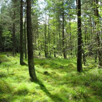
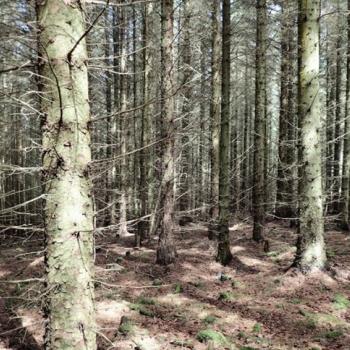
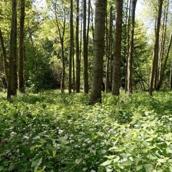
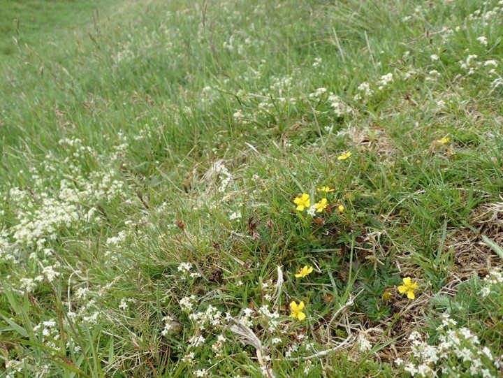
Figure 2: Photographs of examples of some of the additional categories that we have suggested for use in a biodiversity metric in Scotland.

4. Habitat mosaics
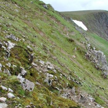
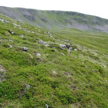
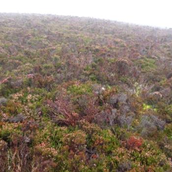
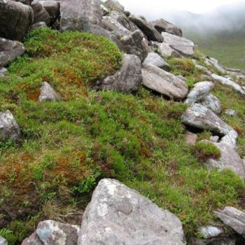
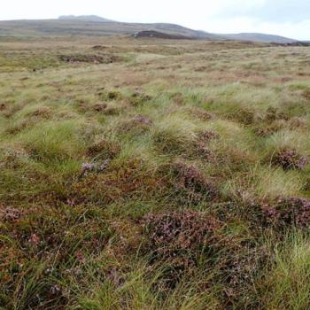
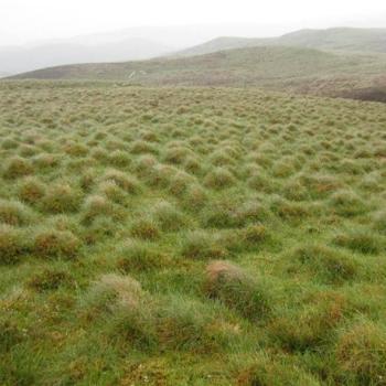
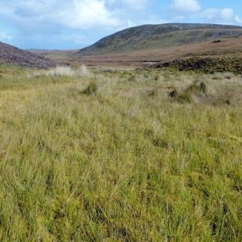
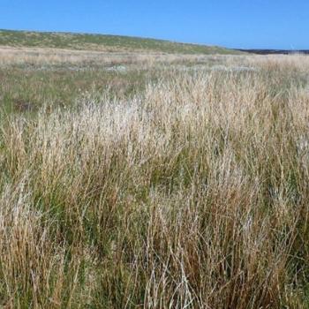
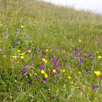
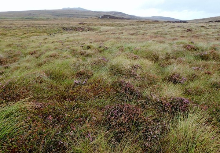
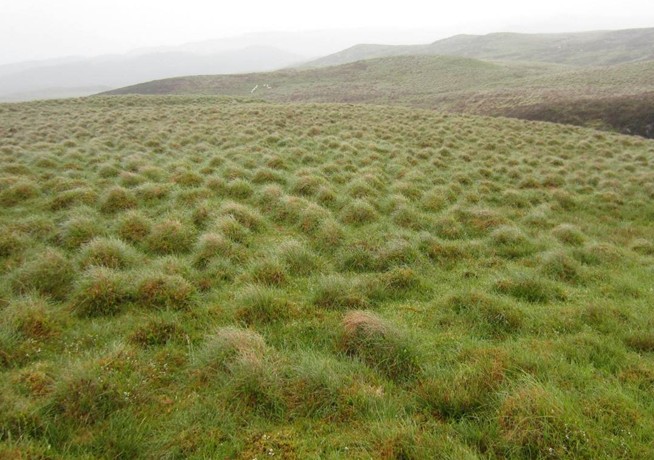
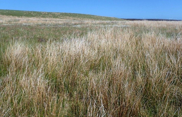
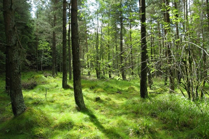
When carrying out surveys using any vegetation/habitat classification, it is very common to find areas with complex small-scale mosaics of different vegetation/habitat types, especially on upland sites with large areas of semi-natural vegetation. In such situations it is impossible to map all of the vegetation as single-type polygons, and in order to capture every type of vegetation present at the site it is standard practice (for example in NVC surveys) to map mosaic polygons, and to label each mosaic polygon with an estimated percentage breakdown of each component vegetation type. This has also been done in surveys using other classifications such as Phase 1 and UK BAP, and it is perfectly possible with any vegetation/habitat classification. Obviously, some polygons that need to be mapped as mosaics of two or more NVC types would be single habitat polygons using broader classifications using UKHab, Phase 1 or EUNIS. Below are photographs of some examples of complex vegetation mosaics (Figure 3).
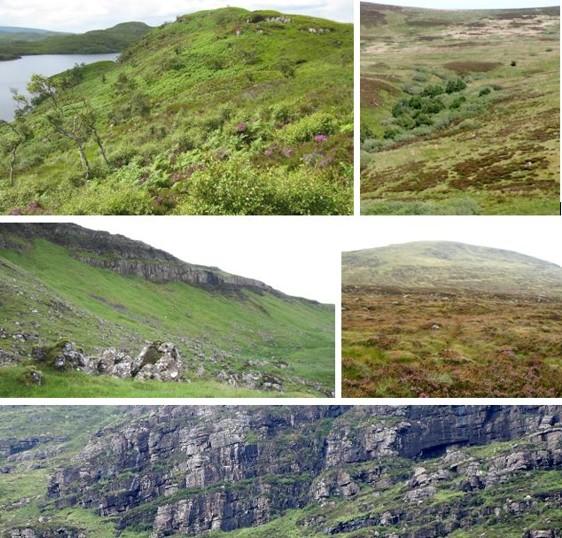
Figure 3: Clockwise from top-left: bracken, wet heath and dry heath in Wester Ross; acid grassland, dry heath and rush mire in East Lothian; wet heath and blanket bog in Galloway; dry heath, wet heath and rock in the NW Highlands
Click for a full description
acid and calcareous grasslands (an example of a complex mosaic whose individual components are not all visually distinct from each other) in the W Highlands.
We are aware that the English statutory biodiversity metric algorithm is currently unable to deal with mosaic polygons, and that the UKHab guidance includes an instruction for surveyors to avoid recording mosaic polygons in vegetation maps. This is perhaps the most serious shortcoming of UKHab, and one that appears unnecessary if the mosaic constraint comes from the English metric. This limitation of the metric algorithm is also a serious shortcoming and is likely to be the subject of repeated criticism in future: it really does need to be able to deal with the mosaics that are an ineradicable fact of life in semi-natural upland vegetation.
Vegetation maps with single-type polygons are visually simple and straightforward to interpret. Through much of southern England, such mapping might well be practicable and provide an accurate enough picture of biodiversity at a small development site. But in the British uplands in general, and the Scottish uplands in particular, it is not possible to capture all of the plant communities and hence the biodiversity present at a study site in single-type polygons, regardless of the scale of mapping.
Table 2 below shows a breakdown, using the aggregated broad vegetation/habitat classes we suggest in Appendix 3, of polygon components on five randomly chosen sites where we have done vegetation surveys between 2017 and 2024, also indicating the high value communities that would not be represented as a primary type in any polygon. The habitat types are broad habitat groupings of the mapped NVC types.
| Site location | No. of polygons | Polygons with a single habitat type (%) | Polygons with habitat mosaics (%) | Percentage of mosaic polygons with one habitat type occupying >50% of that mosaic | Percentage of all polygons in which >50% of the area is occupied by one habitat type | Habitat types of high conservation value that would be missed when using the English metric |
|---|---|---|---|---|---|---|
| West Highlands | 350 | 51% | 49% | 62% | 81% | Base-rich flushes, herb-rich grassland & heath, and juniper scrub |
| East Highlands | 360 | 49% | 51% | 36% | 85% | Base-rich flushes, herb-rich and calcareous grassland |
| Aberdeenshire | 340 | 60% | 40% | 73% | 84% | Base-rich flushes and calcareous grassland |
| Highland Perthshire | 408 | 57% | 43% | 55% | 80.5% | Base-rich flushes, herb-rich and calcareous grasslands |
| Southern Uplands | 361 | 51% | 49% | 75% | 81% | Springs and base-rich flushes |
| Mean | 364 | 53.6% | 46.4% | 60.2% | 82.3% | - |
The sites exampled in Table 2 show that even when using a classification system that aggregates NVC types into broader classes, one can expect, on a typical upland site, that between 40% and 50% of polygons will need to be mapped as mosaics in order to be sure of recording all of the types of vegetation present. The suggestion that on average, about 80% of polygons could be recorded with a single primary vegetation type should not be taken to imply that there is no problem with such a system. The resulting map will be biased towards the more widespread and common types of vegetation, and much potential biodiversity will be missed. About 20% of the polygons will not have a single distinguishable primary type of vegetation in them. Distinguishing a primary type within mosaic polygons is not always easy, with the possibility of doing so varying from as high as 75% to as few as 36% of them. The cover of the most widespread mosaic component in a polygon can be as low as 20%, with up to seven components, even using broad aggregated classes rather than individual NVC types.
One thing that stands out very clearly from Table 2 is that springs, flushes, and small stands of herb-rich and calcareous grasslands would consistently be missed or under-represented in a system in which only a single primary habitat type per polygon goes into the metric. On many upland sites, these communities are where some of the most notable biodiversity resides. Not only that, but those vegetation types that do occur as the primary types in some of the polygons also occur as minor components of many other polygons, so cover a lot more of the site than the single-type polygons show. In this way the metric system as it stands can be expected to significantly undervalue the biodiversity value of a site.
We would strongly discourage any survey method specification that prohibits the use of mosaic polygons, or which complicates or constrains the procedure for recording mosaics (e.g. by requiring surveyors to record one major/primary habitat type with associated types recordable only by use of secondary habitat types). A similar opinion has been made by McMullen & Potter (2022) and other people who we know (various surveyors, pers. comm.). It is best – and simplest – to list all the component types and give an estimated percentage cover value for each one. This will also fit in well with any area measurement work if maps are digitised. This means that the information is available regardless of the constraints of the biodiversity metric algorithms, and avoids the problem of incomplete surveys which do not record all of the types of vegetation at a site.
Ideally, vegetation mosaics should be mapped as appropriate in the field, so that the limitations of the metric algorithms do not affect the accuracy of vegetation maps. As mosaics vary so much in structure and components, it will be necessary to have more than one way of putting them into the metric.
In many mosaic polygons, one of the component aggregated vegetation types will occupy more than 50% of the area and that can be the one to go into the metric. Minor components of those polygons with high conservation value can contribute to the biodiversity score: the metric could uplift the score of the polygon using a multiplier to reflect the conservation value of the minor components. An example of these is springs and flushes (conservation value VH = very high) within stands of grassland or heath with a conservation value of medium (M) or high (H). Another is tall-herb ledge vegetation (VH) or montane willow scrub (VH+) as a minor component of an inland rock polygon (H).
The challenge is how to deal with mosaics in which none of the component vegetation types covers more than 50% of the area. One way to attempt to address the problem of mosaics in relation to the current limitations of the English metric is to have common mixtures of vegetation as predefined types. Wet heath, dry heath and bog are commonly recorded in mosaics in varying combinations, as are grasslands and wet and/or dry heaths; grasslands and bracken; heaths and bracken; grasslands and rush mires; summit heaths and snowbeds, and so on. Then there are mosaics of more subtle difference rather than of broad type: mosaics of acid and calcareous grasslands; acid and neutral mires; intact and modified bogs; dry and wet woodland, and so on.
Phase 1 has two ‘built in’ mosaics – D5 dry heath/acid grassland mosaic and D6 wet heath/acid grassland mosaic – but these do not come anywhere near covering the many other combinations of vegetation types that can occur in intricate mixtures.
A set of predefined mosaic categories could never cover all types of mosaics that one will find. Additionally, a predefined mosaic category would not provide details about the proportions of the component types; these relative proportions are very variable and are an important part of the information recorded for mosaic polygons.
The real solution to this is, of course, to improve the English metric’s algorithm when developing a Scottish metric, so that it will work with mosaic polygons, but we understand that this could take some time. Meanwhile, it has been suggested that it could be useful to have a list of combinations of vegetation types that commonly occur together as mosaics. We have done this in Appendix 4, for polygons in which most or all of the vegetation is a mosaic of two metric habitat types. To do the same for mosaics of three main metric habitat types within a polygon would increase the total number of combinations so much that it could be very difficult to work with. The ultimate aim should be that polygons are given their highest possible biodiversity score rather than their lowest.
It should be stressed that the paragraph above was written specifically with input into the Scottish metric in mind, with the assumption that original habitat mapping will have been done without any constraints for mosaics.
The report Research into Approaches to Measuring Biodiversity in Scotland by McVittie et al. (2023) mentions that treating mosaics on the basis of their individual components (instead of defined mosaic categories as there apparently are in EUNIS) leads to the possibility of overlooking special qualities of mosaics. This comment is presumably based on an assumption that small-scale mosaics are relatively localised. They are actually very common indeed, and can be very varied in terms of their botanical/ecological interest. Polygons mapped as mosaics do not consistently represent smaller-scale mixings than are found elsewhere. In some places, detailed mapping with most (or all) polygons mapped as single habitat types can reflect just as much small-scale diversity as is found in some larger polygons mapped as mosaics. In some larger mosaic polygons, individual patches of a single habitat type can actually be larger than some single habitat polygons; in such cases the reason for using a mosaic polygon is that the patterning is too complex for the individual components to be clearly or meaningfully delineated. It is nonetheless true that intricate mosaics of vegetation, especially when there is a lot of structural diversity, can be outstandingly rich habitats for invertebrates, birds and mammals.
UKHab includes the following four categories, defined by UKHab secondary codes, that typically include mosaics of a number of different vegetation types:
- Floodplain wetland mosaic and Coastal Floodplain Grazing Marsh (UK BAP priority habitat; UKHab secondary code 55).
- Wood-pasture and parkland (UK BAP priority habitat; UKHab secondary code 26)
- Machair (Annex 1 habitat; UKHab secondary code 70).
- Open mosaic habitats on previously developed land (UK BAP priority habitat; UKHab secondary code 80).
All of these, except machair, are also included as habitat categories in the current English metric.
The first three refer to a wider, larger-scale habitat or mixture of habitats, and not to any specific vegetation type. They typically include mosaics of multiple vegetation types, each of which can be assigned to categories elsewhere in the metric, and each of which can be indistinguishable from the same vegetation categories in places that do not fit any of these three types of landscape. For example, NVC MG5 in machair is not always floristically distinguishable from MG5 in non-machair places. For mapping in UKHab, adding the appropriate secondary code to each of the primary codes in all polygons within the whole recognized landscape type will indicate the nature of the vegetation and the fact that it forms part of that landscape.
For the purpose of input to the Scottish metric, with just one category per polygon, our thoughts about these three landscape categories are as follows:
Floodplain wetland mosaic and Coastal Floodplain Grazing Marsh. This is not well defined in vegetation terms and can include a range of grasslands varying from agriculturally improved to unimproved and from damp to wet, and wetlands including rush, sedge and herb communities, swamps and reedbeds. Assuming that the individual components are routinely mapped under their appropriate habitat categories (in UKHab or NVC), it seems reasonable to group them into a single Floodplain wetland mosaic and Coastal Floodplain Grazing Marsh habitat category for the metric.
Wood-pasture and parkland. This is not well defined in vegetation terms and includes various types of woodland, grassland and wetland, and some bracken and heath. As with Floodplain wetland mosaic & Coastal Floodplain Grazing Marsh, assuming that individual components are routinely mapped under their appropriate UKHab or NVC habitat categories it seems reasonable to group them into a single Wood-pasture and parkland habitat category for the metric.
Machair. A single machair category would lose information about the actual vegetation present and its variability, and a machair version of each of the potential individual vegetation categories found in machair would increase enormously the total number of metric habitat categories. With this in mind, one solution could be to have a metric Machair category with the following three subdivisions:
- Machair – dry grassland in the current Grassland metric category (Lowland meadow = NVC MG5/8) and the Sparsely-vegetated land metric category (Dune grassland = NVC SD8 and maybe SD9).
(Note: Lowland meadow is the only place available in the metric for MG5 and MG8 in the west Highlands, despite this area being in the upland climate zone of Britain.)
- Machair – wetland, consisting mainly of various subdivisions of the current metric categories Fens (lowland & upland), Sparsely-vegetated land, Reedbeds, and our suggested Inundation herb vegetation metric category. Fens include neutral sedge mire such as M5 and non-NVC MX and Carex disticha mire, neutral rush mire = NVC M23, neutral tall herb wetland = NVC M27/28, neutral Molinia = NVC M25c and swamp = various NVC communities; Sparsely-vegetated land takes in dune slacks, NVC 13-17, Reedbeds NVC S4/25/26 and S17 with abundant Phragmites, and our Inundation category NVC OV29-33.
(Note: a surveyor might be tempted to map M23 rush and/or M25 Molinia components as belonging in the metric Purple moor-grass & rush pasture category, but that is really for lowland M23 and M25, and lowland status for machair could be challenged because the habitat is in the upland climate zone of Britain.)
- Machair – cropland, which could include various categories in the Cropland metric section.
This would then just leave the question of where this machair category would be best placed in the metric habitat scheme – grasslands, wetlands or croplands? Coastal also comes to mind, but in the current English metric that is under the broader heading of Sparsely vegetated land, which seems wrong for machair as well as much other coastal vegetation. Grasslands is perhaps the best of the currently available options.
Open mosaic habitats on previously developed land is a UK BAP priority habitat category referring to heterogenous mixtures of vegetation, typically with a ruderal and/or ephemeral element, that has developed in places such as industrial/brownfield sites. The scale of habitats here – in extent and patterning – is generally smaller than for Floodplain wetland mosaic & Coastal Floodplain Grazing Marsh, and Wood-pasture and parkland. It seems realistic and practical to treat this as a single metric habitat category, without subdivision. It overlaps floristically with the metric’s Ruderal/ephemeral category. The Open mosaic habitat category appears to be the better one to use where there is a heterogenous mosaic including some barer areas of ground.
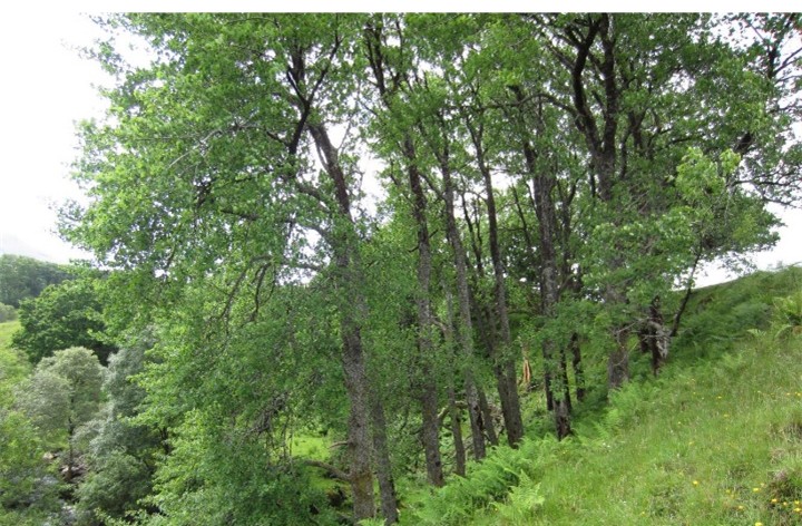
The Temperate rainforest secondary code (25) can be added to woodland UKHab primary habitat codes where it applies. It could be incorporated into the metric too, as rainforest is of such special value and international significance. Appendix 3 includes extra metric categories for this purpose: rainforest versions of certain woodland categories. The rainforest forms have a greater diversity of bryophytes and lichens including western species. Further information about temperate rainforest in Britain and Ireland is available in A Provisional Definition of Temperate Rainforest in Britain and Ireland (Averis 2023), from which the two maps in Figure 4 are copied.
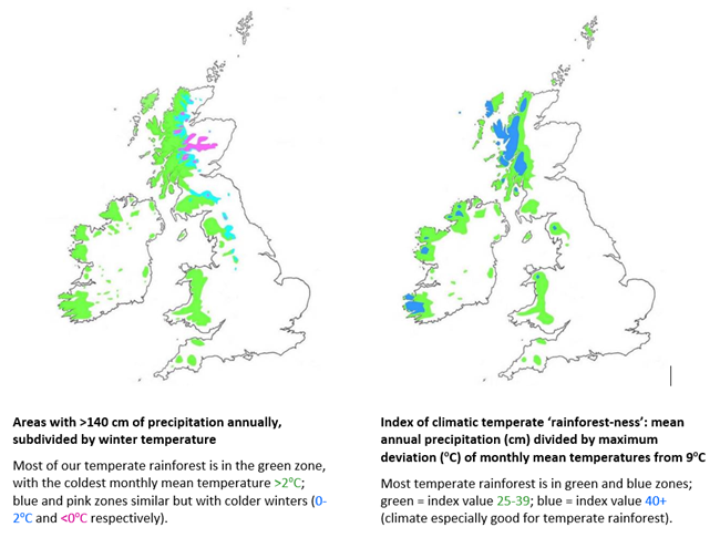
Figure 4: Two maps of Great Britain and Ireland, indicating the climatic conditions (e.g. precipitation, winter temperature, monthly mean temperatures) in relation to where temperate rainforest habitats tend to occur.
5. Scottish habitats not adequately considered in the English statutory biodiversity metric
At a very broad level the English metric habitats in total are expected to cover the complete range of habitats in England, and can be expected to give similarly complete coverage in Scotland and Wales too. We are not aware of any Scottish habitats that are outside the total range of variation among English metric habitats.
Some vegetation types are well represented in Scotland but comparatively rare in, or absent from, England and Wales. These are shown in the left-hand column in Table 3 below. Even though some of them are unrecorded in England and Wales, they can still be accommodated within existing metric habitats, but they could usefully be given separate metric habitat categories, as is already the case for two of them – tall herb communities and native pine woodland.
| Vegetation type(s) well represented in Scotland but comparatively rare or absent from England and Wales | NVC codes | Occurrence in England and Wales | Position in relation to English metric habitats |
|---|---|---|---|
| Montane summit heaths | U9-10 | Scarce | Within Upland acid grassland |
| Snowbeds | U7-8/11-12/14 | Very rare | Within Upland acid grassland |
| Upland tall herb vegetation | U15/17 | Scarce | Tall herb communities (100% equivalence) |
| Montane calcareous grasslands | CG11/12 | Rare | Within Upland calcareous grassland |
| Dryas octopetala heaths | CG13/14 | Absent | Within Upland calcareous grassland |
| Montane Deschampsia cespitosa grassland | U13 | Very rare | Within Upland acid grassland |
| Oceanic liverwort-rich heaths | H20c/21b | Very rare | H20 = within Mountain heaths and willow scrub; H21 = within Upland heathland |
| Montane dwarf shrub heaths* | W20, H13-15/17/19/20/22 plus high-altitude H10/12/18/21, M15 | Rare | Within Mountain heaths and willow scrub |
| Montane willow scrub* | W20 | Absent | Within Mountain heaths and willow scrub |
| Herb-rich Nardus grassland | U5c | Rare | Within Upland calcareous grassland |
| Herb-rich Juncus squarrosus vegetation | A form of U6 not described in NVC | Absent? | Within Upland acid grassland |
| Native pine woodland | W18 | Absent | Native pine woodlands (100% equivalence) |
| Hazel-dominated temperate rainforest | Mainly W9/11 | Rare | Within Hazel scrub |
| Montane springs & flushes | M7-8/11-12/31/33-34 | Rare | Within Fens (upland and lowland) |
*These two together make up the whole of the Mountain heaths and willow scrub metric habitat category.
6. Correspondence between classification systems
The most relevant conversions in this context are discussed below:
6.1 Conversion between UKHab and English statutory biodiversity metric habitats
The English Biodiversity Metric 4.0 User Guide – Technical Annex 2 (Natural England 2023b) includes tables in which each English metric habitat type is shown alongside its UKHab equivalent category.
Appendix 3 shows the equivalent UKHab and NVC categories for each of the terrestrial metric habitat categories, along with other information including distinctiveness/conservation value scores and suggested subdivisions of metric habitat categories.
6.2 Conversion between UKHab and NVC
The NVC to UKHab conversion table (most recent version is in UKHab Correspondence Tables (draft) Feb 2025 spreadsheet) is not fully reliable. For example:
- NVC M15a partly equated with bog habitats. M15a is typically a kind of flushed wet heath, or it can be equally well seen as a heathy flush.
- M15c partly equated with Annex 1 H7140 Transition mires and quaking bogs. This is a relatively dry form of wet heath that is quite different from Annex 1 H7140.
- NVC M25 is equated with UKHab f1 bog habitats and f2b Purple moor-grass and rush-pasture only, but large extents of it belong in UKHab f2f (Other wetland).
- NVC U4c can be UKHab g2b6 but this is not shown.
- NVC U15 is equated partly with UKHab g1b6 acid grassland, which is incorrect.
- NVC CG1 can be (rarely) UKHab g2b7, but this is not shown.
6.3 Conversion between English statutory biodiversity metric habitats and NVC
In the absence of an available conversion table between NVC and English metric habitat categories, we have included a column for NVC in Appendix 3. This shows NVC types for existing metric habitats and also for subdivisions of metric habitats where we have suggested that this would be worthwhile.
6.4 Conversion between UKHab and Phase 1
The spreadsheet UKHab Correspondence Tables (draft) Feb 2025.xls includes a Phase 1 to UKHab worksheet listing the equivalent UKHab codes for each Phase 1 code. In most cases this is not a direct equivalence but a partial one, so further checking will be needed to clarify these conversions; reference to NVC communities could help with this.
6.5 Conversion between English statutory biodiversity metric habitats and Phase 1
In the absence of an available conversion table between Phase 1 and English metric habitats, this is given in Appendix 2.
6.6 Conversion among NVC, Phase 1, UK BAP, Annex 1 and EUNIS
For comparing between classifications other than UKHab and the English metric, there is a Joint Nature Conservation Committee spreadsheet titled Habitat-correspondences-2008.xls (JNCC 2008), with an interactive facility for comparing chosen pairs of habitat classifications including NVC, Phase 1, UK BAP broad, UK BAP priority, Annex 1 and EUNIS. In general it works well, though it has not been updated since 2008 and therefore pre-dates UKHab and the English statutory biodiversity metric.
For NVC-EUNIS conversion, the document by Strachan (2017) is a very good reference. It is more recent and more detailed than the JNCC Habitat-correspondences-2008.xls spreadsheet mentioned above, and a better reference for use in Scotland than the EUNIS terrestrial habitat classification 2021 including crosswalks.xls spreadsheet (European Environment Agency 2021).
In the available conversion spreadsheets, comparisons among habitat classifications that are broader than the NVC include indications of partial equivalence but without full details, presumably (and understandably) because it would take up too much room to give those full details in a consistent way for all comparisons. This does of course limit the usefulness of these comparisons and requires the reader to spend more time checking other sources of information.
The NVC is a useful common currency when converting between classifications. Indeed, it is hard to see how some UKHab, Phase 1, English metric habitats, UK BAP priority, Annex 1 and EUNIS categories can be properly understood without making reference to the NVC. Hence, conversions between UKHab and NVC, between Annex 1 and NVC and between EUNIS and NVC are also relevant.
The NVC part of the JNCC Habitat-correspondences-2008.xls and UKHab Correspondence Tables (draft) Feb 2025 spreadsheets do not include additional vegetation types that are not in the NVC but have been found in various NVC surveys. Many (probably most) of these non-NVC vegetation types are described by Rodwell et al. (2000) and Averis & Averis (2020).
For compatibility of NVC and EUNIS with the English metric habitats, it is perhaps more useful for NVC or EUNIS data to be translated directly into equivalent metric habitat categories instead of conversion first to UKHab categories. This could be done effectively in fieldwork when the intention for subsequent use for metric assessment is known, but it will not work so well for existing NVC or EUNIS data that was recorded without such intention (e.g. in pre-metric times).
It is possible that some translations might underestimate or overestimate the amount of biodiversity on a site, if they are done too quickly or simply, without checking for other possibilities. As mentioned above, translations between two broad classifications will often require checking of this kind. It seems better to break each broader habitat category down according to its NVC components to enable a better understanding of how those broad categories from different classifications relate to each other.
7. Conservation Value
The English metric uses ‘distinctiveness’ where ‘conservation value’ would be a better term. ‘Distinctiveness’ is a potentially misleading term in this context and would be best avoided in a Scottish metric. For example, species-poor agriculturally improved grassland (NVC MG7), rhododendron scrub, dense Sitka spruce plantation and patches of Himalayan balsam or giant hogweed are undoubtedly distinctive but of low biodiversity interest and, in various ways, ecologically undesirable. So are supermarket car parks and six-lane motorways.
Some of the English metric’s habitat categories are broad enough to encompass considerable variation in rarity, species-richness, occurrence of notable species, and so on. A single conservation value level applied to such habitat categories can therefore lead to unrealistic or inappropriate scorings in some cases. Subdivision of metric habitat categories, based largely on the NVC, helps to fine-tune conservation value scores. Ideally, it would be good to have flexibility of scoring beyond just the habitat category, as there can be instances of varied ecological significance within a single NVC community or even sub-community – for example, the presence of a rare species, or some other ecologically interesting aspect of the habitat. It is acknowledged, of course, that attempting to incorporate such details could get very complicated.
In Appendix 3 we have suggested conservation value scores for use in Scotland that differ from those (distinctiveness values) given in the current English metric. These are discussed below (VL = very low; L = low; M = medium; H = high; VH = very high, VH+ = very high with especially notable significance):
- Upland acid grassland is given a M score in the English metric but is a very varied category including montane snowbeds and summit heaths (NVC U7-14) of high ecological interest and conservation value, worthy of VH/VH+, and species-rich acid grasslands (NVC U4c/5c/4F/6R) also worthy of VH.
- Lowland dry acid grassland UK BAP priority habitat scores VH in the current English metric, but from our experience of it in Scotland we think H is more appropriate here – otherwise it scores higher than such things as some fine examples of upland calcareous grassland scoring H.
- Among the Other neutral grassland, all of which currently scores M in the English metric, Lolium-Cynosurus neutral grassland (NVC MG6) and Elytrigia repens grassland (no NVC), both of which are in some way artificial and species-poor, seem more worthy of L. Also, among Other neutral grasslands that currently score M, Schedonorus arundinaceus vegetation (NVC MG12), which is not very common here, appears worthy of H.
- Upland calcareous grassland currently scores H in the English metric, but the uncommon montane/northern forms (NVC CG12-14), including Dryas heath, and also the rare upland examples of the more southern NVC CG2 community, seem worthy of VH.
- Lowland calcareous grassland currently scores H in the English metric, but VH seems more appropriate through Britain generally, except perhaps for tall (less species-rich) southern forms (NVC CG3-6) and, in Scotland, examples belonging to NVC CG10 – we have suggested H for these.
- Tall herb communities score H in the English metric, but given its small total extent, high species diversity, naturalness and, in many places, presence of rare species, a VH score appears more realistic.
- Bracken currently scores L in the English metric, but we suggest M – otherwise it scores the same as agriculturally improved grasslands (which are less semi-natural than bracken stands).
- Native pine woodlands scores H in the English metric, but given the obvious importance of this habitat, surely VH+ would be more appropriate.
- Upland birchwoods, Upland oakwoods, Upland mixed ashwoods, Wet woodland, Lowland mixed deciduous woodland and Lowland beech/yew woodland all currently score H in the English metric, but these UK BAP priority habitats have a high degree of naturalness when compared with unwooded habitats at these altitudes. With this in mind, as well as the generally accepted need for us to greatly value and look after our remaining examples of semi-natural woodland, we think VH is more appropriate. Indeed, we also suggest VH+ for all examples that are forms of temperate rainforest.
- Aspen woodland currently has to be placed in Other woodland; broadleaved, scoring M in the English metric, but given the known high biodiversity value of aspen stands we suggest that this habitat is given a separate category and a VH score.
- Felled woodland currently scores H in the English metric, but we have suggested L in Appendix 3.
- Montane willow scrub currently scores VH in the English metric; we have suggested a higher VH+ score because it is so rare and vulnerable, and is one of the more natural forms of upland vegetation.
- Upland heathland scores H in the English metric, but this category is very varied, including species-poor burned/degraded heath (NVC H9) for which we suggest M, and species-rich or otherwise notable upland heaths (H10d, H21b, M14, M15a, M15c with dwarf juniper, non-NVC Calluna heath with mesotrophic herbs and non-NVC calcicolous Arctostaphylos uva-ursi heath) for which we suggest VH (indeed, VH+ for H21b because of the international significance of its oceanic liverwort assemblages).
- Lowland heathland scores H in the English metric, but some rare forms restricted to parts of southern England could be more worthy of VH.
- Juniper scrub does not yet have a score because there is no English metric category for it; we consider it to be worthy of a VH score.
- Hawthorn scrub currently scores M in the English metric, but the geographically restricted and relatively species-rich southern NVC sub-community W21d seems worthy of H.
- Hazel scrub is given a M score in the English metric, but H seems more appropriate and indeed VH+ for rainforest examples, which can be of great international importance for oceanic bryophytes and, especially, lichens.
- Willow scrub scores M in the English metric but is a habitat of high conservation value and more than just a precursor to taller woodland; a score of H or VH seems more appropriate.
- Non-native sea buckthorn scrub currently scores L in the English metric, but it can still have a considerable semi-natural element and is perhaps worthy of M, especially given that native sea buckthorn scrub, which can be floristically similar, scores H.
- Rhododendron scrub scores L in the English metric, but we think VL is more appropriate because this invasive alien shrub has such a damaging effect on various habitats including internationally important western temperate rainforest.
- Other types of non-native scrub have no current score in the English metric; we suggest L or, in the case of Rosa rugosa (quite seriously invasive in places) VL.
- Raspberry and ivy underscrub have no score because they have no current place in the English metric; we suggest M for these.
- Modified bogs score VH in the English metric; we suggest H because they are ecologically poorer than active bogs in good condition.
- Fen (upland and lowland) has a VH score in the English metric but is a very varied category that includes species-poor Molinia (NVC M25a/b) for which a lower score of M seems more appropriate.
- Reedbeds score H in the English metric, but we suggest VH unless they show signs of eutrophication (as in NVC S26), in which case H. Phragmites swamps in shallow water appear reasonably natural, and Phragmites fens belonging to NVC S24/25 (and S27 with abundant Phragmites) can be of great botanical interest.
- Inundation herb communities do not seem to have a clear place in the current English metric but seem worthy of recognition with scores of M or, in the case of rare southern forms, VH.
- Coastal cliff and Coastal sand dune habitats currently score H in the English metric but given their ecological interest and naturalness we think VH is more appropriate.
- Ruderal/ephemeral vegetation currently scores L in the English metric, but it can be of great interest, so we think M is more suitable.
- Winter stubble currently scores L in the English metric but could be M because it can be good habitat for birds.
- Some urban habitats (Allotments, Bioswale, Rain garden, Sustainable drainage system, Vacant or derelict land and Vegetated garden) score L in the English metric but could be worthy of M because they can make a significant contribution to biodiversity.
These suggested changes to conservation value scores are not based on the English metric’s stated criteria for defining the various categories but are based on a more general assessment of scarcity, naturalness and richness. The current criteria as stated in the English metric’s documentation, with much reference to the Natural Environment and Rural Communities (NERC) Act, Priority Habitat and Red List categories, might seem logical but they lead to some scoring that doesn’t seem right when looked at from a more general ecological perspective.
8. Habitat condition
The criteria in the condition assessment sheets accompanying the English metric (Natural England 2023a) cover a wide range of features. We have used these condition sheets in the field in various habitats in Scotland and have found that some criteria can be difficult to apply or can lead to misleading interpretations of habitat quality. These are described below in Table 4 below.
| Criteria | Criteria description (from English metric condition assessment sheets) | Comments |
|---|---|---|
| Grassland (unimproved) criterion B | Sward height is varied (at least 20% of the sward is less than 7 cm and at least 20% is more than 7 cm) creating microclimates which provide opportunities for insects, birds and small mammals to live and breed. | Some grasslands in good condition could have <20% of the sward <7 cm tall – for example some MG2, MG3 or MG5. Some grasslands on thin/patchy soils (e.g. some U1 and CG7), and also some grazed but species-rich swards (e.g. some upland CG10/11/12) could have <20% of the sward >7 cm tall but still be of high biodiversity value and not appearing degraded. Likewise, some snowbed and summit heath vegetation (especially U10/11/12/13b/14 and non-NVC snowbed communities) could naturally be short, with <20% of the vegetation >7 cm tall. |
| Grassland (unimproved) criterion C | Cover of bare ground is between 1% and 5%, including localised areas, for example, rabbit warrens. | Bare ground needs to be 1-5% to pass, but there are many examples of grassland in good condition with 0% bare ground. |
| Heathland criterion B | There are at least two dwarf shrub species Frequent, and cover of dwarf shrubs is between 25-75% for lowland heathland, 50-75% for upland dry heath, or >20% for upland wet heath. | It might not always be right to interpret >75% dwarf shrub cover as a negative feature. In some upland dry heath >75% dwarf shrub cover is associated with a good semi-natural flora and does not appear to be ecologically problematic. |
| Heathland criterion C | All heather Calluna vulgaris age-classes (pioneer, degenerate and mature) present with at least 10% pioneer heather in the lowlands or at least 10% degenerate or mature in the uplands. | The expectation that pioneer heather will be present (indeed, at a minimum of 10% cover) in heath in good condition seems questionable. We have found a lot of heath whose condition appears generally good but with pioneer heather plants rare or absent. This expectation appears to be based on what happens in moorlands intensively managed for driven grouse shooting, which have high structural diversity on a smaller scale (and in highly artificial mosaic patterns) than is the case in less modified heaths. |
| Heathland criterion G | No more than 33% of heather shoots have been recently grazed, or flowering heather plants are at least Frequent in autumn. | % of heather shoots recently grazed is often unclear and hard to assess. |
| Heathland criterion K (Footnote 7) | Damaging activities include: accidental or unmanaged fires; managed fires on wet heath; excessive poaching; damage from machinery use or storage; and damaging levels of public access resulting in trampling and or litter. | “…e.g. unmanaged fire…” could be changed to “…e.g. fire…” because any fire could be seen as damage. |
| Woodland criterion D | Number of native tree species | A higher number of native tree/shrub species scores positively, but some woods, especially on acid soils in upland areas, appear naturally to have fewer tree/shrub species. The size of the area being assessed will make a difference here too; more species are more likely in larger areas of woodland. |
| Woodland criterion I | Vegetation and ground flora | Non-NVC types of semi-natural woodland in good or poor condition could fail this criterion simply because they are non-NVC. The main example of this is woodland with Luzula sylvatica dominant in the ground layer (recorded as WLz in many NVC surveys in Scotland). |
| Woodland criterion J | Woodland vertical structure | The number of vertical storeys is expected to be more in the condition sheets than is typically seen in many upland birchwoods, which appear naturally to have only one or two vertical storeys. |
| Scrub criterion B | Seedlings, saplings, young shrubs and mature (or ancient or veteran) shrubs are all present. | The very dense and prickly nature of gorse and juniper scrub could make this very difficult to assess. |
| Wetland criterion H | Sphagnum moss Sphagnum spp. and cottongrasses Eriophorum spp. are at least Frequent. Cover of ericaceous dwarf shrubs is less than 75%. | NVC M20 could pass this criterion despite being a rather degraded type of bog. Possible ways to improve this for bogs include a minimum % cover of dwarf shrubs (perhaps about 20%?), cover of Sphagnum fallax less than that of other Sphagnum species, and Polytrichum commune no more than very sparse. Also, some bog vegetation is, apparently quite naturally, on peat <50 cm deep. |
| Limestone pavement criterion C | Species indicative of suboptimal condition make up less than 1% of vegetated ground cover. | Surprising to see Cynosurus cristatus listed as an undesirable species. |
| Coastal saltmarsh criterion F | Zonation and transition to other habitats | In many places such as west Highland sea lochs, zonations can be concentrated within a small distance and one or more of these vegetation zones can be missing. |
8.1 Potential use of the NVC as an indicator of some aspects of habitat condition
We have been asked if the identity of NVC types might help in the assessment of habitat condition in the Scottish metric. Criterion I in the woodland sheet asks if an NVC type is recognisable. This appears to be the only reference to NVC in the condition assessment methodology.
Vegetation in Great Britain varies from highly modified by human activity to near-natural, and NVC types delineating the near-natural end of this range are certainly an indication of vegetation made up of native species acted upon by natural ecological processes. Examples include:
- W17a (but this can be invaded by rhododendron)
- H10d (usually on steep/rocky ground)
- H13-15/17 (prostrate wind-pruned Calluna heaths)
- H20c/21b (liverwort-rich heath)
- H22 (mostly not too grazed/burned)
- M17/18/19 (more heathy, less grazed and less modified than M20)
- M5/7-14 (mostly not too grazed, drained or eutrophicated)
- M15a (less likely to be in poor condition than are some examples of M15b/c/d)
- M23a/25c/28 (mostly not appearing degraded/eutrophicated)
- M29-35 (mostly indicating influence of water that isn’t eutrophicated)
- U4c/5c/6R/CG1-14/MG2/3/5/8 (rich flora can be associated with generally good condition)
- U15 and U17 (mostly on very steep ground inaccessible to large herbivores)
- U7-U14 (montane summit heaths and snowbeds)
Some other NVC types suggest poorer or less natural condition:
- H9 (species-poor dry heath, typically degraded by burning)
- M16 (species-poor wet heath, much of it degraded by burning)
- M20 (bog that has lost most or all dwarf shrub cover by grazing, burning or atmospheric pollution)
- U2 (species-poor Avenella flexuosa grassland mostly associated with previous disturbance such as burning or tree-felling)
- MG6/7 (species-poor agriculturally improved grassland)
However, many NVC communities show considerable variation in some aspects of their condition, reflecting factors such as grazing, burning, draining and eutrophication. In many cases an NVC code added to a UKHab or Phase 1 code will not automatically give a clear picture of the condition of the vegetation/habitat, so we do not recommend using NVC categories as condition indicators.
8.2 Vegetation types that do not fit well within the existing English metric condition assessment sheets
Some vegetation types are not covered by the English metric’s condition assessment sheets and have to be assessed using a sheet that is designed for a different habitat. It would therefore be beneficial to have additional condition assessment sheets with criteria that are relevant to these vegetation types. The vegetation types in question are as follows:
- Bracken (NVC U20 and W25). None of the existing condition assessment sheets work well for it. The nearest are grassland (the default one to use) and heath, but neither are really appropriate, if only because bracken stands are neither grassland nor heath.
- Vegetation dominated by tall ferns other than bracken (NVC U19 + non-NVC Dryopteris/Athyrium vegetation), tall herbs (NVC U17) or Luzula sylvatica (NVC U16). These are currently grouped with upland acid grasslands for condition assessment, but are not grasslands and are different in flora and structure, so a separate condition sheet would probably be better.
- Montane summit heaths and snowbeds (NVC U7-14). These are currently grouped with the upland acid grassland types for condition assessment, but are sufficiently different from them in flora, structure and habitat that a separate condition sheet should help.
- Bog (NVC M17-20 + M1-3 bog pools). Bog is such a floristically and hydrologically well-defined type of wetland that a separate sheet is likely to be beneficial.
9. Summary of classifications and their suitability for use within a biodiversity metric
Table 5 below summarises our thoughts about the suitability of vegetation/habitat classifications for general use and biodiversity metric use.
| Classification | Suitability for mapping and describing vegetation/habitats in general (not specifically for use with biodiversity metric) | Suitability for use with biodiversity metric habitat categories/condition assessment |
|---|---|---|
| NVC | Very good. By far the best classification for mapping, describing, understanding and evaluating British semi-natural vegetation. Also works well in Ireland. Supporting descriptions, floristic tables, etc., (Rodwell 2001 et seq.) are more detailed than for other British vegetation/habitat classifications. Excludes most artificial and some semi-natural habitats, but semi-natural omissions are only a very small proportion of total semi-natural extent. Omissions from NVC can be mapped and described anyway, using non-NVC codes (some such codes now used widely by many surveyors). Information on NVC ‘gaps’ is available online. Because of its detail, NVC is not only the recommended classification for mapping, understanding and evaluating vegetation, but is also a useful/essential ‘common currency’ in understanding habitat categories in other classifications and for conversions among those classifications. NVC is well understood and has been used by many surveyors throughout Britain since the 1980s. | In general, NVC communities can readily be assigned to biodiversity metric categories and also to the habitat categories used for condition assessment in the metric. In some cases, additional information is needed (e.g. on tree canopy species in woodland), but this would not add greatly to the work needed for NVC survey. In general, NVC could form a suitable basis for further work using a biodiversity metric, ideally with revised metric habitat categories based on groupings of NVC communities. |
| Phase 1 | Moderate to good. Has comprehensive coverage of all British habitat types (and will have similar coverage in Ireland), but categories are much broader than in NVC, so for floristic/ecological understanding it is considerably more limited than NVC. Phase 1 is well understood and has been used by many surveyors throughout Britain since the late 1970s. | For conversion to metric habitat categories, additional information is required for many Phase 1 categories. NVC information also helps in Phase 1 to metric habitat conversion. |
| UKHab | Moderate to good. Has comprehensive coverage of all habitat types in the UK (and should also do likewise in the Republic of Ireland). Incorporation of UK BAP priority habitats and Annex 1 habitats allows for more detailed breakdown of categories than in Phase 1, but categories are still much broader than in NVC so for floristic/ecological understanding it is considerably more limited than NVC. For more effective use it would help greatly for some of the categories to be subdivided (as described in this report). A major shortcoming is that the guidance prohibits the mapping of mosaic polygons, but as this actually appears to stem from a limitation in the algorithm of the current English metric it should be possible for surveyors to map in UKHab with mosaics where appropriate (so that good, truthful mapping exists) and simplify to a single category for each polygon specifically for input into the metric. UKHab does not have such a long history of use as NVC and Phase 1, but there are now many surveyors who use it and understand it well. | As the metric habitat categories are based mainly on UKHab, results from a UKHab survey can form a good basis for further work with the metric. Use of UKHab here is desirable for consistency with the English metric, but in order to be more meaningful it would be better for some UKHab categories and some metric categories to be subdivided. |
| UK BAP | Moderate to good. UK BAP broad habitats have comprehensive coverage of all habitats in the UK (and would be similarly comprehensive in the Republic of Ireland) but only at a very broad level. UK BAP priority habitats are selected for special interest and therefore have only partial coverage, but with a more detailed breakdown than with the broad habitats of which they are a part. However, priority habitats are still broader than NVC communities. If UK BAP is used for mapping/classification, a combination of broad and priority habitats is therefore best, to get a combination of complete coverage and extra detail where priority habitats provide this. UK BAP has been used since the 1990s and is well understood by many surveyors, partly from direct use (e.g. Forestry Commission Scotland surveys of open habitats) and also more indirectly through the use of UK BAP priority habitats for conservation assessment and incorporation into UKHab. | UK BAP survey data including that for priority habitats allows for better conversion to metric habitats than is the case with Phase 1, but not quite as direct as with UKHab and also requiring some additional data (e.g. for different scrub categories and use of some Annex 1 types in the metric). NVC data would help in the process of conversion from UK BAP categories to metric habitat categories. |
| SBL | Scottish Biodiversity List (SBL) habitat categories are almost identical to UK BAP priority habitat categories, so comments under UK BAP priority habitats also apply to SBL. | As for UK BAP priority habitats (see above). |
| EUNIS | Moderate to good. This European classification covers all habitats at its broadest level; other levels break them down with more detail, some categories corresponding to Annex 1 habitats. The final level of detail is still less than with NVC. The best reference for use of EUNIS in Scotland is the manual by Strachan (2017). EUNIS was developed in the 1990s and has been used widely, though much of its use appears to have been in conversions from original NVC survey data into EUNIS for various purposes. Ability of surveyors in Britain to map habitats to EUNIS categories in the field is probably much less than for NVC, Phase 1, UKHab, UK BAP and Annex 1. | Most conversion from EUNIS to metric habitat categories would require conversion to UKHab first, probably including some reference to NVC, UK BAP or Annex 1 in the process. |
| Annex 1 | Moderate. Annex 1 habitat categories have only partial coverage because they are selected as habitats of special interest. In terms of level of detail/breakdown they are more or less similar to UK BAP priority habitats and much less detailed than NVC. As they are defined from a total European perspective, some of their names and definitions do not fit very comfortably with the range of variation in British and Irish vegetation. Annex 1 habitat categories have been used by many surveyors since the 1990s. Much of this use appears to be associated with NVC surveys in which NVC-mapped areas that fit Annex 1 categories have been identified. Its use also includes the role of Annex 1 within EUNIS and UKHab. | Annex 1 has only partial overlap with metric habitat categories. It covers only certain habitat types that are considered to be important on a European scale, while the metric categories cover all habitats. Annex 1 data are therefore of limited use for the metric unless accompanied by data such as NVC or UKHab for habitats that do not qualify for Annex 1 status. |
Following this table, here is a brief summary of our main thoughts regarding the suitability of different habitat classifications to general survey and for use with a biodiversity metric.
For general vegetation survey purposes, we consider NVC to be the best classification for vegetated habitats, especially those that are semi-natural.
UKHab has more coverage of hedgerow, unvegetated and urban habitats.
The lack of NVC categories for unvegetated habitats is not a problem in predominantly vegetated landscapes because unvegetated habitats in such areas are mainly restricted to bare rock, scree, bare soil and open water, and can be labelled accordingly. It would be possible with NVC survey to use UKHab codes for unvegetated and urban habitats where these are found.
Many of the UKHab vegetation categories are broad enough to contain significant floristic and ecological variation and would be better split into subdivisions reflecting this variation (as shown in Appendix 1 of this report).
For surveys of well-vegetated landscapes done with a main aim of using the current English metric, it makes little difference whether the classification used is NVC, Phase 1 or UKHab, as long as NVC or Phase 1 surveys include the necessary additional information to allow the mapped vegetation types to be assigned correctly to their metric categories. The more urban the survey area is, the greater role the metric’s many urban habitat categories will play.
In general, and especially in well-vegetated/rural landscapes, it is important to be able to map mosaic polygons without any constraint, so that one can label a mosaic polygon with a list of its component habitat types and an estimated percentage cover for each one of these components. The original mapping can be retained while the necessary simplifications have to be made to polygon data put into the metric.
UKHab secondary codes can be useful in referring to a wide range of features at various scales. It is possible that in surveys done with metric use in mind, secondary codes could be used as suffixes to the main habitat codes, even if those main codes are those of a different classification such as NVC or Phase 1.
As the metric’s habitat categories are generally broader than those of UKHab, we have suggested improvement to the resolution of that classification, mainly by subdividing some of the existing categories. This is shown in Appendix 3 of this report. This appendix also includes suggested changes to some of the conservation value (distinctiveness) scores given in the current English metric, and, additionally, an indication of the possibility or practicability of habitat creation and habitat restoration for each habitat category.
10. References
Averis, ABG & Averis, AM (2020). Plant communities found in surveys by Ben and Alison Averis but not described in the UK National Vegetation Classification. Pdf document available
Averis, ABG (2023). A Provisional Definition of Temperate Rainforest in Britain and Ireland. Pdf document available
Carpenter, D. (2022). Differences between BNG metric and UKHab habitats. Article on LinkedIn
European Environment Agency (2021). EUNIS terrestrial habitat classification 2021 including crosswalks.xls Spreadsheet available online
Joint Nature Conservation Committee (2008). Habitat-correspondences-2008.xls. Spreadsheet available online
Joint Nature Conservation Committee (2010). Handbook for Phase 1 habitat survey – a technique for environmental audit. ISBN: 978-0-86139-636-8. Available online
Joint Nature Conservation Committee (2011). Biodiversity Action Plan Priority Habitat Descriptions. BRIG (ed. Ant Maddock) 2008. (Updated Dec 2011). Available online
McMullen, A. & Potter, R. (2022). UKHab – does it meet its claims? Online blog article
McVittie, A., Cole, L., McCarthy, J., Fisher, H., and Rudman, H. (2023). Research into Approaches to Measuring Biodiversity in Scotland. ISBN 978-1-83521-358-2. Final Report to Scottish Government is available online
Natural England (2023a). The Biodiversity Metric 4.0 - Technical Annex 1: Condition Assessment Sheets and Methodology. Natural England Joint Publication JP039. ISBN 978-1-7393362-2-6. Microsoft Excel spreadsheet available online
Natural England (2023b). The Biodiversity Metric 4.0 - Technical Annex 2 - Technical Information (2023). Natural England Joint Publication JP039. ISBN: 978-1-7393362-3-3. Pdf document available online
Rodwell, J.S. (Ed.) (1991 et seq.). British Plant Communities. 5 volumes: Vol. 1 (1991) - Woodlands and Scrub; Vol. 2 (1991) - Mires and Heaths; Vol. 3 (1992) - Grasslands and montane communities; Vol. 4 (1995) - Aquatic communities, swamps and tall-herb fens; Vol. 5 (2000) - Maritime Cliffs, Sand Dunes, Saltmarshes and Other Vegetation. Cambridge University Press, Cambridge.
Rodwell, JS, Dring, JC, Averis, ABG, Proctor, MCF, Malloch, AJC, Schaminée, JNJ, & Dargie TCD, (2000). Review of coverage of the National Vegetation Classification. JNCC Report No. 302.
Strachan, I. (2017). EUNIS - Publication 2017 - SNH Commissioned Report 766 - Manual of terrestrial EUNIS habitats in Scotland
UKHab Ltd (2025). UKHab Correspondence Tables (draft) Feb 2025.xls Microsoft Excel Spreadsheet.
UKHab Ltd (2023). UK Habitat Classification Version 2.0 (UKHab-v2.01-July-2023-Final-2.pdf document available online).
Wallace, H. & Prosser, M. (2016). A review of the National Vegetation Classification for the Calthion group of plant communities in England and Wales. Report commissioned by the Floodplain Meadows Partnership. Pdf document available online
Appendix 1: Suggested subdivisions of UKHab categories for use in Scotland
These subdivisions are based mainly on NVC communities/sub-communities.
UKHab code | UKHab category name | Recommended split for use in Scotland | NVC types (+ non-NVC types that also apply) | Priority |
|---|---|---|---|---|
g1b5 | Montane acid grasslands | Summit heaths | U9-10, montane lichen heath, montane Racomitrium ericoides moss heath, fell field | High |
g1b5 | Montane acid grasslands | Snowbeds | U8, U11, U12, U13b, U14, Avenella snowbed, Mixed snowbed, Pohlia ludwigii snowbed | High |
g1b5 | Montane acid grasslands | Montane acid grassland | U7, U13a | High |
g1b6 | Other upland acid grassland | Luzula sylvatica swards + woodland flora (mainly on cliffs) | U16a | High |
g1b6 | Other upland acid grassland | Luzula sylvatica swards + grassland flora or v. spp-poor (mainly not on cliffs) | U16b/c | High |
g1b6 | Other upland acid grassland | Typical/widespread upland acid grassland | Upland U4abde/5abde + U6 not on deep peat + more locally U1/2/3 (U3 not in Scotland) | High |
g1b6 | Other upland acid grassland | Flushed upland acid grassland | U4F, U6R (U4c and U5c would count here, but they are included in Annex 1 H6230, which means that in UKHab they are placed with upland calcareous grasslands | High |
g1b6 | Other upland acid grassland | Tall rushes + acid grassland lower layer | Non-NVC types Ja (with abundant Juncus acutiflorus) and Je (with abundant J. effusus) | High |
g1c | Bracken – could be renamed Tall ferns | Bracken | U20, W25 | High |
g1c | Bracken – could be renamed Tall ferns | Other tall ferns | U19, Dryopteris/Athyrium | High |
g2a | Lowland calcareous grassland | Typical/widespread calcareous grassland | Lowland examples of CG10 | High |
g2a | Lowland calcareous grassland | Southern calcareous grassland | Lowland examples of CG1/2/7 | High |
g3c | Other neutral grassland1 | Suggested subdivision for spp-poor swards of Holcus lanatus/mollis, Festuca rubra and Agrostis capillaris/stolonifera | Various non-NVC types | Medium |
g3c | Other neutral grassland1 | Suggested subdivision for swards dominated by Schedonorus arundinaceus | MG12 | Medium |
g3c | Other neutral grassland1 | Suggested subdivision for swards dominated by Elytrigia repens | Non-NVC Elytrigia repens grassland | Medium |
g3c | Other neutral grassland1 | Suggested subdivision for short damp/inundation neutral grassland | MG11, MG13-16 and OV28. MG14-16 are communities described by Wallace & Prosser (2016). | Medium |
w1a5, w1b5, w1d, w1e & w2a5 | Various woodland categories (all of which, except for w1e, have Annex 1 status) | Each of these categories could be split into two: one for non-rainforest and one for rainforest | Varied, including W4, W7, W9, W11, W17, W18 and WLz (WLz = with ground layer dominated by Luzula sylvatica). However, splitting by rainforest status does not depend on NVC types. Another option here, instead of splitting into rainforest/non-rainforest category pairs, is to routinely use secondary code 25 for rainforest examples; this would have the same effect in separating rainforest from non-rainforest. | High |
w1g | Other broadleaved woodland | Examples with canopy dominated by aspen | Mainly aspen-dominated forms of W11 | High |
w1g | Other broadleaved woodland | Examples with canopy dominated by non-native beech | W14-15 (non-native examples) and non-native beech woodland with a ground layer too sparse/species-poor to be assigned to any NVC community | High |
w1g | Other broadleaved woodland | Examples with canopy dominated by non-native poplars | Mainly forms of W6 and W7c | High |
w1g | Other broadleaved woodland | Examples with canopy of various species but not dominated by aspen, beech or non-native poplars | Varied: includes W8-12, W14-16 and WLz | High |
h1a5 | Lowland dry heath | Species-poor modified heath | H1 + lowland H9 | High |
h1a5 | Lowland dry heath | Less-modified heath | H2-3 + lowland H8/10/12/18 | High |
h1b5 | Upland dry heath | Species-poor degraded upland heath | Upland H9 | High |
h1b5 | Upland dry heath | Less-modified (typical) upland heath | Upland H10, H12, H16, H18 (non-montane), H21 | High |
h1b5 | Upland dry heath | Herb-rich upland heath | H10d, Calluna-mesotrophic herb heath, calcicolous Arctostaphylos uva-ursi heath | High |
h1b5 | Upland dry heath | Liverwort-rich upland heath | H21b | High |
h1c5 | Alpine and sub-alpine heath | Prostrate Calluna heaths | H13, H14, H15, H17 | Medium |
h1c5 | Alpine and sub-alpine heath | Montane Vaccinium/Empetrum heaths | H18 (montane forms), H19, H20, H22 | Medium |
h1a7 | Wet heathland with cross-leaved heath; lowland | Flushed/base-enriched wet heath | M14/15a/M16b in lowlands | High |
h1a7 | Wet heathland with cross-leaved heath; lowland | Non-flushed wet heath | M15bd/16acd in lowlands | High |
h1b6 | Wet heathland with cross-leaved heath; upland | Flushed/base-enriched wet heath | M14/15a in uplands | High |
h1b6 | Wet heathland with cross-leaved heath; upland | Non-flushed wet heath | M15bd/16acd in uplands | High |
h3 | Dense scrub2 | Broom scrub | No NVC | High |
h3 | Dense scrub2 | Raspberry underscrub | No NVC | High |
h3 | Dense scrub2 | Ivy underscrub (mostly on cliffs; excludes ivy on walls and trees) | No NVC | High |
h3 | Dense scrub2 | Rosa rugosa scrub | No NVC | High |
h3 | Dense scrub2 | Buddleja davidii scrub | No NVC | High |
h3 | Dense scrub2 | Other non-native scrub, incl. privet, snowberry, red-berried elder, non-native dogwood | No NVC | High |
f2a | Lowland fens3 | Springs (can be subdivided further into acid, neutral and base-rich) | Lowland M30/36 | High |
f2a | Lowland fens3 | Sedge mires (can be subdivided further into acid, neutral and base-rich) | Lowland M4/5/6/9/10/13 + non-NVC MX | High |
f2a | Lowland fens3 | Tall herb mires | Lowland M27/28 | High |
f2a | Lowland fens3 | Swamps | S1, S3, S5-23, S28, S27 not dominated by Phragmites | High |
f2b | Purple moor-grass and rush pasture | Molinia-dominated examples | M24, M26 and lowland M25 | High |
f2b | Purple moor-grass and rush pasture | Juncus-dominated examples | M22 and lowland M23 | High |
f2c | Upland flushes, fens and swamps4 | Springs (can be subdivided further into acid, neutral and base-rich) | Upland M31-38 | High |
f2c | Upland flushes, fens and swamps4 | Sedge mires (can be subdivided further into acid, neutral and base-rich) | Upland M4/5/6/7/8/9/10/11/12 + non-NVC MX | High |
f2c | Upland flushes, fens and swamps4 | Rush mires (can be subdivided further into acid and neutral) | Upland M23a | High |
f2c | Upland flushes, fens and swamps4 | Molinia mire (neutral) | Upland M25c | High |
f2c | Upland flushes, fens and swamps4 | Tall herb mires | Upland M27/28 | High |
f2c | Upland flushes, fens and swamps4 | Swamps | S3, S9, S10, S11, S19 + S27 not dominated by Phragmites | High |
f2f | Other wetlands | Neutral Juncus effusus mire in uplands | Upland M23b | High |
f2f | Other wetlands | Upland acid Molinia mire | Upland M25ab | High |
f2f | Other wetlands | Phalaris fen/swamp? (Inclusion here is unclear) | Upland S28? (Inclusion here is unclear) | High |
f2a8 & f2c8 | Transition mires and quaking bogs5 | Acid soakway | M21 and M29 | High |
SC56 | Depressions on peat substrates5 | Acid soakway | M21 and M29 | High |
EUNIS D2.1 | Oceanic valley mire5 | Acid soakway | M21 and M29 | High |
1 These are some further suggested subdivisions that could be made for ‘Other neutral grassland’, in addition to the existing g3c5, g3c6, g3c7 and g3c8. Also, g3c5 Arrhenatherum neutral grassland could be limited to species-poor NVC MG1a/b, with MG1cde and MG2 being better placed in g3a Lowland meadows.
2 ‘The Dense scrub’ category already has many subdivisions, though these are some more that could usefully be added.
3 The ‘Lowland fens’ category already has four subdivisions (that have Annex 1 status), though these are some more that could usefully be added.
4 The ‘Upland flushes, fens and swamps’ category already had four subdivisions (that have Annex 1 status), though these are some more that could usefully be added.
5 These three categories can have much in common, with some overlap in NVC communities. It can be unclear if some vegetation should be placed in one of them or not. To add to the confusion, the ‘Transition mires and quaking bogs’ category is very varied. NVC M21 is listed for all three habitat categories and appears to be the main one in EUNIS D2.1. It could be more workable to use a new category called ‘Acid soakway for NVC M21 and M29, and to put the remaining listed NVC types for these habitats into the following existing UKHab categories:
- f2a Lowland fens (for lowland M4/5/9/S27)
- f2c Upland flushes, fens & swamps (for upland M4/5/8/9/S27)
- h1a7 lowland wet heath (for lowland M14)
- h1b6 upland wet heath (for upland M14)
- f1a5 blanket bog (for blanket bog M1/2/17/18)
- f1b5 raised bog (for raised bog M1/2/17/18)
Appendix 2: Phase 1 habitat types in relation to current English statutory biodiversity metric categories
The Notes column focuses mainly on what a survey for the current English statutory biodiversity metric would require in addition to standard Phase 1 survey.
| P1 code | Phase 1 name | English statutory biodiversity metric category | Notes |
|---|---|---|---|
| A1.1 | Broadleaved woodland | As for A1.1.1 below | N/A |
| A1.1.1 | Broadleaved woodland - semi-natural | Lowland beech & yew woodland; Lowland mixed deciduous woodland; Other woodland – broadleaved; Upland birchwoods; Upland mixed ashwoods; Upland oakwoods; Wet woodland | Need to record addition information to assign A1.1.1 to any of these metric categories |
| A1.1.2 | Broadleaved woodland - plantation | Other woodland – broadleaved | All examples |
| A1.2.1 | Coniferous woodland - semi-natural | Native pine woodlands | All examples |
| A1.2.2 | Coniferous woodland - plantation | Other coniferous woodland; Other Scots pine woodland | Need to note main canopy species to assign A1.2.2 to any of these metric categories |
| A1.3.1 | Mixed woodland - semi-natural | Lowland beech & yew woodland; Lowland mixed deciduous woodland; Other woodland – broadleaved; Upland birchwoods; Upland mixed ashwoods; Upland oakwoods | Need to record addition information to assign A1.3.1 to any of these metric categories |
| A1.3.2 | Mixed woodland - plantation | Other woodland – mixed | All examples |
| A2.1 | Scrub - dense/continuous | Blackthorn, Gorse, Hawthorn, Hazel, Mixed, Rhododendron and Willow | Need to note main species for classification to metric category |
| A3.1 | Broadleaved Parkland / scattered trees | Wood-pasture and parkland | Check that it fits the UKHAb description for Wood-pasture & Parkland SC26 |
| A3.2 | Coniferous Parkland / scattered trees | Wood-pasture and parkland | Check that it fits the UKHAb description for Wood-pasture & Parkland SC26 |
| A3.3 | Mixed Parkland / scattered trees | Wood-pasture and parkland | Check that it fits the UKHAb description for Wood-pasture & Parkland SC26 |
| A4.1 | Broadleaved woodland - recently felled | Felled | All examples |
| A4.2 | Coniferous woodland - recently felled | Felled | All examples |
| A4.3 | Mixed woodland - recently felled | Felled | All examples |
| B1.1 | Acid grassland - unimproved | Lowland dry acid grassland; Other lowland acid grassland; Upland acid grassland | In lowlands, check criteria for UKHab Lowl. dry acid grassl. g1a (fail criteria = Other lowl. acid grassl. g1d) |
| B1.2 | Acid grassland - semi-improved | Lowland dry acid grassland; Other lowland acid grassland; Upland acid grassland | In lowlands, check criteria for UKHab Lowl. dry acid grassl. g1a (fail criteria = Other lowl. acid grassl. g1d) |
| B2.1 | Neutral grassland - unimproved | Lowland meadows; Other neutral grassland; Upland hay meadows | Need more info (e.g., NVC) to place B2.1 in metric category |
| B2.2 | Neutral grassland - semi-improved | Lowland meadows; Other neutral grassland; Upland hay meadows | Need more info (e.g., NVC) to place B2.1 in metric category |
| B3 | Calcareous grassland | Lowland calcareous grassland; Upland calcareous grassland | Lowland/upland split based on location; UKHab criteria should be met, otherwise it is UKHab g2c for which placement in metric is unclear |
| B3.1 | Calcareous grassland - unimproved | See under B3 above, but can also include Calaminarian grasslands | Metalliferous flora indicates Calaminarian Grasslands; otherwise Lowland or Upland calcareous grassland |
| B3.2 | Calcareous grassland - semi-improved | See under B3 above | N/A |
| B4 | Improved grassland | Modified grassland | All examples |
| B5 | Marsh/marshy grassland | Floodplain wetland mosaic and CFGM; Other neutral grassland; Fens (upland & lowland); Purple moor-grass & rush pastures | More information, especially NVC and landscape setting, needed to place B5 into whichever metric category applies |
| B6 | Poor semi-improved grassland | Modified grassland | All examples |
| C1.1 | Bracken - continuous | Bracken | All examples |
| C2 | Upland species-rich ledges | Tall herb communities (H6430) | All examples |
| C3.1 | Other tall herb and fern - ruderal | Bramble scrub; Ruderal/ephemeral | Bramble dominant = Bramble scrub; other spp. = Rud/eph; Raspberry D =? |
| C3.2 | Other tall herb and fern - non ruderal | Upland acid grassland | Luzula sylvatica or tall non-bracken ferns dominant; Raspberry D =? |
| D1.1 | Dry dwarf shrub heath - acid | Lowland heathland; Upland heathland | Need to separate lowland from upland |
| D1.2 | Dry dwarf shrub heath - basic | As for D1.1 above | - |
| D2 | Wet dwarf shrub heath | Lowland heathland; Upland heathland | Need to separate lowland from upland |
| D3 | Lichen/bryophyte heath | Lowland heathland; Upland heathland; Mountain heaths and willow scrub | Need to separate lowland, upland and montane examples for metric purposes |
| D4 | Montane heath/dwarf herb | Upland acid grassland | All examples |
| D5 | Dry heath/acid grassland mosaic | Mosaic of Lowland heathland + Lowland dry acid grassland or Upland heathland + Upland acid grassland | Need to separate upland and lowland for this purpose |
| D6 | Wet heath/acid grassland mosaic | Mosaic of Lowland heathland + Lowland dry acid grassland or Upland heathland + Upland acid grassland | Need to separate upland and lowland for this purpose |
| E1.6.1 | Blanket sphagnum bog | Blanket bog; Depressions on peat substrates (H7150) | Need to separate Blanket bog from Depressions… (see text for UKHab SC56) |
| E1.6.2 | Raised sphagnum bog | Blanket bog; Depressions on peat substrates (H7150) | Need to separate Blanket bog from Depressions… (see text for UKHab SC56) |
| E1.7 | Wet modified bog | Blanket bog; Depressions on peat substrates (H7150) | Need to separate Blanket bog from Depressions… (see text for UKHab SC56) |
| E1.8 | Dry modified bog | Blanket bog or Lowland raised bog | Need to separate blanket & raised bogs |
| E2.1 | Flush and spring - acid/neutral flush | Fens (upland and lowland); Transition mires and quaking bogs (H7140) | NVC helps here. Most examples will be Fens…; a minority will be Transition mires… |
| E2.2 | Flush and spring - basic flush | Fens (upland and lowland); Transition mires and quaking bogs (H7140) | NVC helps here. Most examples will be Fens…; a minority will be Transition mires… |
| E2.3 | Bryophyte-dominated spring | Fens (upland and lowland) | All examples |
| E3 | Fen | Fens (upland and lowland); Depressions on peat substrates (H7150); Transition mires and quaking bogs; lowland (H7140); Wetland – Oceanic valley mire [1] (EUNIS D2.1) | Need to record more information to allocate E3 to the right metric category; see text for UKHab SC56. Most difficult area here is separation of Depressions…, Transition mires… and Oceanic valley mire, all of which can have much in common. |
| E3.1 | Fen - valley mire | As for E3 above | N/A |
| E3.2 | Fen - basin mire | As for E3 above | N/A |
| E3.3 | Fen - flood plain mire | As for E3 above | N/A |
| E4 | Peat - bare | Lowland heathland; upland heathland Blanket bog; Lowland raised bog | Need to classify adjacent habitat to put E4 in the right metric category |
| F1 | Swamp | Fens (upland and lowland); Reedbeds | Phragmites dominant = Reedbeds; otherwise = Fens (upland & lowland) |
| F2 | Marginal and inundation | Fens (upland and lowland); Reedbeds | Phragmites dominant = Reedbeds; otherwise = Fens (upland & lowland) |
| F2.1 | Marginal and inundation - marginal vegetation | As for F2 above | N/A |
| F2.2 | Marginal and inundation - inundation vegetation | Fens (upland and lowland) | N/A |
| G1 | Standing water | Includes Ornamental lake or pond; Ponds (priority habitat); Ponds (non-priority habitat); Reservoirs; Aquifer fed naturally fluctuating water bodies (this category possibly not in Scotland) | Need to differentiate between these metric habitats and also check for G1.1-G1.5 (see below) |
| G1.1 | Standing water - eutrophic | High alkalinity lakes | N/A |
| G1.2 | Standing water - mesotrophic | Moderate alkalinity lakes | N/A |
| G1.3 | Standing water - oligotrophic | Low alkalinity lakes | N/A |
| G1.4 | Standing water - dystrophic | Peat lakes | N/A |
| G1.5 | Standing water - marl | Marl lakes | N/A |
| G1.6 | Standing water - brackish | ? | N/A |
| G2 | Running water | ? | N/A |
| H1 | Intertidal | Intertidal sediment | N/A |
| H2 | Saltmarsh | Coastal saltmarsh | N/A |
| H3 | Shingle/gravel above high-tide mark | Coastal vegetated shingle (where vegetated) | N/A |
| H4 | Boulders/rocks above high-tide mark | Rocky shore – various subdivisions | N/A |
| H5 | Strandline vegetation | Coastal vegetated shingle | All examples |
| H6 | Sand dune | Coastal sand dunes | All examples |
| H6.4 | Dune slack | Coastal sand dunes | All examples |
| H6.5 | Dune grassland | Coastal sand dunes | All examples |
| H6.6 | Dune heath | Coastal sand dunes | All examples |
| H6.7 | Dune scrub | Dunes with sea buckthorn (H2160); Other sea buckthorn scrub; other scrub categories described above under Phase 1 A2.1 | Note dominant species to classify to metric category; for sea buckthorn, native = Annex 1 H2160 and non-native = Other sea buckthorn scrub |
| H6.8 | Open dune | Coastal sand dunes | All examples |
| H8 | Maritime cliff and slope | Maritime cliff and slopes | All examples |
| H8.1 | Maritime hard cliff | Maritime cliff and slopes | All examples |
| H8.2 | Maritime soft cliff | Maritime cliff and slopes | All examples |
| H8.3 | Crevice and ledge vegetation | Maritime cliff and slopes | All examples |
| H8.4 | Coastal grassland | Maritime cliff and slopes | All examples |
| H8.5 | Coastal heathland | Maritime cliff and slopes | All examples |
| I1 + I1.2 + I1.4 + I1.5 | Natural rock exposure and waste | Inland rock outcrop and scree habitats (UK BAP priority habitat) and Other inland rock and scree | Need to separate Inland rock outcrop and scree habitats UK BAP priority habitat from Other inland rock and scree |
| I1.3 | Limestone pavement | Limestone pavement | All examples |
| I2 | Artificial rock exposure and waste | Includes various categories in the Urban section | Need to identify the various metric categories in the Urban section |
| J1.1 | Cultivated/disturbed land - arable | Various arable/horticulture categories | Need to identify the correct arable/horticulture category |
| J1.2 | Cultivated/disturbed land - amenity grassland | Modified grassland | Some examples |
| J1.3 | Cultivated/disturbed land - ephemeral/short perennial | Includes Ruderal/ephemeral and Tall forbs | Need to separate ruderal/ephemeral from tall forbs |
| J1.4 | Introduced shrub | Introduced shrub | All examples |
| J3 | Built-up areas | Various metric categories | N/A |
| J3.4 | Caravan site | Various metric categories | N/A |
| J3.5 | Artificial sea wall | Intertidal hard structures – Artificial hard structures | N/A |
| J3.6 | Buildings | Developed land; sealed surface | N/A |
| J4 | Bare ground | Bare ground | All examples? |
| J5 | Other habitat | Various metric categories | N/A |
Appendix 3: Habitat categories in the current English statutory biodiversity metric, showing suggested additional categories that could be useful in the Scottish planning biodiversity metric
Tables A3-1 to A3-10 list the suggested additional habitat categories that could be useful to include in the Scottish metric. The focus here is mainly on additional categories that could be useful for semi-natural terrestrial habitats. Urban, cropland and hedgerow habitats could possibly remain largely unchanged in a Scottish metric.
For geographical completeness, coverage is for the whole of Britain. Categories not found in Scotland are written in BOLD font; these are very much in the minority.
For all tables in Appendix 3:
* SC preceding a number = UKHab secondary code; < = our suggested metric category requires subdivision of this current UKHab category.
** Conservation value/distinctiveness codes and scores: VL (very low) = 0; L (low) = 2; M (medium) = 4; H (high) = 6; VH (very high) = 8; VH+ = 10?
| English metric habitat | Habitat category suggested for metric use in Scotland | NVC types (+non-NVC types that also apply) | Equivalent UKHab * | Notes for determination in relation to UKHab survey methodology | Suggested conservation Value ** | English distinctiveness category ** |
|---|---|---|---|---|---|---|
| Upland acid grassland | High montane - summit heath | U9-10, montane lichen heath, montane Racomitrium ericoides moss heath, fell field | g1b5 < | Not difficult to separate summit heath (mostly wind-exposed summit/plateau) from snowbed (typically more sheltered/N-facing). | VH+ | M |
| Upland acid grassland | High montane - snowbed | U8/11-12/13b/14/18, Avenella snowbed, Mixed snowbed, Pohlia ludwigii snowbed | g1b5 < | Not difficult to separate snowbed (typically sheltered/N-facing from summit heath (mostly wind-exposed summit/plateau). | VH+ | M |
| Upland acid grassland | Montane Nardus and Deschampsia cespitosa acid grassland | U7/13a | U7 = g1b5 < U13 = g1b6 < | U13 montane Deschampsia cespitosa grassland is not included in UKHab g1b5 (Annex 1 H6150) but in terms of ecology, rarity and conservation importance it would be well placed there. | VH | M |
| Upland acid grassland | Luzula sylvatica swards + woodland flora | U16a (mainly on cliffs) | g1b6 < | U16 is easy to identify (abundant to dominant Luzula sylvatica); U16a includes ferns + woodland species such as Oxalis, Anemone and many mosses. | H | M |
| Upland acid grassland | Luzula sylvatica swards + grassland flora or spp-poor | U16b/c (mainly not on cliffs) | g1b6 < | U16 is easy to identify (abundant to dominant Luzula sylvatica); U16b has an accompanying acid grassland flora; U16c is very species-poor. | M | M |
| Upland acid grassland | Typical/widespread upland acid grassland | Upland U4abde/5abde + U6 not on deep peat + more locally U1/2/3 (U3 not in Scotland) | g1b6 < | This is the core of upland acid grassland and accounts for most of the acid grassland in Britain. | M | M |
| Upland acid grassland | Species-rich upland acid grassland | Upland U4c/F/5c/6R | g2b6 < | In a UKHab survey U4c and U5c need to be identified in order to separate them from the more common g1b6 grasslands. U4F is an uncommon north-western damp, herb-rich form of U4. U6R is an uncommon form of Juncus squarrosus vegetation, with mesotrophic herbs. | VH | M |
| Upland acid grassland | Tall rushes with acid grassland flora | Juncus effusus/acutiflorus swards with acid grassland spp.; commonly mapped as Ja and Je (Je = commonest). | g1 < | The Juncus effusus form (Je) is common and looks like MG10 but with acid grassland associates instead of mesotrophic grassland spp. The J. acutiflorus form (Ja) is similar but less common. | M | M |
| Lowland dry acid grassland | Species-rich lowland acid grassland | Spp-rich lowland U1/4 | g1a6 | Equates with UKHab g1a6. Mostly NVC U1. | H | VH |
| Other lowland acid grassland | Species-poor lowland acid grassland | Spp-poor lowland U1/2/3/4 (U3 not in Scotland) | g1d | Equates with UKHab g1d. | M | M |
| Upland hay meadows | Upland hay meadow | MG3/8 | g3b5 | Equates with UKHab g3b5. | VH | VH |
| Lowland meadows | Lowland meadow | MG4/5/8 (+ MG1cde/2) (MG1d not in Scotland, MG4 prob. not in Scotland) | g3a5/g3a6 | Equates with UKHab g3a5/g3a6 | VH | VH |
| Other neutral grassland | Arrhenatherum/Dactylis spp-poor neutral grassland | MG1ab | g3c5 | Equates with UKHab g3c5. | M | M |
| Other neutral grassland | Lolium-Cynosurus neutral grassland | MG6 | g3c6 | Equates with UKHab g3c6. | L | M |
| Other neutral grassland | Deschampsia cespitosa neutral grassland | MG9 | g3c7 | Equates with UKHab g3c7. | M | M |
| Other neutral grassland | Holcus-tall Juncus neutral rushy vegetation | MG10 | g3c8 | Equates with UKHab g3c8. | M | M |
| Other neutral grassland | Schedonorus arundinaceus neutral grassland | MG12 | g3c < | Looks like NVC MG1 (UKHab g3c5) but with Schedonorus arundinaceus as the main grass. | H | M |
| Other neutral grassland | Short damp/inundation neutral grassland | MG11/13-16, OV28 | g3c < | Not picked out in UKHab but identifiable as short damp neutral grassland with species including Potentilla anserina or Alopecurus geniculatus or with co-dominant Agrostis stolonifera and Ranunculus repens. | M | M |
| Other neutral grassland | Species-poor Holcus, Holcus/Festuca rubra, Holcus/Agrostis stolonifera or Agrostis capillaris grassland | Non-NVC species-poor Holcus lanatus, H. mollis, Holcus/Festuca rubra, Holcus/Agrostis stolonifera or Agrostis capillaris | g3c < | Not picked out in UKHab but identifiable as lush, species-poor swards of Holcus, Festuca rubra and Agrostis spp. Common at low altitudes. | M | M |
| Other neutral grassland | Elytrigia repens grassland | Elytrigia repens grassland | g3c < | Not picked out in UKHab but easily told by dominance of Elytrigia repens. An occasional vegetation type of previously disturbed places at low altitude. | L | M |
| Upland calcareous grassland | Montane calcareous grassland and Dryas heath | CG12-14 | g2b5 | Equates with UKHab g2b5. Upland/montane calcareous grasslands with species including Silene acaulis and/or Dryas octopetala (CG13 = low alt. Dryas heath and CG14 = montane Dryas heath). | VH+ | H |
| Upland calcareous grassland | Widespread upland calcareous grassland | Upland CG10/11 | g2b6 < upland g2c < some upland g2b7 < | In Scotland most calcareous grassland is in this category. | H | H |
| Upland calcareous grassland | Southern short calcareous grassland in uplands | Upland CG2 | Upland g2b7 < | Found locally on upland limestone; rare in Scotland (some areas of NVC CG2 in Perthshire). | VH | H |
| Upland calcareous grassland | Upland Sesleria grassland (not in Scotland) | CG9 | Upland g2b7 < | Distinctive in having sward of Sesleria. Could be merged with its lowland counterpart NVC CG8. | VH | H |
| Lowland calcareous grassland | Widespread/northern lowland calcareous grassland | Lowland CG10 | Lowland g2b6 <, g2b7 < and g2c < belonging to NVC CG10 | This accounts for much of the lowland calcareous grassland in Scotland. NVC determination needed to separate lowland CG10 from southern calcareous grassland NVC types. | H | H |
| Lowland calcareous grassland | Southern short lowland calcareous grassland | Lowland CG1/2/7 | Lowland g2b7 < and g2c < belonging to NVC CG1/2/7 | NVC needed to separate these communities from CG10 (which can be superficially similar). Occurrences in lowland Scotland are in the SE; they are scarce, are of high significance and are on a range of different bedrocks= types. They are mainly CG7; also a little CG2 and one known site for CG1. | VH | H |
| Lowland calcareous grassland | Southern tall calcareous grassland (not in Scotland) | CG3-6 | Lowland g2b7 < | CG3-5 distinctive with sward of Bromopsis erecta &/or Brachypodium pinnatum. CG6 with abundant Helictotrichon/Helictochloa/Festuca rubra. | H | H |
| Lowland calcareous grassland | Lowland Sesleria grassland (not in Scotland) | CG8 | Lowland g2b7 < | Distinctive in having sward of Sesleria. Could be merged with its upland counterpart NVC CG9. | VH | H |
| Modified grassland | Modified grassland | MG7, OV23 | g4 | Equates with UKHab g4. | L | L |
| Tall herb communities (H6430) | Upland/montane herb vegetation | U15/17 | s1a9 | Equates with UKHab s1a9 (Annex 1 H6430), which refers to NVC U17. NVC U15, which is scarce and montane, has enough in common floristically and ecologically with U17 to fit better here than anywhere else in UKHab or the Metric. | VH | H |
| Tall ferns (suggested renaming of previous Bracken category) | Bracken | U20, W25 | g1c | Equates with UKHab g1c. | M | L |
| Tall ferns (suggested renaming of previous Bracken category) | Tall fern vegetation excluding bracken | U19, Dryopteris/Athyrium | g1b6 < | Not picked out in UKHab but easily identified by the swards of tall tussocky ferns (Oreopteris, Dryopteris & Athyrium). | H | N/A |
| Traditional orchards | Traditional orchards | No clear NVC | SC27 | Defined in UKHab as open-grown fruit or nut trees (minimum of 5) in herbaceous vegetation; structurally/ecologically similar to wood-pasture/parkland but with fruit or nut trees. Ground vegetation variable but commonly some form of neutral grassland. | H | H |
| Floodplain wetland mosaic and CFGM | Floodplain wetland mosaic and Coastal/Floodplain Grazing Marsh | Can include various NVC types (such as MG6/7/9/10/13, M23/27 and a range of swamp/fen communities) that can be assigned to other UKHab types. | SC19 | UK BAP CFGM defined as periodically inundated pasture, or meadow with ditches maintaining water levels, containing standing brackish or fresh water; ditches esp. rich in plants/invertebrates; almost all areas grazed; some cut for hay/silage; sites may contain seasonal water-filled hollows and permanent ponds with swamp, but not extensive tall fen, though they may abut fen/reed swamp. Best to map the vegetation as found, and then use this Floodplain…category for input into the metric. | H | H |
| Machair | Machair (suggested new additional metric category) | Various NVC types including MG5, SD8, M23/27/28/MX (all classifiable to other UKHab primary habitat categories) | SC70 | Best to map as whatever UKHab primary habitat categories apply. For subsequent input into the metric, these could be simplified into three categories: Machair - dry grassland, Machair - wetland and Machair - cropland. See our report for further details. | VH+ | N/A |
| English metric habitat | Habitat category suggested for metric use in Scotland | NVC types (+non-NVC types that also apply) | Equivalent UKHab * | Notes for determination in relation to UKHab survey methodology | Suggested conservation Value ** | English distinctiveness category ** |
|---|---|---|---|---|---|---|
| Native pine woodlands | Native pine woodland | Native W18 or WPC (Pinus-Cladonia woodland, with very abundant Cladonia lichens on the ground) | w2a5 | Equates with UKHab w2a5. | VH | H |
| Other Scots pine woodland | Non-native Scots pine woodland (ground layer W18/WPC) | Plantation W18 or WPC | w2b < | Equates with UKHab w2b + confirmation of ground veg. being W18/WPC. | H | M |
| Other Scots pine woodland | Non-native Scots pine woodland (ground layer not W18/WPC) | Various or no NVC | w2b < | Equates with UKHab w2b whose ground veg. is not W18/WPC. | M | M |
| Other coniferous woodland | Non-native conifer woodland - canopy not Scots pine + woodland-type ground layer | Various or no NVC | w2c < | UKHab w2c with a recognisable woodland-type ground layer | M | L |
| Other coniferous woodland | Non-native conifer woodland - canopy not Scots pine without woodland-type ground layer | Various or no NVC | w2c < | UKHab w2c with a ground layer that is not of a woodland type | L | L |
| Upland birchwoods | Upland birchwood | Upland birch W10e/11/16/17 and WLz (= woodland with a species-poor ground layer dominated by Luzula sylvatica). | w1e | Equates with UKHab w1e without SC25. | VH | H |
| Upland birchwoods | Upland birchwood rainforest | Some western birch W11/17/Lz | w1e + SC25 | Equates with UKHab w1e + SC25. | VH+ | H |
| Upland oakwood | Upland oakwood | Upland oak or oak-birch W10e/11/16/17/Lz | w1a incl. some w1a5 | Equates with UKHab w1a/w1a5 without SC25. | VH | H |
| Upland oakwood | Upland oakwood rainforest | Some western oak or oak-birch W11/17/Lz | w1a5 + SC25 | Equates with UKHab w1a + SC25. | VH+ | H |
| Upland mixed ashwoods | Upland mixed ashwood | Upland W8efg/9 + ash/elm/rowan/hazel W7c | w1b | Equates with UKHab w1b without SC25. | VH | H |
| Upland mixed ashwoods | Upland mixed ashwood rainforest | Some western W9 + ash/elm/rowan/hazel W7c | w1b + SC25 | Equates with UKHab w1b + SC25. | VH+ | H |
| Wet woodland | Wet woodland | W1-7 | w1d | Equates with UKHab w1d without SC25. | VH | H |
| Wet woodland | Wet woodland rainforest | Some western W4/7 | w1d + SC25 | Equates with UKHab w1d + SC25. | VH+ | H |
| Lowland mixed deciduous woodland | Lowland mixed deciduous woodland | Most native/semi-natural W8/10/16 | w1f7 (+ w1f5/w1f6, both not in Scotland) | Equates with UKHab w1f. | VH | H |
| Lowland beech and yew woodland | Lowland beech/yew woodland - native beech (not in Scotland) | Native W12/14-15 | w1c5, w1c6 | In UKHAb already identified as w1c5/w1c6. | VH | H |
| Lowland beech and yew woodland | Lowland beech/yew woodland - native yew (not in Scotland) | Native W13 | w1c7 | In UKHAb already identified as w1c7. | VH | H |
| Other woodland; broadleaved | Aspen woodland | Mainly aspen-dominated W11 | w1g7 + | In UKHab not picked out automatically from other w1g7, but easy to separate because of the aspen canopy. | VH | M |
| Other woodland; broadleaved | Various tree spp. - beech/aspen/non-native poplar not dominant | Broadleaved woodland not fitting Upl. birch, Upl. oak, Upl. mixed ash, Wet woodland, Lowland mixed decid., Beech/yew, Hazel or Aspen categories; incl. plantation W8-12/14-16/WLz | w1g7 < | In UKHab not picked out automatically from other w1g7, but easy to separate because the canopy is not dominated by aspen, beech or non-native poplars. | M | M |
| Other woodland; broadleaved | Non-native beech dominant | Non-native W14-15 + spp-poor (no NVC) non-native beech | w1g7 < | In UKHab not picked out automatically from other w1g7, but easy to separate because of the beech canopy. | M | M |
| Other woodland; broadleaved | Non-native poplar dominant | W6/7c poplar plantation | w1g7 < | In UKHab not picked out automatically from other w1g7, but easy to separate because of the non-native poplar canopy (poplars typically even-aged and evenly spaced). | M | M |
| Other woodland; mixed | Other woodland; mixed | Broadleaf/conifer mix not fitting Native pine, Upl. birch, Upl. oak, Upl. mixed ash, Wet woodland, Lowland mixed decid., Beech/yew, Hazel or Aspen categories; including some plantation W8-12/14-16 (+ WLz) | w1h | Equates with UKHab w1h. | M | M |
| Felled | Felled woodland | Includes various NVC + non-NVC vegetation (e.g. U2, OV27 and Je) | SC206 | Equates with UKHab SC206. | L | H |
| Wood-pasture and parkland | Wood-pasture and parkland | Can include various NVC types including MG1, MG5, MG6, MG9, MG10, U4, U20, W7-11 and W21-25. | SC26 | Has to fit description of SC26 in UKHab manual. Because of the wide range of vegetation types that can occur here and that have their own categories in the current metric (and for which it would be worth retaining categories in a Scottish metric), it is best to map those vegetation types so that vegetation information is not lost with just a Wood-pasture & parkland label. | VH | VH |
| English metric habitat | Habitat category suggested for metric use in Scotland | NVC types (+non-NVC types that also apply) | Equivalent UKHab * | Notes for determination in relation to UKHab survey methodology | Suggested conservation Value ** | English distinctiveness category ** |
|---|---|---|---|---|---|---|
| Mountain heaths and willow scrub | Montane Vaccinium-Empetrum heath | H18 (montane), H19-20/22 | h1c5 < | Separable from other UKHab h1c5 by the sward of Vaccinium/Empetrum. | VH | VH |
| Mountain heaths and willow scrub | Prostrate Calluna heath | H13-15/17 + spp-poor prostrate Calluna heath | h1c5 < | Separable from other UKHab h1c5 by the sward of wind-pruned Calluna. | VH | VH |
| Mountain heaths and willow scrub | Montane willow scrub | W20 | h1c6 | Equates with UKHab h1c6. Mostly, but not invariably, on cliffs. | VH+ | VH |
| Upland heathland | Degraded upland dry heath | Upland H9 | h1b5 < | Separable from other UKHab h1b5 by the absence or near-absence of dwarf shrubs other than Calluna. | M | H |
| Upland heathland | Widespread/northern dry heath | H10abc, H12, H16, H18 (non-montane), H21a + non-montane Vaccinium-Sphagnum and Calluna-Empetrum heaths | h1b5 < | Separable from other UKHab h1b5 by being neither degraded, species-rich nor liverwort-rich. | H | H |
| Upland heathland | Herb-rich upland dry heath | H10d, Calluna-mesotrophic herb heath, calcicolous Arctostaphylos uva-ursi heath | h1b5 < | Separable from other UKHab h1b5 by the species-rich/herb-rich flora including species indicative of some base-enrichment. | VH | H |
| Upland heathland | Liverwort-rich Calluna heath | H21b | h1b5 < | Separable from other UKHab h1b5 by the abundance of northern oceanic liverworts such as Herbertus hutchinsiae; mostly on NNW-NE-facing slopes. | VH+ | H |
| Upland heathland | Wet heath with dwarf juniper | M15c with dwarf juniper | h1b6 < | Separable from other UKHab h1b6 by the frequent to abundant dwarf juniper; found in NW Scotland on thin peat on rocky hill ground. | VH | H |
| Upland heathland | Flushed/spp-rich upland wet heath | Upland M14/15a/16b | h1b6 < | Separated from other UKHab h1b6 by the occurrence of species indicative of flushing/base-enrichment (e.g. Carex panicea, Sphagnum auriculatum, Breutelia chrysocoma and various basiphilous vascular plants). | VH | H |
| Upland heathland | Typical upland wet heath | Upland H4bcd, M15bcd, M16acd, uncommon Calluna-Empetrum-Eriophorum angustifolium heath (H4 not in Scotland) | h1b6 < | Separated from other UKHab h1b6 in that dwarf juniper or species indicative of flushing/base-enrichment are absent or rare. | H | H |
| Lowland heathland | Degraded lowland dry heath | H1 and lowland H9 | h1a5 < | Separable from other UKHab h1a5 by the absence or near-absence of dwarf shrubs other than Calluna. | M | H |
| Lowland heathland | Dry lowland heath (widespread NVC types) | Lowland H10ac, H12, H18 (non-montane) | h1a5 < | Separable from other UKHab h1a5 by containing some dwarf shrubs other than Calluna but lacking the southern species Ulex gallii/minor or Agrostis curtisii. | H | H |
| Lowland heathland | Dry lowland heath (southern NVC types) | Lowland H1-2/4a/8 (only H8 in Scotland, but VR) | h1a5 < | Separable from other UKHab h1a5 by containing at least some of the southern species Ulex gallii/minor or Agrostis curtisii. | H | H |
| Lowland heathland | Rare southern lowland dry heath | H3c/6 (not in Scotland) | h1a5 <, h1a6 | Separable as dry heath containing Erica ciliaris &/or E. vagans. | VH | H |
| Lowland heathland | Flushed/spp-rich lowland wet heath | Lowland M14/15a/16b | h1a7 < | Separated from other h1a7 by the occurrence of species indicative of flushing/base-enrichment. | VH | H |
| Lowland heathland | Typical lowland wet heath | Lowland H4bd, M15bd, M16acd (H4 not in Scotland) | h1a7 < | Separated from other h1a7 by the lack of species indicative of flushing/base-enrichment and the lack of Erica ciliaris/vagans. | H | H |
| Lowland heathland | Rare southern lowland wet heath | H3ab/4c incl. Erica ciliaris/vagans/H5 (not in Scotland) | h1a7 <, h1a8 | Separable as wet heath containing Erica ciliaris &/or E. vagans. | VH | H |
| Juniper scrub | Juniper scrub | W19 | h3k, s3a4 | Equates with UKHab h3k/s3a4. | VH | N/A |
| Gorse scrub | Gorse scrub | W23 | h3e | Equates with UKHab h3e. | M | M |
| Gorse scrub | Broom scrub | Related to W23 | h3 < | Belongs within UKHab h3 but currently has no separate UKHab category. | M | M |
| Blackthorn scrub | Blackthorn scrub | W22 | h3a5, h3a6 | Equates with UKHab h3a5/h3a6. | M | M |
| Hawthorn scrub | Hawthorn scrub - widespread forms | W21abc | h3f < | Much the commonest form of UKHab type h3f; lacks the southern native shrub/climber element (Ligustrum vulgare, Viburnum lantana, Cornus sanguinea, Tamus communis and Clematis vitalba). | M | M |
| Hawthorn scrub | Hawthorn scrub - shrub/climber-rich southern form (not in Scotland) | W21d | h3f < | Separated from typical UKHab type h3f by the southern native shrub/climber element (Ligustrum vulgare, Viburnum lantana, Cornus sanguinea, Tamus communis and Clematis vitalba). | H | M |
| Hazel scrub (would be better placed within Other woodland; broadleaved) | Hazel woodland | Hazel-dominated W8-11 | h3b6 | Equates with UKHab h3b6 without SC25. | VH | M |
| Hazel scrub (would be better placed within Other woodland; broadleaved) | Hazel woodland - rainforest form | Western rainforest hazel-dominated W9/11 (+ some hazel W7c) | h3b5 | Equates with UKHab h3b6 + SC25. | VH+ | M |
| Willow scrub | Willow scrub | Relatively dry Salix aurita/cinerea scrub; ground layer can include W11 | h3j | Equates with UKHab h3j. | VH | M |
| Mixed scrub | Mixed scrub | Intricate mix of species (e.g. W21-22-23) | h3h | Equates with UKHab h3h. | M | M |
| Dunes with sea buckthorn (H2160) | Dunes with sea buckthorn (H2160) | Native SD18 (not in Scotland) | h3c5 | Equates with UKHab h3c5. | H | H |
| Introduced scrub (suggested new category, including Other sea buckthorn scrub and Rhododendron scrub) | Non-native sea buckthorn scrub | Non-native SD18 | h3c6 | Equates with UKHab h3c6. | M | L |
| Introduced scrub (suggested new category, including Other sea buckthorn scrub and Rhododendron scrub) | Rhododendron scrub (= strongly invasive) | Rhododendron dominant (no NVC) | h3g | Equates with UKHab h3g. | VL | L |
| Introduced scrub (suggested new category, including Other sea buckthorn scrub and Rhododendron scrub) | Japanese Rose scrub (= invasive) | Rosa rugosa scrub (no NVC) | h3 < | Not picked out from other h3 in UKHab but easily identified by the abundance/dominance of the invasive alien Rosa rugosa. | VL | N/A |
| Introduced scrub (suggested new category, including Other sea buckthorn scrub and Rhododendron scrub) | Buddleja davidii scrub (= invasive) | Buddleja davidii scrub (no NVC) | h3 < | Not picked out from other h3 in UKHab but easily identified by the abundance/dominance of the invasive alien Buddleja davidii. | L | N/A |
| Introduced scrub (suggested new category, including Other sea buckthorn scrub and Rhododendron scrub) | Other non-native scrub | Other non-native scrub, incl. privet, snowberry, red-berried elder, non-native dogwood | h3 < | In UKHab identifiable as h3 that has no level 4 or level 5 category and lacks abundant/dominant rhododendron, Rosa rugosa or Buddleja davidii. | L | N/A |
| Underscrub (suggested new category, incl. Bramble scrub) | Bramble underscrub | W24 | h3d | Equates with UKHab h3d. | M | M |
| Underscrub (suggested new category, incl. Bramble scrub) | Raspberry underscrub | Raspberry dominant (no NVC) | h3 < | In UKHab identifiable as h3 that has no level 4 or level 5 category and is dominated by raspberry. | M | N/A |
| Underscrub (suggested new category, incl. Bramble scrub) | Ivy underscrub | Ivy dominant, e.g. on cliffs (no NVC); not including ivy on walls and trees | h3 < | Not picked out in UKHab, but easily identifiable by the dominance of ivy; most commonly seen on cliffs. | M | N/A |
| English metric habitat | Habitat category suggested for metric use in Scotland | NVC types (+non-NVC types that also apply) | Equivalent UKHab * | Notes for determination in relation to UKHab survey methodology | Suggested conservation Value ** | English distinctiveness category ** |
|---|---|---|---|---|---|---|
| Blanket bog | Blanket bog | M1-3/17-19 in BB situations | f1a5 | Equates with UKHab f1a5 | VH | VH |
| Blanket bog | Blanket bog - modified | M15bcd/16/M20/M25ab/U6 on deep peat in BB situations | f1a6 | Equates with UKHab f1a6 | H | VH |
| Lowland raised bog | Raised bog | M1-3/17-19 in RB situations | f1b5 | Equates with UKHab f1b5 | VH | VH |
| Lowland raised bog | Raised bog - modified | M15bcd/16/M20/M25ab on deep peat in RB situations | f1b6, f1b7 | Equates with UKHab f1b6/fib7 | H | VH |
| Transition mires & quaking bogs + Annex 1 H7150 Depressions on peat substrates + EUNIS D2.1 Oceanic valley mire | Acid soakway (suggested replacement for these three English metric categories) | M21 and M29 = proposed new category called Acid soakway. Other listed NVC types could go into the following UKHab types: f2a Lowland fens (for lowland M4/5/9/S27 h1a7 lowland wet heath (for lowland M14) | f2a8, f2c8, SC56, EUNIS D2.1 | These three categories can have much in common, with some overlap in NVC communities. It can be unclear if some vegetation should be placed in one of them or not. To add to the confusion, the Transition mires & quaking bogs category is very varied. NVC M21 is listed for all three habitats and appears to be the main one in EUNIS D2.1. It could be more workable to use a new category called Acid soakway for NVC M21 and M29, and to put the remaining listed TMQB NVC types (M4/5/8/9/14 + S27) in UKHab f2a, f2c, h1a7 or h1b6, and the remaining Annex 1 H7150 NVC types (M1/2/17/18) into f1a/b bog; see details in 'NVC types' column. | VH | VH |
| Fens (upland and lowland) | Spring (acid) | M31/32a/33/35 | f2f < | In UKHab this is not separated out but can be recognised as an acid spring with abundant bryophytes (e.g. Anthelia julacea, Philonotis fontana, Dichodontium palustre, Sphagnum auriculatum and Pohlia wahlenbergii glacialis, and/or Ranunculus omiophyllus). | VH | VH |
| Fens (upland and lowland) | Spring (neutral) | M30/32b/36 | f2f < | In UKHab this is not separated out but can be recognised as a neutral spring with bryophytes such as Calliergonella and Brachythecium rivulare, and herbs such as Montia fontana and Chrysosplenium oppositifolium. | VH | VH |
| Fens (upland and lowland) | Spring (calcareous) | M34/37-38 | M37-38 = f2a7/f2c7 | Equates with UKHab f2a7 (lowland) and f2c7 (upland), in both cases being Annex 1 H7220. Base-rich spring (NVC M37-38) with abundant mosses including Palustriella spp., or a stony montane spring/flush (M34) with species including the very rare Koenigia islandica (known in Britain only on Skye and Mull). | VH | VH |
| Fens (upland and lowland) | Sedge mire (acid) | M4/6ab/7 | f2a < + f2c < | Not separated out as a specific UKHab category but identifiable by the sedge sward (esp. Carex rostrata, C. echinata, C. nigra or C. canescens) with abundant acidophilous Sphagnum mosses such as S. fallax and S. palustre. | VH | VH |
| Fens (upland and lowland) | Sedge mire (neutral) | M5, MX (non-NVC neutral small sedge mire), Carex disticha mire and (less sedgy but floristically and ecologically related), Equisetum palustre flush. | f2a < + f2c < | Not separated out as a specific UKHab category but identifiable by the sedge sward (esp. Carex rostrata, C. panicea, C. flacca, C. echinata, C. nigra or C. disticha) or very abundant Equisetum palustre, with mesotrophic herbs such as Galium palustre and Cardamine pratensis, and mosses such as Calliergonella, Brachythecium rivulare and Sphagnum teres and S. squarrosum). | VH | VH |
| Fens (upland and lowland) | Sedge mire (basic) | M8-13 | f2a < + f2c < | Not separated out as a specific UKHab category but identifiable by the sedge sward (esp. Carex rostrata, C. panicea, C. flacca, C. pulicaris, C. caxatilis or Schoenus nigricans) with bryophytes including 'brown mosses' such as Scorpidium, Palustriella, Ctenidium and Campylium. | VH | VH |
| Fens (upland and lowland) | Rush mire (acid) | M6cd | f2a < + f2c < | Not separated out as a specific UKHab category but identifiable by the tall rush sward (Juncus effusus &/or J. acutiflorus) with abundant acidophilous Sphagnum mosses such as S. fallax and S. palustre. | VH | VH |
| Fens (upland and lowland) | Rush mire (upland neutral) | M23 in uplands | Upl. M23a = f2c <; upl. M23b = f2f < | Not separated out as a specific UKHab category but identifiable by the tall rush sward (Juncus acutiflorus = M23a and J. effusus = M23b) with mesotrophic herbs (e.g. Galium palustre, Lotus pedunculatus, Cardamine pratensis, Filipendula ulmaria and mosses such as Calliergonella, Brachythecium rivulare, Sphagnum teres and S. squarrosum). | VH | VH |
| Fens (upland and lowland) | Molinia - upland acid | M25ab in uplands | f2f < | Upland examples of acid Molinia mire that is species-poor, or with some dwarf shrubs (e.g. Calluna, Erica tetralix & Myrica), or with acid grassland grasses/herbs. | H | VH |
| Fens (upland and lowland) | Molinia - upland neutral (not Purple moor-grass & rush pasture) | M25c in uplands | f2c < | Upland examples of Molinia mire with mesotrophic herbs, similar to M24 and M26 but lacking Cirsium dissectum, Sanguisorba officinalis and Valeriana dioica. | VH | VH |
| Fens (upland and lowland) | Neutral tall herb-dominated wetland | M27-28 | f2a < + f2c < | Neutral wetland with swards of Filipendula ulmaria or Iris pseudacorus | VH | VH |
| Fens (upland and lowland) | Polytrichum commune-dominated vegetation | No NVC (spp-poor, Polytrichum commune dominant) | f2 < | Easily identifiable as patches (can be coalescing hummocks) of the large moss Polytrichum commune, with little else. | M | VH |
| Fens (upland and lowland) | Swamp | S1-3/5-23/27/28, Menyanthes swamp, Ranunculus lingua swamp, Hippuris swamp (S15-17 not in Scotland) | f2a < + f2c < | The most 'aquatic' end of UKHab f2a/f2c: vegetation in shallow water or on very wet ground, consisting of a sward of just one or a few species of sedge, herb (e.g. Typha) or tall grass (Glyceria maxima or Phalaris). | VH | VH |
| Purple moor grass and rush pastures | Purple moor-grass & rush pasture - Molinia-dominated | M24/26 + lowland M25 | f2b5 | Equates with UKHab f2b5. | VH | VH |
| Purple moor grass and rush pastures | Purple moor-grass & rush pasture - rush-dominated | M22 + lowland M23 | f2b < | Rush-dominated examples of UKHab f2b. | VH | VH |
| Reedbeds | Reedbeds - not eutrophicated | S4/24-25 + S27 with Phragmites A-D | f2e < | Examples of reedbed (UKHab f2e) without abundant nettle. | VH | H |
| Reedbeds | Reedbeds - eutrophicated | S26 | f2e < | Examples of reedbed (UKHab f2e) with abundant nettle. | H | H |
| Inundation herb vegetation (new added category) | Inundation vegetation - widespread | OV29-33 | N/A | Varied mixtures of herbs (esp. low-grown/patchy & mesotrophic) on ground subjected to periodic inundation (e.g. around edges of ponds). | M | N/A |
| Inundation herb vegetation (new added category) | Inundation vegetation - rare southern | OV34-36 (not in Scotland) | N/A | Short vegetation of periodically inundated southern lowland habitats, with species including some of Allium schoenoprasum, Isoetes histrix, Juncus capitatus, Scilla autumnalis, Alopecurus aequalis, Pilularia globulifera and (scarce alien) Lythrum hyssopifolia. | VH | N/A |
| English metric habitat | Habitat category suggested for metric use in Scotland | NVC types (+non-NVC types that also apply) | Equivalent UKHab * | Notes for determination in relation to UKHab survey methodology | Suggested conservation Value ** | English distinctiveness category ** |
|---|---|---|---|---|---|---|
| Calaminarian grasslands | Calaminarian grasslands | OV37 + related metalliferous vegetation | s1c5 | Equates with UKHab s1c5. | VH | VH |
| Maritime cliff and slopes | Maritime cliff & slopes - crevice/ledge | MC1-4, Schoenus-Eupatorium veg. (MC4 not in Scotland) | s2a5 < | Separated from other s2a5 in consisting largely of herbs in crevices and ledges. | VH | H |
| Maritime cliff and slopes | Maritime cliff & slopes - disturbed/eutrophicated | MC6-7 | s2a5 < | Separated from other s2a5 in including species indicative of disturbance &/or nutrient enrichment (e.g. Atriplex prostrata, Beta vulgaris, Tripleurospermum maritimum and Stellaria media). | VH | H |
| Maritime cliff and slopes | Maritime cliff & slopes - grassland | MC5/8-12 (MC11 not in Scotland) | s2a5 < | Separated from other s2a5 in having relatively continuous swards (but patchier in NVC MC5) of grasses. | VH | H |
| Coastal vegetated shingle | Coastal vegetated shingle | SD1-3, Catabrosa aquatica vegetation | s3b5, s3b6 | Equates with UKHab s3b. | VH | H |
| Coastal sand dunes | Coastal sand dunes - foredune | SD4-5 | s3a5 | Equates with UKHab s3a5. | VH | H |
| Coastal sand dunes | Coastal sand dunes - mobile dune | SD6 | s3a6 | Equates with UKHab s3a6. | VH | H |
| Coastal sand dunes | Coastal sand dunes - dune grassland | SD7-12/19 | s3a7 | Equates with UKHab s3a7. | VH | H |
| Coastal sand dunes | Coastal sand dunes - dune slack | SD13-17 | s3a3 | Equates with UKHab s3a3. | VH | H |
| Ruderal/Ephemeral | Ruderal/Ephemeral vegetation (excl. tall forbs) | OV1/3-4/7-22 (OV8/11/15-17 not in Scotland) | SC80, SC81 | Varied mixtures of ruderal/ephemeral herbs on disturbed ground. Overlaps with Open mosaic habitats on previously developed land (in Urban section). | M | L |
| Tall forbs | Ruderal - tall forbs | OV24-27, Petasites hybridus veg., Rumex obtusifolius veg. | SC16 < | Tall forbs in varied habitats; generally places that have experienced soil disturbance or eutrophication. | L | L |
| Tall forbs | Ruderal - tall invasive forbs | Vegetation with abundant to dominant Impatiens glandulifera, Heracleum mantegazzianum, Reynoutria, Gunnera or Crocosmia. | SC16 < | Invasive tall forbs, mostly in places where the soils are or have been disturbed in some way. | VL | L |
| Inland rock outcrop and scree habitats | Inland rock outcrop and scree habitats | N/A | s1a < | Equates with UKHab s1a, except that upland herb vegetation (UKHab s1a9) is in a different metric habitat in the grassland section. | H | H |
| Limestone pavement | Limestone pavement | Limestone pavement habitat - can include some CG9-10, OV38-40, W8-9/13/21-22 | s1b5 | Equates with UKHab s1b5. | VH+ | VH |
| Other inland rock and scree | Other inland rock and scree | Can include some OV41-42 | s1d | Equates with UKHab s1d. | M | M |
| English metric habitat | Habitat category suggested for metric use in Scotland | NVC types (+non-NVC types that also apply) | Equivalent UKHab * | Notes for determination in relation to UKHab survey methodology | Suggested conservation Value ** | English distinctiveness category ** |
|---|---|---|---|---|---|---|
| Coastal saltmarsh | Coastal saltmarsh - eelgrass/tasselweed | SM1-3 (SM3 not in Scotland) | Some SM1-2 = t2g5 | Typically lowest zone mudflats with eelgrass or tasselweed. | H | H |
| Coastal saltmarsh | Coastal saltmarsh - lower marsh | SM4-15 (SM4-5/7/11 not in Scotland) | t2a5 <, t2a6, t2a7 <, t2a8 < | Varied mix of plant communities; best to refer to NVC types. | H | H |
| Coastal saltmarsh | Coastal saltmarsh - middle marsh | SM16-20/22-23/27 (SM22 not in Scotland) | t2a5 <, t2a7 <, t2d5 < | Varied mix of plant communities; best to refer to NVC types. | H | H |
| Coastal saltmarsh | Coastal saltmarsh - upper marsh | SM21/24-26/28 (SM21/25-26 not in Scotland) | t2a8 <, t2d5 < | Varied mix of plant communities; best to refer to NVC types. | H | H |
| English metric habitat | Habitat category suggested for metric use in Scotland | NVC types (+non-NVC types that also apply) | Equivalent UKHab * | Notes for determination in relation to UKHab survey methodology | Suggested conservation Value ** | English distinctiveness category ** |
|---|---|---|---|---|---|---|
| Arable field margins cultivated annually | Arable field margins cultivated annually | NVC unclear or variable | c1a7 | Equates with UKHab c1a7 | M | M |
| Arable field margins game bird mix | Arable field margins game bird mix | NVC unclear or variable | c1a8 | Equates with UKHab c1a8 | M | M |
| Arable field margins pollen and nectar | Arable field margins pollen and nectar | NVC unclear or variable | c1a6 | Equates with UKHab c1a6 | M | M |
| Arable field margins tussocky | Arable field margins tussocky | NVC unclear or variable | c1a5 | Equates with UKHab c1a5 | M | M |
| Cereal crops | Cereal crops | No NVC | c1c | Equates with UKHab c1c except that c1c5 = metric Winter stubble habitat | L | L |
| Winter stubble | Winter stubble | No NVC | c1c5 | Equates with UKHab c1c5 | M | L |
| Horticulture | Horticulture | No NVC | c1f | Equates with UKHab c1f | L | L |
| Intensive orchards | Intensive orchards | NVC unclear or variable | c1e | Equates with UKHab c1e | L | L |
| Non-cereal crops | Non-cereal crops | No NVC | c1d | Equates with UKHab c1d | L | L |
| Temporary grass and clover leys | Temporary grass and clover leys | MG7 | c1b5 | Equates with UKHab c1b5 | L | L |
| English metric habitat | Habitat category suggested for metric use in Scotland | NVC types (+non-NVC types that also apply) | Equivalent UKHab * | Notes for determination in relation to UKHab survey methodology | Suggested conservation Value ** | English distinctiveness category ** |
|---|---|---|---|---|---|---|
| Allotments | Allotments | No clear NVC types | SC616 | Equates with UKHab SC616 | M | L |
| Artificial unvegetated, unsealed surface | Artificial unvegetated, unsealed surface | No NVC types | u1c | Equates with UKHab u1c | VL | VL |
| Bioswale | Bioswale | No clear NVC types | SC849 | Equates with UKHab SC849 | M | L |
| Biodiverse green roof | Biodiverse green roof | No clear NVC types | SC87 | Equates with UKHab SC87 | M | M |
| Built linear features | Built linear features | No NVC types | u1e | Equates with UKHab u1e | VL | VL |
| Cemeteries and churchyards | Cemeteries and churchyards | No clear NVC types | SC800 | Equates with UKHab SC800 | M | M |
| Developed land; sealed surface | Developed land; sealed surface | No NVC types | u1b | Equates with UKHab u1b | VL | VL |
| Façade-bound green wall | Façade-bound green wall | No NVC types | SC843 | Equates with UKHab SC843 | L | L |
| Ground based green wall | Ground based green wall | No NVC types | SC842 | Equates with UKHab SC842 | L | L |
| Ground level planters | Ground level planters | No NVC types | SC845 | Equates with UKHab SC845 | L | L |
| Intensive green roof | Intensive green roof | No NVC types | SC88 | Equates with UKHab SC88 | L | L |
| Introduced shrub - better placed in Heath/scrub section because it is not all in urban settings | Introduced shrub - better placed in Heath/scrub section because it is not all in urban settings | Mainly non-NVC types | SC847 | Equates with UKHab SC847 | L | L |
| Open mosaic habitats on previously developed land | Open mosaic habitats on previously developed land | No clear NVC types | SC80 | Overlaps floristically with ruderal/ephemeral, but probably the one to choose for places with heterogenous mosaics including some areas of barer ground. | H | H |
| Other green roof | Other green roof | No clear NVC types | SC89 | Equates with UKHab SC89 | L | L |
| Rain garden | Rain garden | No clear NVC types | SC850 | Equates with UKHab SC850 | M | L |
| Actively worked sand pit quarry or open cast mine | Actively worked sand pit quarry or open cast mine | No clear NVC types | SC850 | Equates with UKHab SC850 | L | L |
| Sustainable drainage system (SuDS) | Sustainable drainage system (SuDS) | No clear NVC types | SC848 | Equates with UKHab SC848 | M | L |
| Unvegetated garden | Unvegetated garden | No NVC types | SC827 | Equates with UKHab SC827 | VL | VL |
| Vacant or derelict land | Vacant or derelict land | No clear NVC types | SC827 | Equates with UKHab SC827 | M | L |
| Bare ground | Bare ground | No NVC types | SC510 | Equates with UKHab SC510 | L | L |
| Vegetated garden | Vegetated garden | No clear NVC types | SC828 | Equates with UKHab SC828 | M | L |
| English metric habitat | Habitat category suggested for metric use in Scotland | NVC types (+non-NVC types that also apply) | Equivalent UKHab * | Notes for determination in relation to UKHab survey methodology | Suggested conservation Value ** | English distinctiveness category ** |
|---|---|---|---|---|---|---|
| Species-rich native hedgerow with trees - associated with bank or ditch | Species-rich native hedgerow with trees - associated with bank or ditch | No clear NVC | h2a5 | N/A | VH | VH |
| Species-rich native hedgerow with trees | Species-rich native hedgerow with trees | No clear NVC | h2a5 | N/A | H | H |
| Species-rich native hedgerow - associated with bank or ditch | Species-rich native hedgerow - associated with bank or ditch | No clear NVC | h2a5 | N/A | H | H |
| Native hedgerow with trees - associated with bank or ditch | Native hedgerow with trees - associated with bank or ditch | No clear NVC | h2a6 | N/A | H | H |
| Species-rich native hedgerow | Species-rich native hedgerow | No clear NVC | h2a5 | N/A | M | M |
| Native hedgerow - associated with bank or ditch | Native hedgerow - associated with bank or ditch | No clear NVC | h2a6 | N/A | M | M |
| Native hedgerow with trees | Native hedgerow with trees | No clear NVC | h2a6 | N/A | M | M |
| Ecologically valuable line of trees | Ecologically valuable line of trees | No clear NVC | w1g6 | N/A | M | M |
| Ecologically valuable line of trees - associated with bank or ditch | Ecologically valuable line of trees - associated with bank or ditch | No clear NVC | w1g6 | N/A | M | M |
| Native hedgerow | Native hedgerow | No clear NVC | h2a6 | N/A | M | L |
| Line of trees | Line of trees | No clear NVC | w1g6 | N/A | M | L |
| Line of trees - associated with bank or ditch | Line of trees - associated with bank or ditch | No clear NVC | w1g6 | N/A | M | L |
| Non-native and ornamental hedgerow | Non-native and ornamental hedgerow | No clear NVC | h2b | N/A | L | VL |
| English metric habitat | Habitat category suggested for metric use in Scotland | NVC types (+non-NVC types that also apply) | Equivalent UKHab * | Notes for determination in relation to UKHab survey methodology | Suggested conservation Value ** | English distinctiveness category ** |
|---|---|---|---|---|---|---|
| Rural tree | Rural tree | No NVC | N/A | N/A | M | M |
| Urban tree | Urban tree | No NVC | N/A | N/A | M | M |
Appendix 4: Vegetation pairs often found in Scotland to occur together as a mosaic occupying most or all of a polygon
Notes: (1) these are far from comprehensive; (2) they are for pairs only, because doing the same for groups of three or more types would greatly increase the number of combinations; (3) this list is made on the assumption that full/normal use of mosaics (as many as needed, with percentage breakdown of component types) will be possible in the original vegetation mapping, so predefined mosaic categories are specifically for use when inputting polygon data into the metric (whose current algorithm cannot deal with normal/full mosaic polygon data).
| Component 1 | Component 2 | Comments |
|---|---|---|
| Wet heath (esp. typical upland wet heath) | Blanket bog | Common in upland areas |
| Wet heath (esp. typical upland wet heath) | Dry heath (non-montane) | Common in upland areas |
| Wet heath (esp. typical upland wet heath) | Montane prostrate Calluna heath | Common at higher altitudes in the Highlands |
| Wet heath (esp. typical upland wet heath) | Acid grassland (non-montane) | Common in upland areas) |
| Wet heath (esp. typical upland wet heath) | Bracken | Common in upland areas |
| Wet heath (esp. typical upland wet heath) | Molinia-dominated vegetation (non-bog forms) | Common in upland areas |
| Blanket bog | Molinia-dominated vegetation (acidic non-bog form) | Common in upland areas |
| Blanket bog | Modified blanket bog | Common in upland areas |
| Raised bog | Modified raised bog | Common in the central belt |
| Dry heath (non-montane) | Rock | Common in upland areas |
| Dry heath (non-montane) | Acid grassland (non-montane) | Common in upland areas |
| Dry heath (non-montane) | Bracken | Common in upland areas |
| Acid grassland (non-montane) | Bracken | Common in upland areas |
| Acid grassland (non-montane) | Molinia-dominated vegetation (various non-bog forms) | Common in upland areas |
| Acid grassland (non-montane) | Neutral or acid rush mire | Common in upland areas |
| Acid grassland (non-montane) | Calcareous grassland | Locally common in upland areas |
| Rush mire (acid or neutral) | Molinia-dominated vegetation (various non-bog forms) | Common in upland areas |
| Acid rush or sedge mire | Neutral rush or sedge mire | Common in upland areas |
| Montane summit heath | Snowbed | Local at high altitudes |
| Montane summit heath | Montane acid grassland (NVC U7/U13) | Locally common at high altitudes |
| Upland birchwood | Upland oakwood | Common in upland areas |
| Upland birchwood | Wet woodland | Common in upland areas |
| Upland birchwood | Bracken | Common in upland areas |
| Upland oakwood | Bracken | Common in upland and lowland areas |
| Upland oakwood | Wet woodland | Common in upland areas |
| Upland mixed ash woodland | Wet woodland | Common in upland areas |
| Native pine woodland | Blanket bog | Locally common in parts of the Highlands |
| Native pine woodland | Wet heath (esp. typical upland wet heath) | Locally common in parts of the Highlands |
| Native pine woodland | Dry heath | Locally common in parts of the Highlands |
| Deschampsia cespitosa neutral grassland (NVC MG9) | Neutral rushy grassland (NVC MG10) or rushy wetland (NVC M23) | Common at low altitudes in upland and lowland areas |
| Neutral tall herb wetland (NVC M27/28) | Neutral rushy grassland (NVC MG10) or rushy wetland (NVC M23) | Common in upland and lowland areas |
| Modified or Other (spp-poor) neutral grassland | Neutral rushy grassland (NVC MG10) or rushy wetland (NVC M23) | Common in upland and lowland areas |


