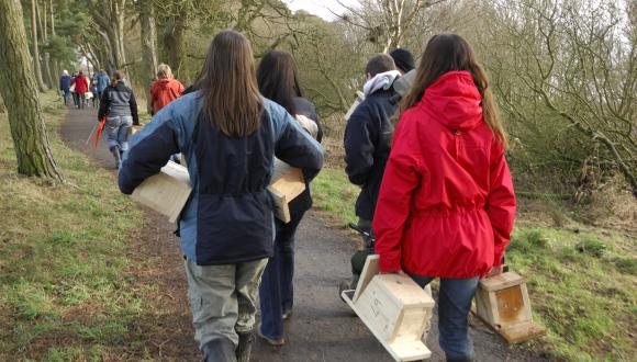
Citizen Science for biodiversity
Taking part in Citizen Science is a really useful and fun way of helping the environment and expanding our scientific knowledge.
What is citizen science?
The collection of information on the environment by volunteers of all ages and levels of experience makes an invaluable contribution to expanding our knowledge and understanding of the natural world. Taking part in systematic citizen science activities is a great way to contribute to that sum of knowledge, to help the environment, and to expand your own skills and understanding.
This webpage aims to provide reliable and relevant information about a wide range of citizen science activities for everyone from new volunteers to more experienced naturalists wishing to build and use their knowledge. There are also some links that may help if you are working with young people or planning to organise your own citizen science activities.
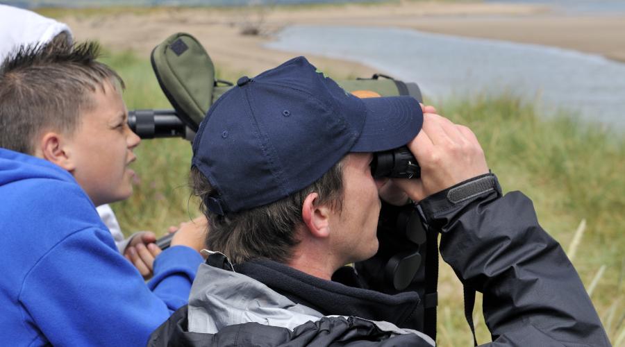
A growing number of mobile apps now enable inexperienced or novice participants to record noticeable or charismatic species, with observations later checked through photographs, video recordings, or sound recordings. This type of 'opportunistic' citizen science can be a great way to enjoy nature, and to learn and develop skills.
Britain is lucky to have a rich history in the study of nature and has a well-developed network of organisations involved in making systematic environmental observations. Most biological recording requires some expertise in species identification although that is not always the case. There are even great citizen science activities you can contribute to without going outdoors!
For some taxa, such as birds and butterflies there are sufficient dedicated volunteers to run systematic monitoring schemes including the UK Butterfly Monitoring Scheme, the Breeding Bird Survey and the National Plant Monitoring Scheme. To ensure the data collected are as useful as possible it is important that all participants adhere to a consistent approach such as stratified random sampling in which sites for recording are allocated by survey managers who coordinate and support participants. Many of the citizen science biodiversity surveys listed below are of this type.
Records gathered by citizen scientists contribute to important reports such as the State of Nature report, or help to identify special places that should be protected from development, such as Local Nature Conservation Sites, and many volunteers contribute records that are presented in atlases such as the Plant Atlas 2020. By getting involved in citizen science you really can make a difference!
Citizen science – guidance, learning and resources
Citizen science is a fantastic way to engage with real world learning, whatever your age and stage in education.
Citizen Science Best Practice Guides have been published by the UK Centre for Ecology and Hydrology. These are helpful guides if you are planning to organise and run citizen science projects.
Citizen science reports and guidance from the UK Environmental Observation Framework provide useful background and context on involving people and volunteers in environmental citizen science.
The Natural History Museum website is a good place to find out more about recording wildlife, including guidance on using two of the most popular apps: iNaturalist and iRecord.
The Natural History Museum’s Nature Recording Hub is a ‘one stop shop’ for learning about monitoring wildlife in urban greenspaces.
The Outdoor Learning Directory is supported by Scotland’s forestry, environment and heritage agencies and is a comprehensive source of information on everything to do with learning outdoors, including citizen science resources aimed at young people. Search the News page for ‘citizen science’.
TCV Scotland’s Citizen Science webpages share many practical activities and projects that learners can get involved in. This includes resources for young people, communities and people who are new to citizen science.
The Countryside Jobs Service has published a selection of projects and surveys in their guide, many of which are active in Scotland: CJS Citizen Science, Surveys and Fieldwork.
The Education Scotland webpage Citizen Science and Curriculum for Excellence sets out how citizen science can act as a motivating context to connect learners with exciting real-life situations while developing their skills in sciences and STEM subjects. Resources on this page include the downloadable publication Citizen Science and Curriculum for Excellence and a PowerPoint presentation on Citizen Science: Creating a passion for science and Learning for Sustainability.
Open Air Laboratories (OPAL) provides a suite of field and desk-based citizen science surveys suitable for all ages, abilities, and backgrounds. Resources include downloadable materials (water, soil, pollinators, invertebrates, trees), an easy-to-follow set of instructions, a workbook to record results and species identification guides/keys.
This Field Studies Council Scotland Citizen Science & STEM Learning briefing explains how citizen science activities create natural opportunities for interdisciplinary learning across and beyond STEM subjects. Stem by Nature was a term coined to embrace the rich potential of citizen science, outdoor settings and nature-based experiences to contribute and respond to STEM learning outcomes. This includes a professional learning programme for educators.
Don’t forget to check out Zooniverse, which gives people of all ages and backgrounds the chance to participate in real research from their desks with over 50 active online citizen science projects looking for help.
Recording apps, help with ID, and managing data
The Biological Records Centre Apps - The BRC has collaborated with several recording schemes and mobile app developers to launch a range of smartphone apps. These provide identification resources and aim to make it easy to submit wildlife records with sightings going to iRecord and allowing recorders to see all their observations in one place.
iRecord is not a survey but provides a way to submit your records online, you can include multiple photographs and details of specimens. The iRecord app turns your mobile phone into a tool for recording on the go. iRecord allows you to curate and visualise your own records with your data archived securely and made available to experts for review.
iNaturalist is a website where people can share observations of species. It includes an automated species ID tool, and it allows users to further assist each other in identifying species from photographs. You can also download the iNaturalist app to your mobile device.
iSpot from the Open University is aimed at helping anyone identify anything in nature! It is an app that supports a friendly and free community that can help you identify wildlife and share nature. It connects you with others and allows you to make incidental records of the presence of any species.
Merlin Bird ID helps you to identify the birds you see or hear with Sound ID and Photo ID, and it acts as a personal recording app.
If there is a Local Environmental Records Centre covering the area for your wildlife record, then send your records to them. Contact them first to make sure you get them into the right format. They will do all the hard work and may submit your records to a recording scheme.
Many organisations and individuals who collate species records send them to the National Biodiversity Network, which acts as a national repository. The NBN is a valuable resource where you can create maps from records across the UK. If you are confident in your identification, then you can submit sightings to the NBN Atlas Scotland to help build up a complete picture of Scotland’s wildlife.
Citizen Science indoors
Zooniverse is a citizen science website where you can help researchers analyse data from real projects around the world. With over 50 active online citizen science projects you might get involved with deciphering herbarium samples, watching nest box cameras or counting seabirds from photographs.
Seabird Watch is a citizen science project set up by Oxford University to fill research gaps in understanding breeding behaviour and population trends by using timelapse photography as part of a monitoring network that includes sites in the UK, Ireland, Iceland, Svalbard, Faroes, Greenland, and Mauritius. They need your help to count birds, nests and eggs in thousands of photos to create hard data for analysis.
Penguin Watch is a citizen science project set up by Oxford University to find solutions to research gaps by using cameras to study breeding behaviour and success at two Southern rockhopper penguin colonies at the Southern tip of Argentina. They need your help to count penguins, chicks, nests and eggs in thousands of photos to create hard data for analysis.
The British Antarctic Survey (BAS) and RSPB are recruiting albatross detectives to help to search for wandering albatrosses in satellite images taken from space. Using high-resolution satellite images, BAS researchers have found a way to pin-point the albatrosses. Anyone can take part in this project – you don’t need to be an expert.
Herbaria@home is an online citizen science project with hundreds of volunteers helping to digitise information from collections of wild plants held by museums and universities in the UK and beyond, including the Royal Botanic Garden Edinburgh.
Citizen Science biodiversity surveys
There are many different surveys to participate in depending on your interests and how much time you have. Some don't require any previous knowledge, while others are for specialists.
The Biological Records Centre maintains a list of wildlife recording and monitoring schemes, and the National Biodiversity Network provides an online searchable database that lets you search for a survey by name or by species to discover if a specialist recording scheme or survey is already in place.
Birds
The British Trust for Ornithology (BTO) Breeding Bird Survey (BBS) records birds during the breeding season using pre-defined randomly selected sites. The scheme website has information about the survey and resources and guidance that provide useful background to the survey and field methods.
The Wetland Bird Survey (WeBs) run by BTO records waterbirds from a large number of inland and coastal sites. Almost any wetland area can contribute to WeBS, and if you want to start recording at a local site that does not feature on the WeBS site map you can contact BTO to have it added. The website has a lot of information about two main counts that make up WeBS, and extensive resources and guidance to support contributors.
The Working for Waders & BTO Wader Calendar encourages repeat recording of waders from April to July. This is a relatively new project, and it is hoped that the data will help improve our understanding of national and regional trends. Anyone able to revisit the same patch of land can participate.
The Working for Waders Nest Camera Project helps volunteers safely set up cameras at wader nests to monitor their outcome. These data help highlight some of the problems waders face in different parts of the country and help track overall breeding productivity. The project has a small number of cameras that can be loaned to participants.
BTO Garden BirdWatch is a weekly wildlife survey where participants contribute sightings of species they have seen in their gardens. Through this BTO can help monitor the fortune of birds, mammals, reptiles, amphibians and invertebrates in gardens contributing to our understanding of urban wildlife.
If you are lucky enough to have birds nesting in your garden you can participate in BTO’s Nesting Neighbours.
BirdTrack is a free and convenient way of storing your bird records online. In addition to being a facility for observers to store and manage their own personal records, the submitted records also contribute to a major resource enabling the monitoring of many species, primarily birds but records of other taxa can also be submitted. As a result, your observations support species conservation at local, regional, national and international scales. The mobile app makes it easy to upload your records even while in the field.
There are lots of other opportunities to help with bird projects on the BTO website.
Swift Surveyors in Tayside. Sightings of flying swifts and knowledge of actual nest sites. This task can be undertaken from your own garden or front door - counting the number of swifts that fly over (and repeating the survey as often as you wish between May and August). Not sure of the difference between a swift, house marten or swallow? Download the survey form and ID chart.
Amphibians and Reptiles
The National Amphibian and Reptile Monitoring Programme run by Amphibian and Reptile Conservation Trust (ARC) is made up of several surveys that generate data to inform the conservation of amphibians and reptiles at a range of scales. The comprehensive guide to amphibian and reptile survey protocols will help you carry out effective surveys that produce good quality data.
The National Amphibian Survey is coordinated by ARC and is designed to determine trends in the occurrence and relative abundance of frogs, toads, and newts in the UK by monitoring sites on repeat visits. A survey protocol provides step by step guidance on how to undertake the survey, and the online training area has information on how to identify species.
Record Pool. The Record Pool collects data on reptiles and amphibians in the UK and makes them available, locally and nationally, for conservation purposes. The site welcomes garden records, as well as observations made whilst out exercising locally.
Dragon Finder. Launched in May 2013 as part of our London Dragon Finder Project, this free smart phone app can be used to identify and record native UK amphibian and reptile species. You can use the app to identify all native UK amphibian and reptile species, find out more about each species, including listening to their calls, and record your sightings. You can download the app here.
Garden Dragon Watch. Gardens can provide important habitats for reptiles and amphibians. This Amphibian and Reptile Conservation survey recommends spending a few minutes carefully looking in your garden and then recording what you find by filling in a form on your device.
Reptile Genebank. Amphibian and Reptile Conservation and Amphibian and Reptile Groups of the UK are asking people to send in reptile sloughs (shed skins) that they find in the UK. These will be used to build up a ‘Reptile Genebank’ - a resource that can be used for long term studies into the effects of population isolation. DNA can be extracted from the sloughs, revealing much about their population.
Have you seen a grass snake in Scotland? Until 2010, it was generally believed that wild grass snakes (Natrix helvetica) do not occur in Scotland. However, three confirmed records were made in Dumfries & Galloway between 2009 and 2010, and there are other unconfirmed but possible records from elsewhere in Scotland. Research has since shown that grass snakes are present in Scotland, but we do not know if they are recent arrivals or what is their current range. Use the online form to help us to learn more about the distribution of Scotland’s largest terrestrial reptile.
The Toads on Roads project run by Froglife has been running for over twenty years to register ‘migratory crossings’ where common toads cross roads to migrate to ancestral breeding ponds each year. The project can help to coordinate local Toad Patrols and you can apply for road warning signs to be installed.
Invertebrates
The UK Butterfly Monitoring Scheme (UKBMS) records annual data on the population status of all 59 species of butterfly that regularly occur in the UK.. It is easy to get involved in the surveys, which involve repeat recording of butterflies along transects in recorder selected sites or in stratified random 1 km squares. The UKBMS also includes some more rapid approaches targeted at specific species and sites (e.g. egg and larval web counts). Guidance, training and other resources are available.
The UK Pollinator Monitoring Scheme (PoMS) Flower-Insect Timed (FIT) count aims to establish how insect pollinator populations are changing across Great Britain. Carry out a FIT Count by taking ten minutes to sit and collect data on the number of insects at broad group (rather than species) level that visit a particular flower, ideally chosen from the list of 14 target flowers in your garden during warm, dry weather between April - September. FIT counts can be submitted via an app. Extensive resources and guidance on surveys are available on the PoMS website, including information on recording of other insects.
Butterfly Conservation runs a number of surveys involving different levels of commitment, for example the Garden Butterfly Survey asks you to record butterflies that visit your garden over the course of a year, while the Big Butterfly Count takes place annually and involves recording all butterfly and moth species seen from a single position over 15 minutes. Alternatively you can simply download iRecord Butterflies to record any butterflies you see anywhere at any time.
The UK Ladybird Survey aims to encourage the recording of all species of ladybird found within the UK – including the invasive harlequin ladybird. On their great website, you will find lots of information to help you find and identify species, and online forms so that you can record your observations.
BeeWalk is the Bumblebee Conservation Trust’s standardised bumblebee-monitoring scheme active across the UK, recording the abundance of each bumblebee species seen between March and October.
There are over 4,000 species of beetle found in Britain, Ireland and surrounding islands. The UK Beetle Recording website allows you to find out more about these fascinating insects and provides a gateway to submit and manage your beetle records.
Plants
The National Plant Monitoring Scheme (NPMS) is a structured UK survey of plants across different habitats using pre-defined randomly selected sites to obtain an understanding of their abundance and diversity, and so help us to understand the health of different habitats and monitor changes in the countryside. It is aimed at anyone interested in nature who can identify plants, or who is keen to learn. You need to identify 25-30 specially selected distinctive 'indicator species' per habitat. The NPMS website includes resource materials to get you started, including survey guidance, data collection forms, species ID guides, a plant survey ‘handbook’ and access to training resources on survey methodology and habitat and species identification. Training videos can be viewed on the NPMS YouTube channel.
The Botanical Society of Britain & Ireland (BSBI) welcomes records of plants growing in the wild in Britain and Ireland and provides useful guidance on how to submit a record. BSBI will conduct a New Year Plant Hunt 2025 from 29 Dec 2024 – 1st Jan 2025.
The Urban Flora of Scotland is a long-term survey run by the Botanical Society of Scotland to fill data gaps and help understand the history of settlements, monitor impacts of climate change, and possibly identify the arrival of new invasive species. Beginners and experts in plant identification are invited to record flowering plants, ferns, mosses, liverworts, lichens, fungi and algae in towns and cities with over 1,000 inhabitants using iRecord or record sheets to capture data.
Mammals
The Bat Conservation Trust (BCT) National Bat Monitoring Programme (NBMP) includes several surveys that monitor all but the scarcest of UK bat species. The surveys are carried out either by a surveyor using a bat detector or by placing a monitoring device in a suitable location to record bat calls. The BCT runs training for volunteers and there are lots of online resources and training materials for traditional and passive acoustic monitoring to help you get started with bat monitoring. Some of the surveys need no prior expertise on bats.
The British Bat Survey (BBatS) is a new citizen science survey run by the Bat Conservation Trust making use of cutting-edge acoustic technology to increase our understanding of bats across Great Britain. It runs during a five-week period end of June - end of July.
Mammal Web enlists members of the public to upload camera trap data they capture or to help with identifying animals in camera trap footage, or both. You don’t need a camera trap to take part and help to build up a picture of the state of our wild mammals. See the Quick-start guide.
People’s Trust for Endangered Species (PTES) is calling for volunteers to take part in its Living with Mammals survey,. Volunteers across the country are needed to record sightings of wild mammals (or the signs they leave behind, such as footprints or droppings) including in urban areas such as gardens, allotments, local parks, or churchyards. Counting our wild neighbours, and knowing how their numbers are changing, tells us about the health of these green spaces.
Mammal Mapper is a free app for recording signs and sightings of mammals in the UK. These may have been recorded along a route whilst you’re walking, running, cycling or even a passenger in a car, or as one-off sightings, for example a hedgehog in your garden.
The Volunteer Mountain Hare Survey invites you to use your smartphone and the free Mammal Mapper app to record sightings of mountain hares in the Scottish uplands and so contribute to improving our understanding of their abundance and distribution and help inform management and conservation strategies for this charismatic species. An alternative paper-based recording option is available.
The Saving Scotland’s Red Squirrels Scheme allows you easily to report sightings of Red and Grey Squirrels across Scotland.
Marine recording
Supporting citizen science is a key part of the conservation work of the Marine Conservation Society who invite the submission of sightings, especially of marine turtles and jellyfish, as vital to understanding marine life and contributing to scientific research.
Social media are changing the way we learn about cetaceans in remote locations and making it much easier to submit your sightings. Sightings of whales and dolphins around our shores are very useful as we currently rely on infrequent surveys that can only provide a snapshot. So, if you are lucky enough to live by the sea you can keep a watch out and then report your sightings online to the Hebridean Whale and Dolphin Trust’s Whaletrack sightings map or to the SeaWatch Foundation.
The Shark Trust collaborates with other organisations to promote eggcase hunting as a way to engage with shark conservation. Its great egg case hunt invites the public to submit records of empty shark and skate eggcases to help record which species are present. Some sharks, and all true skates, reproduce by laying eggs surrounded by a tough leathery capsule that protects the embryo until it hatches. By recording these empty eggcases (or mermaid’s purses) washed up on the beach we can all help to discover more about the egglaying species in our waters. Together citizen scientists have recorded over 375,000+ individual eggcases.
Coastal communities wishing to learn more about their local marine environment, and possibly start to monitor it for any changes, can use the resources developed by the NatureScot Community-led Marine Biodiversity Monitoring Project to plan and conduct surveys of marine life in their local waters. The project can help communities with training, equipment and knowledge exchange, and will support good data management to help build the evidence-base that underpins good decision-making.
Invasive Non-Native Species
INNS Mapper lets you record ad hoc records, structured surveys and even management actions, such as pulling up seedlings. It uses crowdsourcing to verify records.
Scotland’s Environment Web offers a simple way to submit records of widespread INNS that can then be used to help coordinate national action.
BSBI’s Plant Alert is aimed at discovering which garden plants have the potential to become invasive and problematic in future.
The Asian Hornet Watch app enables you to record this a non-native species within the UK. It could have a serious impact on native insects, including honeybees, so early detection is important. Several common and widespread native insects look similar to the Asian Hornet, so the app provides an identification guide and is designed to identify, record and help with early detection.
Freshwater Surveys
Bloomin’ Algae is a citizen science app for reporting the presence of harmful algal blooms of blue-green algae. The app helps speed up public health warnings and can help to recognise the risks to you, children and animals.
The Riverfly Monitoring Initiative (RMI - also known as the Anglers’ Riverfly Monitoring Initiative, ARMI) has been pioneered by the Riverfly Partnership to provide a simple, standardised monitoring technique which groups can use to detect any severe perturbations in river water quality. The website also provides information on The Urban Riverfly scheme, which adds six invertebrate groups to the original eight used in the basic RMI scheme to provide a more detailed picture of the changes in river environments, particularly in rivers with low numbers of riverflies.
Other biodiversity surveys
Nature’s Calendar. What effect has recent weather had on wildlife? Does climate change affect timings in nature? Take part in the Nature’s Calendar citizen science project run by The Woodland Trust and help scientists discover answers to these questions. Simply record the signs of spring that you can see from your window or garden.
Garden Wildlife Health. This project hosted by the Zoological Society of London aims to monitor the health of – and identify disease threats to – British wildlife, with a particular focus on garden birds, amphibians, reptiles and hedgehogs. Wildlife diseases can cause population declines and even local species extinctions. By monitoring trends in wildlife diseases, we can assess their impact, look at underlying causes, and identify new and emerging threats. Our results inform conservation actions and garden wildlife management advice.
Britain is home to rare ancient grasslands where distinctive fungi, including waxcaps still thrive. Recording these and other grassland fungi helps us to pinpoint where rare fragments of ancient meadows survive, so enabling them to be protected. Plantlife’s waxcApp recording scheme enables everyone to record a number of different grassland fungi based on their colour. Plantlife have also published an attractive guide to identifying and managing waxcaps and grassland fungi, and have developed this thorough online waxcap course.
The NatureScot grassland project is helping to locate and protect Scotland’s remaining fragments of meadow. Read more about grasslands in the interactive story map and click the button at the end to submit records of sites that you know about.
Open Air Laboratories (OPAL) - a suite of field and desk-based citizen science surveys suitable for all ages, abilities and backgrounds including downloadable materials (water, soil, pollinators, invertebrates, trees), an easy-to-follow set of instructions, a workbook to record results and species identification guides/keys.
Treezilla is a UK-wide citizen science mapping project supported by The Open University and Forest Research that enables everyone to map individual urban trees and submit data that can then help to calculate all the ecosystem services trees provide us with, such as increased wellbeing from enjoying nature and absorption of carbon dioxide. Communities, schools or universities can plot trees in their grounds, campus and local area and help to calculate their eco-benefits.
Last updated: