Potential Masters Projects
The following lists potential Masters projects relating to NatureScot's work.
If you are a university supervisor, or a student enrolled on a course and looking for a project, then do please get in touch. The listed projects cover important work for us.
Please complete the expression of interest form and return it to [email protected].
Find out more about our Research.
Potential Masters Student Projects Related to Peatland ACTION Communications
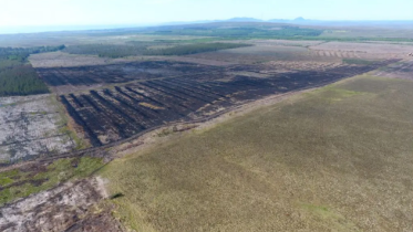
Project Proposal 1 - Photography/Videography
Development of a suite of photography and/or videography assets along a set theme. This could be along an environmental theme such as nature-based solutions or climate action or a social theme such as connection between landscapes and culture incorporating connections to peatlands and need to protect and restore them. An alternative angle could be photography of people and peatlands around contractors, landowners and communities. Individuals could be offered access to peatland sites or supported to develop a project such as a series of images or a documentary on an aspect of Peatland ACTION: the benefits of restoration, challenges of scaling up work tackling the climate emergency or perhaps a human story – following a contractor or trainee.
Projects would be to capture and present a narrative focused along a specific theme. This would be suitable for photography, film, journalism or digital media student requiring to complete a portfolio element. If required, this could also be built into a bigger exhibition project.
Examples course tie-ins:
- Filmmaking MA at University of the West of Scotland require students to develop short films including a documentary to add to their portfolio.
- Photography MA at Middlesex University, London ask students for a series of photographic projects or a single large project.
- Journalism MA at Edinburgh Napier University – part of the course is to produce a Major Project, an in-depth piece of journalism either video or audio, text or online.
As well as masters, there are many more photography and videography courses at undergraduate, HND and other levels.
Benefit for NatureScot/Peatland ACTION:
With agreement of use, additional imagery and videography for use in Peatland ACTION promotional work.
List the relevant delivery plan objectives this project will help meet:
Peatland ACTION Programme Plan:
3. Run a Communications campaign to raise awareness of peatland restoration across the supply chain. [Provide assets for?]
Project Proposal 2 – Creative or Performance Art Masters
Performance art, script writing and theatre courses often require a performance project to complete the coursework requirements. Peatland ACTION has previously worked with performance artists to create engaging storytelling projects and so Peatland ACTION could suggest topics for such students to develop into a play, exhibition or performance feature. These could incorporate the urgency of restoration needed and the impacts of degraded peatlands.
While not student-based, a previous example was a Drama on the Bog event which took place in Shetland. Performance artists focused on the loss of peatland habitat through storytelling and highlighted the impact of degraded and damaged peat through a story of trows (local trolls) losing their home.
Benefit for NatureScot/Peatland ACTION:
Promotions of NatureScot and Peatland ACTION in a unique way. Depending on location, this could also incorporate Gaelic language elements alongside projects that connect to landscape and sense of place.
List the relevant delivery plan objectives this project will help meet:
Would fulfil our general public audience requirements, provide opportunities for wider press on Peatland ACTION messaging and engagement with new audience.
Project Proposal 3 - Peatland benefits awareness within a specific audience
Social science project focused on levels of environmental awareness, understanding of peatland restoration or Peatland ACTION specifically. Could target landowners, crofters, contractors, foresters, MSPs, general public all depending on the student course.
This could also highlight misconceptions which prevent people from supporting the concept of peatland restoration, and barriers – social, educational, economic which stand in the way of greater understanding and support. We could propose that student projects don’t just focus on people’s level of awareness and understanding of peatland restoration but that they also investigate the reasons behind this and what factors contribute.
This could be investigated either through questionnaire or interview-style survey work or could focus on a specific project site or sites. It could also potentially reveal if peatland restoration knowledge increased after a campaign or an event.
Individuals could also pose research questions on whether knowledge of peatland restoration/ understanding of restoration as a nature-based solution differ based on location, sector, exposure to our materials and so on.
Benefit for NatureScot/Peatland ACTION:
Insight into a target audience, could highlight specific areas we are missing, help identify where we need to place more effort or what types of communications have most effect. It could also highlight areas outwith our direct control, but which could be tackled in other ways.
List the relevant delivery plan objectives this project will help meet:
Peatland ACTION Programme Plan:
- Undertake targeted engagement with landowners, prioritising the c300 largest registered IACS businesses that have ~700,000 hectares of degraded peat on their land.
4. Undertake research better to understand landowner attitudes and motivations to peatland restoration and natural capital markets.
5. Engage with and support crofting communities interested in restoring degraded peatland on common grazings.
Project Proposal 4 - Stakeholder mapping
A project that could break down our stakeholders and do a mapping exercise would be useful. Potentially a marketing student or analyst course work piece on researching target markets or business sector analysis.
This could highlight where peatland restoration could work alongside other conservation-funded work – e.g. Nature Restoration Fund, NLHF or other wider environmental organisations as well as those completely separate to conservation. Mapping stakeholders could help identify potential landscape scale working that would be mutually beneficial to a range of stakeholders.
Benefit for NatureScot/Peatland ACTION:
Insight into a target audience, could highlight specific supply chain or sectors we are missing in our outreach, help identify where we need to place more effort, increase peer-to-peer promotion, and projects where we can highlight the multiple benefits of restoration.
List the relevant delivery plan objectives this project will help meet:
Peatland ACTION Programme Plan:
4. Undertake research better to understand landowner attitudes and motivations to peatland restoration and natural capital markets.
Engage with and support crofting communities interested in restoring degraded peatland on common grazings.
Find out more
Central Scotland Green Network
Understanding people’s awareness of the Central Scotland Green Network (CSGN)
The Central Scotland Green Network (CSGN) was set up to support, link up and build on existing partnerships and programmes across central Scotland with the objective of developing natural climate solutions, making liveable places, promoting health and well-being and supporting a green recovery.
A lot of good work has been done across the CSGN but there is very little information on actual awareness of the CSGN amongst people living in Central Scotland. This project will help us understand current awareness and identify how this can be improved. We would also like to know what has worked and what hasn’t worked and what people would like to get involved in (e.g. citizen science projects, skills training in habitat creation, invasive non-native species control etc).
This information will help inform a range of initiatives and communications to help raise awareness of the CSGN for those living in Central Scotland.
Wetland
Fossorial Water Voles in North East Glasgow
The water vole is one of the fastest declining wild mammals in the UK and has disappeared from many parts of the country where it was once common.
Populations of water voles in North East Glasgow and North Lanarkshire have been found living away from water. This unusual “fossorial” behaviour means the Glasgow populations are of national importance and offer many opportunities for research into their behaviour, habitat needs, genetics and conservation requirements.
In 2022, a Conservation Action Plan was completed which identifies some priorities for survey and research. Your project could address one of these issues, although we are willing to discuss research ideas with project applicants.
We can offer a range of projects, covering multiple disciplines, ranging from social sciences through to ecology/ zoology and landscape ecology.
Some possible areas for study include:
- Habitat management techniques
- Understanding trapping and translocation requirements
- Mapping dispersal routes and corridors, understanding habitat networks
- Predator/ prey relationship studies (Esp. American Mink)
- The impacts of development pressure on water vole conservation, possible themes include green infrastructure, development planning, spatial strategies etc
- The importance of working with the public to secure conservation outcomes
- Exploring whether newly identified populations can be considered fossorial
Tourism
Has the Natural & Cultural Heritage Fund created sustainable tourism?
We have a requirement to report to the European Regional Development Fund on our outcome of creating sustainable tourism - we want to investigate that the money we have invested is actually achieving substantial and sustainable results for jobs in the projects, but also the wider area. Some projects are physical (eg museum renovations), others are digital (eg virtual reality tours), and each have its own way of reporting on the measures agreed. We would further like to explore whether the projects have led to an increase in sustainable tourism for the areas surrounding them.
The most important measure we have asked or projects to evidence is:
Employment generation - the number of jobs created in delivering your project and then sustained by it in the long term. This is to be measured by the number of full time equivalent jobs resulting from your project whether through direct employment or in sustaining jobs elsewhere in the community.
The student would work with Scottish Government-produced statistics and investigate the multiplier effect on contributions to the local economy, as well as impacts on the areas surrounding the projects.
National Nature Reserves
Understanding the impacts of visitor pressure and behaviours on our nature reserves
We manage our Nature Reserves for nature and for people and we welcome the fact that more and more people are visiting these special places. In order to ensure these sites remain special we need to be able to understand the impacts of visitor numbers and behaviour on the wildlife and habitats of these special sites. This project would examine these interactions to help inform reserve management actions to keep these sites special and maximise people’s enjoyment of them.
Gaining insights into how visitors use, enjoy and think about our nature reserves
Since the Covid pandemic we have seen significant increases in numbers of people visiting our reserves and possibly new demographics enjoying these sites. We want to make sure that we can maximise the opportunities that our reserves can offer to people in connecting with and understanding the benefits and importance of nature. This project would examine how visitors use and see our nature reserves so that we can maximise the benefits they provide.
Recycled material for National Nature Reserves
A spatial mapping exercise in linking recycled construction material sources with National Nature Reserve (NNR) locations. NNRs require material for projects (e.g. track construction, fencing, general infrastructure development, laying surfaces and maintenance requirements). Having a local, recycled option for material use will further NatureScot’s contribution to the circular economy and reduce our carbon budget.
Climate Change
Carbon opportunities cost from deer grazing
MSc student to build on short ClimateXChange review, expanding literature review, on C implications from impacts of deer on woodlands, and seek to estimate the role of deer population reduction in achieving the net zero target, possibly developing some simple scenarios.
Rivers
Using remote sensing technology to assess the physical response to river restoration
It is widely acknowledged that the true physical and ecological responses to river restoration are poorly monitored, appraised, and understood. The paucity of information about the actual effects of restoration leads some to question its value, is thought to discourage some from offering additional financial support, and hampers the refinement of both restoration and monitoring and appraisal techniques.
The increasing availability and quality and reduction in cost of remotely sensed data suggests that the assessment of a river’s physical response, including changes in the quality, quantity, and distribution of habitat, may now be relatively easy. Remotely sensed information can also be used to create compelling imagery suitable for illustrating restoration induced changes to a broad audience.
This project will explore the types of data suitable for demonstrating the physical changes resulting from restoration. It will use available data to assess spatial and temporal changes in the form of and habitats supported by a selection of restored Scottish rivers; comparisons with control sites will be undertaken. It will consider how best to measure change, success, and present results. NatureScot has completed a range of river restoration projects that could be examined as part of this project.
Sediment build up in the weir pools of Run-of-River hydro schemes
Small scale Run-of-river hydro schemes have proliferated across, particularly, the west coast of Scotland over the last 10 years. We would be interested to know the implications of a large build-up of sediment behind the weir pool. Comparisons of control waterbodies could be made for sediment distribution in-stream, and potential salmonid migration, temperature, water chemistry impacts considered.
Carbon assessment in planning
Carbon assessment in planning - how much peat disturbance is too much?
Under SPP 2010 the onus is on demonstrating minimisation of impact by avoidance in layout design and in construction methods, plus compensatory enhancement of degraded habitats / creation of new peatland habitats. Can an equitable means of dividing up the sectoral carbon budgets (as allocated by the Committee on Climate Change) be devised for application to development management? Presumably local authority contributions to emissions under Land Use, Land Use Change and Forestry (LULUCF) are for actual development – is it worth also considering projected emissions that already have consent but are not yet built?
Soil carbon, Peatland condition, Carbon emission savings and peatland restoration
Can we expand the required carbon assessment and/or peat management information to account for peatland condition, and use this with the emission factors used in the Peatland Carbon Code to estimate the carbon emissions savings associated with proposed restoration? Could this also be used in some way to look at the change in emissions after construction in the areas which have been reinstated and those which are now under the infrastructure footprint?
Peatland Carbon Code emission factors:
Pre-Restoration
Category (Baseline) Baseline Emission Factor (tCO2e/ha/yr)
Actively Eroding 23.84
Drained 4.54
Modified 2.54
Near Natural 1.08
For selected area, the condition categories on page 3 of the Peatland Code Field Protocol could also be used with aerial data (satellite, drone etc remote sensing) and image analysis to estimate the carbon emissions savings from restoring all the actively eroding haggs/gullies, or flat bare erosion features, or drainage (from artificial drains or from erosion features).
Expansion of the carbon assessment into all development management
What would accelerate the process? How accurate needed? What needs to be included? What most useful metric for decision making and determining how much compensation is required?
In Wales, NRW use the ratio of carbon lost from land to restoration gains. The NRW ratio includes the following terms from the carbon calculator:
• In losses from soil ecosystem (aka soil + vegetation): reduced carbon fixing potential (always trivial), DOC & POC leaching, soil organic matter, felling forestry
• In gains – improvement of degraded bogs, improvement of felled forestry (what does this mean?), peatland restoration/reinstatement in borrow pits
However, we frequently receive carbon calculator submissions where the applicant hasn’t included the carbon rich habitat restoration or habitat management information. This gives a worst case scenario but doesn’t give us anything useful in terms of the ratio. Any future tool should be a lot simpler than the carbon calculator and should keep the details of mechanisms of gains flexible to allow for innovation.
Use standard values for carbon emissions by peatland condition to estimate soil organic matter loss from soil ecosystems – could also allow for future expansion to other carbon rich soil.
How to accelerate the rate of peatland restoration through compensatory mechanism in Development Management (i.e. Planning)?
Currently consider the area of peatland habitat disturbed and volume of peat to be excavated:
• permanent or temporary (e.g. temporary could be access track for construction period only; floated (no excavation, on geotextile) construction compound during construction phase)
• direct loss (excavated/under infrastructure footprint) or indirect loss (due to changes in hydrology)
• volume of peat soil (> 50 cm of peat) to be excavated and reused (total, acrotelmic, catotelmic)
Could a greater amount of restoration be required if using carbon gains from restoration activities? Would that require a greater effort to be delivered by the developer if based on the carbon (given that that is determined by the excavated peat volume, so a function of the peat depth as well as the surface area affected). How much additional effort will be require to consider volume of peat displace from other carbon rich soil (peat <50cm)?
Connecting people with nature through enjoyment and recreation, learning and volunteering
Measuring the impact of Outdoor learning on nature connectedness in young people
Using the nature connectedness indicator to assess if outdoor learning increases connection to nature in young people.
Evaluating the impact of Digital Outdoor learning apps on nature connectedness in young people
Explore the impact of the digital outdoors apps in engaging young people with nature and increasing nature connectedness? The study could focus on the new Zepto nature app NatureScot has been involved in developing.
Outdoor learning and its impacts on families of children involved
What is the health and well-being impact on the families of the children who are have regular outdoor learning and how is this changing since COVID19?
Health & wellbeing benefits to teachers engaging in Outdoor learning
What is the health and well-being impact on teachers who regularly take outdoor learning and how is this changing since COVID19.
How can we best improve the Scottish nature and landscape based content in Scottish secondary curriculum?
What Scottish nature and landscape content is currently included in the CfE and how can this be improved to enhance learning and increase climate-nature literacy? The project could contribute to the SQA revised content/ STEM with recommendations and exemplars of practice.
Defining and measuring changes in climate-nature literacy
What do we mean by climate-nature literacy in Scotland and how could we influence and measure changes to it among the adult population?
Investigating the reasons behind people’s satisfaction levels with their local greenspace
Through surveys or other means, find out why people rate their local greenspace as they do? This could compare types of areas and / or greenspace. It would help build a picture of the main aspects that people value.
Identifying barriers to citizen scientists’ engagement with monitoring of local landscape change
This would help us find out more about problems, and therefore how to help overcome or avoid them. The type of monitoring could be open to selection, or a range of types could be covered, as barriers may vary with the type or format of monitoring (measurement, surveys, fixed-point photography etc.).
Attitudes to climate change adaptation measures in greenspace or parks
For a type, or range of types, of area (park or other greenspace, or peri-urban areas), find out more about the community’s attitudes to interventions such as SuDS, tree planting, Has it changed, and if so, how? Has also it changed their opinions on climate change?
Attitudes to “rewilding” of parks and greenspaces
For a type, or range of types, of area (park or other greenspace, or peri-urban areas), find out more about the community’s attitudes to changes to management which enhance biodiversity such as grass cutting, leaving dead wood, letting areas naturalise etc. What are people’s attitudes and why? Are they changing, and if so, in what ways and why? Has it changed their opinions on nature and its benefits?
Monitoring local perceptions of the impacts of visitors on communities and wildlife
How do we best gather evidence of the local perceptions of the impacts of visitors on communities and wildlife, what are the key influences on these perceptions and how could this inform future visitor management?
Evaluating the impact of local signage on visitor behaviours
What evidence exists on the impact of signage on changing visitor behaviours and how does this contrast with the on-the –ground experience from the use of a range of signs in Scotland’s nature reserves and national parks?
The role of landscape character assessment (LCA) in planning for habitat connectivity and adaptation to climate change
Look into potential links between the 2019 landscape character types dataset and Habitat Opportunity mapping (in CSGN area). How can LCTs helpfully influence measures to improve habitat connectivity? What does it tell us about future adaptation to climate change?
Using qualitative data to evaluate the impact of Green health partnerships on health policy and practice
How can we best use the qualitative data being collated by the four green health patrnerships to better assess their impact on health and practice in Dundee, Highland, Lanarkshire and North Ayrshire?
Quantifying the health & wellbeing benefits to NHS staff from using the NHS estate
Following the improvements to greenspace on the NHS estate, are staff using them more and why? What are the personal and organisational benefits which are resulting and how best can we quantify them?
Planning/Renewables
Effective alignment of plans and strategies in the planning system
A project looking at lessons that could be learned from the ways other countries align their plans and strategies.
A study to look at the environmental impacts and potential mitigation relating to pipe bursts on hydro schemes.
Pipe bursts during the testing or operation stage of a hydro development can be a catastrophic event. They are dangerous, and can cause the movement of tonnes of rock, soil and overburden material to be dislodge with potential massive diffuse pollution effects. Are there engineering improvements to aid early detection?
A project to assess the effectiveness of, and alternatives to, mitigation used during construction. For example, are their better techniques for building tracks / drainage systems on steep ground?
Current good practice guidance is laid out in a number of documents, both of SNH origin and from others. Construction in the uplands however, remains a challenging undertaking. What improvements can be proposed on design and mitigation to minimise impacts on landscape, drainage and ecology – for example, what is the most effective means of reinstating steeply cut batters??
Cable removal
Research into effective reinstatement of habitats following the removal of long sections of energy sector redundant cabling
Can chemical contamination hotspots be predicted without ground investigation?
Project title: The opportunities and challenges for nature in green hydrogen production
Delivery Plan Objectives
This project would support our objective to engage and influence planning and other regulatory systems to ensure they deliver nature and climate by helping identify opportunities and challenges for nature during green hydrogen developments.
Background
In order to help achieve net zero, the Scottish Government have set a target of 5 GW of renewable and low-carbon hydrogen production by 2030 and 25 GW by 2045. Increasingly green hydrogen proposals are being proposed as part of this yet we have still to fully understand the opportunities and challenges for nature that they pose.
Description of proposed research (max 250 words)
The aim of the project is understand what opportunities and challenges green hydrogen projects pose.
This could involve both desk-based and field research in order to pull together a minimum of five case studies identifying the opportunities and challenges. The location of these case studies should be within Scotland.
NatureScot can provide details of any advice it has given on the chosen projects. It would also be useful to review Environmental Impact Assessments and other responses from other bodies to understand other impacts or opportunities for nature.
By having a selection of case studies, NatureScot can then feed the results into forthcoming guidance on hydrogen and use lessons learned in other areas of work.
Project timescale limitations
The project can take place at any time of year.
Project title: Review of the use of peat in windfarm track verge and hard standing reinstatement
Delivery Plan Objectives
This project would support our objective to engage and influence planning and other regulatory systems to ensure they deliver nature and climate by helping to protect peatland habitats during wind farm development.
Background
Onshore wind farm sites are often located in upland environments where peatlands are present. Sites should be designed to avoid disturbing peatlands wherever possible but this still means that some peat is excavated. National Planning Framework 4 Policy 5 requires that sites need to be restored and enhanced into a functioning peatland system capable of achieving carbon sequestration. This is significant challenge when reinstating the verges of wind farm tracks and hard standing areas with a variety of methods during handling and storage currently employed to varying successes.
Description of proposed research (max 250 words)
The aim of the project is understand what methods are currently employed, the rational for the chosen methods, how the different methods have impacted the adjacent peatland habitat and details of any mitigation.
This will require both desk-based and field research in order to pull together a minimum of five case studies. The location of these case studies should be within Scotland.
NatureScot can provide details of any advice it has given on the chosen projects. It would also be useful to review the Environmental Impact Assessments and contractor plans and specifications to understand the rational for the chosen method and any subsequent environmental impacts and mitigation.
By having a selection of case studies, NatureScot can then feed the results into forthcoming guidance on the protection of peatlands and use lessons learned in other areas of work.
Project timescale limitations
The project can take place at any time of year.
Project title: Comparison of the environmental impact of gravity based and piled wind turbine bases
Delivery Plan Objectives
This project would support our objective to engage and influence planning and other regulatory systems to ensure they deliver nature and climate by helping to understand a possible opportunity to further protect habitats during wind farm development.
Background
The Scottish Government have ambitious targets to increase onshore wind production. Many of these sites are located in upland areas on sensitive sites. Gravity bases for turbines requires significant excavations whereas the use of piled turbine bases can reduce the size of excavation.
Description of proposed research (max 250 words)
The aim of the project is to understand what the differences in environmental impact are between gravity bases and piled bases during the life of a windfarm from construction, repowering and decommissioning.
This would mainly involve desk-based research in order to pull together a minimum of three case studies identifying why the type of base was chosen, what environmental impacts occurred and what mitigation was used to address these impacts. There may be opportunities for field research where it would be useful to understand any on-site implementation aspects. The location of these case studies should be within the UK preferably in an upland environment however other sites may be considered.
NatureScot can provide details of any advice it has given on the chosen projects. It would also be useful to review the Environmental Impact Assessments and contractor plans and specifications to understand the rational for the chosen design and any subsequent environmental impacts and mitigation.
By having a selection of case studies, NatureScot can then feed the results into forthcoming guidance and use lessons learned in other areas of work.
Project timescale limitations
The project can take place at any time of year.
Project title: Delivering NPF4’s policy ambitions for nature – how well is Development Management delivering in practice?
Delivery Plan Objectives
This project would support our objective to engage and influence planning and other regulatory systems to ensure they deliver nature and climate. It has particular relevance to our work supporting NPF4’s delivery of positive effects for biodiversity.
Background
NPF4 Biodiversity Policy 3 has introduced new requirements for development to enhance biodiversity, strengthening previous policy that only encouraged such actions. Depending on the category of development, policy now requires development to contribute to restoring degraded habitats, strengthening nature networks, providing significant enhancements, leaving nature in a demonstrably better state than before, or including appropriate measures.
The extent to which development will successfully deliver NPF4’s policy intent will largely depend on what, and how well, these biodiversity measures are implemented and managed in the longer term. Earlier work and discussion with stakeholder suggests that standards are often poor.
Description of proposed research (max 250 words)
- The aim of the research is to examine current development management practice and experience in planning for and implementing actions to enhance biodiversity, assess the standard of their implementation, and identify key lessons and recommendations for improving practice.
- Research will involve desk based review of relevant development management documentation, interview / questionnaire of key stakeholders (planning officers, developers, factors), site survey of implementation on site.
- Proposed that a number of planning authorities are selected from anywhere in Scotland.
- NatureScot can provide the findings of an earlier study examining the implementation and management of biodiversity measures to be implemented by development.
Project timescale limitations
The project can take place at any time of year.
Urban natured based solutions and green infrastructure
Design of street vegetation in Scottish urban centres to support Low Emission Zones
Street vegetation is known to help with urban cooling, management of rainwater and mental wellbeing. It can also have a positive or negative impact on NOx and particulate pollution. The impact is affected by factors like species, spacing, size and configuration or the vegetation. The current streetscape and wind regime is a critical factor. Best practice recommended by research is to gather evidence on baseline conditions and design Nature-based Solutions accordingly.
The project could use field work, currently available data or computer modelling, to map air circulation in a single streetscape, or city centre, and use the results to suggest possible design criteria.
Did developing access to Claypits LNR change nature visits by Glasgow’s Chinese community?
Lifespan of tree pit trees in cities
Urban street trees are being recognised as ever more important to combat effects of climate emergency (eg urban heat island effect, air pollution, water run-off management). What is their lifespan under best practice conditions?
Have the trees and changes in Sauchiehall Street reduced particulate pollution?
Tie in with longer-term urban street tree programmes in the wider Avenues projects.
Biodiversity of street trees
How far does biodiversity penetrate our cities? How long does it take? Can it be seeded?
Do fossorial voles change their behaviour when translocated to a new wetland park?
Focus on Greater Easterhouse GI project where fossorial water voles were found and then translocated as part of the project. Links with Glasgow Water Vole Project.
The impact of GI interventions on house prices and council tax returns as a proxy for more people in work
Explore the impacts of GI interventions in the longer term. Projects are focussed in areas of multiple deprivation with longer term strategic objective of addressing multiple deprivation indicators including education/upskilling and employment.
Do GI projects increase Outdoor Learning in Nature in local schools?
Most GI projects include outdoor learning spaces as part of the intervention. Explore how these are being used and what the impacts are on increasing outdoor learning provision and uptake.
How GI interventions can increase green prescribing by GPs?
Gene flow via green/blue infrastructure: how can these be made effective?
What is gene flow in urban GI projects? What influences or prevents it? What are the risks or benefits?
Business impacts of flood management of GIF projects
As well as quantitative evidence of this it would be really good to have some qualitative evidence from business owners/residents about the difference it’s made to them. No. of businesses/households benefiting from flood management etc of GI projects
Health & wellbeing impacts of GIF greenspace improvements
Open space audits and changes in the sites, amount of path put in and correlations with wellbeing data etc.
The outdoor classroom and non-traditional learning
There was a lot of talk about skills development outside the traditional classroom setting, learning the cues in conversations, experiencing challenges, seeing numerical questions in a new context, learning about elements, science and nature in a ‘live’ setting. How quality greenspace enhances educational opportunity and offers a ‘less formal’ setting for education which for some pupils is a key non-classroom experience.
Measuring the local success of GI projects
What makes a site successful and part of the community and is there a template for future sites in this to enhance the chances of others being successful.
Successful community engagement and impacts in GIF projects
The role of engagement and involvement of the local community from the outset in GI projects: is involvement actually more powerful than it seems on the surface – i.e. do parents take on a greater involvement on the back of their children visiting the site regularly, does this spread to the wider family group and community.
Is MOHAWk applicable to cities other than Manchester?
‘Development of an observation tool for measuring physical activity and wellbeing in urban spaces: MOHAWk’ is a 2018 research paper by Benton, et al published in the Journal of Physical Activity & Health. The authors from Manchester University believe that the tool is applicable to other areas, but it needs work to confirm it.
Marine
Investigating potential light disturbance from cruise ships on petrels/ shearwater and developing best practice guidance.
Light disturbance is a well-recognised pressure acting on petrels and shearwaters. Work is underway to consider this impact pathway with respect to offshore wind farm (OWF) development but we are also aware that during the breeding season, cruise ships anchor off seabird islands overnight ahead of a land visit the following day. Ships remain fully lit up throughout the night and have the potential to disorientate shearwaters/petrels. The degree to which this is happening is not known and the level of impact poorly understood. This project would take an initial look at identifying scale of occurrence, impact and making recommendations for best practice to avoid/reduce light disturbance.
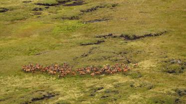
Rum Manx shearwaters - exploring drivers of population dynamics to inform conservation management
The Manx shearwater colony on the island of Rum is globally important, holding some 30% of world population. The drivers of population size and trends for this population are complex and include both intrinsic and extrinsic factors operating within the colony and in the birds' marine range, which includes wintering and pre-breeding areas in the western Atlantic. At the colony, factors influencing breeding success include flooding of nest burrows during heavy rainfall and depredation of eggs or chicks by brown rats. Levels of rat activity at the colony may also be affected by climatic factors (e.g. winter temperatures). The development of large offshore wind farms (OWF) within the birds' foraging ranges may also impact birds from this population.
A Bayesian state-space model of the colony population dynamics has recently been developed by Jason Matthiopoulos (under a ScotMer contract). The aim of this MSc project would be:
a) to use the model framework to further explore how proximate factors, in particular rainfall patterns at the colony during the breeding season, may influence colony dynamics. Technically, this task can be thought of as an apportioning of the empirically inferred dispersion (the random effects), into the contributions of covariates.
b) to use the model framework to explore potential population outcomes under various scenarios of future change, including pulse and press perturbations (potentially operating in tandem) to key demographic parameters
Sustainable fisheries indicator development
In addition to the stock removed, fisheries sustainability also needs to take account of impacts on the wider environment (e.g. the bycatch of non-target species, some of which are also protected, as well as impacts on benthic habitats). Although there are a variety of approaches that take these considerations into account (e.g. the Marine Stewardship Council Fisheries Standard or Seafish’s Ecological Risk Assessment of the South West), we do not have an indicator that combines stock assessment, fishing effort and biodiversity for assessing the sustainability of Scotland’s fisheries. The aim of this project is to explore ways in which ICES stock assessments can be combined with biodiversity indicators (e.g. those for determining Good Environmental Status or Favourable Conservation Status) in order to develop an indicator for sustainable fishing.
Investigating the decline of Seagrass in Loch Fleet
The seagrass beds in Loch fleet SSSI have experienced significant decline. Some evidence suggests that water quality, management and climate change could be the contributors to the decline, but more evidence is needed to understand this loss. Investigating the decline of Seagrass in Loch Fleet, with a focus on water quality. Methodology needed to investigate this would need to be discussed and agreed.
Reviewing biosecurity protocols for Native Oyster and/or Seagrass restoration
Biosecurity is a key consideration when introducing species to a location during restoration projects e.g., native oysters, seagrass. There are recognised processes to minimise introduction of disease and Invasive Non-Native Species (INNS) that can be mixed in or attached to the species being introduced. It is normal practice to produce a biosecurity plan, but communities are finding the practice hard to carry out as it is time-consuming, and labour-intensive. There are requests to investigate whether alternative methods can be used that are more manageable within the community/volunteer sector but still have the required level of biosecurity. Aims: Review current biosecurity protocols that have been produced; Assessment of these methods I.e. pros, cons, issues – this could include interviews/surveys with communities carrying out restoration; Review of alternatives e.g. different methods, chemicals, technology (e.g. eDNA and mechanisation); and Recommendations on ways forward.
Find out more
Marine Alliance for Science and Technology for Scotland (MASTS)
Last updated: