Wilding our Parks case studies
Rewilding our Parks
During the first year of lockdowns in 2020, the grass in our parks was cut less than before. In some places, this allowed more wild flowers to grow and beautiful spaces to develop, which wildlife and locals have enjoyed.
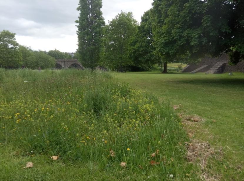
Wildflower meadow, Stirling Bridge
Click for a full description
Greenspace with scattered trees, long grass and wildflowers including yellow rattle, with mown border in front of Stirling Bridge.
Some call this rewilding. It is a word that conjures up images of large landscape-scale projects, often delivered in scenic rural regions of the Highlands. But rewilding isn’t about being remote, or “wild” in the traditional, unmanaged sense. In an urban context, we are talking about “rewilding” of areas that are currently low in biodiversity, such as short amenity grassland in parks, or vacant and derelict land, to turn it into something that can look and be closer to nature.
We need nature on in our cities to live healthy, happy lives. Lockdown has shown that we need natural beauty on our doorstep, to exercise, play, or just spend time in.
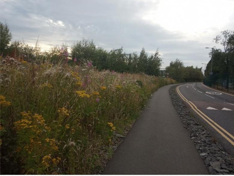
Wildflower verge along roadside
Click for a full description
High verge of yellow ragwort, pink rosebay willowherb, grasses and thistles on the left, bordering on cyclepath leading into the distance. Adjacent road with speedbumps.
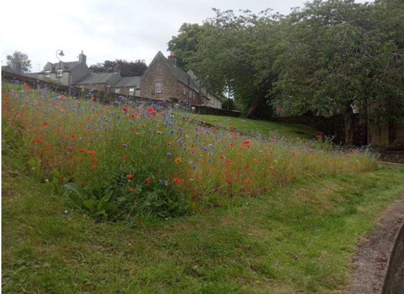
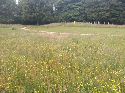
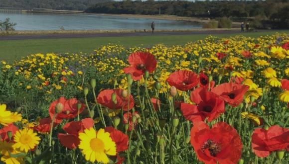
Pocket park with wildflowers - top of the town, Stirling
Click for a full description
Poppies and cornflowers in triangular-shaped pocket park with mown edge on slope between two streets, replacing former flower bed. Residential housing of old town in the background.
Here are some examples of Local Authorities that are now leading the way with managing their greenspaces in a way that makes them more attractive, inviting people to walk, exercise, play and picnic. Wild flowers provide food for insects and birds and mammals can find shelter in the long vegetation.
See also the Community Rewilding web page.
NatureScot worked with greenspacescotland and the Park Managers Forum to develop the case studies.
West Lothian: Construction of bog garden
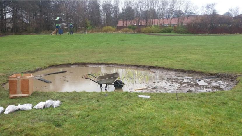
Bog garden to help drain Livingston park
Click for a full description
A pond-like muddy area with open water a wheelbarrow inside it and other construction materials on the bank, amongst amenity grassland, with a children’s slide in the background.
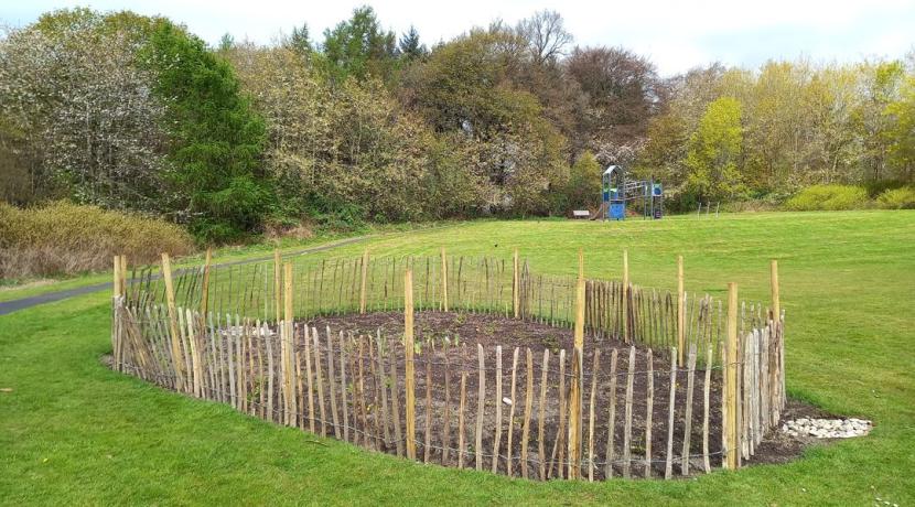
Falcon Brae raingarden
Click for a full description
Fenced, still bare bog garden amidst short amenity grassland, fringed by trees with spring blossoms.
West Lothian soils have a high clay content, so most of the area’s parks have drainage issues. As part of wider improvements to Falcon Brae Park, an experimental bog garden was created to see if it would address waterlogging. The work took place during 2020/21 as part of West Lothian Council’s ongoing capital programme. Whilst upgrading drainage in the park, a suitable site within the grassland, and near hedging, was used to create the bog garden. It is one of the first bog gardens created by the council.
West Lothian case study report
Use of signage to explain what is happening and why the change is important is essential, particularly at areas that do not immediately look finished. This message is for the community, as well as for operatives who may feel the area needs to be cut or sprayed to stay in keeping with more formal areas.
The team will continue to monitor this bog garden and extend use of them across other sites in West Lothian. The use of sensors to monitor water levels in bog gardens is being explored, and two new sites are currently being planned in other parks.
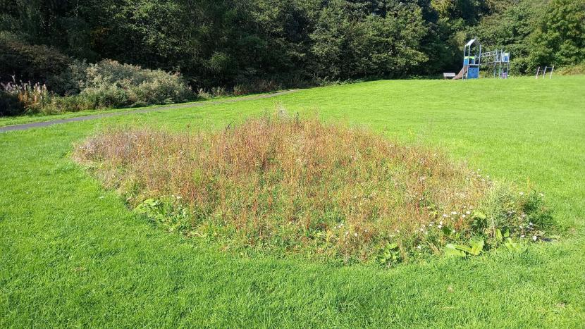
Falcon Brae raingarden - in bloom
Click for a full description
Bog garden covered in plants, much of it docks in flower, amongst amenity grassland, with a children’s slide in the background.
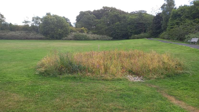
Falcon Brae garden in bloom
Click for a full description
Bog garden in bloom as before, but from a different perspective, with a small area of pebbles at the entrance of the garden and shallow grassy channel leading up to it in the foreground.
Dundee City: Naturalising amenity grassland
At Myrekirk and Lochee Parks, ‘summer meadows’ with yellow rattle have been created. These parks are busy parks mostly used for sport and recreation, and so it was important to complement rather than compete with these activities in the plans for introducing more nature into the grasslands.
Lochee park
Click for a full description
Large wildflower meadow on gentle slope with buttercup and yellow rattle flowers, bordering on short-mown football pitch in the distance, with trees and some houses on the horizon.
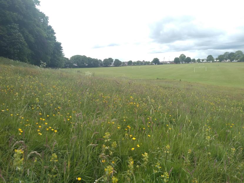
Myrekirk Park
Click for a full description
Wildflower meadow with long grass, yellow buttercup heads and yellow rattle in foreground, separated through path from short mown amenity grass and more long grass on hillock and trees in the background.
A major driver for the initiative came during the first lockdown in spring 2020 when people reported to Dundee City Council they enjoyed seeing the longer grass and more wildlife in their parks and open spaces.
During a city-wide public consultation, three-quarters of respondents were in favour of proposals to dedicate areas of amenity grassland to biodiversity.
In response, areas of suitable grassland within 27 of Dundee’s parks and greenspaces have been managed less intensively as ‘naturalised grasslands’ or converted to ‘biodiversity meadows/grasslands’.
Due to the number and size of these areas it was decided that the sites exhibiting most floral diversity would become the ‘biodiversity grasslands’. These would be managed to mimic a hay meadow, with cutting and lifting the arisings once or twice a year. The remaining sites (the ‘naturalised grasslands’) would be cut on an annual basis, with arisings left in situ.
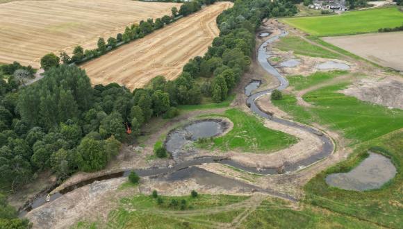
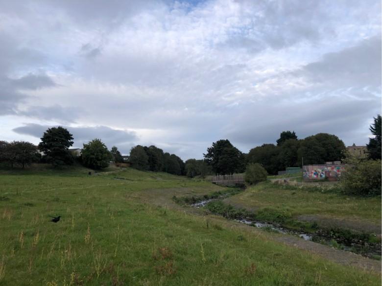
Fife: River restoration creates a green corridor
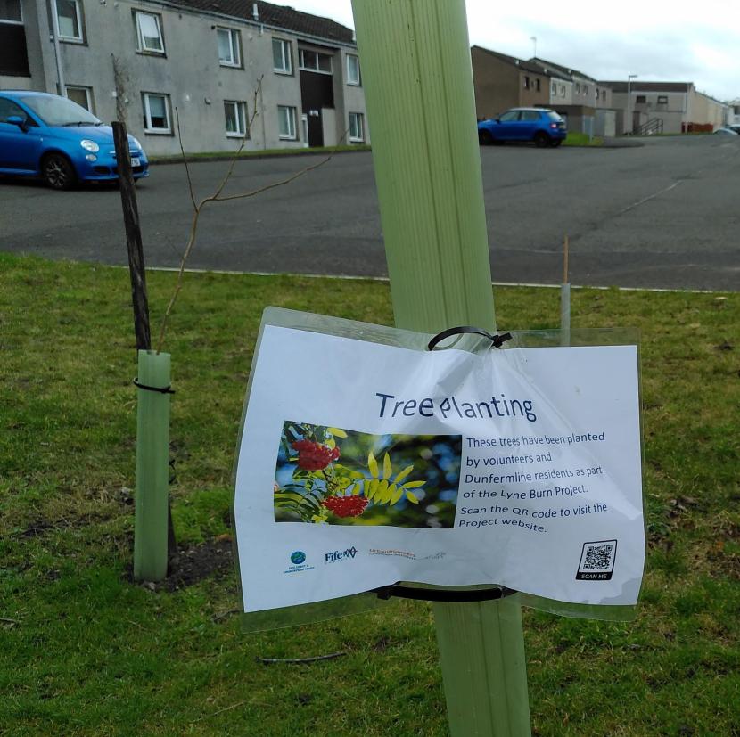
Lyneburn Park, Fife - tree planting notice and QR code.
The Lyne Burn is a river restoration and greenspace improvement initiative, which has created a green corridor for Dunfermline. Fife Council’s first Open Space Strategy in 2011 identified this project as a priority.
Lyne Burn
Click for a full description
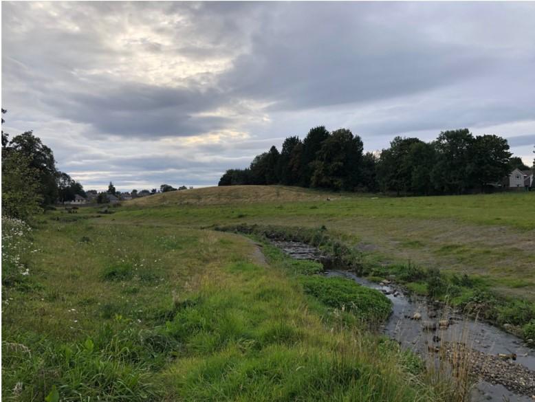
A burn meanders through grassland, woody brash used for bank restoration visible on the near side. There are trees a few meters away from the water, and the edge of a fenced housing estate within 30m. There is a SUDS outlet with a white painted fence around it leading from the estate into the burn.
SEPA classified the Lyne Burn as a ‘heavily modified watercourse’. Larger and more frequent river spates were damaging the concrete walls and increasing the risk of flooding, and so this project addresses flood risk management and climate change mitigation. It is located close to two areas of multiple deprivation; many residents live in flats, without gardens, so there was scope to improve quality of and access to greenspace.
453m of watercourse has been restored. Civil engineering works removed the original linear concrete channel. The bed of the burn was widened, and a naturalised meander course created to slow the water down at times of high rainfall, and to allow the water to spread out rather than flood areas downstream within Dunfermline.
Coir matting was used along restored riverbanks, with wildflower seed underneath.
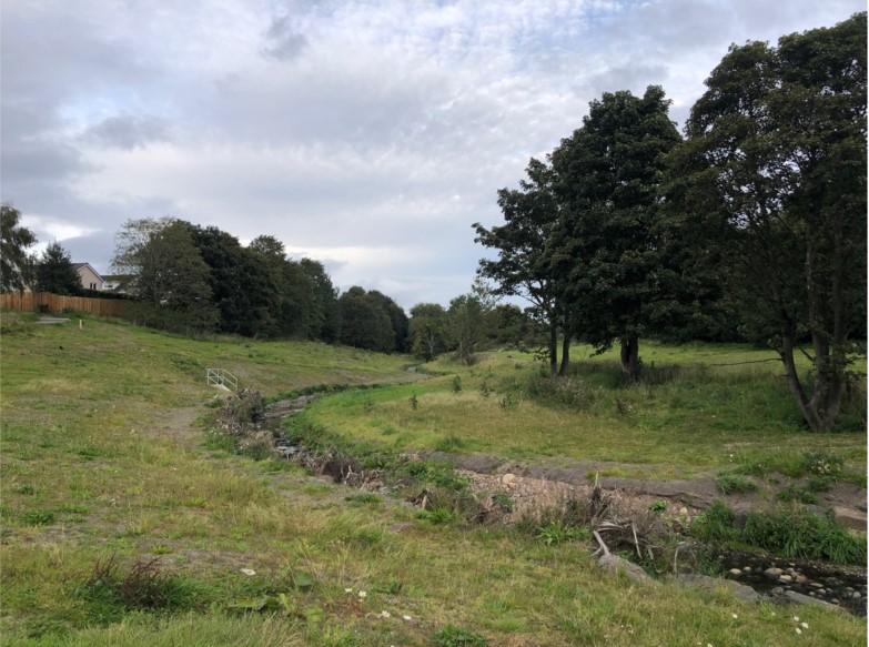
Lyne Burn
Click for a full description
Two access paths run through an unmown grassland fringed by trees, some residential housing and a spray-painted building, the burn at the centre of the greenspace. There is a bridge across the burn, which has stabilising matting on both sides, with vegetation starting to grow through.
Areas of short grass amenity management were changed to long grass management, in line with the Fife-wide programme, with arisings being transported to Fife Council’s anaerobic digester.
The community planted native trees, shrubs and wildflower meadows to create new habitats.
Fife burn
Click for a full description
A burn meanders through grassland, woody brash used for bank restoration visible on the near side. There are trees a few meters away from the water, and the edge of a fenced housing estate within 30m. There is a SUDS outlet with a white painted fence around it leading from the estate into the burn.
Council staff report local citizens are taking more pride in their area, as evidenced through less litter, volunteer planting sessions, a children’s outdoor summer activity play scheme, community gardening and a nature club.
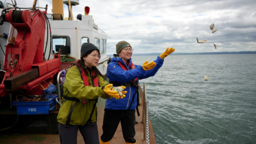
Edinburgh City: Edinburgh Living Landscape - wildflowers along Cramond's foreshore
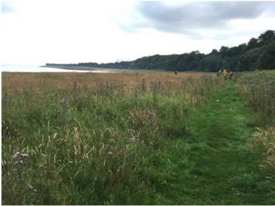
Wild grassland at Cramond foreshore
Click for a full description
A mown path leads through long grass, towards a small group of people in the distance. The meadow, with grasses and thistles in flowerc, runs along the shoreline on the left, and is bordered by trees on the right.
Gypsy Brae and Cramond foreshore was one of the first sites developed under the Edinburgh Living Landscape programme, which started in 2014/2015. Its long-term vision is to make the city one of the most sustainable in Europe by 2050 to benefit local people and wildlife. This includes integrating nature into parks, greenspaces, gardens and neighbourhoods across the city.
Gypsy Brae and Cramond was amenity grassland before the Living Landscape programme commenced. The majority of the area is now naturalised grass with cut paths and edges.
The continued naturalisation of Edinburgh’s shoreline is also a part of the Wild Line project, which started in 2019 and is led by the Royal Botanical Gardens Edinburgh.
In 2021, this project funded wildflower meadows at Gypsy Brae and Cramond Foreshore sown with a diversity of species that were carefully selected to benefit insect pollinators.
This initiative has enjoyed increasing community support, collected long-term scientific data on biodiversity benefits and developed guidelines for maritime meadow mix composition and management.
Visit Edinburgh Living Landscape web page.
East Dunbartonshire: Pond and lade naturalisation in Lennoxtown
Whitefield lade
Click for a full description
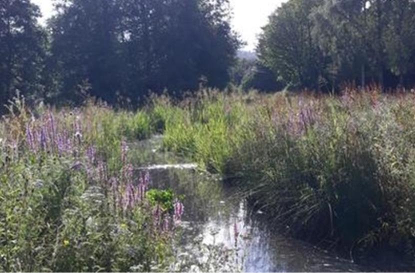
A lade with still open water and tall side vegetation including reed sweet grass and purple loose-strife, trees in the background.
East Dunbartonshire case study report
The otherwise pleasant area around Whitefield pond was let down by the unattractive lade feeding the pond, with canalised vertical sides, granite setts and concrete slabbing. There were areas of breaching and increasing issues with erosion, silt deposition and leaking which needed to be addressed, along with its poor level of biodiversity. The Council viewed these required repair works as an opportunity to create a more attractive and biodiversity- friendly space to complement the pond and the rest of the greenspace.
Today, the pond is a popular recreational area used by the community of Lennoxtown, anglers and visitors. The area includes a man-made pond, fed by the lade, and surrounded by amenity grass, shrub area and native woodland planting. Over a number of years, the Council has naturalised sections of the pond, upgraded the path surface, and installed attractive seating, sculptures and interpretation, along with attractive stone boundary walls and entrances.
Glasgow City: Working with volunteers and third sector to enhance habitats in Auchinlea Park, Easterhouse
Auchinlea Park includes Provan Hall, one of the oldest surviving buildings in Glasgow. The park is being developed as a heritage visitor attraction and a hub for environmental and heritage learning.
Auchinlea Park was chosen as one of 20 sites within the Seven Lochs and Cumbernauld Species Rich Network Team (SpRiNT) project, where past (or lack of) management has resulted in areas with little biodiversity. It will create and then monitor species rich grassland, woodland, and wetland habitats in an urban network across north-east Glasgow and North Lanarkshire. A partnership between two local authorities, local charities and volunteer groups, the project prioritised training for local staff and skilled volunteer team to establish, manage and monitor the sites. The work at Auchinlea included the enhancement and management of 4 ha of grassland, woodland and wetland habitats.
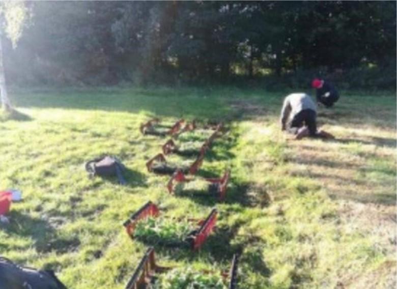
Bulb planting in Auchinlea Park
Click for a full description
Short rough grassland with line of trays containing plant material and two people kneeling to the side of it planting plugs. Line of trees in the background.
Community consultation was ongoing through local partners, volunteers, on-site information and social media. The existing management structures for the Seven Lochs Project and Cumbernauld Living Landscape project include elected members. The training programme involved local volunteers. Although the council if often expected to deliver neat and tidy parks, there has been little community resistance, possibly because the residents are already familiar with the Seven Lochs Project delivering nature projects.
Last updated: