Guidance - Licensing - providing supporting information for badger licence applications
The Protection of Badgers Act 1992 (c.51) (as amended)
Guidance notes for providing supporting information for badger licence applications
This document has been prepared to help people submit licence applications to permit activities that could disturb, damage or destroy badger setts
Clear photographs and maps are extremely helpful to allow a licensing officer to understand exactly what is proposed under licence and what the impact of the licenced activity might be. They are also extremely useful as a reference point for any licence that is subsequently issued: they can clearly show what activities are permitted and where and they can help people demarcate these on the ground.
The pages below show examples of photographs and a map that provide clear and unambigious information about badger setts, the proposed works and the location of these in relation the surrounding land and proposed works.
Applications missing this information, or presenting it in a vague manner, often result in delays in the amount of time taken to assess licence applications. By providing information of the quality below, the need to go back to the applicant is greatly reduced meaning where appropriate licences can be issued quicker avoiding delays to works.
More general guidance on surveying and monitoring protected species and also filling in licence application forms can be found on the licensing pages. To keep up to date on new guidance and changes the licensing news page should be checked frequently.
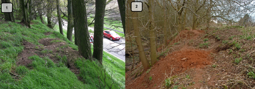
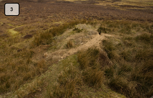
Examples of badger setts
Click for a full description
Each of the three photos attached is a good example of an image showing the position of the sett within the surrounding landscape. All photos clearly show the topography of the land surrounding the sett. Photos 1 and 2 also show features that may be of importance such as road, field or surrounding trees. Photos can also be labelled i.e. arrows pointing to where an access route may be or, more clearly showing the position of sett entrances. All photos are owned by Roger Cottis, Scottish Badgers.
Examples of badger setts
Click for a full description
Each of the three photos attached is a good example of an image showing the position of the sett within the surrounding landscape. All photos clearly show the topography of the land surrounding the sett. Photos 1 and 2, in particular, also show features that may be of importance such as a road, field or surrounding trees. Photos can also be labelled i.e., arrows pointing to where an access route may be or, more clearly showing the position of sett entrances. All photos are owned by Roger Cottis, Scottish Badgers.
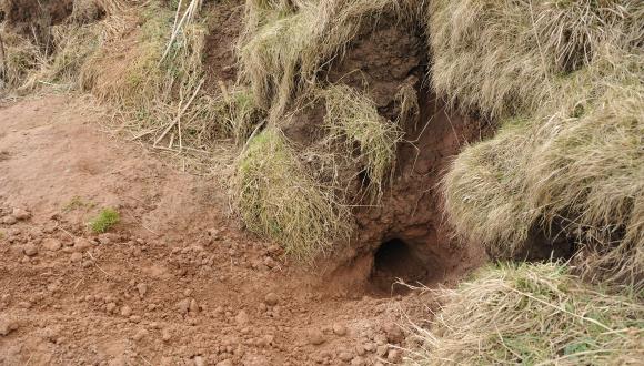
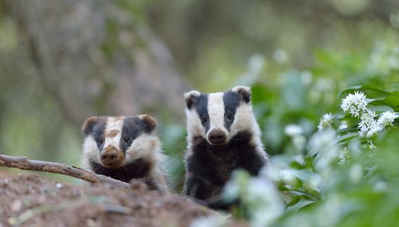
Examples of signs of use at badger setts.
Click for a full description
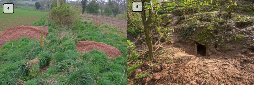
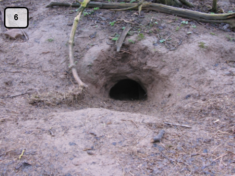
Photos four, five and six all clearly indicate signs of badger use. Photo 4 shows signs of recent excavation and also bedding material whereas photos 5 and 6 illustrate well that sett entrances appear to be in use frequently. Finally, photo 5 also clearly shows well-worn badgers paths and it can be clearly seen in which direction they go. Whilst these photos all show signs indicating recent activity, photos can also be used to illustrate signs of little to no activity i.e., overgrown paths or, degraded sett entrances. All the photos shown here provide clear documentation that could be used in support of a licence application and would help allow the case to be processed in a timely manner. All photos are owned by Roger Cottis, Scottish Badgers.
Examples of signs of use at badger setts.
Click for a full description
Photos four, five and six all clearly indicate signs of badger use. Photo 4 shows signs of recent excavation and also bedding material whereas photos 5 and 6 illustrate well that sett entrances appear to be in use frequently. Finally, photo 5 also clearly shows well-worn badgers paths and it can be clearly seen in which direction they go. Whilst these photos all show signs indicating recent activity, photos can also be used to illustrate signs of little to no activity i.e., overgrown paths or, degraded sett entrances. All the photos shown here provide clear documentation that could be used in support of a licence application and would help allow the case to be processed in a timely manner. All photos are owned by Roger Cottis, Scottish Badgers.
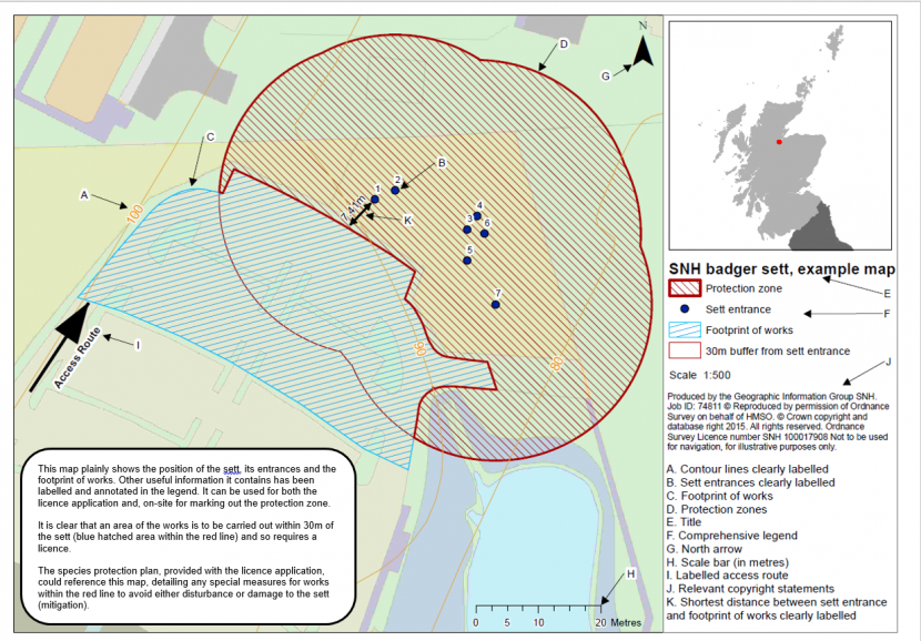
Badger Sett, Example Map
Click for a full description
This map plainly shows the position of the sett, its entrances and the footprint of works. Other useful information it contains has been labelled and annotated in the legend. It can be used for both the licence application and, on-site for marking out the protection zone.
It is clear that an area of the works is to be carried out within 30m of the sett (blue hatched area within the red line) and so requires a licence.
The species protection plan, provided with the licence application, could reference this map, detailing any special measures for works within the red line to avoid either disturbance or damage to the sett (mitigation).
Disclaimer: Scottish Natural Heritage (SNH) has changed its name to NatureScot as of the 24th August 2020.
At the time of publishing, this document may still refer to Scottish Natural Heritage (SNH) and include the original branding. It may also contain broken links to the old domain.
If you have any issues accessing this document please contact us via our feedback form.
Contacts
If you already have a licence number, include it in the subject line of your email, or have it to hand when you call.
You should receive an automatic confirmation email from us if you send an email. If you do not receive this, please phone us on the number below: