Greenspace Map
In 2017, Ordnance Survey published datasets that tell us about the type and extent of greenspace across Great Britain.
Two Ordnance Survey (OS) datasets are available:
- OS Open Greenspace
- OS MasterMap Greenspace – which includes more detail for public sector use
To find out about the open dataset, visit the OS Open Greenspace webpage.
You can also view the open data via the free, interactive map on the OS Maps website.
About the datasets
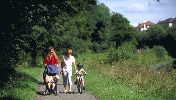
OS Open Greenspace maps publicly accessible recreational and leisure greenspace in Great Britain. It shows both the extent of each greenspace and the access points for larger sites.
Greenspace types include:
- public parks and gardens
- play spaces
- playing fields
- golf courses
- tennis courts
- bowling greens
- allotments
OS MasterMap Greenspace broadly follows the typology used in Planning and Advice Note 65: Planning and Open Space.
OS produced its greenspace products in collaboration with a partnership of government, public sector and third sector organisations. The datasets build on the original Scotland’s Greenspace Map, which was published in 2011.
Analysing the Greenspace Map
A national dataset greatly improves our understanding of our greenspace resource. The Second State of Scotland’s Greenspace Report was published shortly after the 2011 dataset. This provided – for the first time – an accurate picture of the amount and type of greenspace in urban Scotland and by a local authority.
The Third State of Scotland’s Greenspace Report, which will draw on the OS greenspace datasets, is expected in autumn 2017.
Research potential
The OS MasterMap Greenspace data should open new avenues for academics researching greenspace. The dataset has the added advantage of covering the whole of Great Britain as well as all settlements with a population of 500 or more. It will also be updated every 6 months.
The Scotland’s Greenspace Map dataset has influenced strategies and informed policies. The three Scotland's Greenspace Map case studies show how Scotland’s Greenspace Map has been used alongside other datasets by various organisations and at different scales.
- Case study 1: Informing strategy and planning in Fife
- Case study 2: Climate change adaptation opportunities mapping in Glasgow and the Clyde Valley
- Case study 3: Open space and health research in urban Scotland
Last updated: