Landscape Character Assessment: Aberdeen City - Landscape Evolution and Influences
The PDF version of this document can be found at the foot of the webpage
This document provides information on how the landscape of the local authority area has evolved. It complements the Landscape Character Type descriptions of the 2019 dataset.
The original character assessment reports, part of a series of 30, mostly for a local authority area, included a “Background Chapter” on the formation of the landscape. These documents have been revised because feedback said they are useful, despite the fact that other sources of information are now readily available on the internet, unlike in the 1990’s when the first versions were produced.
The content of the chapters varied considerably between the reports, and it has been restructured into a more standard format: Introduction, Physical Influences and Human Influences for all areas; and Cultural Influences sections for the majority. Some content variation still remains as the documents have been revised rather than rewritten,
The information has been updated with input from the relevant Local Authorities. The historic and cultural aspects have been reviewed and updated by Historic Environment Scotland. Gaps in information have been filled where possible.
The new documents include photographs. They do not include the maps or sketches from the original LCAs, but these are still available from the Nature Scot Information Library. Additional information can be obtained from the websites of;
- British Geological Survey www.bgs.ac.uk
- Historic Environment Scotland (Historic Land use Assessment, Gardens and Designed Landscapes, historic features and their designations, etc). www.historicenvironment.scot/
- NatureScot website, Landforms and Geology (more specifically the “Landscape Fashioned by Geology” series); and About Scotland’s Landscapes (soils; wild land; landscape character; designations etc.) www.nature.scot
- The relevant local authority, which will have information on landscape policies, etc.
The content of this document was drawn from the background chapter information in the “Aberdeen City Landscape Character Assessment”, Final Report November 2018 currently unpublished, Doug Harman + Associates et al, Aberdeen City Council, NatureScot, Aberdeenshire Council.
If you have any comments, please email [email protected]
INTRODUCTION
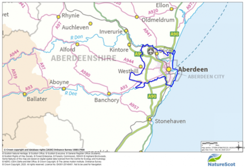
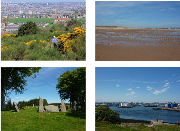
Known as ‘the Granite City’, Aberdeen is a harbour city that is largely situated between the two valleys of the rivers Dee and Don. The two river valleys are instrumental in forming visible and distinctive links with the surrounding landscape. They bring elements of the countryside and associated flora and fauna right through the city, and are an important feature of Aberdeen. The valleys, and the ring of low hills which encloses the western side of the city, provide views of the countryside from many parts of the city and underpin a distinctive and diverse landscape character.
The influence of coastal and river landscapes upon the city’s development has been considerable and these elements have helped to create a strong identity. As a small city, the surrounding landscape and seascape have a considerable influence on urban character and the individuality of Aberdeen’s townscape underlines the importance of conserving and enhancing its distinctive setting and sense of place.
Clearly, the influence of humans in an area as developed as Aberdeen has been profound. The development of the city has been gradual and, before technology reached its present advanced stage, it involved a more direct response to the natural landscape. However, the pace of change over recent times has become more accelerated and dynamic and is largely driven by economic growth.
PHYSICAL INFLUENCES
Aberdeen has a close relationship with its natural environment – the names ‘Granite City’ and ‘Silver City’ reflecting the abundance of buildings constructed from the locally sourced sparkling silver grey granite. Its coastal location, its two river valleys, and the arc of hills that bound it to the west are key features of the city, and they shaped the city’s development.
Landform
The landform has a significant influence on the character of the landscape and Aberdeen is fortunate in having a dramatic setting between hills, valleys and the coast. The two main river valleys of the Dee and Don are major landscape features within the area, and were undoubtedly instrumental in the location of the city. Both valleys have developed as transport corridors, and major roads follow the valley landform.
Hills are a distinctive feature, most notably to the west where it forms a distinctive western edge to the city. Smooth slopes predominate and all the hills have gently rounded landforms. At 266 metres AOD, Brimmond Hill is the highest point in the city. Expansive views can be experienced from these hills including towards the Grampian hills to the west and across the city to the east. There is a smaller area of hills to the south of the city namely Kincorth Hill and Tullos Hill. Although relatively low, these hills form a prominent skyline feature when seen from northern parts of the city.
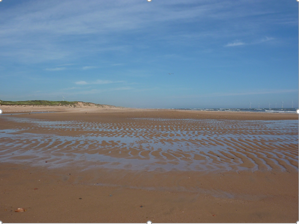
The varying coastal landforms are also a distinctive feature in the city. The high contrast between the sea and the land that occurs anywhere along the coast is heightened in Aberdeen by the sandy beach and dunes near to a harbour city. The craggy rocky coast south of the Girdle Ness headland is formed into a series of striking coastal landforms including ravines, small rocky headlands, sea caves and jagged rock platforms.
Bedrock Geology
The oldest rocks in the study area are regionally metamorphosed sedimentary rocks of the Dalradian Supergroup. In Aberdeen, these are represented by the Aberdeen Formation. They comprise a series of strongly deformed metasediments, generally occurring as psammites, semi-pelites, pelites and rarer calcareous bodies. These were formed from sandstones, mixed sandstones and shales, and shales with limestone sediments which, following deep burial, underwent intense metamorphism during the Grampian Orogeny. In addition to these metamorphosed sediments, some basic igneous material was transformed to amphibolite during metamorphism.
This Dalradian succession was originally formed as a series of marine sediments, along with some basic igneous bodies, on the south-east margin of the opening ancient Iapetus Ocean, whilst attached to the Laurentian-Greenland continent. These Aberdeen Formation rocks probably range in age from the late Pre-Cambrian to possibly the Middle Cambrian.
Following closure of the Iapetus Ocean, large-scale mountain building, known as the Caledonian Orogeny, occurred. This led to deep-burial and associated complex deformation and metamorphism. This has resulted in highly complex geological structures that are difficult to interpret, due to lack of good exposure; multiple deformation episodes, each masking the evidence of previous events; and the effect of migmatitisation. Within the study area, the cliffs from Aberdeen southwards, for example at Girdle Ness, provide exposures that display many of these complex structural features. The most resistant of the metamorphic rocks are quartzites, and they are associated with high ground in the area, such as Brimmond and Tyrebagger Hills.
The Dalradian sequence is intruded by granites, which underlie much of Aberdeen. The Aberdeen granite is a large pluton which trends NNW-SSE, forming a body 16-17 kilometres long by 6 kilometres wide, comprised of grey-coloured muscovite biotite granite. It was emplaced about 470 million years ago in the Ordovician, based on material from Rubislaw quarry. This is significant, indicating that it is not linked to the younger suite of Newer Granites formed in the Silurian to Devonian.
The famous Rubislaw Quarry, opened around 1741, is located within this area of granite and has a depth of about 150 m, although much of the quarry is now flooded. For the early part of the modern period, up to Victorian times, most of the buildings in Aberdeen were constructed from solid granite, until rising costs prevented the stone being used for more than facing or decorative work. This prevalent use of granite is the most noted characteristic of the city. Rubislaw and the quarry at Kenmay supplied stone for building docks and lighthouses as well as houses and municipal buildings. The quarries supplied a range of grey granites, their colour and texture dependent on the proportion of the mineral quartz, feldspar (orthoclase and plagioclase) and mica (muscovite and biotite). The silver-grey granite is best seen in the outstanding Marischal College building on Broad Street. Coloured granites owe their hue to the presence of coloured feldspars, notably small quantities of iron oxides in the orthoclase crystals. The salmon pink of Corrennie quarry, near Kenmay was used for polished work, a fine example being Aberdeen Art Gallery on Schoolhill.
Red and un-metamorphosed sedimentary rocks are found to underlie the eastern part of Aberdeen city, extending from north of Dyce southwards to the Dee, where they terminate against a possible fault trending ENE-WSW. They comprise conglomerates with rarer sandstones and argillaceous (clay-rich) beds and thicken eastward. Study of these rocks is hindered by lack of good exposure, and much of what we know has been derived from temporary exposures and drill holes. However, they have allowed its boundaries, character and extent to be determined. Although they lack fossils, they have been assigned to the Old Red Sandstone (ORS) of Devonian age and may be part of the Lower ORS. During deposition, Scotland lay between 20 and 30 degrees south of the equator. These sediments were deposited as alluvial fans and fluvial deposits in a semi-arid climate across a major unconformity surface which was highly irregular in character. This unconformity can be seen in a low cliff face on the southern bank of the Don just east of the Brig o’Balgownie.
The coast where the Old Red Sandstone occurs consists of the wide sandy beach at Aberdeen, the shifting estuary of the Don, and the dune system to the north where the links are now used for golf. In complete contrast, where the Dalradian rocks form the coastline south of Aberdeen, the coast takes the form of cliffs. The rocks here are interspersed by igneous (dolerite) dykes that were injected into the existing rock approximately 295 million years ago, during the late Carboniferous period, when Scotland was located near the equator. These dykes were more easily eroded than the surrounding metamorphic rocks, and the differential erosion that occurred has resulted in the highly varied coastline of today.
Drift Geology
The present landform of Aberdeen is the result of various erosional and depositional processes acting on the underlying solid geology over time. Generally, the more resistant rocks form the higher ground while softer rocks have been subject to greater erosion. In comparison with the west of the country, the drier north-east of Scotland was eroded less by rivers and glaciers, but glaciation has still been the most significant recent agent of erosion and deposition. During the Quaternary period (from 2 million to 10,000 years ago) many separate glaciations occurred but understandably only the last, termed the Devensian (approximately 11,500 years ago), has left a noticeable onshore record.
The Cairngorm plateau and the Mounth were probably major sources of the ice sheets that flowed roughly eastwards. The high ground would have been glacially eroded with deposits occurring on lower ground, for example along much of the Dee valley. The vast quantities of meltwater that resulted when the glaciers shrank due to the warming climate deposited large amounts of eroded material, and had sufficient power to carve out channels in the substrate. Zones of relative weakness, for example existing river valleys or fault lines, were deepened the most.
Both the Dee and the Don currently follow meltwater channels that were cut into bedrock. The Dee used to outflow at Nigg Bay, south of its present river mouth, but the old channel was infilled with glacial deposits, including some erratics of Scandinavian origin. This is possible evidence of the wastage of older ice sheets from the Devensian. The Don has also changed its course through what is now Seaton Park. The Don takes a steeper course than the Dee, with a narrower channel which creates a faster flow. The rapidity of the flow enabled the river to be used as a source of power for fabric and, subsequently, paper mills. The constricted and shallow outlet of the river negated its use as a harbour. In contrast, the mouth of the Dee, after considerable dredging, formed the basis of the important harbour of Aberdeen.
Other meltwater features such as valley side-terraces and eskers were formed in the area. For example, the ridge between the Dee and Don estuaries, at either end of which the early, separate settlements of Aberdeen were located, is an esker. An esker is a ridge of stratified sand and gravels formed within ice wall tunnels by streams within and under glaciers, or by the accumulation of sediment in an ice crevasse. The small-scale undulating topography between Tyrebagger and Brimmond hills is due to kames being deposited by meltwater, and the spillways that were carved into the hillsides by ice, water and debris. The material for the kames was deposited in depressions by retreating ice which was then pushed out of the depression and onto the land by further retreating ice.
Away from the meltwater channels widespread rock debris, or till, was plastered over the lower terrain by the retreating ice. It is likely that much of this boulder clay moved by the ice was developed from local material. The painstaking work of clearing the larger stones from the boulder clay to improve the cultivability of the soil resulted in the distinctive drystone dykes that form field boundaries in many parts of the area. The sand and gravel morainic mounds in the area – Ferryhill, Woolmanhill and Broad Hill for example – are distinctive in the topography of Aberdeen. These were either deposited as the ice sheet was meeting the sea or when it was breaking up and moving in streams rather than as an unbroken front. The valley of the Pitmuckston Burn, Carnegie's Brae, Berryden, and the hollow west of the Spital Hill are examples of where the ice sheet was breaking up, creating narrow streams.
In the 11,500 years or so since the last ice sheets melted, minor changes to the drift geology of the area have continued to occur. There is evidence of peri-glacial activity throughout the Aberdeen area and hinterland. It may be that this coincided with the last glaciation in Scotland – the Loch Lomond Readvance – which did not directly affect the area around Aberdeen, but which would have been accompanied by a lowering of temperature across the country. The changes in sea level as the glaciers melted resulted in the raised beach deposits that are located between the mouths of the rivers Dee and Don. In addition to the present day beach and dune systems along the coast at Aberdeen, recent deposits include the alluvium that occurs along the stream valleys and, at a broader scale, in the valleys of the Dee and Don. Peat deposits also occur in the area, particularly in the poorly-drained basins that were the result of glacial erosion.
Soils
Soils can be broadly classified according to the parent material that formed them. However, this basic division is complicated by the interaction of other factors including climate, vegetation, time and human influences. It is common in north-east Scotland for soils to have better drainage on hill slopes than in flatter area, although this will be locally dependent on soil parent material, soil texture and degree of slope.
As would be expected given the geology of the area, most of its soils are formed from glacial till that was derived from granitic rocks. In the study area it is known as the Countesswells association (a soil association is a series of soils that share a common parent material). Variations within this depend on how freely-drained the soil is, with better-drained soils generally occurring on higher ground. Soils formed from a different parent material are found in the river valleys and tributaries, where they developed on alluvium or meltwater-sorted sands and gravels.
A humus iron podzol predominates over much of the area in combination with brown forest soils and gleys. The podzols and brown earths tend to exist on hillsides with gleys dominating the lower, wetter ground. Humus iron podzols are naturally acidic and tend to be nutrient deficient, however, they are capable of supporting a number of uses, such as forestry and agriculture when they have been improved, although the soils tend to be stony with rocky outcrops which can inhibit their use for agriculture. The stony nature of the till-derived soils is revealed by the extensive use of drystone dykes to demarcate fields.
Within this mosaic, there are areas of non-calcareous gleys, peaty gleys, some humic gleys and peat. At Grandholme Moss, for example, there are occasional pockets of basin peat; this is a lowland peat soil, formed in basins created through glacial erosion. Basin peat is ombrotrophic, receiving nutrients and water from precipitation alone. They are confined by mineral ground which prevents drainage, causing a build-up of organic material which forms peat as it decomposes in acidic conditions. Basin peats have no mineral layer and can appear domed.
Lower river valleys are dominated by alluvium. These fluvial deposited soils tend to be more fertile than other soils in the area because they are periodically inundated which enables nutrient deposition. Further up the valley sides the alluvium gives way to humus iron podzols and gleys.
Along the coastline running north from the urban area, soils are characterised by sand which is classed as a regosol (soil consisting of unconsolidated material derived from freshly deposited alluvium or sands). In contrast, to the south of the urban area, on the cliff tops running from Greg Ness southwards, soils tend to be dominated by the richer brown forest soils with humus iron podzols and some gleys.
Climate
The climate of Aberdeen is milder in winter than its northerly location would suggest. This is due to the oceanic climate created by proximity to the sea. With a prevailing north-easterly wind, the cooling sea breeze in summer means that Aberdeen is recorded as the coldest UK city. Proximity to the coast also reduces snowfall within the city although this is relatively high inland and on higher ground. The sea is also associated with the prevalence of haar (sea fog) forming over the city. This is most common in spring but can occur throughout the year. The higher ground within the city is associated with greater wind exposure and colder temperatures. Historically, the climate has influenced the pattern of development and the location and type of agriculture.
Landcover
Despite being a relatively small area and urban in much of its character, the topography of the area provides a range of plant habitats, from coastal cliffs and dunes to forestry and agriculture, predominantly improved grassland but with a high proportion of arable land and some rough grazing river valleys and hill slopes. While the coastal habitats are largely unchanged from their natural state due to their limited usefulness (except, relatively recently, for recreation), the inland areas have been significantly altered by humans over time. The natural vegetation of much of the inland reaches of the study area would have been woodland. This developed after the last glaciation when the climate, ameliorated by the presence of the North Atlantic Drift, gradually became suitable for tree growth.
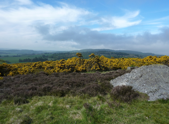
Following retreat of the ice sheet the first pioneering species to colonise inland would have been dwarf shrubs, such as crowberry and juniper. Dwarf shrub habitats still exist within heath/ moorland patches throughout the landscape. Some patches are relatively large but generally moorland only exists as small areas and is often associated with woodlands, usually broadleaved woodlands.
Heathland is one of the habitats at Scotstown Moor Local Nature Reserve. This site comprises heathland and marshy grassland/ wetland which is also designated as a Site of Special Scientific Interest (SSSI). There is also extensive heathland on Brimmond Hill and Kincorth Hill.
As the climate began to warm further, tree species would have started to spread from the south. The first of these was birch, approximately 10,000 years ago, and hazel would have also become more common. From 8,000-7,000 years ago, the species mix would have become richer: oak, ash and elm in drier areas and alder, hawthorn, willow and rowan on wetter soils. The woodland cover would have been highest and most diverse 5,000 years ago. After this, changing climate and the clearance of land for agriculture, settlement, fuel and timber led to a decline in woodland cover and the establishment of a habitat matrix more comparable with that of today with a combination of farmland, both arable and pasture depending on soil quality, grasslands, heath, woodland and peat.
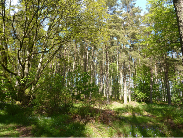
The use of wood for timber and fuel, and clearance for agriculture, meant that much of the native woodland was felled, leaving small pockets of woodland in less accessible areas, such as valley sides. During the 18th and 19th Centuries, landowners began a process of replanting woodlands, often for economic benefits. These plantations can still be seen in the landscape today, for example at Hazlehead Park, and are characterised by a diverse non-native species mix including sycamore, sweet chestnut and beech. Some woodlands were managed for coppice to provide wood for a variety of uses including charcoal production and the use of bark for tanning. The hazel and rowan woodlands at Den of Maidencraig Local Nature Reserve were managed as coppice woodland and in recent years, the practice has been reinstated. Predominantly, conifer plantations have been planted on higher ground relating to soil conditions where deciduous species would be less likely to thrive, such as Kirkhill forest on Tyrebagger Hill. Most of the hilltops and uplands around Aberdeen are characterised by such forestry, although there are some examples of moorland habitats and Ancient Woodland on higher ground too.
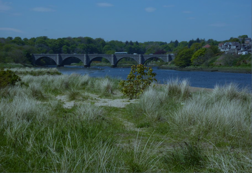
Approximately half of the Aberdeen Bay coastline comprises soft sand dune systems and beaches. The dune system extends inland to no more than 1km and in places has been altered by human intervention. The bay supports intertidal and subtidal habitats, including saltmarsh, sand spits and mud. The mouth of the River Dee is now a harbour and, as such, has limited habitat value due to the construction of features such as breakwaters and dredging to enable shipping. The River Dee is designated as a Special Area of Conservation. Despite the harbour development at the river mouth, the Dee provides a range of important tidal habitats, including sandflats and mudflats, fens, marshland, wet grassland, scrub and the estuary itself. The river supports three species of high conservation value: freshwater pearl mussels, otter and Atlantic salmon.
The mouth of the Don has not been subject to the same human influence and is designated as a local nature reserve. It is very dynamic in nature with a spit bar complex deflecting the channel to the north. It supports a range of species, including harbour seals and wading birds such as oystercatcher, redshank and sandwich tern.
Across the city, there are 45 Local Nature Conservation Sites (LNCS) with a diverse range of woodland, grassland and wetland habitats supporting important wildlife. For example, Corby Loch forms a local landscape feature centred on a large body of water surrounded by reed beds, floating mire and scrub woodland. The site has a rich insect fauna and is important for roosting wildfowl and breeding birds and is one of the best and least disturbed wetland sites in the area, with a particular value for educational purposes.
Along the Balnagask to Cove coast, there are coastal cliffs and caves, shingle beaches, coastal and neutral grassland, European dry heath and coastal heath with a range of nationally scarce coastal plants and associated insects. The rocks by the harbour have pools that provide mini salt-marsh habitats. The site also has a good variety of coastal birds including those that nest on the rocky cliffs. Whales, dolphins and porpoises can sometimes be seen out to sea.
Kinaldie Den Local Nature Conservation Site consists of damp broadleaved woodland with a mix of priority habitats and species such as red squirrel and hard shield fern, the latter being uncommon in the north east.
HUMAN INFLUENCES
Early Settlers
Archaeological excavation near Milltimber in advance of construction of the new Aberdeen Bypass recently recovered stone tools dating to the Upper Palaeolithic period between about 13,000 BC and 10,000BC. Scottish evidence from this time is very rare and major river valleys, like that of the Dee, may have been an important route for people moving through the post-glacial landscape.
In contrast, several sites have produced evidence for Mesolithic activity in the Aberdeen area. These include flint-working sites uncovered during the course of archaeological excavations at The Green, close to the mouth of the River Dee, and covered pits at Garthdee. The "hunter-gatherer" communities that created these would have exploited the natural resources of the rivers, coast and woodlands from around 8000BC to 4000BC, and may have contributed to clearance of parts of the natural vegetation cover. At Milltimber these groups dug pits and left them open, perhaps as part of a hunting strategy, and we should not underestimate the extent to which these early people understood and exploited the resources around them. However, in the Aberdeen area these early settlers have left very little visible trace in the landscape.
What we can begin to describe as agriculture began to be practiced from around 4000BC. While these Neolithic settlements are rarely visible, their occupants did leave burial cairns. There is an early long cairn at West Hatton, near Westhill.
Burial cairns continued to be built throughout the Neolithic and the succeeding Bronze Age (from around 2500BC to about 800BC) though their architecture, and the practices this reflects, changed. Several Bronze Age cairns are located in a linear arrangement, occupying a prominent position on the Tullos ridge to the south of the present City. The cairns at Tullos were clearly built to be seen and have important relationships with each other and the landscape around them. These relationships may have expressed a particular group’s claim to land and we can still experience and discuss what these relationships might have meant to the cairns’ builders today.
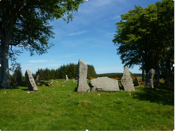
There are several other important Bronze Age sites around Aberdeen and these include a type of stone circle distinctive to the northeast – the recumbent stone circle. This particular type of circle has a flat, or recumbent, stone between two upright markers. They were normally built on sloping hillsides and are aligned with reference to the moon. These monuments had important relationships with the surrounding landscape that expressed the beliefs of the people who built and used them. There are examples at Standingstones and at Binghill. Both have been designated as Scheduled Monuments.
During the Bronze Age it is thought that a milder climate and increase in population resulted in an expansion of settlement into higher elevations. Towards the end of the Bronze Age the climate deteriorated and these settlements were abandoned. Because they are in marginal land many have avoided cultivation and can still be identified as low stone and earth banks or mounds in the landscape. A surprising number of these settlements survive as hut circles and so-called cairnfields, irregular areas cleared for cultivation, in the hills around Aberdeen.
Evidence from the Iron Age (from about 800BC to 500AD) is relatively scarce in and around Aberdeen. However, recently a small defended homestead dating to the 2nd Century AD has been identified on a terrace overlooking the River Don on the edge of Seaton Park. This monument is still visible as a mound known as Mote Hill. The homestead was clearly built with defence in mind and the occupants may well have controlled the lands around the river that it overlooked.
Around the time this homestead was lived in a Roman marching camp at Normandykes is thought to have been built. The camp is rectangular in shape and would have been surrounded by a ditch and bank, although earthworks of the perimeter only survive along the northern edge. Elsewhere, the perimeter is visible as cropmarks crossing arable fields. Excavations in the 1930s confirmed the Roman origins of the site and identified six defended gates around the perimeter. More recent small-scale excavations revealed evidence for hearths within the camp. Normandykes is one of a series of temporary marching camps established by the Emperor Severus in 208-9AD and his son Caracalla in 210AD. The temporary camps extend from the Antonine Wall to the Moray Firth, and are thought to result from punitive expeditions against the Scots following disruption in Northern Britain at the end of the 1st Century AD.
More recently, in advance of construction of the Aberdeen Bypass, a remarkable collection of Roman ovens, built into the side of a silted up watercourse, was excavated. These ovens were probably used to produce bread for a Roman military expedition in the late 1st Century AD. They were not within a fort or camp and may have been associated with one of Agricola’s expeditions into Scotland.
Pictish symbol stones which stand in the Kirkyard of the Chapel of St Fergus at Dyce are pointers to the communities which lived in the area in the 8th and 9th Centuries, about whom very little is known. One of the stones is decorated with a Christian cross which provides tangible evidence of the adoption of Christianity by the native population, to set alongside the dedications of various churches and chapels to Celtic saints and the tradition that St Machar, a disciple of Columba of Iona, was the first to introduce Christianity to this part of the North East.
Twelfth to Eighteenth Centuries
Old Aberdeen, close to the south bank of the Don, and New Aberdeen, occupying a cluster of small hills on the north bank of the Dee, were both in existence by the 12th Century. Their earlier origins are obscure.
It has been suggested that the dedication of the chapel at Fittie (Footdee) to St Clement, a saint revered by Danish sea-faring communities, may point to a small settlement in the mouth of the estuary founded by traders from across the North Sea in the 11th Century. The dedication of the parish church of Aberdeen to St Nicholas also speaks of the strong maritime influence which shaped and characterised the burgh of (New) Aberdeen which developed around the natural harbour at the mouth of the River Dee, and which was created a Royal Burgh in the reign of David I (1124 - 1153).
The River Don estuary was narrower than the Dee and constantly changed through the repeated deposition and erosion of silt and sand. As a result, it was not suitable for development as a harbour. In the 12th Century, a small religious centre grew up close to the River Don, focused on St Machar's Church, the cathedral of the Diocese of Aberdeen. This settlement - Old Aberdeen - was created a Free Burgh of Barony in 1489 and it functioned as a distinct and separate community from "New" Aberdeen in the south, having its own social, political, religious, economic and, most notably, educational infrastructure, until both towns merged in 1891. The University of Aberdeen which characterises much of Old Aberdeen, dates from the late 15th Century when Bishop Elphinstone established King’s College. It is Scotland’s third and the UK’s fifth oldest university.
With the advent of the oil boom in the mid 1970's, and the associated re-development of much of the city centre, the opportunity arose to excavate several sites within the bounds of the former medieval burgh. The information thus uncovered, carried out in tandem with documentary research, has revealed much about the growth and character of Aberdeen over several centuries: its trading links with a large hinterland, the sea-borne import and export trade to other Scottish burghs, England and across the North Sea upon which the economy depended, and the day-to-day decisions of the Burgh Council which ultimately influenced and dictated most aspects of life in the town.
By 1300 the street pattern of ‘New Aberdeen’, which survived unaltered until the late 18th Century, was well established. It was centred on the focus of the main roads leading to and from the harbour. Broad Street/Gallowgate formed the main route from Old Aberdeen and the north whilst Castle Street formed part of the road to the south and also served as the link between the castle (recorded in 1264, destroyed in the early 14th Century) at one end of the burgh and the parish church at the other. A number of other streets radiated out form this outline, among them Shore Brae, Futty Wind, Upper and Nether Kirkgate and Putachieside. The hummocky terrain that was the result of glacial deposition would have influenced the alignment of these routes. For example, the road linking Old and New Aberdeen was built on a north-south orientated ridge of morainic deposits.
Of major importance to the prosperity of the burgh were the watercourses which provided power for the town mills and water for the many small industrial activities which flourished in the town. The Loch, which lay to the immediate north-west of the burgh, provided much of the supply through its outlet the Mill Burn, while the Denburn and Puttachie Burn were of importance in the south-western sector of the town. Over time, the Loch dried out leaving the area of marshland that was recorded on the earliest map of Old and New Aberdeen, drawn in 1661. Marshland also precluded the early growth of settlements beside the link road between the two burghs where the leper hospital stood in isolation until the development of the Mounthooly and Spital areas in the late 18th Century.
Most of the buildings in the 12th – 14th Century burgh were constructed of timber which was weather- and water-proofed by the addition of daub, and thatched with heather, rushes or straw. Only St Nicholas Church (late 12th Century), the Tolbooth (14th Century, replaced 17th Century), and the Friaries (13th Century, destroyed 16th Century) were built of stone. Continual re-building of the relatively flimsy, fire-prone buildings occurred. This required a constant source of timber, and consequently the surrounding forest was gradually cut back. As the pressure of population increased, new houses were built with their gable ends to the street. The addition of extra stories was used as a means of accommodating more and more people in the same limited area, rather than expanding into the surrounding countryside to any significant extent.
By the 15th Century, a distinctive pattern of land-holding was well established with the long-riggs (or tenements) partitioned into foreland, inland and backland, with the houses of the wealthier burgesses and merchants situated on the street frontage and the homes of poorer, more self-sufficient Aberdonians on the backlands. Gradually, stone - usually granite - became the preferred building material for those who could afford it, giving rise to fine examples of 16th Century burgh architecture which survive in portions of Provost Skene's House (Guestrow) and Provost Ross's House (Shore Brae). Sandstone, quarried some distance away, was restricted to prestigious buildings or small intricate details and by the beginning of the 18th Century brick was making an appearance.
One of Aberdeen’s subtle but distinctive landscape features are the boundary stones (known as ‘March Stones’) which ring the city. There are two sets of March Stones: the inner set which mark the boundaries of the crofts which ringed the medieval Burgh of Aberdeen, and the outer set which define a larger area known as the ‘freedom lands’. These lands became the responsibility of the medieval (and later Royal) burgh of Aberdeen.
In 1313 Robert the Bruce granted Aberdeen custodianship of his Royal forest (hunting ground) of the Stocket. Between 1379 and 1680 the City Council also bought three other plots of land (Rubislaw, Cruives and Gilcomston) which became known as the ‘Freedom Lands’. In 1551, Aberdeen applied to Mary Queen of Scots for the right to let these lands, and they became privately managed. Many of the estates established at this time are still part of today’s landscape, including Countesswells, Forresterhill, Hazlehead and Kingswells.
In medieval times it was customary to ride around the boundaries (Marches) of the city in order to ensure that its boundaries were being observed, and that adjacent landowners had not encroached on City lands. To aid this process, a series of stones were placed around the boundaries. From 1790 the older stones were replaced with a series of lettered and numbered stones. They are inscribed “ABD” for Aberdeen, and a numeral from 1-65. They are still in situ, and Aberdeen City Council has produced a March Stones Trail leaflet. The March Stones are designated as Listed Buildings.
Due to the need for timber for construction as well as the need for farmland, the native forests around the town were gradually cut back, and from the twelfth century onwards much of the area was converted to pasture or open heath. Only two fragmented areas of woodland, at Stocket and Nigg, remained up to mediaeval times as royal hunting forests.
To the west and north of the burgh, the cleared croftlands provided a proportion of the grains and cereals milled at the town's mills and also some of the root crops consumed by the burgh's population. The area of cultivated fields continued right up to the edge of the town and small remnants of the medieval rig-and-furrow and some field boundaries have survived (for example around Broomfold and on the lower eastern slopes of Brimmond Hill. The cleared fields produced barley, oats, and root crops, or provided pasture for livestock. The fields are likely to have been farmed communally, with strips of land within each field allocated to individuals. Beyond this area were moors and marshes through which very poor roads passed. Moors, marshes, heaths and some woodlands would generally have been common land, where villagers would have had common rights (for example grazing animals, cutting peat, collecting wood for fuel, and gathering bracken for animal bedding). Fishing rights on the Dee and Don were highly prized and tended to be monopolised by the burgh oligarchy which passed them on from generation to generation. Similarly, the right to collect shellfish from the shores was restricted by the council.
Over several centuries, from the medieval period onwards, the communal fields were broken up and common land was enclosed, often in an ad hoc manner. They were gradually replaced by groups of fields with an associated farmhouse, owned by individual farmers. These ‘rectilinear fields and farms’ are shown on the Historic Landuse Assessment database (Historic Environment Scotland), and cover the majority of the rural land within the Study Area. They have a range of origins from small crofting parcels of land to ever-larger field systems resulting from agricultural improvement measures from the eighteenth century up to the present day. The fields are generally rectilinear in shape, but vary in size, orientation and regularity. They may be surrounded by stone walls, ditches, fences or very occasionally hedgerows.
Aberdeen acted as a market for the surrounding rural areas with produce sold and exchanged around the fish and flesh crosses in the Castlegate close to the Burgh Tolbooth. The hinterland also provided the raw materials for the export trade: wool, hides, skins, tallow and salmon made up the bulk of cargoes sent to ports in present day Belgium and the Netherlands. Manufactured goods and luxury items formed the main imports with wines, spices, clothing and precious metals reaching the burgh alongside the more mundane, but necessary, timber, grain, wax and iron.
Aberdeen today comprises an amalgamation of several once distinct and separate communities which developed around the periphery of the medieval burgh. The fishing village of Fittie (Footdee), the burgh of Torry, Ferryhill district and the weaving village of Gilcomston were only incorporated within Aberdeen in the last century. Traces of field systems outwith the bounds of the present urban area point to the presence of small farming communities which developed at some distance from the medieval town but which now form part of the modern conurbation, for example Bankhead, Bucksburn, Kingswells and Dyce.
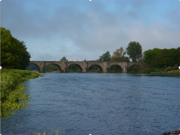
Effective interaction with a wider hinterland (which stretched beyond present day Inverurie to the north, and south to Montrose) assumes that a certain level of sophistication existed in terms of communication, transport, and travel networks in the late medieval period. Sea transport formed one of the quickest and most effective ways of moving goods and people from place to place although the existence of rough roads also connected Aberdeen to the inland burghs, for example Kintore, Inverurie and Huntly. The Category ‘A’ listed Bridge of Dee dates from 1527, at the northern end of the Causey Mounth, a drovers’ road between Aberdeen and Stonehaven. The Don Valley Canal was constructed at the start of the nineteenth Century to link the Inverurie / Port Elphinstone area to the northwest with the city, mainly for the marketing of agricultural produce. A section of the canal, though now drained, is preserved as a scheduled monument. With the Turnpike Road Act of 1795 a programme of widening and improving the existing road network in the County was instigated, linking Aberdeen with a country-wide system of highways.
In the first half of the 18th Century, a few notable classical buildings designed by UK pre-eminent architects were built in New Aberdeen. James Gibb’s West Church of St Nicholas (1751) category ‘A’ listed, occupies the site of its medieval predecessor, and William Adam’s Palladian hospital (1732) now the category ‘A’ listed ‘Auld Hoose’, the centrepiece of Robert Gordon’s College quadrangular school complex behind Aberdeen Art Gallery, on Schoolhill. The ‘Auld Hoose’ is Aberdeen’s most important Georgian building and first formally classical building in the city. It is also among the earliest uses of granite ashlar in Aberdeen.
Late 18th Century Onwards
A new Tolbooth with elaborate spire (now incorporated into the category ‘A’ listed massive 19th to 20th Century Town House and Municipal Buildings) was constructed at Castlegate in 1750. This marked a new era of major urban improvement, conceived in 1794 by the engineer Charles Abercrombie. In 1750 Aberdeen maintained its medieval street pattern tightly confined around the base of St Katherine’s Hill. From the late 18th Century several new streets were constructed which dramatically changed the appearance of the town. The first formally planned street was Marischal Street in 1767, a ramped viaduct lined with regular terraced houses, directly linking the market area of Castlegate to the harbour. It is the first ‘bridge street’ in Scotland to be built with flanking houses. It was also the precursor for Union Street, Market Street, and Rosemount Viaduct.
St Katherine's Hill, a major landmark, was flattened to aid the construction of the long, straight, gently rising Union Street in a westerly direction from Castlegate, carried over the now-culverted Denburn valley by the monumental Union Bridge (1805) which is category ‘B’ listed. To the North King Street (1803) provided new easy access from the Castlegate to the new Don Bridge (opened in 1830) and the laying out of George Street, St Nicholas Street and Rosemount Viaduct (also over the Denburn Valley) further opened up access to the city centre. These developments, together with the construction of Victoria Bridge (1881) over the River Dee, opened the way for the outward expansion of the town. Along the coastal strip the Links were flattened and reduced in size to make way for additional housing.
Union Street was the principal focus of expansion, lined with large terraced housing with ground floor shops, interspersed with public buildings, notably the category ‘A’ listed: Assembly Rooms/Music Hall (1820, 1858-9); Ionic columned corniced screen (1829) to St Nicholas kirkyard; the ‘B’ listed Advocates Hall (1836-7) and Trinity Hall (1844), ‘B’ listed, now part of a shopping centre (2006).
The first part of King Street was lined with an even richer collection of classical public and commercial buildings, including the category ‘A’ listed corner axial building, the former Clydesdale Bank, 5 Castle Street (1839), now the Archibald Simpson pub, with outstanding Corinthian-columned quadrant corner entrance portico, adjoining classical tenement 1-5 King Street (1839), and terminating on the west side with the landmark former North Church, 33 King Street (1830) now Aberdeen Arts Centre.
In both Union and King Streets, and connecting terraces, squares, and crescents, the renowned Aberdeen architects Archibald Simpson and John Smith established a refined Neo-classicism as the prevailing architectural style with predominant use of quarry-dressed to polished granite. This style was continued by subsequent pre-eminent architects, A. Marshall Mackenzie, such as the category ‘A’ listed Aberdeen Art Gallery complex including domed War Memorial and Cowdray Hall (1885 -1925), in distinctive polished grey granite ashlar with pink Corrennie quarried granite dressings, and the Gothic masterpiece Marischal College (1893 – 1906), Aberdeen’s largest and Europe’s second largest granite building . Its fine precision-cut dressed silver-grey granite is an outstanding example. Another example of significant work by A Marshall Mackenzie is the ‘B’ listed St Mark’s Church (1892), one of an important group of classical granite buildings in a prominent position on Rosemount Viaduct facing Union Terrace Gardens (1877-8), Aberdeen’s principal formal public space laid out to a design also by A. Marshall Mackenzie, including granite ornamental balustrades and arcades. The other buildings within the group are the ‘C’ listed Aberdeen Central Library (1891) Watt & Brown architects and the ‘A’ listed His Majesty’s Theatre (1904-6), Frank Matcham architect. The group is fondly titled ‘Education, Salvation, Damnation’. Aberdeen’s title as the ‘The Granite City’ emanates from this late 18th to 19th Century period of rapid development and its transformation from a medieval town.
Aberdeen harbour, which had proved adequate to cope with the demands of medieval shipping despite the constantly changing character of its shallow basin, was continually re-shaped throughout the 19th century. The North Pier was built in 1815, followed by the construction of Trinity, Waterloo and Regent Quays in 1829; the building of several wet docks; and the diversion of the channel of the River Dee to its present course immediately to the south of the harbour in 1874. From 1839 Aberdeen Clipper ships, operating out of the improved facilities, dominated the China Tea Trade. The harbour was protected by the building of a battery at Torry in response to the perceived threat of a French invasion in 1857. The remains of the battery survive as an important landmark and are a great vantage point for appreciating the critical importance of the harbour, as well as the relationships between the river valleys, the coast, the city and the hills surrounding it.
Aberdeen was also particularly attractive as a site for the new factory production of textiles and paper, given the presence of its two rivers which could be harnessed for water power. The Don, with a steep gradient between Dyce and the sea, was especially suited to such exploitation and a series of mills was built along its banks. The largest and most outstanding textile mill complex is the Category ‘A’ listed Broadford Works, Maberly Street, just north of the city centre. It ceased operating in 2003. Mostly 19th to 20th Century, the vast complex of mills and warehouses contained within a walled site, includes the Old Mill (1808) the oldest iron-framed mill in Scotland and one of the oldest in the world. The tall brick and concrete chimneys of Broadford Works are prominent landmarks across the city skyline.
Around the City, a number of estates, with their distinctive buildings, designed grounds and policy woodlands, influenced the character of the rural landscape, and continue to do so. The estate houses varied in size and grandeur, but were usually set in a parkland landscape of trees and grassland, often with avenues and other ornamental features. Away from the main house, the estates contained areas of managed woodland/ plantation, and farmland. Estate farms and cottages often have distinctive designs which contribute to the character and local distinctiveness of the rural landscape. Most of the large houses and some of the smaller estate buildings are now Listed Buildings. Their ornamental grounds are recorded as ‘designed landscape’ on the Historic Land-use Assessment.
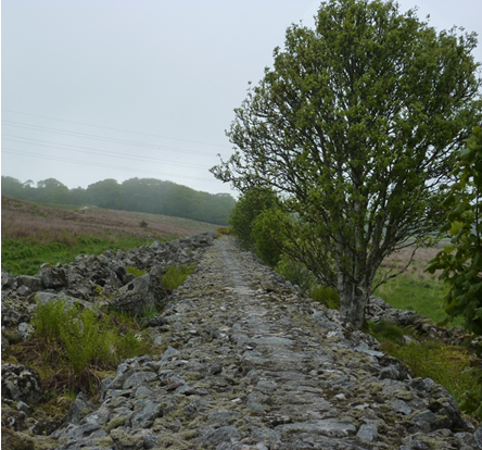
In the mid-19th Century, some of the stoniest land was cleared by landowners in a series of planned enclosures to create the 'planned rectilinear fields and farms' described in the Historic Landuse Assessment. The stones cleared from the fields were incorporated into field walls (often several metres wide) known as consumption dykes. These consumption dykes (named because of the way they consumed the stones from the fields) are a distinctive feature of the landscape around Aberdeen and are visible in several locations within the area. There are particularly good surviving examples of consumption dykes around Kingswells, with some designated as Scheduled Monuments.
In 1850 the railway reached Aberdeen with the first station built at Ferryhill, prior to the construction of the Ferryhill Viaduct which made it possible to re-locate the main station at Guild Street. This sparked additional housing and industrial development along the course of the Dee, with the Victoria Bridge opening in 1881. Soon Aberdeen was at the centre of a comprehensive rail network that radiated out in all directions from the city and provided links between small communities in the north and west of the city. More recently, the development of the airport at Dyce has widened links with other parts of the country while the only railway routes to have survived the cuts of the 1960's are those to Dundee and the south, and north-west to Inverness. There was rapid building and expansion of the city during the 20th Century, which required extension to its administrative boundaries. At the beginning of the twentieth Century, the administrative area of Aberdeen City was around 27 square kilometres in area; in 1950 it was 47 square kilometres; and in 1970 it was approximately 186 square kilometres. Today, the city area remains the same.
During the late 20th Century, the discovery of North Sea oil changed the city. The oil boom brought unprecedented wealth to the area and Aberdeen became known as the “Oil Capital of Europe”. Today, Aberdeen Harbour is one of the UK’s busiest ports. A world leading marine support centre, it is the principal port for the energy sector in Western Europe and serves a number of industries as the main commercial port in the North-East of Scotland.
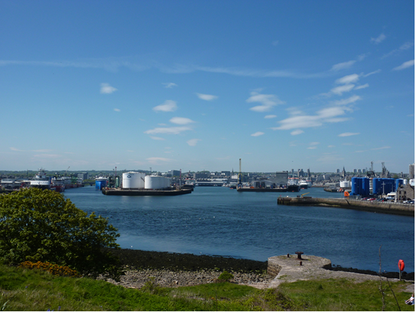
As a consequence of the sustained economic growth from the oil and gas boom, there has been significant demand in recent times for additional housing, land for business and industrial expansion, and other related infrastructure such as roads and port development.
Document downloads
Contact
If you have any comments, please email


