Habitats Regulations Appraisal (HRA) on the Moray Firth - A Guide for developers and regulators
Introduction
The purpose of this guide is to help developers and regulators meet the requirements of the Habitats Regulations in the Moray Firth area when first considering proposals. It does this by presenting the multiple protected areas present in the Moray Firth explaining the habitats regulations appraisal process. Then presenting information on qualifying interests explaining basic principles of ecology and the most important impact pathways while identifying key activities and associated pressures considered capable of affecting qualifying interests.
It considers the activities involved in carrying out projects in the Moray Firth that could affect the qualifying interests of associated European sites: We hope it will help in making decisions about projects, by introducing broad principles to consider including how to avoid or mitigate impacts on European sites before proposals become so defined that problem solving is expensive or difficult. Links to Naturescot guidance are provided throughout this document and these should be used when carrying out Habitats Regulation Assessment (HRA).
The Moray Firth area contains a number of European sites, including:
- Moray Firth SAC
- Dornoch Firth and Morrich More SAC
- River Moriston SAC
- Culbin Bar SAC
- River Oykel SAC
- River Evelix SAC
- Inner Moray Firth SPA
- Cromarty Firth SPA
- Dornoch Firth and Loch Fleet SPA
- Moray and Nairn Coast SPA
- Moray Firth SPA
Habitats Regulations Appraisal
Under the Habitats Regulations, decision makers (known as Competent and Relevant Authorities in the legislation) can only agree to development proposals, which are unconnected with the nature conservation management of the site, after having confirmed that they will not affect the integrity of the European sites. The process of coming to this judgement is commonly referred to as Habitats Regulations Appraisal (HRA). If this is not the case and there are no alternative solutions, the proposal can only be allowed to proceed if there are imperative reasons of over-riding public interest (IROPI)
Development in and around the Moray Firth often has potential to affect European qualifying interests and therefore requires HRA. The size and diversity of the European sites which could be affected by development on or around the Firth means that assessment of potential impacts can seem complex and daunting. This guide will make HRA simpler by presenting common themes and issues which can help to focus thinking when considering impacts. Recent EC guidance linked below has highlighted that many of the delays and problems encountered in HRA’s and Appropriate Assessments are caused by incomplete or deficient information gathering and provision, meaning Competent Authorities cannot confirm that there are no adverse effects on site integrity. The following are EU guidance on Article 6 (of the Habitats Directive) on the protection and management of European sites, and guidance for a range of sectors:
- Managing Natura 2000 sites, The provisions of Article 6 of the ‘Habitats’ Directive 92/43/EEC (EU 2019 )
- Guidance document on wind energy developments and EU nature legislation (EU 2021,)
This guidance document is intended to help with the collating of information to support HRAs in the area of the Moray Firth.
There are some key things to consider at the earliest opportunity.
- What is the development in its entirety?
- Could works, through activities and related pressures, involve impact pathways on the qualifying interests of European sites?
- If so, can works be modified in location, scale, nature or timing to avoid the impact pathway entirely?
To consider these issues, it is helpful to have a basic understanding of the qualifying habitats sensitivities and species’ ecological requirements and how they might be affected by development. By ecology we mean breeding, lifecycles, diet and habitat. We hope that the habitat and species accounts in this document will help provide useful information on the both the ecology and sensitivities of these qualifying interests.
Impact Pathways
With such a large site, there are many types of possible impact pathways which can occur, through human-related activities and their related pressures. For example:
- industry including harbours, offshore energy, oil rig repair and decommissioning sites, and their pressures including disturbance, displacement, collision, loss or damage to habitats and prey supporting habitats
- dredging and disposal and their pressures including damage of supporting habitat, smothering of prey supporting habitat, water clarity changes
- exploitation of natural resources and reclamation for industrial uses and their pressures including colonisation by non-native invasive species, habitat loss, and reductions in prey abundance
- leisure activities (onshore and offshore) and their pressures including disturbance, vehicle tracking and trampling
Climate change
Where we understand effects of climate change are likely to affect European site features, this must be borne in mind and considered when carrying out an HRA. The Scottish coast is exposed to climate change pressures due to effects of rising sea level, rising land and sea temperatures, increasing storms and waves, and rainfall changes on land affecting freshwater input and salinity in coastal areas These climate changes will place additional pressures on qualifying species and habitats on European sites in the Moray Firth. Coastal erosion is a naturally occurring process that affects much of Scotland’s coastline, but rising sea level and increasing storms will intensify erosion, in turn effecting greater pressures on, for example, qualifying coastal dune, saltmarsh and mudflat habitats. Sea-bird and marine mammal foraging success and behaviour could be affected by geographic shifts in the presence of prey fish species in Scottish waters. Impacts to supporting Intertidal habitats is already being seen due to rising land and sea temperatures.
See the latest Naturescot advice on climate change impacts on species and habitats; Impacts on the coast; Present and future sea-levels and also coastal adaptation guidance.
Ecosystem Services
The wider Moray Firth area (stretching from Duncansby Head in the north to Fraserburgh in the east) is the largest of Scotland’s Firths, occupying a large proportion of the coast of north-east Scotland. In addition to its marine waters the Moray Firth also includes a mosaic of coastal habitats and settlements that support a wide range of species. The qualifying features of the Moray Firth provide ecosystem services, which provide benefits for both people and nature. For example the sandbank sediments within the Moray Firth SAC provide provisioning services of shellfish, and regulating services of carbon storage, the Atlantic salt meadows and dune habitats within the Dornoch and Morrich More SAC provide maintaining services of storm protection and the bottlenose dolphins of the Moray Firth SAC provide cultural services through wildlife watching benefits and opportunities for connection with nature. For further information on Ecosystem Services, see the Conservation Management Advice documents (CMAs) for the Moray Firth protected areas.
Habitats Regulations Appraisal (HRA)
European Sites
European Sites encompass the network of Special Protection Areas and Special Areas of Conservation set up to conserve key natural habitats and species which are rare, endangered, or vulnerable. Following EU exit the network continues in the UK as the ‘National Site Network of European Sites’. Due to their international importance, European sites receive protection from development and other regulated activities (including general permitted development rights) in Scotland through both the Conservation (Natural Habitats, &c.) Regulations 1994, known as the ‘Habitats Regulations’ and policy. The European sites network is not, however, a series of strict nature reserves where all human activities are excluded; instead the emphasis is on ensuring that the management of European sites is sustainable while maintaining or securing the restoration of the conservation status of qualifying species and habitats.
The HRA procedure
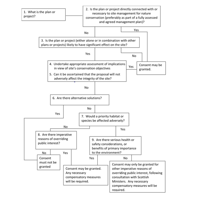
Habitats Regulations Appraisal is a precautionary and rigorous procedure required by the ‘Habitats Regulations’ when consenting a plan, project or proposal: e.g. under the Planning Acts. The HRA procedure must be applied to any plan or project that might affect the qualifying interests of any European site; this includes plans and projects outside a European site. It provides an opportunity to consider appropriate mitigation that can reduce impacts, avoid adverse effects and permit plans or projects to proceed having taken full account of the protected features of a European site. The HRA comprises a series of stages, and is explained in full in our Habitats Regulations Appraisal Guidance The HRA stages (1 - 6) look to assess 3 key tests:
- Is the plan or project directly connected with or necessary to site management for nature conservation
- Is the plan or project likely to have significant effect on the site
- Can it be ascertained that the proposal will not adversely affect the integrity of the site
How to Consider Plans and Projects that could affect European Sites (SPAs and SAC’s)
Click for a full description
From revised Circular 6/95 with amendments.
Q: Stage 1. What is the plan or project? Move to stage 2.
Q: Stage 2. Is the plan or project directly connected with or necessary to site management for nature conservation (preferably as part of a fully assessed and agreed management plan)?
If "Yes" process complete and consent may be granted. If "No" move to stage 3.
Q: Stage 3. Is the plan or project (either alone or in combination with other plans or projects) likely to have significant effect on the site?
If "No" process complete and consent may be granted. If "Yes" move to stage 4.
Stage 4. Undertake appropriate assessment of implications in view of site’s conservation objectives. Move to stage 5.
Q: Stage 5. Can it be ascertained that the proposal will not adversely affect the integrity of the site?
If "Yes" process complete and consent may be granted. If "No" move to stage 6.
Q: Stage 6. Are there alternative solutions?
If "Yes" consent must not be granted. If "No" move to stage 7.
Q: Stage 7. Would a priority habitat or species be affected adversely?
a. If "No" move to stage 8. Q: Stage 8. Are there imperative reasons of overriding public interest?
i. If "No" consent must not be granted.
ii. If "Yes" consent may be granted. Any necessary compensatory measures will be required.
b. If "Yes" to would a priority habitat or species would be adversely affected move to stage 9.
Q: Stage 9. Are there serious health or safety considerations, or benefits of primary importance to the environment?
i. If "Yes" consent may be granted. Any necessary compensatory measures will be required.
ii. If "No" consent may only be granted for other imperative reasons of overriding public interest, following consultation with Scottish Ministers. Any necessary compensatory measures will be required.
In stage 3 of the HRA process the Competent Authorities (i.e. the body responsible for consenting the proposal in question) are required to make a judgement if the plan or project is likely to have a significant effect (LSE) on a European site, either alone or in-combination with other plans and projects (Stage 3). The test for likely significant effect acts as a simple but very precautionary filter to exclude from further assessment, any plans or projects which are not capable of having a significant effect. To help clarify this the Waddenzee Judgement (para 45 p19/20) says there is a Likely Significant Effect, “…if it cannot be excluded, on the basis of objective information, that it will have a significant effect on that site”, and as such there is a high likelihood that many projects are likely to have significant effects which require further consideration. European case law states that mitigation cannot be considered at this stage, although we recognise that some measures that avoid a significant effect will be intrinsic to some projects. For more information see the handling of mitigation in Habitats Regulations Appraisal following the People over Wind CJEU judgement.
If the answer is yes, the plan or project is likely to have a significant effect on the site, they need to carry out an appropriate assessment (AA) of a plan or project, this is stage 4 . European guidance states that Competent Authorities must judge proposals on a case-by-case basis because it should be recognised that what may be significant in relation to one site may not be in relation to another.
In stage 5 of the HRA process the Competent Authority must come to a conclusion as to whether there are no adverse effects on the integrity of the European site. This conclusion must be reached in view of the conservation objectives of each of the sites’ qualifying features. The conservation objectives (COs) can be thought of as ecological yardsticks against which to assess the effects of proposals, and apply to each qualifying species or habitat of a European site. The CO’s can be found for each qualifying feature of a European Site on Sitelink On Sitelink qualifying feature conservation objectives are provided within Conservation and Management Advice (CMA) documents for marine SACs, Conservation Advice Packages (CAP) for coastal and river SAC’s, and Conservation Objectives/CMA documents for SPAs. The developer is usually expected to supply the information required for the Competent Authority to complete its HRA. The Competent Authority must consult NatureScot over their appropriate assessment and have regards to our comments. Further help and advice on HRA including links to useful guidance, court cases, legislation, and other websites can be found on the HRA page.
HRA in the Moray Firth area
The Moray Firth area contains a number of European sites, including:
- Moray Firth SAC
- Dornoch Firth and Morrich More SAC
- River Moriston SAC
- Culbin Bar SAC
- River Oykel SAC
- River Evelix SAC
- Inner Moray Firth SPA
- Cromarty Firth SPA
- Dornoch Firth and Loch Fleet SPA
- Moray and Nairn Coast SPA
- Moray Firth SPA
These sites all occur within the inner part of the Moray Firth (or have connectivity to it) or are within the wider area delineated by the Moray Firth SAC (i.e. waters and intertidal west of a line drawn from Helmsdale to Lossiemouth). There are a number of European sites out with this area which are not included within the scope of this report designated for mobile species such as fish and birds which may be found within or transit through the Firth. Whilst some sites are not included we hope that the principles and information provided in this report will be useful for considering development in the Moray Firth as a whole.
The information required
The breadth, content, and level of information required for an HRA depends upon the individual circumstances of each case. There can be a perception that the HRA process is complicated; however the level of detail should reflect the complexity of the case and be sufficient to allow the Competent Authority to determine, beyond reasonable scientific doubt, that there are no adverse effects on site integrity. This could include mitigation within plans and proposals with the aim to reduce the level of impacts on European sites. A HRA need not therefore be a difficult or lengthy process when the issues involved are straightforward. It is usually the proposer of the plan or project who must supply the relevant information to the Competent Authority to carry out the HRA.
Determining that there are no adverse effects on site integrity
At stage 5 of the HRA, for a plan or project to be consented, the appropriate assessment must ascertain that the plan or project will not adversely affect the integrity of a European site. It is important to remember that the test is whether the plan or project will not adversely affect the integrity of a European site, not whether it will. Conclusions must be made on the basis of there being no reasonable scientific doubt as to the absence of adverse effects. Each case will be judged on its own merits.
The integrity of the European site only applies to the qualifying interests and is directly linked to the Conservation Objectives for each feature. Depending on the ‘condition status’ of a feature, that is whether the condition status is favourable or unfavourable, this will have a bearing on that feature’s Conservation Objectives. If a plan or project does not undermine the conservation objectives, then the integrity of the site should be maintained or, where relevant, have the ability to be restored. Conversely, if any of the conservation objectives could be undermined (or not met), or if there was uncertainty, it would not normally be possible to ascertain that the integrity of the site would not be adversely affected.
If it can be concluded that the proposal will not adversely affect the integrity of a European site, permission may be granted. If not, or there is uncertainty, permission must be refused (subject to exceptions - see HRA guidance stages 6-9 ). A competent authority may add legally enforceable conditions to a consent to ensure no adverse effect on the integrity of a European site.
Exceptional Circumstances
Stages 6-9 are only considered in exceptional circumstances where it cannot be ascertained that the plan or project will not adversely affect the integrity of a European site , These exceptions are set out in regulation 49 of the Habitats Regulations. The regulation provides some scope to approve a plan or project even when it cannot be ascertained that there is no adverse effect on European site integrity. For a proposal to proceed there must be no alternative solutions and there must also be imperative reasons of overriding public interest (IROPI). It needs to be considered whether a priority habitat or species would be adversely affected, see full list of SAC priority habitats, (there are no priority species in Scotland’s SACs). This decision requires notification to Scottish Ministers.
Potential Pathways of Impact
Here are examples of common ways in which a proposal can have an effect and exert pressures on the qualifying interests in the SAC’s and SPA’s associated with the Moray Firth. Thinking about the ecological principles that result in these impact pathways may also be useful when considering solutions. A discussion is provided in the next section – we have not tried to discuss every issue but rather we aim to deal with some of the most common principles. The discussion largely focuses on birds but the principles discussed also apply to other qualifying interests.
Pressure examples
- Permanent or temporary habitat loss/deterioration
- Disturbance and/or displacement (e.g. noise and visual)
- Introduction of lighting or shading
- Underwater noise and vibration impacts from piling and construction, and traffic movements (including shipping) during construction
- Reduced water quality (including increased suspended solids, reduced dissolved oxygen and release of contaminants) from deposition of polluting materials and dredging
- Changes to coastal processes, e.g. hydrology and sedimentation
- Introduction or spread of Invasive non-native species
- Barrier to species movement and collision risk
In many cases the pressures exerted by activities do not work independently and the way they interact needs to be considered. For example land-claim and dredging may lead to changes in coastal processes, sediment deposition and water flows. Some may be temporary. Other activities may present a risk pathway to European interests throughout the life of a development from construction onward, such as the risk of introducing invasive non-native species (INNS).
Planning and development guidance on minimising impacts on habitats and species is available on the NatureScot website pages: Planning and development advice and Marine planning in Scotland. Also see FeAST a web-based application which allows users to investigate the sensitivity of marine features to pressures arising from human activities.
The table below identifies generic pressures and mitigation measures for some of the commonly occurring potential activities which could exert pressures on the qualifying interests in the SACs and SPAs associated with the Moray Firth. The mitigation suggested may not be applicable in all cases, but will provide a starting point for consideration.
| Impact Pathways | Potential Generic Mitigation |
|---|---|
| Damage to intertidal habitat through run-off or pollution. |
|
| Direct loss of intertidal and subtidal habitats within the European site and supporting qualifying interests. |
|
| Abrasion and siltation effects on subtidal habitats |
|
| Indirect loss of intertidal habitat within the European site and supporting qualifying interests (for example as a consequence of changed coastal processes). |
|
| Temporary (construction) disturbance. |
|
| Permanent disturbance e.g. from lighting, noise, human activity, etc. on development sites adjacent to areas of use by qualifying species. |
|
| Permanent disturbance from recreational activity in the intertidal area, i.e. people walking on the beach. |
|
| Temporary (construction) disturbance/damage to intertidal habitat. |
|
| Collision risk / barriers to flight lines (from wind turbines or tall buildings on or very close to the intertidal area) or migratory passage through water for fish and marine mammals. |
|
| Loss of feeding or roosting sites for birds associated with the SPA and on greenfield sites outwith the SPA, e.g. agricultural land, parks, sports fields, etc. |
|
Ecological Principles
Habitats and physical processes
Animals require energy to survive and to breed which they obtain from their food. Different species are adapted to feed on different resources and therefore favour different habitats. Even within the same habitat, different species may exploit different food resources. For example, through variation in bill length and shape, birds are adapted to feed on different prey species. Many waders and other long-billed birds such as curlew have touch-sensitive bill tips and typically forage by touch or a combination of sight and touch, whereas the short-billed plovers forage mainly by sight.
Minor changes to processes such as sediment deposition, water flows, availability of food resources and predator/prey relationships constantly occur. Their impact can be extremely complicated and, in some cases, small incremental changes may lead to a substantial overall effect. Minor changes to the environment therefore need to be assessed carefully when considering factors that could cause declines in bird numbers.
There are a number of characteristics of estuarine habitats that are critical for birds; the following are especially important either for their own survival or for their preferred food source:
- Tidal flows, water depths and the extent of the intertidal area
- Sediment particle size and the substrate character of the intertidal area
- Nutrient levels
- Salinity
- Low disturbance levels and requiring the area around them to be mainly open and visible
- Light
Sediment transport
Estuarine habitats are strongly influenced by sediment transport processes, a supporting benefit of their ecosystem services Sediment particle size varies throughout an estuary, determined by topography, currents, tides and weather and these aspects create different substrates from coarse sand through to fine muds. Whether a substrate is rocky, shingle, sand or mud is a key determinant of which animals and food-plants are abundant in which parts of an estuary, and hence the food available to the various species of estuarine bird. This variability of habitat in and around the Moray Firth is key and also influences the abundance of prey items in the water column for seabirds and marine mammals.
Tidal Cycle
In the estuarine environment, the tidal cycle influences habitat availability and has a strong effect on bird behaviour. This is compounded by limited daylight hours in winter. Estuarine birds may therefore need to feed at night. Tactile feeders are adapted better for this than visual feeders (e.g. plovers) though the latter often have large eyes which enable them to feed in low light conditions, at least on moonlit nights. Movement of fish species and their associated marine mammal predators are also influenced by the tidal cycle in terms of daily movements and migration.
Intertidal habitats are important for purposes other than foraging. At high tide when coastal areas and their associated food resources are unavailable to waders and wildfowl, these species often move to a safe place where they roost and wait for the tide to turn. Some birds may seek alternative feeding sites such as coastal fields or lagoons adjacent to the estuary. Birds, especially when migrating or over-wintering, must conserve their resources and minimise unnecessary and wasteful energy expenditure. Consequently, roosting sites need to be undisturbed, by predators and human activity. Roost sites may comprise natural habitats, for example a saltmarsh or an island or mudflat, or man-made sites such as concrete islands and jetties.
Species migration
Many species use different habitats in different seasons or at different stages of their life. This is particularly pronounced for fish species such as lamprey and salmon where different stages of the life cycle move between the sea and freshwater. It is also true of many bird species that migrate between breeding and non-breeding areas. For some species, including oystercatcher, curlew and redshank a proportion of birds do remain within the UK, but many of them move inland to breed and only small numbers breed within the Moray Firth and its immediate vicinity.
Human pressures effecting changes to the environment
Pressures resulting from land-claim and physical change to the intertidal
Land-claim (also referred to as “reclamation’) involves converting marine or intertidal habitat to dry land, often by constructing a barrier such as a seawall to prevent the tide from reaching that area. Historically, parts of the Moray Firth have been claimed and converted for use as industrial sites (e.g. the Longman Industrial site, Inverness and the former oil rig fabrication yards at Nigg and Ardersier). In addition there have been longer term and progressive loss of habitats for agriculture, harbours and other industrial development.
The most obvious land-claim pressure on birds is the loss of natural marine and intertidal habitats. However, these changes are not always entirely negative and can lead to some ecosystem benefits. In time, some of the areas claimed from the estuary develop into different habitats, some of which become valued as wildlife habitats and local nature reserves in their own right (e.g. the Nigg Bay managed re-alignment scheme and the Musselburgh lagoons are an example in the Firth of Forth ). Though even where development has minimal or no physical impact on intertidal habitat, birds may still be affected, through introduced disturbance pressures for example. In addition, some developments adjacent to the estuary may not directly affect estuarine habitats but result in loss of inland habitat used by estuarine birds e.g. feeding areas for pink-footed geese, wigeon, lapwing, golden plover, curlew and roost sites for a variety of species.
Birds and mammals that previously used claimed areas must find new habitat. Their ability to do so will depend on whether alternative areas have capacity to support a greater population. A study of birds displaced by the construction of Cardiff Bay barrage highlighted that displaced birds will not necessarily be able to find suitable alternative long-term habitat elsewhere. The barrage caused the displacement of almost all of the shelduck, oystercatcher, curlew and redshank that had previously used the area. Some displaced shelduck, oystercatcher and curlew moved initially to nearby sites. However, the increases at these sites were not sustained in subsequent winters. Earlier studies had demonstrated that redshank were largely faithful to the bay. Continued studies confirmed that the displaced birds moved to nearby sites where they joined other redshank already present. The study demonstrated that the displaced birds were significantly lighter than those which had previously been using the site, and suffered significantly higher winter mortality.
Land-claim may also have indirect effects. Altered topography may cause changes to currents and tidal flows, affecting sediment deposition and erosion and potentially affecting the extent and type of intertidal habitat available. Such effects may extend well beyond the immediate vicinity of the development. For example, the creation of jetties may cause additional accretion to occur one side of the jetty and reduced accretion or scour on the other. Land-claim also has the potential to create narrower estuaries and ‘coastal squeeze’, making habitats more vulnerable to future sea-level rise.
Land-claim and development projects may often be small but the cumulative effect of many small-scale developments causing minor loss of habitat may be significant.
Dredging and disposal pressures
The act of dredging has consequences beyond the area dredged and the immediately adjacent seabed. It alters the sediment equilibrium leading to redistribution over a much wider area. Many living organisms are removed and habitats for others are destroyed or redistributed.
Maintenance dredging is an ongoing process and there may be insufficient time for ‘recovery’. Therefore changes in sediment structure and invertebrate communities may be more permanent and the bird assemblages associated with such continuously dredged areas could potentially achieve a new stable equilibrium. Capital dredging is likely to have a greater impact on established use of an area by birds.
Dredging may also increase the levels of metals and organic pollutants in the estuary, by releasing contaminants that have been trapped within the sediments. In some cases, it has also been suggested that nutrients have also been released during dredging operations.
Dredging can also change the level of mudflats and sandflats so that less area is exposed at certain states of the tide, reducing areas available for foraging birds.
The impact of dredging can differ markedly between sites and therefore potential changes to the water and sediment flows of an estuary should be carefully assessed and tested through models specific to that site. Modelling is most often carried out at the project stage. Strategic planning should therefore consider whether dredging associated with proposals is possible in principle, and should ensure adequate policy safeguards are in place in addition to ensure no adverse effect on site integrity.
Disturbance and displacement pressures and ecological consequences
Types of disturbance and displacement
Disturbance is defined as ‘the result of direct or indirect interaction with people that changes the behaviour of any animal or changes the environment, which in turn affects the well-being or survival of an animal in the short, medium or long-term. Disturbance can occur naturally, for example when predators approach potential prey. However, this section focuses on anthropogenic disturbance pressures. The effects of disturbance depend on magnitude, frequency, predictability, extent and duration. Nature can also experience ‘displacement’ effects without ‘audible disturbance’. For example, due to the sustained presence of new objects and/or infrastructure which denies or limits the use of an area by particular species. Whilst it is clear and obvious that species may be disturbed to some extent by human activity, it is more difficult to assess the actual impact that disturbance, and displacement, may have on individuals or at a site or population level. Feeding and resting activity of birds and mammals may be disturbed by both the presence of people or noise associated with particular activities. Sound may travel long distances in air and underwater depending on the local topography and hydrography.
Activities causing disturbance and displacement pressures include:
Construction work
Construction work on or adjacent to an estuary may cause noise and visual disturbance. Major construction work can reduce densities, or exclude birds and marine mammals from favoured areas, both during the construction phase and sometimes after construction. Otters can be susceptible to vehicle collision. Most collisions occur within 100m of watercourses, especially when river levels are high and otters are reluctant or unable to swim under bridges or through culverts due to strong currents or blockages.
Noise
Birds and mammals often respond to loud noise by flying or moving away but few studies have looked at the effect of noise on feeding and resting. Most studies have found that irregular and/or louder noises cause more disturbance than more predictable and/or quieter noises. Depending on level and frequency, underwater noise can disturb marine mammals or mask their ability to communicate or find prey.
Artificial lighting
Artificial lighting has been found to affect the movements of migratory birds by attracting them, sometimes causing mortality, it can also make birds more vulnerable to predation. However, artificial lighting can make it easier for visual feeders to find and capture prey
Aircraft
Aircraft may have particularly strong effects on waterfowl, but as with other influences this depends on volume, height, frequency of flights and other factors.
Walking and dog-walking
Walking (including bird-watching) and dog-walking are among the most common and widespread activities carried out on British estuaries. Individual instances of disturbance from these activities may be relatively minor, but cumulatively the effects may be considerable. For example a stretch of shore used by many people for recreation may become unusable for birds or otters.
Water-based recreation
Water-based recreational activities include sailing, fishing, water-skiing, jet-skis, motorboats, kayaking and windsurfing, paddle boarding.
Disturbance whilst foraging
The impact of disturbance to feeding animals depends on the effects of disturbance on energy intake and expenditure. This will be determined by:
- how much foraging time is lost
- how much extra energy expenditure occurs because of disturbance, and
- whether individuals can compensate for energy spent
Animals may be able to compensate by a variety of means:
- using alternative habitat, if available
- increasing food intake rates when they resume feeding and/or
- extending the length of time that they feed
Minor levels of disturbance may therefore have little long-term effect. However, the ability to compensate may be limited. Wading birds can feed on mudflats only during low tide when they are uncovered, and different areas will vary in their foraging quality. Disturbance becomes more important in cold weather when birds need to feed for longer to meet their energy requirements. Some species need to feed for longer than others and will therefore be more susceptible to disturbance during cold weather. Sustained or repeated disturbance may result in an area becoming unusable and effectively the long-term loss of an area for feeding. Such disturbance could lead to a reduction in the number of birds that a site can support, known as the 'carrying capacity' of a site.
Disturbance at roosting and resting sites
Birds
Disturbing activities can occur at or close to the high-tide mark, where roosting birds are often more vulnerable to disturbance pressures, as they gather in large flocks. Foraging birds are generally spread out over a wide area of mudflat, and often further away from most human activities. Many subtidal species, such as the seaducks, roost during the night, irrespective of tidal cycles. Some seaducks may also have ‘retreat zones’ which they may use if they are disturbed. Therefore, considering which species are susceptible to disturbance, for any given proposal, will be important, and may have a bearing on potential impacts.
Seals
Seals (grey and common) are vulnerable to disturbance and displacement at their haul out sites. People getting too close, especially with dogs are a particular problem. Seals are especially vulnerable to disturbance during the breeding season and, during their moult.
Mothers recognise their pups from their calls and smell. The bond formation between mother and pup can be interrupted by excessive or persistent disturbance, particularly during the first few days after birth. If a mother fails to recognise her pup and abandons it, the pup is likely to starve and die. Females pupping for their first time are often more susceptible to disturbance. During their moult, seals prefer to spend longer out of the water than at other times of the year. This is because they are growing new hair. At this time their peripheral blood supply is open, providing the cells that make the new hair with the necessary nutrients. If they are forced to enter the water the blood system closes down and they have to restart this system when they next haul out. This is a drain on their energy reserves.
Otters
Otters are vulnerable to disturbance at their breeding or resting sites. Otter have been recorded breeding in every month of the year and it is therefore difficult to avoid potential impacts through careful timing of work, as is the case with breeding birds. Consequently other mitigation measures such as exclusion zones during critical periods may be required.
Bottlenose Dolphin
It is difficult to determine specific resting or breeding sites for dolphin, but we do know that certain areas are particularly important for them. In the Moray Firth this includes the Sutors, Chanonry Point, the Kessock Channel and Spey Bay in particular, although they do occur across the entire SAC, usually with 10km of the shore.
Sensitivity and habituation
The impact of disturbance may be lower if it occurs regularly and is predictable e.g. walkers staying on footpaths or marine vessels maintaining constant speed and direction. In such cases, birds may show habituation to disturbance and allow a closer approach than birds which are not habituated. This does not mean that it is safe to assume that birds will habituate to any disturbance; the level of habituation varies from one activity to another and certain species are more able to habituate than others. Similarly, marine mammals may habituate to low and predictable levels of disturbance in areas that are not crucial for important life stages such as resting, feeding, breeding etc.
Measures to prevent disturbance to birds in late winter may be particularly important as this is when many species are likely to be most sensitive to disturbance and less able to tolerate and recover from the effects of disturbance; declining temperatures and food quality combine to make survival more difficult in late winter. This is especially true during periods of severe weather, when birds may be at risk of starvation even without the added pressure of disturbance. A formal statutory process and set of criteria already exists in the UK to suspend shooting of wildfowl on the foreshore in severe weather.
Accounts for Qualifying Interests
Habitats
Atlantic salt meadows
Relevant SAC(s) and Area Extent of Feature:
- Dornoch Firth and Morrich More SAC (530.77ha)
Sitelink provides feature condition assessment details, with feature conservation objectives provided in either a Conservation Advice Package (CAP), Conservation and Management Advice (CMA) or generic Conservation Objectives
General Feature Description
Atlantic salt meadows develop when salt-tolerant vegetation colonises soft intertidal mud and sand in areas protected from strong wave action. This vegetation forms the middle and upper reaches of saltmarshes, where tidal inundation still occurs but with decreasing frequency and duration. Saltmarshes can cover large areas and the communities it supports vary with climate and the frequency and duration of tidal inundation.
Grazing by domestic livestock is particularly significant in determining the habitat’s structure and species composition which can influence its relative value for plants, invertebrates and wintering or breeding waterfowl. For instance, grazing can affect sward height which in turn can affect the saltmarshes ability to intercept and retain sediment.
Feature Description in the Context of Relevant SACs
Dornoch Firth and Morrich More is the most northerly site selected for Atlantic salt meadows and represents this habitat type in the northern part of its UK range. The site supports a wide variety of community types, with the characteristic zonation of saltmarsh vegetation. At Morrich More the saltmarshes lie adjacent to sand dunes and there are important transitions between these habitats.
Pressures:
- Dornoch Firth and Morrich More – grazing, agricultural activities (including vehicular access).
Coastal dune heathland
Relevant SAC(s) and Area Extent of Feature:
- Dornoch Firth and Morrich More SAC (356.75ha)
Sitelink provides feature condition assessment details, with feature conservation objectives provided in either a Conservation Advice Package (CAP), Conservation and Management Advice (CMA) or generic Conservation Objectives.
General Feature Description
Coastal dune heathland occurs on mature, stable dunes towards the landward end of the dune system and represents the latter stages in the succession of sand dune habitats.
Though similar in composition to Lime-deficient dune heathland with crowberry (see below) this habitat is more widespread, tolerating drier and warmer conditions. The main species present vary considerably throughout the UK but the most characteristic community is dune heath in which ling heather (Calluna vulgaris) is found in combination with sand sedge (Carex arenaria).
Feature Description in the Context of Relevant SACs
Dornoch Firth and Morrich More represents the only site in north-east Scotland to be selected for its coastal dune heathland. At this site, dune vegetation has developed on a coastline that has been generally rising relative to sea level in the 7,000 years since the last glaciation. A combination of leaching, stabilisation and the decreased influence of saltwater has produced a sequence of dry, stable dune ridges, interspersed with wet dune hollows. The coastal dune heathland vegetation covers a large area on this site and forms part of a complex mosaic of fixed dune vegetation types, including other types of heathland together with saltmarsh and transitional communities. This is the most important acidic dune site in Scotland, owing to its size and the exceptional diversity of habitats within it. Despite some localised industrial development, structure and function are well-conserved at this site and accretion is continuing.
Pressures:
- Dornoch Firth and Morrich More - Agricultural activities, statutory undertaker development.
Lime-deficient dune heathland with crowberry (Empetrum nigrum)
Relevant SAC(s) and Area Extent of Feature:
- Dornoch Firth and Morrich More SAC (60.91ha)
Sitelink provides feature condition assessment details, with feature conservation objectives provided in either a Conservation Advice Package (CAP), Conservation and Management Advice (CMA) or generic Conservation Objectives
General Feature Description
Like Coastal dune heathland (above) lime-deficient dune heathland with crowberry also occurs on mature, stable dunes and represents the latter stages in the succession of sand dune habitats. This habitat develops in areas with increased soil acidity; conditions which are favoured by ling heather and crowberry.
This type of heathland habitat tends to occur in mosaics with other dune habitats, depending on local physical and soil conditions (e.g. dune heath, dune slacks and acidic grasslands).
Grazing helps to maintain the open nature of the vegetation, this would otherwise develop into scrub and woodland through the process of succession. However, it is vulnerable to overgrazing, and planting of trees can lower the water table, which in turn will suppress open dune heath vegetation.
Similar in composition to Coastal dune heathland this habitat has a more restricted distribution in Scotland in relatively wetter and more base-poor conditions. At some sites it is very difficult to allocate stands of different dune heath habitat as the vegetation forms a continuous spectrum of variation within complex habitat mosaics. The two types may also succeed one another in the same location over time.
Feature Description in the Context of Relevant SACs
Dornoch Firth and Morrich More SAC represents one of just two sites which are designated for this habitat type in the UK. Here, the dune vegetation has developed on a coastline that has been generally rising relative to sea level in the 7,000 years since the last glaciation. A combination of leaching, stabilisation and the decreased influence of salt water has produced a sequence of dry, stable dune ridges, interspersed with wet dune hollows.
A large area of this habitat type occurs on site as a mosaic with other fixed dune vegetation types, principally coastal dune heathland (see above). Within this complex of habitats there are examples of dune, saltmarsh and transitional communities that include large populations of several northern dune species, such as Baltic rush (Juncus balticus).
This is the most important acidic dune site in Scotland because of its size and the exceptional diversity of habitats within it. Despite some localised industrial development, structure and function are well-conserved at this site and accretion is continuing.
Pressures:
- Dornoch Firth and Morrich More - Agricultural activities, statutory undertaker development.
Embryonic shifting dunes
Relevant SAC(s) and Area Extent of Feature:
- Dornoch Firth and Morrich More SAC (52.21ha)
- Sitelink provides feature condition assessment details, with feature conservation objectives provided in either a Conservation Advice Package (CAP), Conservation and Management Advice
General Feature Description
Embryonic shifting dunes represent the newest part of sand dune systems and form closest to the sea at the dune/beach interface. They develop where windblown sand settles and accumulates to form sand mounds and ultimately, over time sand dunes. However, they are highly dynamic and unstable and can be modified by high winds or wave action particularly during storm conditions.
Embryonic dunes represent the first zone where vegetation can colonise, above the sea although the typical plant community is species-poor being limited to salt-tolerant species such as sea rocket (Cakile maritima) and the sand-binding grasses lyme-grass (Leymus arenarius) and sand couch (Elytrigia juncea).
This pioneer habitat type rarely occurs in isolation because of its position in the succession of dune systems and is typically succeeded by marram further up the dune system which distinguishes embryonic shifting dunes from the shifting dunes with marram habitat (see below).
Feature Description in the Context of Relevant SACs
Dornoch Firth and Morrich More is one of three sites representing embryonic shifting dunes on the east coast of Scotland and is the most northerly example of the habitat type with well-marked lyme-grass (Leymus arenarius) dominated areas. The process of continued progradation is central to the conservation of this habitat type at this site, which has the largest, most complete area of sand dune in the UK, in part owing to the exceptionally high rate of progradation.
This habitat type rarely occurs in isolation because it‘s position in the success of dune systems and is typically found in association with other dune habitats.
Pressures:
- Dornoch Firth and Morrich More – Recreation/disturbance.
Shifting dunes with marram
Relevant SAC(s) and Area Extent of Feature:
- Dornoch Firth and Morrich More SAC (26.1ha)
Sitelink provides feature condition assessment details, with feature conservation objectives provided in either a Conservation Advice Package (CAP), Conservation and Management Advice (CMA) or generic Conservation Objectives
General Feature Description
Shifting dunes with marram is a transitional habitat which occurs between embryonic shifting dunes (above) and older, more stable fixed dune habitats and is represented by the predominance of sand-binding marram.
Like embryonic shifting dunes, this habitat type also rarely occurs in isolation because of its position in the succession of dune systems and is typically succeeded by marram further up the dune system and is typically succeeded inland by other dune habitats (e.g. dune grassland (above)).
There is also geographical variation in the floristic composition of the habitat type.
Feature Description in the Context of Relevant SACs
The large dune system of Dornoch Firth and Morrich More is physically diverse, with areas of active accretion, marine erosion and internal instability as well as well-formed parabolic dunes. All of these formations provide opportunities for shifting dunes with marram to develop. As a result this habitat type is relatively extensive within the site. The vegetation is representative of northern mobile dune vegetation, with lyme-grass prominent in some stands. The site is largely undisturbed, resulting in a natural habitat structure.
Pressures:
- Dornoch Firth and Morrich More –Recreation/disturbance.
Dune grassland
Relevant SAC(s) and Area Extent of Feature:
- Dornoch Firth and Morrich More SAC (287.14ha)
Sitelink provides feature condition assessment details, with feature conservation objectives provided in either a Conservation Advice Package (CAP), Conservation and Management Advice (CMA) or generic Conservation Objectives
General Feature Description
Dune grassland occurs on mature, stable areas inland of the dune zone which is dominated by marram grass (Ammophila arenaria). It is formed as the sand is stabilized and the organic content increases.
It is a complex habitat type and the herbaceous vegetation it supports exhibits considerable variation across the UK.
Feature Description in the Context of Relevant SACs
The extensive dune grassland system of Dornoch Firth and Morrich More consists of a low dune plain which is still active. The dune system consists of a series of ridges with heath and juniper scrub on the older ridges which grade into the fixed dune vegetation of maritime grassland in the mid and outer parts.
Pressures:
- Dornoch Firth and Morrich More - Agricultural activities, reacreation/disturbance.
Dunes with juniper (Juniperus communis) thicket
Relevant SAC(s) and Area Extent of Feature:
- Dornoch Firth and Morrich More SAC (17.4ha)
Sitelink provides feature condition assessment details, with feature conservation objectives provided in either a Conservation Advice Package (CAP), Conservation and Management Advice (CMA) or generic Conservation Objectives
General Feature Description
This habitat type comprises common juniper scrub on coastal sand dunes and occurs within the inland zone of dune systems, away from the shore. Stands are usually very small and are intimately mixed with other Annex I habitat types, including dune grassland and heath. In the UK, dunes with juniper only occur in Scotland.
Feature Description in the Context of Relevant SACs
Morrich More is the most important site in the UK for juniper stands on dunes. Stands of juniper cover approximately 10 ha, with scattered individuals over a larger area. The juniper is extremely well-developed on the dry ridges and transitions to dune slacks. The best stands occur in grasslands in the southern sector, but prostrate individuals also extend into wet heath and slack habitats within the site.

Juniper berries.
Pressures:
- Dornoch Firth and Morrich More - Recreation/disturbance.
Humid dune slacks
Relevant SAC(s) and Area Extent of Feature:
General Feature Description
Dune slacks are low-lying areas within dune systems that are seasonally flooded and where nutrient levels are low.
True dune slacks are fed mainly by rain water and are characterised by a pattern of pronounced annual fluctuation of the water table. Variations in the extent and duration of flooding of the dune surface as well as the physical, environmental and chemical conditions associated with the dune system are very important in determining the vegetation communities which exist there.
Feature Description in the Context of Relevant SACs
Morrich More is one of the largest acidic dune sites in the UK. The sequence of development has resulted in the formation of extensive humid slack communities of an acidic character which lie as parallel hollows between the dune ridges and form part of a complex mosaic of dune habitats, several of which have been proposed as Annex I habitat types in their own right. This is the most important acidic dune system in Scotland, owing to its size and the exceptional diversity of the habitats within it.
Pressures:
- Dornich Firth and Morrich More - Forestry operations, development.
Coastal Shingle Vegetation outside the reach of waves
Relevant SAC(s) and Area Extent of Feature:
- Culbin Bar SAC (116.2ha)
Sitelink provides feature condition assessment details, with feature conservation objectives provided in either a Conservation Advice Package (CAP), Conservation and Management Advice (CMA) or generic Conservation Objectives
General Feature Description
Shingle structures develop when a sequence of foreshore beaches is deposited at the limit of high tide. More permanent ridges are formed as storm waves throw pebbles high up on the beach, from where the backwash cannot remove them. Several beaches may be piled against each other and extensive structures can form. The ecological variation in this habitat type depends on stability, the amount of fine material accumulating between pebbles, climatic conditions, width of the foreshore, and past management of the site. The ridges and lows formed also influence the vegetation patterns, resulting in characteristic zonations of vegetated and bare shingle.
Feature Description in the Context of Relevant SACs
Historically, Culbin Bar formed part of the same shingle aggregation as Lower River Spey – Spey Bay to the east. Although sea-level rise has separated the sites, they are still linked, being maintained by the same coastal processes. Culbin Bar and the Lower River Spey – Spey Bay are, individually, the two largest shingle sites in Scotland and together form a shingle complex unique in Scotland. They represent Perennial vegetation of stony banks in the northern part of its UK range. Culbin Bar is considered to be one of the best areas in the UK.
Culbin Bar is 7 km long. It has a series of shingle ridges running parallel to the coast that support the best and richest examples of northern heath on shingle. Dominant species are heather Calluna vulgaris, crowberry Empetrum nigrum and juniper Juniperus communis. The natural westward movement of the bar deposits new ridges for colonisation. Being virtually unaffected by damaging human activities, Culbin Bar is an example of a system with natural structure and function.
Narrow, less-stable structures (spits and bars or the fringing beach associated with older, fossil beaches) are more exposed to waves or salt spray. Where wave energy causes movement of the shingle, the plant communities have affinities with the vegetation of drift lines. The presence of the yellow horned-poppy Glaucium flavum and the rare sea-kale Crambe maritima both species that can tolerate periodic movement, is significant. In more stable areas above this zone, where sea spray is blown over the shingle, plant communities with a high frequency of salt-tolerant species such as thrift Armeria maritima and sea campion Silene uniflora occur. These may exist in a matrix with abundant lichens.
On the largest and most stable structures the sequence of vegetation includes scrub, notably broom Cytisus scoparius and blackthorn Prunus spinosa. Heath vegetation with heather Calluna vulgaris and/or crowberry Empetrum nigrum occurs on the more stable shingle structures, particularly in the north. This sequence of plant communities is also influenced by natural cycles of degeneration and regeneration of the shrub vegetation that occurs on some of the oldest ridges.
Pressures:
Culbin Bar – Colonisation by invasive species
Estuaries
Relevant SACs and Area Extent of Feature:
- Dornoch Firth and Morrich More SAC (6813.06ha)
Sitelink provides feature condition assessment details, with feature conservation objectives provided in either a Conservation Advice Package (CAP), Conservation and Management Advice (CMA) or generic Conservation Objectives
General Feature Description
Estuaries are habitat complexes consisting of subtidal and intertidal habitats, which are closely associated with the surrounding terrestrial habitats. They form the transition between rivers and the sea which results in a gradient of salinity from freshwater to increasingly marine conditions towards the open sea. Estuarine habitats are also subject to the tide as well as other physical and environmental influences.
The parts of estuaries furthest away from the open sea are usually characterised by soft sediments and the salinity is more strongly influenced by riverine freshwater input. Here the animal communities are typically dominated by sediment-living worms, with few other invertebrates.
Closer towards the mouth of the estuary and the sea, the substrate become coarser and more sand-dominated while the water gradually becomes more saline. Here the animal communities of the sediments are dominated by invertebrates such as marine worms, bivalve molluscs and small crustaceans.
In addition to the sedentary communities of the subtidal and intertidal muds and sands, the water column of estuaries supports free-living species such as fish and juvenile stages of benthic plants and animals. In articular, they are important pathways for fish species such as Atlantic salmon (Salmo salar) which migrate between the marine and freshwater environments.
Feature Description in the Context of Relevant SACs
Dornoch Firth is the most northerly large, complex estuary in the UK. The estuary is fed by the Kyle of Sutherland and is virtually unaffected by industrial development. There is a complete transition from riverine to fully marine conditions and associated communities. Inland, and in sheltered bays, sediments are generally muddy. Gravelly patches occur in the central section of the Firth. Wide sandy beaches dominate the large bays at the mouth of the Firth and areas of saltmarsh occur around the shores. Sublittoral sediments are predominantly medium sands with a low organic content.
Pressures:
- Dornoch Firth and Morrich More – Forestry operations, development, agricultural activities, recreation..
Glasswort (Salicornia spp.) and other annuals colonising mud and sand
Relevant SAC(s) and Area Extent of Feature:
Sitelink provides feature condition assessment details, with feature conservation objectives provided in either a Conservation Advice Package (CAP), Conservation and Management Advice (CMA) or generic Conservation Objectives
General Feature Description
This pioneer saltmarsh vegetation community colonises intertidal mud and sandflats in areas protected from strong wave action and is an important precursor to the development of more stable saltmarsh vegetation (see Atlantic salt meadows above). It typically develops at the lower reaches of saltmarshes where the vegetation is frequently flooded by the tide.
It is dominated by glassworts (Sarcocornia spp) or annual seablite (Suaeda maritima) along with other saltmarsh species such as common saltmarsh-grass (Puccinellia maritima), common cord-grass (Spartina anglica) and sea aster (Aster tripolium).
A less common form of the habitat consists of ephemeral vegetation colonising open pans in upper saltmarshes.
Feature Description in the Context of Relevant SACs
Dornoch Firth and Morrich More has the most extensive area of pioneer glasswort Salicornia spp. saltmarsh in Scotland. It is the most northerly site selected for this Annex I habitat type and represents the habitat in the northern part of its range in the UK. It forms part of a complete transition from pioneer to upper salt meadow and important sand dune habitats.
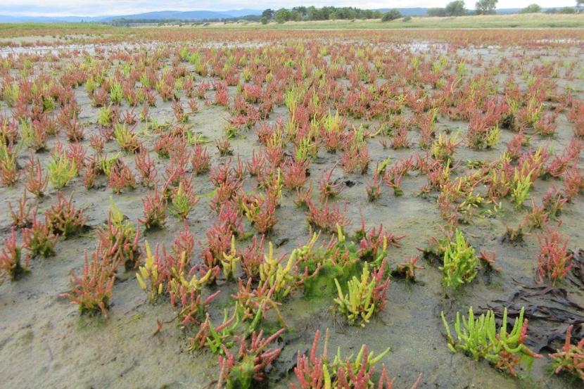
Glasswort, Nigg Bay, Cromarty Firth.
Pressures:
- Dornoch Firth and Morrich More – pressures not identified.
Intertidal mudflats and sandflats
Relevant SAC(s) and Area Extent of Feature:
- Dornoch Firth and Morrich More SAC (3854.64ha)
Sitelink provides feature condition assessment details, with feature conservation objectives provided in either a Conservation Advice Package (CAP), Conservation and Management Advice (CMA) or generic Conservation Objectives
General Feature Description
Intertidal mudflats and sandflats are submerged at high tide and exposed at low tide. They form a major component of the over-arching estuaries and large shallow inlets and bays habitat types in the UK but also occur along the open coast and in lagoonal inlets. The physical structure of the intertidal flats ranges from mobile, coarse-sand beaches on wave-exposed coasts to stable, fine-sediment mudflats in estuaries.
This habitat type can be divided into three broad categories (clean sands, muddy sands and muds), although in practice there is a continuous gradation between them. Within this range the plant and animal communities which occur vary according to the type of sediment, its stability and the salinity of the water.
Feature Description in the Context of Relevant SACs
The Dornoch Firth is the most northerly complex estuary in the UK and contains extensive areas of mudflats and sandflats. The flats extend in a wide belt along the northern and southern shores and are characteristic of a range of environmental conditions. There is a continuous gradient in the physical structure of the flats, from medium-sand beaches on the open coast to stable, fine-sediment mudflats and muddy sands further inland. This results in a high diversity of animal and plant communities supporting marine worms, molluscs and amphipod crustaceans. The sheltered bays provide a habitat for communities of algae, eelgrass (Zostera spp.) and the pioneer saltmarsh plant glasswort (Salicornia spp.).
Pressures:
Dornoch Firth and Morrich More – pressures not identified.
Reefs
Relevant SAC(s) and Area Extent of Feature:
- Dornoch Firth and Morrich More SAC (78.31ha)
Sitelink provides feature condition assessment details, with feature conservation objectives provided in either a Conservation Advice Package (CAP), Conservation and Management Advice (CMA) or generic Conservation Objectives
General Feature Description
Reefs are rocky marine habitats or biological concretions that rise from the seabed. They are generally subtidal but may extend into the intertidal zone, where they are exposed to the air at low tide. Reefs are very variable in form and in the communities that they support with two main types being recognised: those where animal and plant communities develop on rock or stable boulders and cobbles (rocky reefs), and those where structure is created by the animals themselves (biogenic reefs).
Rocky reefs are extremely variable and include a wide range of topographical forms ranging from vertical rock walls to horizontal ledges, sloping or flat bed rock, broken rock, boulder fields, and aggregations of cobbles. They are characterised by communities of attached algae and invertebrates, usually associated with a range of mobile animals, including invertebrates and fish, the compositions of which vary according to a variety of physical and environmental factors.
Biogenic reefs are less variable but the associated communities can vary according to local conditions of water movement, salinity, depth and turbidity.
Feature Description in the Context of Relevant SACs
Both rocky and biogenic reefs occur within the Dornoch Firth. Rocky reefs exist as small outcrops of predominantly intertidal bedrock along the shores of the upper estuary. These typically support lichens on the upper shore with brown algae in the mid to lower shore and dense kelp forests (Laminaria spp.) inhabited by marine invertebrates below the low water mark.
The biogenic reefs are represented by well-developed common mussel (Mytilus edulis) beds which predominate in shallow sites between the middle of the estuary and the estuary mouth. These reefs are characterised by an abundant and species-rich flora and fauna that is more diverse than the adjacent sediment-based habitats. This includes various algae, crustaceans, molluscs and starfish. Towards the mouth of the estuary the reefs are also colonised by an abundance of the soft coral, dead men’s fingers (Alcyonium digitatum).
Pressures:
- Dornoch Firth and Morrich More – pressures not identified.
Subtidal sandbanks
Relevant SACs and Area Extent of Feature:
- Dornoch Firth and Morrich More SAC (2958.41ha)
- Moray Firth SAC (45382.2ha)
Sitelink provides feature condition assessment details, with feature conservation objectives provided in either a Conservation Advice Package (CAP), Conservation and Management Advice (CMA) or generic Conservation Objectives
General Feature Description
Subtidal sandbanks are permanently covered by shallow sea water. The diversity and types of faunal community associated with this habitat are determined particularly by sediment type as well as other physical, chemical and environmental factors such as exposure to wave action, water depth, turbidity and salinity.
The shallow sandy sediments are typically colonised by a burrowing worms, crustaceans and bivalve molluscs while mobile fauna such as shrimps, gastropod molluscs, crabs and fish, with sand-eels (Ammodytes spp.) in particular representing an important food source for birds living on the surface of the sandbank. Where coarser, more stable material is present species of seaweeds and specialist marine invertebrates may form distinctive communities. Shallow sandy sediments are often important nursery areas for fish, and feeding grounds for seabirds.
Feature Description in the Context of Relevant SACs
This feature represents an important supporting habitat within the wider estuarine/marine ecosystems of these sites.
In the Dornoch Firth there is a continuous gradient in the physical structure of sublittoral sediments from sandy muds and muddy sands in the upper estuary to medium and coarse sands at the entrance and adjacent to the open coast. Fine sands and muds in the upper estuary are colonised by assemblages of invertebrates typical of upper estuarine communities that are tolerant of low and fluctuating salinities. The species diversity increases towards the middle reaches of the estuary. The sublittoral sandbanks in the outer estuary are characterised by animals that are adapted to coarse or sandy substrates.
In the Moray Firth SAC sublittoral sediments range from muddy sands and sandy sediments in the more sheltered parts of the site with coarser sand and gravel-based sediments in the outer, more coastal reaches of the Firth. These contrasting habitat conditions support a variety of distinctive algal and invertebrate species.
These sandbank habitats may be spawning grounds and nursery areas for juvenile fish species and may support large populations of sandeels. This productivity in turn becomes an important food source for marine mammals and seabirds.
Pressures:
- Dornoch Firth and Morrich More & Moray Firth – Flood/coastal defence works, recreation/disturbance;
Birds
The bird species accounts apply to the European sites to which they relate, and identify their populations at classification, origin, behaviour, habitat, diet, seasonality, pressures, and population trends. Reference sources are included from which the information required to complete the various aspects of each species’ account was obtained.
Condition Status
SPA & SAC interests may, or may not, be in ‘favourable condition’. Please check SiteLink to see the most up to date ‘condition status’ for each European feature. The condition of a feature can be important to take into consideration when undertaking an HRA. For example, if a feature is ‘unfavourable-declining/no change’ it means that the potential for that feature to accept further and/or ongoing pressures is going to be low, thus it’s resilience to deal with ongoing impacts could potentially affect its recovery. Therefore, ‘condition status’ has relevance for including within HRAs.
Origin
Describes whether each species is a resident within the each of the relevant designated sites or whether they are migratory. For non-resident species, it identifies where they spend the rest of the year.
Behaviour
Provides key information on each species’ feeding, roosting and breeding behaviour.
Diet
Provides key information on the diet of each species when they are present within the each of the relevant designated sites.
Habitat
Summarises information on the principle habitats that each species uses both within the relevant designated sites and more generally. Where relevant, habitat use is described for both high and low tides as some species’ presence in a particular habitat can be dependent on the state of the tide.
Distribution
Identifies the spatial occurrence and abundance of each species within the relevant designated sites as well as more generally.
Seasonality
Identifies the periods of the year when each species typically occurs in greatest abundance within the relevant designated sites and more generally.
Pressures
Where a Conservation Management Advice document exists, activities and their related pressures are covered there. This section Identifies some of the key pressures which are recognised to potentially threaten the presence, abundance and distribution of each species’ both within the relevant designated sites and more generally. Highly Pathogenic Avian Influenza or HPAI is affecting seabirds - for most recent guidance see our Avian influenza guidance.
Population Trends
Where a Conservation Management Advice document exists, population trends are covered there. This section summarises, where data are available, the population trends of each species in relation the relevant designated sites as well as at the national (Scottish) and UK level. For most waterfowl and wading birds, site specific data was obtained from Cook et al. (2013) via the British Trust for Ornithology’s (BTO) Wetland Bird Survey (WeBS) Alerts website. For other species information was obtained from Robinson et al., (2004) for whooper swan, Challis et al, 2015 for osprey, Mitchell (2016) for greylag goose, and more generally from Forrester et al., (2007).
Whooper swan (Cygnus cygnus)
SPA Population(s) at Classification:
Sitelink provides feature condition assessment details, with feature conservation objectives provided in either a Conservation Advice Package (CAP), Conservation and Management Advice (CMA) or generic Conservation Objectives
Origin – Birds wintering in UK originate almost exclusively from the Icelandic breeding population.
Behaviour – Typically occurs in small groups/ family parties with strong fidelity to key wintering grounds.
Diet – Terrestrial and aquatic plant material.
Habitat – Freshwater lochs/ponds, estuarine/coastal fringe habitats (salt marshes, lagoons, intertidal mudflats) and nearby grass and arable stubble fields.
| Habitat | Low tide | High tide |
|---|---|---|
| Open water | Y | Y |
| Intertidal mud | Y | - |
| Saltmarsh | Y | Y |
| Rocky shore | - | - |
| Coastal fields | Y | Y |
| Inland fields | Y | Y |
Distribution
Loch Eye and nearby surrounding coastal fringe habitats and inland fields associated with Cromarty Firth. Small numbers also associated with Dornoch Firth at Loch Evelix and the Beauly Firth.
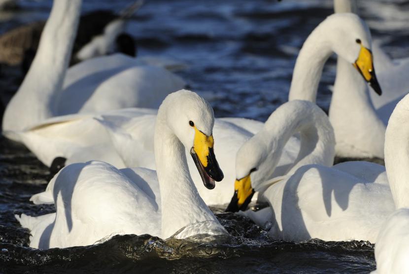
Whooper swans (Cygnus cygnus)
Seasonality – Winter visitor, predominantly from October to March.
Pressures – Collision with powerlines, lead poisoning, habitat loss, HPAI.
Population trends – The number of whooper swan over-wintering on Cromarty Firth SPA have fluctuated markedly over the past few decades making interpretation of the underlying trend challenging. However, numbers over-wintering in Scotland have been stable in the short-term, and have been increasing in the long term in the wider UK.
Greylag goose (Anser anser)
SPA Population(s) at Classification:
- Cromarty Firth SPA: 1,782
- Dornoch Firth and Loch Fleet SPA: 1,146
- Inner Moray Firth SPA : 2,651
Sitelink provides feature condition assessment details, with feature conservation objectives provided in either a Conservation Advice Package (CAP), Conservation and Management Advice (CMA) or generic Conservation Objectives
Origin – The vast majority of the birds which over winter in Scotland breed in Iceland.
Behaviour – Highly gregarious, roosting and feeding in small to medium-sized flocks.
Diet – Herbivorous with wintering birds feeding on low-lying agricultural areas including improved grassland and stubble fields.
Habitat – Foraging on low-lying agricultural areas surrounding nearby roosting lochs and coastal areas.
| Habitat | Low tide | High tide |
|---|---|---|
| Open water | - | - |
| Intertidal mud | Y | - |
| Saltmarsh | Y | Y |
| Rocky shore | - | - |
| Coastal fields | Y | Y |
| Inland fields | Y | Y |
Distribution
Coastal fringe habitats and inland fields associated with Inner Moray Firth, Cromarty Firth and Dornoch Firth & Loch Fleet.
Greylag goose in winter.
Seasonality – Winter visitor, predominantly from late September to March.
Pressures – Shooting (particularly in Iceland), changes in agricultural practice and recreational disturbance at roost sites and feeding areas, HPAI.
Population trends – Population trends for this species at the site level have not been evaluated. At the UK level however, the species’ Icelandic breeding population has undergone a recent decline suspected to have been influenced by shooting in Iceland and in Orkney. Nonetheless the species’ population remains high and as such conservation status remains favourable.
Wigeon (Anas penelope)
SPA Population(s) at Classification:
- Cromarty Firth SPA : 9,204
- Dornoch Firth and Loch Fleet SPA: 15,304
- Inner Moray Firth SPA: 7,310
Sitelink provides feature condition assessment details, with feature conservation objectives provided in either a Conservation Advice Package (CAP), Conservation and Management Advice (CMA) or generic Conservation Objectives
Origin – Birds wintering in UK breed mainly in Iceland, Scandinavia and Russia.
Behaviour – Gregarious, forming large flocks, often grazing on coastal fringe habitats and grassy fields.
Diet – Terrestrial and aquatic plant material.
Habitat – Freshwater lochs/ponds, estuarine/coastal fringe habitats (salt marshes, lagoons, intertidal mudflats) and nearby grass and arable stubble fields.
| Habitat | Low tide | High tide |
|---|---|---|
| Open water | Y | Y |
| Intertidal mud | Y | - |
| Saltmarsh | Y | Y |
| Rocky shore | - | - |
| Coastal fields | Y | Y |
| Inland fields | Y | Y |
Distribution
Estuarine and coastal fringe habitats and inland fields associated with Inner Moray Firth, Cromarty Firth and Dornoch Firth/Loch Fleet.
Seasonality – Winter visitor, from September to March.
Pressures – Damage/destruction of eel grass (Zostera sp.) beds and human disturbance HPAI.
Population trends – The number of wigeon over-wintering on the Cromarty Firth, Dornoch Firth and Loch Fleet and Inner Moray Firth SPAs have been decreasing in the short to medium-term. Numbers of this species over-wintering in Scotland have also been decreasing in the short-term, although at the UK level the over-wintering population has been stable.
Teal (Anas crecca)
SPA Population(s) at Classification:
- Dornoch Firth and Loch Fleet SPA: 1,462
- Inner Moray Firth SPA: 2,066
Sitelink provides feature condition assessment details, with feature conservation objectives provided in either a Conservation Advice Package (CAP), Conservation and Management Advice (CMA) or generic Conservation Objectives
Origin – Birds wintering in UK breed mainly in Iceland, Fennoscandia and Russia.
Behaviour – Gregarious, forming large flocks, typically in coastal fringe habitats.
Diet – Terrestrial and aquatic plant material.
Habitat – Predominantly estuarine/coastal fringe habitats (salt marshes, lagoons, intertidal mudflats) and occasionally nearby arable land.
| Habitat | Low tide | High tide |
|---|---|---|
| Open water | Y | Y |
| Intertidal mud | Y | - |
| Saltmarsh | Y | Y |
| Rocky shore | - | - |
| Coastal fields | - | - |
| Inland fields | - | - |
Distribution
Estuarine and coastal fringe habitats particularly associated with Inner Moray Firth and Dornoch Firth/Loch Fleet, but also Cromarty Firth.
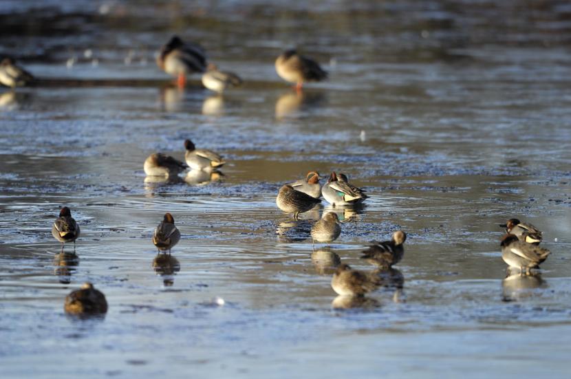
Teal ducks roosting on Morton Loch NNR.
Seasonality – Winter visitor, predominantly from September to March.
Pressures – Localised loss/deterioration of wetland habitat.
Population trends – Numbers of teal over-wintering on Dornoch Firth and Loch Fleet and Inner Moray Firth SPAs have been decreasing in the short-and medium term respectively. Numbers over-wintering in Scotland have also been decreasing in the short-term while at the UK level numbers have been stable in the medium term.
Pintail (Anas acuta)
SPA Population(s) at Classification:
- Cromarty Firth SPA: 319
Sitelink provides feature condition assessment details, with feature conservation objectives provided in either a Conservation Advice Package (CAP), Conservation and Management Advice (CMA) or generic Conservation Objectives
Origin – Birds wintering in UK breed mainly in Fennoscandia and Russia.
Behaviour – Occurs in small localised flocks.
Diet – Aquatic plant material and invertebrates.
Habitat – Estuarine/coastal fringe habitats (salt marshes, lagoons, intertidal mudflats) and freshwater lochs.
| Habitat | Low tide | High tide |
|---|---|---|
| Open water | Y | Y |
| Intertidal mud | Y | Y |
| Saltmarsh | - | - |
| Rocky shore | - | - |
| Coastal fields | - | - |
| Inland fields | - | - |
Distribution
Estuarine and coastal fringe habitats particularly associated with Cromarty Firth, but also occurring in the Inner Moray Firth.
Seasonality – Winter visitor, from September to March.
Pressures – Localised loss/deterioration of wetland habitat and human disturbance.
Population trends – The number of pintail over-wintering on Cromarty Firth SPA have been increasing in the short-term following a previous decline. Numbers of this species over-wintering in Scotland have also been increasing in the longer term while at the UK level numbers have been decreasing in the short-term.
Scaup (Aythya marila)
SPA Population(s) at Classification:
Sitelink provides feature condition assessment details, with feature conservation objectives provided in either a Conservation Advice Package (CAP), Conservation and Management Advice (CMA) or generic Conservation Objectives
Origin – Birds wintering in the UK come from Iceland, the Baltic, Scandinavia and Russia.
Behaviour – Occurs in large, localised flocks in shallow coastal waters, mainly diving to feed, but will also dabble and sift on tidal edge.
Diet – Omnivorous, but mostly molluscs in winter.
Habitat – Winters in sheltered coastal waters and estuaries.
| Habitat | Low tide | High tide |
|---|---|---|
| Open water | Y | Y |
| Intertidal mud | Y | Y |
| Saltmarsh | - | - |
| Rocky shore | - | - |
| Coastal fields | - | - |
| Inland fields | - | - |
Distribution
Widely distributed within coastal waters of the wider Moray Firth, with particular concentrations in the Inner Moray Firth. The Cromarty Firth is currently the 2nd most important site in Scotland for Scaup (as of 2021 WeBS data).
Seasonality – Winter visitor, predominantly from October to March.
Pressures and population trends can be found in Moray Firth SPA Conservation and Management advice (CMA) document
Common eider (Somateria mollissima)
SPA Population(s) at Classification:
- Moray Firth SPA1,733
Sitelink provides feature condition assessment details, with feature conservation objectives provided in either a Conservation Advice Package (CAP), Conservation and Management Advice (CMA) or generic Conservation Objectives
Origin – In Scotland mainly a resident species with only a few birds making short-distance movements.
Behaviour – Typically occurs in small flocks in inshore as well as further offshore, diving to feed.
Diet – Predominantly molluscs and small crustaceans.
Habitat – Almost entirely coastal occurring in sheltered inshore waters, including estuaries.
| Habitat | Low tide | High tide |
|---|---|---|
| Open water | Y | Y |
| Intertidal mud | - | Y |
| Saltmarsh | - | - |
| Rocky shore | - | - |
| Coastal fields | - | - |
| Inland fields | - | - |
| Offshore islands | - | - |
Distribution
Widely distributed within coastal waters of the wider Moray Firth, particularly along the Nairn Coast.
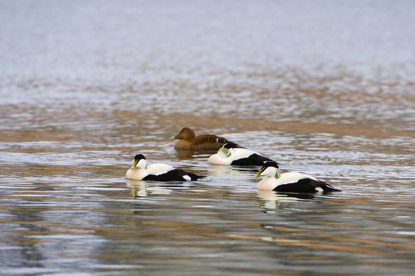
Seasonality – Present year round.
Pressures and population trends can be found in Moray Firth SPA Conservation and Management advice (CMA) document.
Long-tailed duck (Clangula hyemalis)
SPA Population(s) at Classification:
- Moray Firth SPA : 5,001
Sitelink provides feature condition assessment details, with feature conservation objectives provided in either a Conservation Advice Package (CAP), Conservation and Management Advice (CMA) or generic Conservation Objectives
Origin – Breeds around the Arctic Circle. Those wintering in Britain may originate from Iceland, Fennoscandinavia and north west Russia.
Behaviour – Occurs in small to large flocks of foraging and roosting birds, in both inshore and offshore waters, diving to feed.
Diet – Predominantly molluscs and small crustaceans.
Habitat – Almost entirely coastal, occurring in sheltered inshore waters, including estuaries as well as further offshore.
| Habitat | Low tide | High tide |
|---|---|---|
| Open water | Y | Y |
| Intertidal mud | - | Y |
| Saltmarsh | - | - |
| Rocky shore | - | - |
| Coastal fields | - | - |
| Inland fields | - | - |
Distribution
Widely distributed within coastal waters of the wider Moray Firth, particularly within the Inner Moray Firth and along the Nairn Coast.
Pressures – Human disturbance, marine pollution and negative changes in food supply.
Pressures and population trends can be found in Moray Firth SPA Conservation and Management advice (CMA) document
Common scoter (Melanitta nigra)
SPA Population(s) at Classification:
- Moray Firth SPA 5,479
Sitelink provides feature condition assessment details, with feature conservation objectives provided in either a Conservation Advice Package (CAP), Conservation and Management Advice (CMA) or generic Conservation Objectives.
Origin – Mostly a winter visitor from Iceland and Fennoscandinavia, although small numbers of non-breeding birds may be present year round.
Behaviour – Occurs in small to large flocks of foraging and roosting birds, in both inshore and offshore waters, diving to feed.
Diet – Predominantly molluscs and small crustaceans, but may also feed on mobile prey in the spring (e.g. small fish).
Habitat – Almost exclusively marine in the non-breeding season, occurring in shallow near-shore and coastal waters.
| Habitat | Low tide | High tide |
|---|---|---|
| Open water | Y | Y |
| Intertidal mud | - | Y |
| Saltmarsh | - | - |
| Rocky shore | - | - |
| Coastal fields | - | - |
| Inland fields | - | - |
Distribution
Widely distributed within coastal waters of the wider Moray Firth, particularly along the Nairn coast. With hot-spots which are traditionally used by common scoter within the SPA.
Seasonality – Present year round with numbers peaking in mid-winter. As with LTDs will use different sites at different times of the season, so may have seasonal prey preferences.
Pressures and population trends can be found in Moray Firth SPA Conservation and Management advice (CMA) document
Velvet scoter (Melanitta fusca)
SPA Population(s) at Classification:
- Moray Firth SPA1,488
Sitelink provides feature condition assessment details, with feature conservation objectives provided in either a Conservation Advice Package (CAP), Conservation and Management Advice (CMA) or generic Conservation Objectives.
Origin – A winter visitor from Fennoscandinavia and Russia, although small numbers of non-breeding birds may be present year round.
Behaviour – Occurs in small to large flocks of foraging and roosting birds, in both inshore and offshore waters, diving to feed.
Diet – Predominantly molluscs and small crustaceans.
Habitat – Almost exclusively marine in the non-breeding season, occurring in shallow near-shore and coastal waters.
| Habitat | Low tide | High tide |
|---|---|---|
| Open water | Y | Y |
| Intertidal mud | - | Y |
| Saltmarsh | - | - |
| Rocky shore | - | - |
| Coastal fields | - | - |
| Inland fields | - | - |
Distribution
Widely distributed within coastal waters of the wider Moray Firth, particularly along the Nairn coast.
Pressures and population trendsand seasonality can be found in Moray Firth SPA Conservation and Management advice (CMA) document.
Goldeneye (Bucephala clangula)
SPA Population(s) at Classification:
Sitelink provides feature condition assessment details, with feature conservation objectives provided in either a Conservation Advice Package (CAP), Conservation and Management Advice (CMA) or generic Conservation Objectives.
Origin – A small number of birds breed in the north of the UK but most wintering birds in Scotland are thought to be from Norway and northern Sweden.
Behaviour – Occurs in small to large flocks, diving to feed.
Diet – Mostly aquatic insects, molluscs and crustaceans and occasionally fish and aquatic plant material.
Habitat – Sheltered, shallow coastal waters, estuaries, rivers and freshwater lochs.
| Habitat | Low tide | High tide |
|---|---|---|
| Open water | Y | Y |
| Intertidal mud | - | Y |
| Saltmarsh | - | - |
| Rocky shore | - | - |
| Coastal fields | - | - |
| Inland fields | - | - |
Distribution
Widely distributed within coastal waters of the wider Moray Firth, but with particular concentrations in the Inner Moray Firth.
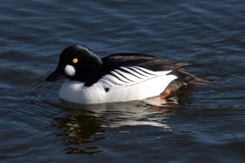
Seasonality – Winter visitor, predominantly occurring between November and March.
Pressures and population trends can be found in Moray Firth SPA Conservation and Management advice (CMA) document.
Red-breasted merganser (Mergus serrator)
SPA Population(s) at Classification:
- Cromarty Firth SPA: 204
- Inner Moray Firth SPA: 1,184
- Moray Firth SPA151
Sitelink provides feature condition assessment details, with feature conservation objectives provided in either a Conservation Advice Package (CAP), Conservation and Management Advice (CMA) or generic Conservation Objectives.
Origin – Wintering birds include some local breeders and probably some from central Europe, but most are from Iceland and possibly eastern Greenland.
Behaviour – Typically occurs in small groups, diving to feed. Will gather in large (moulting) flocks in early autumn, where many birds will be flight-less.
Diet – Predominantly fish, crustaceans and other invertebrates.
Habitat – Winters mainly at sea, in sheltered, shallow coastal waters and estuaries.
| Habitat | Low tide | High tide |
|---|---|---|
| Open water | Y | Y |
| Intertidal mud | - | Y |
| Saltmarsh | - | - |
| Rocky shore | - | - |
| Coastal fields | - | - |
| Inland fields | - | - |
Distribution
Widely distributed within coastal waters of the wider Moray Firth.
Seasonality – Mainly a winter visitor largely occurring between September and March.
Pressures and population trends can be found in Moray Firth SPA Conservation and Management advice (CMA) document.
Goosander (Mergus merganser)
SPA Population(s) at Classification:
Sitelink provides feature condition assessment details, with feature conservation objectives provided in either a Conservation Advice Package (CAP), Conservation and Management Advice (CMA) or generic Conservation Objectives.
Origin – Birds wintering in the UK breed in northern Europe and western Russia.
Behaviour – Typically occurs in small groups, diving to feed.
Diet – Predominantly fish.
Habitat – Winters on the lower reaches of rivers including tidal stretches and estuaries, as well as in shallow coastal waters.
| Habitat | Low tide | High tide |
|---|---|---|
| Open water | Y | Y |
| Intertidal mud | - | Y |
| Saltmarsh | - | - |
| Rocky shore | - | - |
| Coastal fields | - | - |
| Inland fields | - | - |
Distribution
Sheltered near-shore coastal waters of the Inner Moray Firth, particularly around the mouths of river systems.
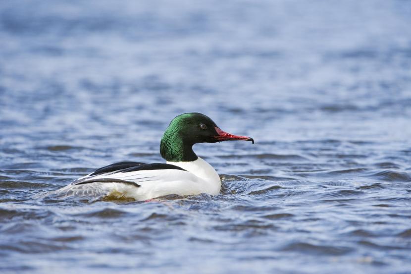
Male Goosander.
Seasonality – Occurs at coastal sites in winter mainly between September and February, particularly during the autumn moulting period.
Pressures – Human disturbance and culling at game fisheries.
Population trends – The number of goosanders over-wintering on Inner Moray Firth SPA have been decreasing in the long term. Similarly, numbers of this species over-wintering in Scotland and the wider UK have been decreasing in the medium-term.
Red-throated diver (Gavia stellata)
SPA Population(s) at Classification:
- Moray Firth SPA 324
Sitelink provides feature condition assessment details, with feature conservation objectives provided in either a Conservation Advice Package (CAP), Conservation and Management Advice (CMA) or generic Conservation Objectives.
Origin – Circumpolar species with Scotland at the southern edge of the breeding range. Wintering birds can originate from Scotland, Fennoscandinavia, Iceland and Greenland.
Behaviour – Feeds by diving, usually solitary or in small groups.
Diet – Primarily fish.
Habitat – Principally a marine species in winter, occurring in sheltered nearshore and coastal waters.
| Habitat | Low tide | High tide |
|---|---|---|
| Open water | Y | Y |
| Intertidal mud | - | Y |
| Saltmarsh | - | - |
| Rocky shore | - | - |
| Coastal fields | - | - |
| Inland fields | - | - |
Distribution
Widespread throughout the Moray Firth with particular concentrations in the coastal waters of the Dornoch, Cromarty and Outer Moray Firth (Spey Bay).
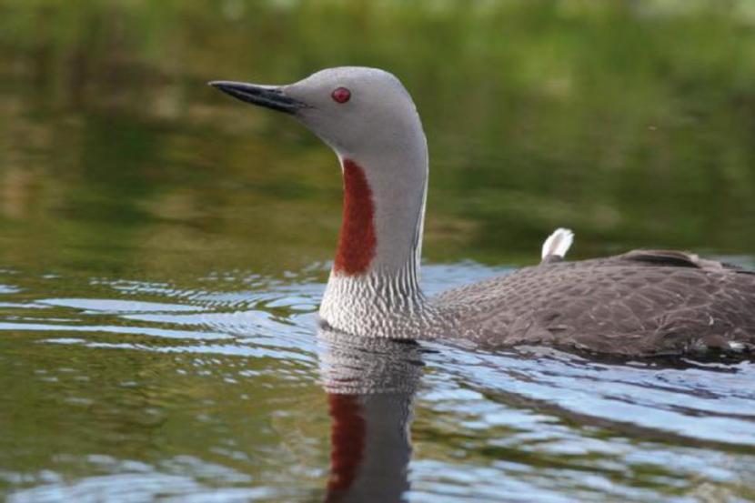
Seasonality – Occurs in coastal waters in winter predominantly between October and March.
Pressures and population trends can be found in Moray Firth SPA Conservation and Management advice (CMA) document.
Great northern diver (Gavia immer)
SPA Population(s) at Classification:
- Moray Firth SPA 144
Sitelink provides feature condition assessment details, with feature conservation objectives provided in either a Conservation Advice Package (CAP), Conservation and Management Advice (CMA) or generic Conservation Objectives.
Origin – Breeds in Iceland, Greenland and North America with birds wintering in Scotland predominantly originating from Iceland and Greenland.
Behaviour – Feeds by diving, usually solitary or in small groups.
Diet – Primarily fish, but also crustaceans opportunistically.
Habitat – Principally a marine species in winter, occurring in sheltered nearshore and coastal waters.
| Habitat | Low tide | High tide |
|---|---|---|
| Open water | Y | Y |
| Intertidal mud | - | Y |
| Saltmarsh | - | - |
| Rocky shore | - | - |
| Coastal fields | - | - |
| Inland fields | - | - |
Distribution
Widespread throughout the Moray Firth with particular concentrations in the coastal waters of the Dornoch Firth and Outer Moray Firth (Spey Bay).
Seasonality – Winter visitor predominantly occurring in coastal waters between October and April, but birds still present in shallow waters into May.
Pressures and population trends can be found in Moray Firth SPA Conservation and Management advice (CMA) document.
Great cormorant (Phalacrocorax carbo)
SPA Population(s) at Classification:
Sitelink provides feature condition assessment details, with feature conservation objectives provided in either a Conservation Advice Package (CAP), Conservation and Management Advice (CMA) or generic Conservation Objectives
Origin – Birds wintering in the Moray Firth probably comprise a mixture of Scottish breeders (of the carbo sub-species) and, to a lesser extent, breeders from continental Europe (of the sinesis sub-species).
Behaviour – Dives underwater from the surface to catch prey.
Diet – Predominantly small fish.
Habitat – Largely marine, particularly sheltered coastal waters, but also inland freshwater habitats to forage.
| Habitat | Low tide | High tide |
|---|---|---|
| Open water | Y | Y |
| Intertidal mud | - | Y |
| Saltmarsh | - | - |
| Rocky shore | - | - |
| Coastal fields | - | - |
| Inland fields | - | - |
Distribution
Widely distributed throughout the Moray Firth, with particular concentrations in the Inner Moray Firth.
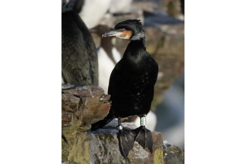
Seasonality – Occurs year round but with numbers increasing over winter between August and February.
Pressures – Marine pollution and persecution at Game fisheries.
Population trends – The number of cormorants over-wintering on Inner Moray Firth SPA have fluctuated over the past few decades making interpretation of the underlying trend difficult. Numbers of this species over-wintering in Scotland have been decreasing in the short-term having previously been relatively stable while in the UK numbers have remained relatively stable over the long term.
European shag (Phalacrocorax aristotelis)
SPA Population(s) at Classification:
- Moray Firth SPA: 6,462 (non-breeding) / 5,494 (breeding).
Sitelink provides feature condition assessment details, with feature conservation objectives provided in either a Conservation Advice Package (CAP), Conservation and Management Advice (CMA) or generic Conservation Objectives.
Origin – The species is largely sedentary with birds tending to remain close to breeding site year round.
Diet – Small fish, predominantly sand eel.
Habitat – Entirely marine, preferring sheltered coastal waters.
| Habitat | Low tide | High tide |
|---|---|---|
| Open water | Y | Y |
| Intertidal mud | - | - |
| Saltmarsh | - | - |
| Rocky shore | Y | Y |
| Coastal fields | - | - |
| Inland fields | - | - |
Distribution
Breeding grounds concentrated along the northern Moray Firth coast between Brora and Helmsdale.
Wintering distribution concentrated in two areas along northern (Helmsdale to Berriedale) and southern (Portsoy) Moray Firth coast.
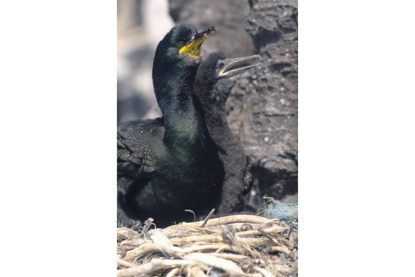
Nesting Shags on the Bass Rock. East Lothian.
Seasonality – Birds tend to remain close to breeding site year round.
Pressures and population trends can be found in Moray Firth SPA Conservation and Management advice (CMA) document.
Slavonian grebe (Podiceps auritus)
SPA Population(s) at Classification:
- Moray Firth SPA: 43
Sitelink provides feature condition assessment details, with feature conservation objectives provided in either a Conservation Advice Package (CAP), Conservation and Management Advice (CMA) or generic Conservation Objectives
Origin – Birds wintering in the Moray Firth probably breed in Iceland and Norway but may be accompanied by individuals from the small Scottish breeding population.
Behaviour – Feeds by diving, usually solitary or in small groups. Will associate closely & benefit from diving within seaduck flocks.
Diet – Mainly small fish and crustaceans.
Habitat – In winter predominantly a marine species, preferring sheltered, shallow coastal waters.
| Habitat | Low tide | High tide |
|---|---|---|
| Open water | Y | Y |
| Intertidal mud | - | - |
| Saltmarsh | - | - |
| Rocky shore | - | - |
| Coastal fields | - | - |
| Inland fields | - | - |
Distribution
Widespread in coastal waters of the Outer Dornoch, Cromarty and Moray Firths and Inner Moray Firth.
Seasonality – A winter visitor to coastal waters occurring between October and March.
Pressures and population trends can be found in Moray Firth SPA Conservation and Management advice (CMA) document.
Osprey (Pandion Haliaetus)
SPA Population(s) at Classification:
Sitelink provides feature condition assessment details, with feature conservation objectives provided in either a Conservation Advice Package (CAP), Conservation and Management Advice (CMA) or generic Conservation Objectives
Origin – Birds breeding in Scotland migrate from west Africa and south western Europe.
Behaviour – Ospreys are long-distance migrants returning to the UK each year from their wintering grounds (see above). Osprey pairs are typically monogamous and return to the same nesting site each year throughout their lives.
Diet – Exclusively fish, predominantly comprising brown trout and pike as well as sea trout and flounder where near the sea.
Habitat – Nests in trees, predominantly conifers, as well as on pylons, within range of freshwater and coastal fishing/foraging grounds.
| Habitat | Low tide | High tide |
|---|---|---|
| Open water | Y | Y |
| Intertidal mud | - | Y |
| Saltmarsh | - | - |
| Rocky shore | - | - |
| Coastal fields | - | - |
| Inland fields | - | - |
Distribution
Birds associated with the Cromarty Firth, Dornoch Firth and Loch Fleet and Inner Moray Firth SPAs predominantly nest in trees located within 10km of these sites. As well as these coastal waters however, they will also use rivers and inland waterbodies in search of fish.

Osprey with a fish.
Seasonality – Ospreys arrive from their wintering grounds in late march/early April and remain until late August/early September.
Pressures – HPAI.
Population trends – Although site specific population trend data for ospreys were not available, at the Scotland-wide level the species’ successful and well documented recovery continues following its historic persecution. Indeed it is in the Highland region (the most relevant region to the three SPAs for which this species is designated) where Scotland’s largest breeding population occurs. This indicates that at the associated regional level, the population trend is at least stable if not continuing to increase, as reflected in the species’ continued favourable site condition status at all three SPAs.
Oystercatcher (Haematopus ostralegus)
SPA Population(s) at Classification:
- Cromarty Firth SPA: 2,509
- Dornoch Firth and Loch Fleet SPA: 3,270
- Inner Moray Firth SPA: 3.063
Sitelink provides feature condition assessment details, with feature conservation objectives provided in either a Conservation Advice Package (CAP), Conservation and Management Advice (CMA) or generic Conservation Objectives
Origin – Some wintering birds breed in Scotland. Large numbers also come from Iceland, the Faroes and Norway.
Behaviour – Gregarious during winter, occurring in small to large flocks, congregating at high tide roosts and dispersing across foraging ground at low tide. Prey is caught by both visual capture and sensory probe feeding (touch).
Diet – Predominantly shellfish, but also marine worms and earthworms when foraging inland.
Habitat – Estuarine/coastal fringe habitats including intertidal mud-/sandflats and rocky shores for foraging and salt marshes, lagoons and rocky shores to roost. Inland greenfield areas are also used as supplementary foraging areas.
| Habitat | Low tide | High tide |
|---|---|---|
| Open water | - | - |
| Intertidal mud | Y | - |
| Saltmarsh | Y | Y |
| Rocky shore | Y | Y |
| Coastal fields | Y | Y |
| Inland fields | Y | Y |
Distribution
Intertidal and coastal fringe habitats of the Inner Moray Firth, Cromarty Firth and Dornoch Firth/Loch Fleet.
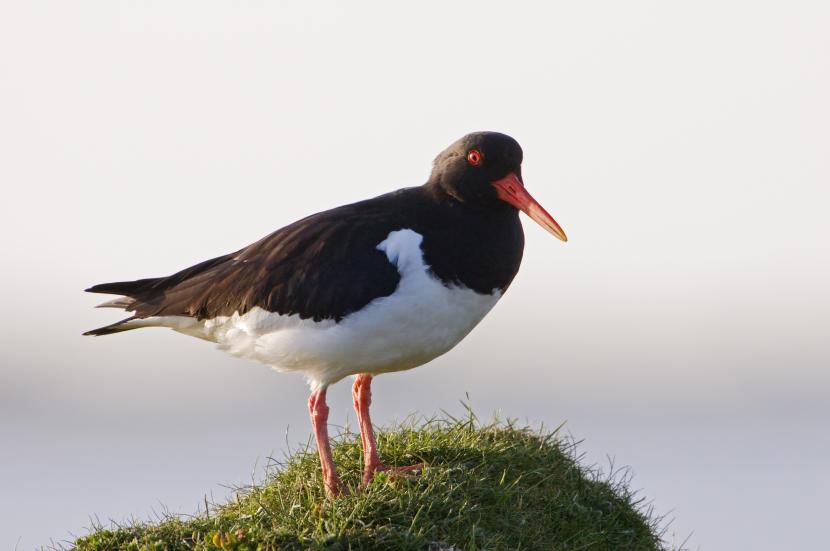
Oystercatcher feeding by Loch Bee, South Uist, Western Isles Area.
Seasonality – Although small numbers will remain at coastal sites throughout the summer to breed, the highest numbers occur during the winter months between August and February.
Pressures – Human disturbance, dredging for shellfish and habitat loss, HPAI.
Population trends – The number of oystercatchers over-wintering on the Cromarty Firth, Dornoch Firth and Loch Fleet and Inner Moray Firth SPAs has decreased in the medium-term. Similarly, numbers over-wintering in Scotland have also been decreasing in the medium-term in the wider UK numbers have remained relatively stable in the long term.
Curlew (Numenius arquata)
SPA Population(s) at Classification:
- Cromarty Firth SPA: 1,313
- Dornoch Firth and Loch Fleet SPA: 1,366
- Inner Moray Firth SPA: 1,262
Sitelink provides feature condition assessment details, with feature conservation objectives provided in either a Conservation Advice Package (CAP), Conservation and Management Advice (CMA) or generic Conservation Objectives
Origin –The vast majority of curlew in eastern Scotland in winter are from Fennoscandinavia.
Behaviour – Gregarious during winter, occurring in small to large flocks, congregating at high tide roosts and dispersing across foraging ground at low tide. Prey is primarily caught by sensory probe feeding (touch).
Diet – Invertebrates, including intertidal worms, crustaceans, molluscs and earthworms.
Habitat – Estuarine/coastal fringe habitats including intertidal mudflats for foraging and salt marshes, lagoons and rocky shores to roost. Inland fields are also used as supplementary foraging areas.
| Habitat | Low tide | High tide |
|---|---|---|
| Open water | - | - |
| Intertidal mud | Y | - |
| Saltmarsh | Y | Y |
| Rocky shore | Y | Y |
| Coastal fields | Y | Y |
| Inland fields | Y | Y |
Distribution
Intertidal and coastal fringe habitats of the Inner Moray Firth, Cromarty Firth and Dornoch Firth/Loch Fleet.
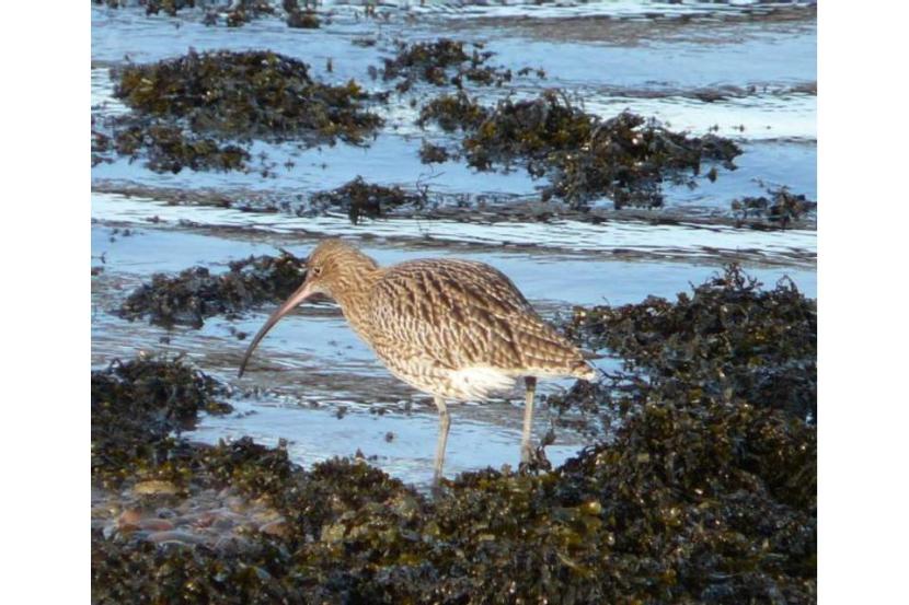
Seasonality – Thought small numbers will remain at coastal sites throughout the summer the highest numbers occur during the winter months between August and March.
Pressures – Human disturbance and agricultural intensification, afforestation and predation on breeding grounds, HPAI.
SPA Site Condition status:
Population trends – The number of curlew over-wintering on Cromarty Firth and Inner Moray Firth SPAs have been stable in the medium-term having previously increased while on the Dornoch Firth and Loch Fleet SPA have been decreasing in the medium-term having previously peaked. Numbers over-wintering in Scotland and the wider UK have been decreasing in the medium-term having previously peaked.
Bar-tailed godwit (Limosa lapponica)
SPA Population(s) at Classification:
- Cromarty Firth SPA: 1,355
- Dornoch Firth and Loch Fleet SPA: 1,184
- Inner Moray Firth SPA: 1,090
Sitelink provides feature condition assessment details, with feature conservation objectives provided in either a Conservation Advice Package (CAP), Conservation and Management Advice (CMA) or generic Conservation Objectives
Origin – Wintering birds breed in northern Europe and western Siberia (lapponica race).
Behaviour – Gregarious during winter, occurring in moderate to large flocks. Prey is primarily caught by sensory probe feeding (touch).
Diet – Predominantly marine worms as well as crustaceans.
Habitat – Estuarine/coastal fringe habitats including intertidal mud-/sandflats for foraging and salt marshes, lagoons and rocky shores to roost.
| Habitat | Low tide | High tide |
|---|---|---|
| Open water | - | - |
| Intertidal mud | Y | - |
| Saltmarsh | Y | Y |
| Rocky shore | Y | Y |
| Coastal fields | Y | Y |
| Inland fields | - | - |
Distribution
Intertidal and coastal fringe habitats of the Inner Moray Firth, Cromarty Firth and Dornoch Firth/Loch Fleet.
Seasonality – A winter visitor predominantly occurring between September and March.
Pressures – Human disturbance and habitat loss (e.g. estuarine land reclamation), HPAI.
Population trends – The numbers of bar-tailed godwits over-wintering on the Cromarty Firth and Inner Moray Firth SPAs have been decreasing in the short and medium-terms respectively having previously peaked. On Dornoch Firth and Loch Fleet SPA number have fluctuated over the past few decades making interpretation of the underlying trend difficult. Numbers over-wintering in Scotland have also been decreasing in the medium-term, which is considered to be partly due to a shift in wintering range in response to climate change (MacLean et al., (2008), while in the wider UK numbers have remained relatively stable in the long term.
Knot (Calidris canutus)
SPA Population(s) at Classification:
- Cromarty Firth SPA: 4,312
Sitelink provides feature condition assessment details, with feature conservation objectives provided in either a Conservation Advice Package (CAP), Conservation and Management Advice (CMA) or generic Conservation Objectives
Origin – The majority of wintering birds are from Greenland.
Behaviour – Occurs in moderate to large flocks and primarily feeds by sensory probe feeding (touch).
Diet – Invertebrates, predominantly molluscs and marine worms.
Habitat – Estuarine/coastal fringe habitats including intertidal mudflats for foraging and salt marshes and lagoons to roost.
| Habitat | Low tide | High tide |
|---|---|---|
| Open water | - | - |
| Intertidal mud | Y | - |
| Saltmarsh | Y | Y |
| Rocky shore | - | - |
| Coastal fields | - | - |
| Inland fields | - | - |
Distribution
Intertidal and coastal fringe habitats of the Cromarty Firth and to a lesser extent the Inner Moray Firth and Dornoch Firth/Loch Fleet.
Seasonality – Winter visitor, predominantly between October and March.
Pressures – Human disturbance and habitat loss (e.g. estuarine land reclamation) HPAI.
Population trends – The number of knot over-wintering on Cromarty Firth SPA have been decreasing in the medium-term having previously peaked. Numbers over-wintering in Scotland have fluctuated over the past few decades making interpretation of the underlying trend difficult, while in the wider UK numbers have remained relatively stable in the long term.
Dunlin (Calidris alpina)
SPA Population(s) at Classification:
- Cromarty Firth SPA: 3,384
- Dornoch Firth and Loch Fleet SPA: 4,462
Sitelink provides feature condition assessment details, with feature conservation objectives provided in either a Conservation Advice Package (CAP), Conservation and Management Advice (CMA) or generic Conservation Objectives
Origin – The majority of wintering birds are from northern Fennoscandinavia and European Russia. Dunlin from Iceland and south-eastern Greenland are common on passage.
Behaviour – Occurs in moderate to large flocks and primarily feeds by sensory probe feeding (touch).
Diet – Invertebrates, predominantly small molluscs, crustaceans and marine worms.
Habitat – Estuarine/coastal fringe habitats including intertidal mudflats and occasionally rocky shores for foraging and salt marshes, rocky shores and lagoons to roost.
| Habitat | Low tide | High tide |
|---|---|---|
| Open water | - | - |
| Intertidal mud | Y | - |
| Saltmarsh | Y | Y |
| Rocky shore | Y | Y |
| Coastal fields | - | Y |
| Inland fields | - | - |
Distribution
Intertidal and coastal fringe habitats of the Cromarty Firth and Dornoch Firth/Loch Fleet as well as the Inner Moray Firth although to a lesser extent.
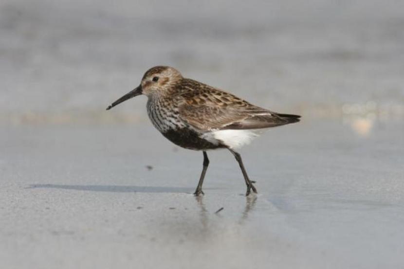
Seasonality – Winter visitor, predominantly between October and February.
Pressures – Human disturbance and habitat loss (e.g. estuarine land reclamation), HPAI.
Population trends – The numbers of dunlin over-wintering on both the Cromarty Firth and Dornoch Firth and Loch Fleet SPAs have been decreasing in the medium-term having previously peaked. Numbers over-wintering in Scotland and the wider UK have also been decreasing in the medium-term, which is considered to be partly due to a shift in wintering range in response to climate change (MacLean et al., (2008).
Redshank (Tringa totanus)
SPA Population(s) at Classification:
- Cromarty Firth SPA 1,149
- Inner Moray Firth SPA1,621
Sitelink provides feature condition assessment details, with feature conservation objectives provided in either a Conservation Advice Package (CAP), Conservation and Management Advice (CMA) or generic Conservation Objectives.
Origin – Most wintering birds are Icelandic breeders with some Scottish birds present.
Behaviour – Occurs in small to large flocks and feeds by both visual capture and sensory probe feeding (touch).
Diet – Invertebrates including marine worms molluscs and crustaceans as well as terrestrial and freshwater invertebrates where foraging at inland site.
Habitat – Estuarine/coastal fringe habitats including intertidal mudflats, saltmarshes, lagoons, rocky shores and occasionally inland fields. For both foraging and roosting.
| Habitat | Low tide | High tide |
|---|---|---|
| Open water | - | - |
| Intertidal mud | Y | - |
| Saltmarsh | Y | Y |
| Rocky shore | Y | Y |
| Coastal fields | Y | Y |
| Inland fields | Y | Y |
Distribution
Intertidal and coastal fringe habitats of the Inner Moray Firth, Cromarty Firth and Dornoch Firth/Loch Fleet.
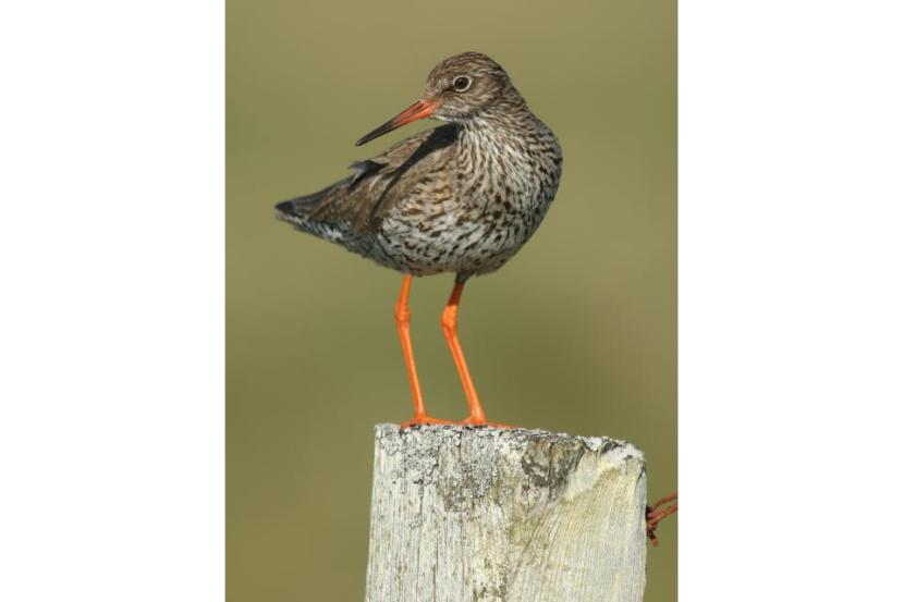
Seasonality – Thought small numbers will remain at coastal sites throughout the summer the highest numbers occur during the winter months predominantly between August and March.
Pressures – Human disturbance and habitat loss (including estuarine land reclamation and agricultural intensification on breedinggrounds), HPAI.
Population trends – The number of redshank over-wintering on Cromarty Firth SPA having remained relatively stable in the long term, while on Inner Moray Firth SPA numbers have been decreasing in the medium-term having previously been relatively stable. Numbers over-wintering in Scotland have also been decreasing in the short-term while in the wider UK numbers have remained relatively stable in the long term.
Common tern (Sterna hirundo)
SPA Population(s) at Classification:
- Cromarty Firth SPA 294 (pairs)
- Inner Moray Firth SPA310 (pairs)
Sitelink provides feature condition assessment details, with feature conservation objectives provided in either a Conservation Advice Package (CAP), Conservation and Management Advice (CMA) or generic Conservation Objectives
Origin – Breeding birds from the UK winter off west Africa. Birds breeding in Iceland, Scandinavia and western Siberia occur on passage.
Behaviour – Nests in colonies and roosts communally often with other tern species. Feeds by diving into surface waters from an aerial dive, and picking from water surface.
Diet – Small fish, principally sandeels.
Habitat – Predominantly a marine species in Scotland, nesting on flat sand and shingle beaches, undisturbed docksides and jetties and specially provided artificial platforms, and foraging over both inshore and offshore waters.
Distribution
Near-shore and coastal waters of the wider Moray Firth with nesting sites in the Inner Moray Firth and Cromarty Firths.
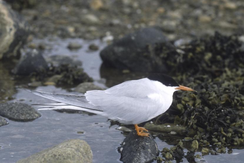
Seasonality – Common terns begin to arrive back from their wintering grounds in mid-April with the majority back by early to mid-May and remain until September.
Pressures – Human disturbance and predation of eggs and chicks (e.g. American non-native Mink), HPAI.
Population trends – Although site specific population trend data for breeding common terms were not available, data for the Ross and Cromarty area shows that the number of breeding pairs has increased markedly over the past few decades. Meanwhile numbers in the Moray and Nairn area have declined over the same period, a trend which is consistent with the population across Scotland.
Mammals, Fish and Aquatic Invertebrates
The species accounts for mammals, fish and aquatic invertebrates include similar information to that provided in the bird accounts as well as summarised details to the designated sites to which they relate.
The majority of the information used to complete these accounts was taken from NatureScot Sitelink and the JNCC website. This was supplemented by information provided in the following:
- Habitats Regulations Advice Notes for the Dornoch Firth and Morrich More SAC (SNH, 2006a) for otter and harbour seal and the Moray Firth SAC (SNH, 2006b) for bottlenose dolphin;
- Cheney et al., (2012), Cheney et al., (2014) and Quick et al., (2014) for bottlenose dolphins;
- Duck and Morris (2012), Duck and Morris (2016), Marine Scotland (2016) and annual seal monitoring reports for the Natural Environment Research Council’s (NERC) Special Committee on Seal (SCOS, 2015) for harbour seal;
- Chanin (2003) and Findlay et. al, (2015) for otter;
- Hendry and Cragg-Hine (2003), Malcolm et al., (2010), Beatrice Offshore Wind Ltd. (BOWL) (2011) and Rivers and Fisheries Trusts of Scotland (2014) for Atlantic salmon; and,
- Skinner et al., (2003) for freshwater pearl mussel.
Mammals
Otter (Lutra lutra)
Relevant SACs and Site Condition Status:
- Dornoch Firth and Morrich More SAC, maintained (2011).
Population(s) at designation:
Dornoch Firth and Morrich More: undefined (Possibly minimum of 8 females).Sitelink provides feature condition assessment details, with feature conservation objectives provided in either a Conservation Advice Package (CAP), Conservation and Management Advice (CMA) or generic Conservation Objectives
Feature description in the context of relevant SAC:
The estuarine habitats of Dornoch Firth and Morrich More SAC and terrestrial and freshwater habitats which surround and feed into it represent good quality habitat for otters. As such, the area supports a good population of otters in what is the only east coast estuarine site selected for the species in Scotland.
Origin – Otters are resident in the UK with Scotland representing a stronghold for the species.
Behaviour – Although otters are typically most active at night and around twilight, coastal-dwelling otters are also often active during the day. Resting sites consist of underground holts and above-ground couches, with holts typically considered to be the more important and frequently used. Males and females live apart for most of the year, but their home-ranges overlap, with males overlapping the ranges of more than one female. Young can be born at any time of the year.
Diet – Predominantly fish supplemented by crabs, amphibians, mammals (e.g. even rabbits) and birds (e.g. ducks)
Habitat – Coastal margins and associated freshwater habitats, particularly areas which are well sheltered by woodland and scrub. Will also use man-made structures, such as coastal and railway defences.
Distribution – Shallow coastal waters throughout much of the Moray Firth, particularly the more sheltered areas including the Dornoch Firth and associated rivers and nearby surrounding freshwater bodies.
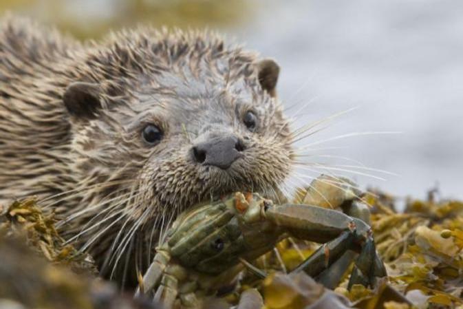
Kilmarie otter.
Seasonality – Resident year round.
Pressures – Road traffic mortalities, fishing gear, human disturbance and over grazing. Large scale industrial and/or housing developments in flood-plains. Loss of flood-plain area can result in changes to river flow characteristics, more extreme flood events, scouring of the riverbed and associated changes to the invertebrate and fish populations. All of these can have detrimental effects on otters, predominantly by impacts on their food supply. In order to maintain good body condition an otter needs to consume about 1 - 1.5kg of prey every day (predominately fish or frogs, but occasionally birds, mammals or crustaceans).
Population trends – The otter population has been steadily increasing in Scotland since the species’ historic decline in the early part of the 20th century. The last national otter survey conducted in 2007 concluded that the species had increased its population and range throughout Scotland and that it could now be considered ubiquitous. That survey included Dornoch Firth and Morrich More SAC where otter presence was confirmed at all monitoring locations with the site considered to be in favourable condition for the species.
These findings were repeated during site condition monitoring in 2011 resulting in the site’s condition status for otter being maintained as favourable.
Bottlenose dolphin (Tursiops truncatus)
Relevant SACs and Site Condition Status:
- Moray Firth SAC: Favourable, recovered (2016).
Population(s) at designation:
- Moray Firth: 101-250.
Sitelink provides feature condition assessment details, with feature conservation objectives provided in either a Conservation Advice Package (CAP), Conservation and Management Advice (CMA) or generic Conservation Objectives
Feature description in the context of relevant SAC: The Moray Firth supports the only known resident population of bottlenose dolphin in the North Sea and is one of only two UK sites designated for the species as a primary qualifying feature. The north east of Scotland population is estimated to comprise approximately 195 individuals. Between 1990 and 2013, annual estimates of the number of dolphins using the SAC ranged between 43 and 134.
Origin – The bottlenose dolphins of the Moray Firth are part of the Scottish east coast population. They occur in the Moray Firth all year round.
Behaviour – Sightings are usually of small groups of up to 20 individuals with animals either foraging, commuting or occasionally breaching. Females can produce a calf approximately every 4 to 5 years. In the wild they can live up to 20-50 years. Calves can be born any time of year but typically between March and September.
A wide range of fish species including cod, saithe, whiting, salmon and haddock (Santos et al., 2001) as well as squid, crabs and shrimp.
Habitat – Predominantly inshore coastal waters within 10km of the land but may range further offshore.
Distribution – Although dolphins are found throughout the Moray Firth they seem to prefer certain parts of the Inner Firth, the southern Moray Firth coastline and the mouth of the Cromarty Firth. The population also ranges outwith the Moray Firth with small groups regularly occurring off the Aberdeenshire, Fife and East Lothian coasts and occasionally as far as Northumberland.
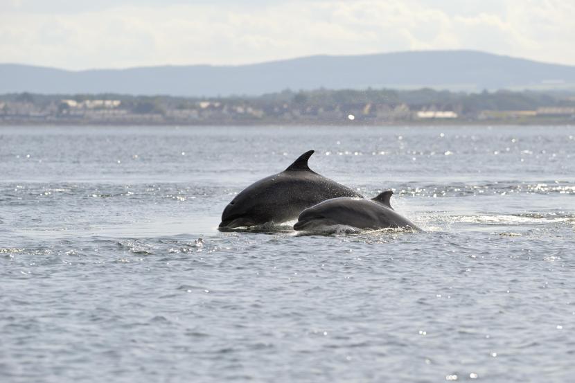
Seasonality – Present within the Moray Firth year round though abundance and distribution varies between summer and winter with animals appearing more dispersed and ranging further down the east coast in winter.
Pressures – Underwater noise from vessels (recreational and commercial) and development activity (e.g. piling, blasting, dredging, seismic survey and general engine noise), recreational disturbance, boat/propeller strikes, marine pollution, capture in fishing nets and potentially tidal turbines.
Population trends –
Despite inter-annual variability, the number of dolphins using the SAC has remained stable. Additional data suggest that the population of dolphins on the east coast of Scotland is increasing, and the SAC is used by greater than 50% of the population annually.
Harbour seal (Phoca vitulina)
Relevant SACs and Site Condition Status:
- Dornoch Firth and Morrich More SAC: Unfavourable, declining (2013).
Population(s) at designation:
- Dornoch Firth and Morrich More: 251-500.
Sitelink provides feature condition assessment details, with feature conservation objectives provided in either a Conservation Advice Package (CAP), Conservation and Management Advice (CMA) or generic Conservation Objectives.
Feature description in the context of relevant SAC: The Dornoch Firth supports a significant proportion of the inner Moray Firth’s harbour seal population and represents almost 2% of the UK population.
Origin – Harbour seals are resident in the Dornoch Firth and wider Moray Firth year round.
Behaviour – Harbour seals are typically found hauled out on sand-bars and shores at the mouth of the estuary which are used habitually as favoured locations by the same groups of individuals. Notable haul-out sites include the intertidal sandflats of Dornoch and Whiteness Sands and the intertidal sand bars of the Gizzen Briggs which consistently support around 600 seals. These areas are also used as breeding sites, including locations which are inundated by the tide as pups can swim within an hour after birth with pupping typically occurring in early to mid-June-July. Adult seals undergo an annual moult between August and September during which they spend extended period out of the water.
Diet – Fish, octopus, squid and various shellfish.
Habitat – Sandbanks, sandy and rocky shores and open (marine) water.
Distribution – Harbour seals are found throughout the wider Moray Firth and may range widely in search of prey (up to 50km). However, as they have high fidelity to their favoured haul out sites they tend to remain.
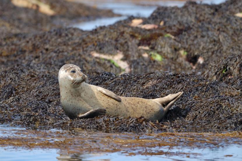
Seasonality – Harbour seals are present within the Dornoch Firth year round. The harbour seal breeding season is from June, July and August inclusive. The seal moult - for all animals older than pups - follows the pupping season. The moulting season usually lasts about 4–5 weeks, although the time of the moult for individuals may vary according to age, sex and reproductive status.
Pressures – Underwater noise from vessels (recreational and commercial) and development activity (e.g. piling, blasting, dredging, seismic survey and general engine noise), recreational disturbance – particularly at haul out sites, potential persecution from fisheries, marine pollution, capture in fishing nets and potentially tidal turbines.
Trends – There has been a substantial reduction in numbers on the east coast over the past decade or so, including within Dornoch Firth where numbers have declined from around 600 in the mid 1990’s to between 111 and 219 since 2010. However, numbers elsewhere in the wider Moray Firth, such as Loch Fleet and Culbin Sands, have increased markedly. At this broader geographic level harbour seal numbers have fluctuated over the medium term showing no discernible trend, although there has been a decline in the short-term. In light of this fluctuation and the more recent declining trend reference should be made to the latest Special Committee on Seals (SCOS) reports for the most up to data population data.
Fish
Atlantic salmon (Salmo salar)
Relevant SACs and Site Condition Status:
- River Moriston SACUnfavourable, no change (2011).
Population(s) at designation:
- River Moriston: undefined.
Sitelink provides feature condition assessment details, with feature conservation objectives provided in either a Conservation Advice Package (CAP), Conservation and Management Advice (CMA) or generic Conservation Objectives.
Feature description in the context of relevant SAC: Although a qualifying species of the River Moriston SAC, Atlantic salmon is not a primary feature of the site’s selection. The River Moriston is a tributary of the River Ness and is a regulated river which extends from its outflow at Loch Ness up to the dam below Loch Cluanie.
Origin – Adult Atlantic salmon return to their native rivers to spawn following a period at sea, so the majority of fish within River Moriston originate from this river or its tributaries.
Behaviour - Atlantic salmon have a complex life cycle which begins and ends in freshwater spawning grounds with adults spending a period at sea in between. In Scotland Atlantic salmon can spend up to four years as juveniles (‘fry’ and ‘parr’) in freshwater before the immature fish (‘smolts’) migrate downstream and out to sea. This stage is typically achieved in two years in the River Moriston, although some may take longer. After entering the sea, Atlantic salmon may spend up to four years before coming back to spawn in the same river where they were born. While most fish stay at sea for two or three years and come back as ‘salmon’, some spend only one year away. These fish (known as ‘grilse’) are relatively small when compared to multi-sea-winter fish. Atlantic salmon have a strong homing instinct which has led to the establishment of genetically distinct populations both between rivers and within catchments. After spawning the majority of fish die, but a small proportion (known as ‘kelts’) are able to migrate back to the sea to feed and survive to spawn again.
Diet - Juveniles feed on a wide range of aquatic invertebrates such as caddis flies, stoneflies and mayflies. At sea, adult Atlantic salmon feed on range of prey items, including marine amphipods, shrimps and squid and fish, such as sand eels, capelin and herring. Adults do not feed once they return to freshwater.
Habitat – Juvenile Atlantic salmon require rivers with clean, unpolluted and well-oxygenated water with a habitat mosaic which comprises suitable spawning gravels, cobbles and boulders.
On their return from the sea, it is thought that adult Atlantic salmon use inshore waters of the Moray Firth before migrating up-river to their original/natal spawning grounds.
Distribution – River Moriston and associated tributaries. Fish migrating to the sea disperse via the Moray Firth and North Sea en route to the North Atlantic and return by the same route 1-3 years later.
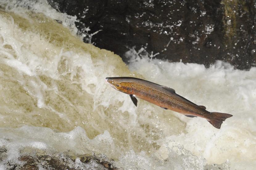
Atlantic Salmon (Salmo salar) leaping up a waterfall on the River Almond.
Seasonality – Juveniles migrate from river to sea in the spring with the peak in the Moray Firth considered to be between April and May. Adults may migrate back to their natal rivers at any time of year. The core period in the Moray Firth is between May and October with spawning occurring in the River Moriston catchment between November-December. In some localities, such as larger rivers, this may extend from October to late February.
Pressures – Overexploitation, forestry and agricultural operations which impact water quality, invasive species, alteration in water flow regime, physical barriers to migration, pollution, damage to spawning habitat, disease and parasites from fish farming, underwater noise and vibration (e.g. from piling, blasting, dredging), climate change and potentially tidal turbines.
Population trends - Site condition monitoring for Atlantic salmon undertaken in 2011 for the River Moriston SAC found that while densities of parr were reasonably high the density of fry was low. Meanwhile the total number of rod-caught adults within the Ness District, has generally declined since the highest catches in the mid-1960s to typically less than 1500 individuals being caught. Since then, catch figures have fluctuated around 1000 individuals.
Regarding the Southern European Atlantic salmon population of which the Scottish population is part, the trend has been downwards in many Fishery Districts, and, the Spring stock component in particular since the early 1970s. This decline reflects a long-term and substantial reduction in marine survival rates which has largely been attributed to the indirect effects of climate change, and incidental by-catches of smolts. Marine survival is now considered to be the most critical factor affecting Atlantic salmon populations.
Aquatic Invertebrates
Freshwater pearl mussel (Margaritifera margaritifera)
Relevant SACs and Site Condition Status:
Population(s) at designation:
- River Moriston: 10,000-500,000.
Sitelink provides feature condition assessment details, with feature conservation objectives provided in either a Conservation Advice Package (CAP), Conservation and Management Advice (CMA) or generic Conservation Objectives
Feature description in the context of relevant SAC: The River Moriston flows into the northern side of Loch Ness, and supports a functional freshwater pearl mussel population. Due to illegal pearl-fishing the population is not abundant but survey results show that 40% of the population is composed of juveniles. This is the highest percentage recorded in any Scottish pearl mussel population and indicates that recent successful recruitment has taken place. Iain to check – this is only true below Dundreggan.
Origin – Freshwater pearl mussels are sedentary therefore resident in the River Moriston.
Behaviour – Freshwater pearl mussels can grow to 140mm in length and burrow themselves into sandy substrates, often between boulders and pebbles, in fast-flowing rivers and streams. They feed by filtering fine organic matter syphoned from the water around them. Mussels spend their larval, or glochidial, life stage attached to the gills of salmonid fishes. The larvae attach themselves during mid to late summer and drop off the following spring to settle in the riverbed gravel where they grow to adulthood.
Diet – Suspended organic particles filtered from the water around them.
Habitat – Freshwater pearl mussels require cool, well-oxygenated, clean and relatively nutrient poor, fast-flowing rivers, with course sand or fine gravel substrate into which they can bury. In order for the populations to reproduce, they also require the rivers they inhabit to support good numbers of salmonids which they rely on in part of their life cycle (as detailed above).
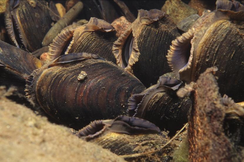
Freshwater pearl mussels (Margaritifera margaritifera), North Highland Area.
Seasonality –present in the river all year round, Adults are sedentary, larvae are released in mid to late summer and attach to the gills of fish (see ‘behaviour’).
Pressures – Development – particularly hydro power schemes, flood protection and fishery improvement measures, statutory undertaker development, deterioration in water quality (pollution and turbidity), alteration in water flow regime and illegal pearl fishing.
Population trends – A comprehensive survey of Scottish rivers from 1996 to 1999 revealed that freshwater pearl mussels are now extinct in most of the lowlands, and scarce everywhere except for a handful of Highland rivers. If the present rates of extinction continue, it has been estimated that surviving Scottish populations may only persist for a further 25 years.
Further Reading
Glossary of Terms
| Conservation Objective term | Definition |
|---|---|
|
Distribution |
The “distribution” is how the qualifying feature is spread out within the site. |
|
Favourable condition |
This refers to the assessed condition of a feature through Site Condition Monitoring. Features considered to be in favourable condition for the purposes of these Conservation Objectives are those that have an assessed condition of either:
|
|
Generation length |
Generation length is “the average age of parents of the current cohort”. Generation length therefore reflects the turnover rate of breeding individuals in a population (IUCN, 2019). |
|
Maintain |
Where a qualifying feature of the SPA is assessed as being in favourable condition the conservation objective is ‘maintain’. This means that the various attributes of the feature should be kept at that favourable level. This can include increasing/improving condition as well, but not a permanent decline. |
|
Marine birds |
This term encompasses true seabirds and waterfowl (seaducks, divers, and grebes). |
|
Metapopulation |
A group of connected populations of a species within a defined area, where the individual populations may interact with one another. |
|
Restore |
Where a qualifying feature of the SPA is assessed as being in unfavourable condition the conservation objective is ‘restore’. This means that the various attributes of the feature should be returned to the favourable level by increasing/improving condition. |
|
Site integrity |
The integrity of a site is defined in general terms as the coherence of its ecological structures and function, across its whole area, which enables it to sustain the habitat, complex of habitats and and/or the levels of populations of the species for which it was designated. |
|
Site reference population |
This refers to the estimated population figure for the site and should be used to form the basis of carrying out HRAs. In most cases, the site reference population will be the baseline population (figure at designation). However, where recent surveys show a population to have increased or stayed stable, the current population is considered the most appropriate population figure to use for HRA’s. |
|
Supporting habitats and processes |
This includes the following environmental conditions (but is not limited to) which are important for maintaining/restoring the protected features, e.g. hydrography and supporting water currents, chemical water quality parameters, suspended sediment levels, radionuclide levels. |
|
Unfavourable condition |
This refers to the assessed condition of a feature through Site Condition Monitoring. Features considered to be in unfavourable condition for the purposes of these Conservation Objectives are those that have an assessed condition of either:
|
|
Waterfowl |
Encompasses seaducks, grebes and divers. |
References
HRA Process
- The Conservation (Natural Habitats & c.) Regulations 1994
- Habitats Regulations Appraisal
- Appropriate assessment (AA)
- Likely to have a significant effect (LSE)
- Sitelink
- Help and advice on HRA
Marine Mammals
Cheney, B., Graham, I.M., Barton, T.R., Hammond, P.S. and Thompson, P.M. 2014. Site
Condition Monitoring of bottlenose dolphins within the Moray Firth Special Area of
Conservation: 2011-2013. Scottish Natural Heritage Commissioned Report No. 797.
Quick, N., Arso, N, Cheney, B, Islas, V, Janik, V, Thompson P. M. and Hammond, P
The east coast of Scotland bottlenose dolphin population: Improving understanding of ecology outside the Moray Firth SAC
UK Department of Energy and Climate Change offshore energy Strategic Environmental Assessment (SEA) programme.
Russell, D. J. F., McConnell, B., Thompson, D., Duck, C., Morris, C., and Harwood, P.
and Jason Mathiopoulos – Uncovering the links between foraging and breeding regions in a highly mobile mammal Journal of Applied Ecology 2013, 50, 499-509.
Wilson, D. R. B. 1995. The ecology of bottlenose dolphins in the Moray Firth, Scotland : a population at the northern extreme of the species' range – Aberdeen University Thesis.
Fish
Bergstedt, R. A. & Seelye, J. G.1995. Evidence for lack of homing by sea lamprey. Transactions of the American Fisheries Society 124, 235–239.
Gaudron, S. M. & Lucas, M. C. 2006. First evidence of attraction of adult river lamprey in the migratory phase to larval odour. Journal of Fish Biology, 68, 640–644.
Gill, A.B. & Bartlett, M. 2010. Literature review on the potential effects of electromagnetic fields and subsea noise from marine renewable energy developments on Atlantic salmon, sea trout and European eel. Scottish Natural Heritage Commissioned Report No.401
Godfrey, J.D., Stewart, D.C., Middlemas, S.J. & Armstrong, J.D. 2014. Depth use and movements of homing Atlantic salmon (Salmo salar) in Scottish coastal waters in relation to marine renewable energy development. Scottish Marine and Freshwater Science Vol 05, No 18
Hardisty, M.W. 2013. Biology of the Cyclostomes. Springer, London.
Maitland, P.S. 2003. Ecology of the River, Brook and Sea Lamprey. Conserving Natura 2000 Rivers Ecology Series No. 5. English Nature, Peterborough.
Maitland, P.S., Morris, K.H. East, K., Schoonoord, M. P., van der Wal, B. & Potter, I.C. 1984. The estuarine biology of the River lamprey, Lampetra fluviutilis, in the Firth of Forth, Scotland, with particular reference to size composition and feeding. Journal of the Zoological Society of London, 203, 211-225.
Malcolm, I.A., Godfrey, J. & Youngson, A.F. 2010. Review of migratory routes and behaviour of Atlantic salmon, sea trout and European eel in Scotland’s coastal environment: implications for the development of marine renewables. Scottish Marine and Freshwater Science 1: No 14.
Riley W.D., Bendall B., Ives M.J., Edmonds N.J. & Maxwell D.L. 2012. Street lighting disrupts the diel migratory pattern of wild Atlantic salmon, Salmo salar L., smolts leaving their natal stream. Aquaculture, 330-333, 74-81.
Smith, I.P. & Smith, G.W. 1997. Tidal and diel timing of river entry by adult Atlantic salmon returning to the Aberdeenshire Dee, Scotland. Journal of Fish Biology 50, 463–474.
Vrieze, L. A. & Sorensen, P. W. 2001. Laboratory assessment of the role of a larval pheromone and natural stream odor in spawning stream localization by migratory sea lamprey (Petromyzon marinus). Canadian Journal of Fisheries and Aquatic Sciences, 58, 2374–2385.
Last updated: