Open space audit and strategy - The OSS Hub
Planning authorities should assess current and future open space needs, and plan how to protect open spaces to help meet those needs.
The Planning (Scotland) Act 2019 requires planning authorities to prepare and publish an Open Space Strategy (OSS).
The OSS is to set out a strategic framework of the planning authority’s policies and proposals as to the development, maintenance and use of green infrastructure in their district, including open spaces and green networks. An open space strategy must contain an audit of existing open space provision an assessment of current and future requirements. The Act also introduces a requirement for planning authorities to prepare a Forestry and Woodland Strategy and to carry out a play sufficiency assessment.
The Act defines some key terms as follows:
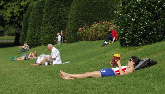
- Open space is the space within and on the edge of settlements comprising green infrastructure or civic areas such as squares, market places and other paved or hard landscaped areas with a civic function.
- Green infrastructure means features of natural and built environments and the connections between them that provide a range of ecosystem and social benefits.
- Green networks are connected areas of green infrastructure and open space.
Guidance to support the preparation of open space strategies in your area:
'Wayfinder Guide' to the preparation of Open Space Audits and Strategies
Review and development of open space audit and strategy guidance and best practice - NatureScot Commissioned Report No.625
Examples of good practice in open space strategies:
Developing Open Space Standards - Guidance and Framework
Open Space 2021 Edinburgh's Open Space Strategy
Planning for green networks in Fife
Find out more:
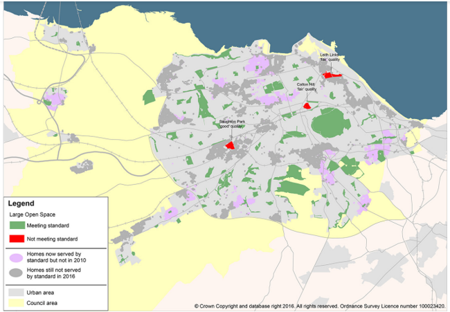
Good graphics, simple message
This OSS is a good example of setting a standard and how to measure its success in an intuitive, visual format. The Large Greenspace Standard applies to the management of existing greenspaces and also provision of new developments. All homes should be within 800m walking distance of an accessible large greenspace of at least 2 hectares, and all newly created large greenspaces should be of ‘good’ quality.
This map analysis shows an increase of almost 10% of homes being served by the standard over a period of six years.
This map analysis shows an increase of almost 10% of homes being served by the standard over a period of six years.
Click for a full description
A map of Edinburgh urban and council area showing the location of the many large open spaces meeting the standard versus those not meeting the standard (in the minority) in different colours.
Development briefs
This Supplementary Planning Guidance is a good example of delivering the requirements of an Open Space strategy through the development plan, with a practical, map-based expression of how to apply it on the ground.
A series of Development Briefs have been prepared for new sites allocated for development within the LDP. In this design-led approach, the requirements for open space and its functions (e.g. connectivity with cycle routes) are mapped out in detail for each site, encouraging developers to design high quality developments.
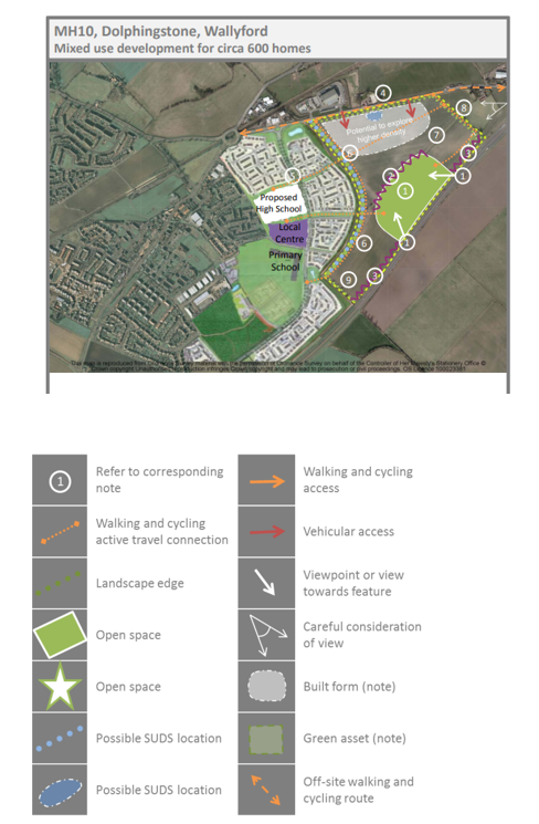
The image shows an aerial view of a proposed mixed use development at Wallyford with the locations of schools and settlements, and their relationship with possible drainage systems and open spaces, viewpoints and walking and cycling routes marked, through e.g. polygons and arrows.
East Lothian Council - Local Development Plan 2018 Supplementary Planning Guidance
Strategic alignment
PAN 65 states that “an open space strategy provides an effective means of co-ordinating the policies of the different Council services [Fig 2] with responsibilities for open space, and of focusing liaison and partnership working with relevant public, private and community interests”. It is a corporate document that is informed by, and will help deliver, other strategies and plans of the Council and its partners.
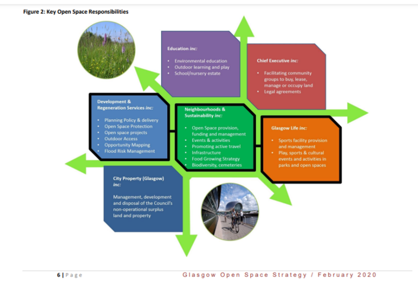
A flowchart showing various Glasgow City Council strategies that are linked to open space such as education, city property, and development & regeneration services, and their connection, grouped around neighbourhoods and sustainability at the heart of the flowchart.
Site prioritisation
A quality standard for open space provides not only a measure of progress, but also ensures the Strategy targets sites of poorest quality. Each settlement area has, in addition to a list of all opportunities, a selection of priority projects, which may be reviewed and changed, subject to funding availability and partnership initiatives.
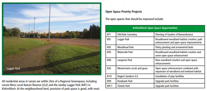
Luggie Park at Lenzie in East Dunbartonshire.
Click for a full description
Image shows short grass in the foreground and a path leading to a sports pitch on the left. On the right, there is a table listing various open spaces like this one that should be improved through e.g woodland creation or other upgrade of facilities.
Last updated: