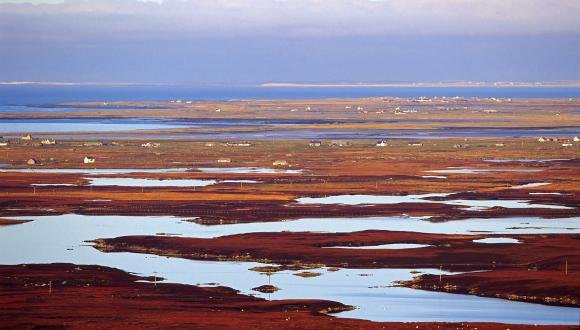
Carbon and Peatland 2016 map
This map is a high-level planning tool to promote consistency and clarity in the preparation of spatial frameworks by planning authorities.
The Carbon and Peatland map 2016 is now available for download as a Geographic Information Systems (GIS) shape file from the NaturalSpaces section of the SNHi Information Service (renewable category). You can also view this map on the Scotland's Soils Website.
What the map is
A high-level planning tool to promote consistency and clarity in the preparation of spatial frameworks by planning authorities.
The map is a predictive tool which provides an indication of the likely presence of peat on each individually mapped area, at a coarse scale. The types of peat shown on the map are:
- carbon-rich soils
- deep peat
- priority peatland habitat
These are now available for the first time in a consolidated spatial dataset. Development Plans are expected to include wind farm spatial frameworks (paragraph 161 in Scottish Planning Policy) – these should be informed by the Carbon and Peatland 2016 map (it maps the carbon-rich soils, deep peat and priority peatland habitat listed in Table 1 in Scottish Planning Policy).
Spatial frameworks can provide more than just an initial steer in the development plan. They can help to inform the scoping stage of an Environmental Impact Assessment (EIA) and provide a framework for site selection, environmental assessment and decision-making.
What the map shows
The map shows the areas of peat referred to in Table 1 in Scottish Planning Policy (SPP) – carbon-rich soil, deep peat and priority peatland habitat. On the map, the top two classes (1 and 2) taken together identify the nationally important resource:
Class 1
- Nationally important carbon-rich soils, deep peat and priority peatland habitat*
- Areas likely to be of high conservation value
Class 2
- Nationally important carbon-rich soils, deep peat and priority peatland habitat
- Areas of potentially high conservation value and restoration potential
*Priority peatland habitat is land covered by peat-forming vegetation or vegetation associated with peat formation.
How the map will be used
The purpose of the map is to inform the preparation by planning authorities of spatial frameworks for onshore wind. It has been created to help provide a consistent approach across Scotland.
The map provides planning authorities with the information they need to implement Scottish Planning Policy. This policy requires Planning Authorities to develop spatial frameworks for onshore wind – and Table 1 in SPP sets out what should be shown in these spatial frameworks. Alongside other areas to be included, planning authorities are required to include carbon-rich soils, deep peat and priority peatland habitat – and to afford these areas significant protection, although this is not a ban on development.
Although the map can only indicate that carbon-rich soils, deep peat and priority peatland habitat are likely to be present, it will be helpful in the initial site selection process undertaken by developers.
The map should not be used in development management decision-making. A detailed site survey and EIA will be required.
NatureScot guidance on spatial planning emphasises:
"The location of a proposal in the mapped area does not, in itself, mean that the proposal is unacceptable, or that carbon rich soils, deep peat and priority peatland habitat will be adversely affected. The quality of peatland tends to be highly variable across an application site and a detailed assessment is required to identify the actual effects of the proposal."
Spatial Planning for Onshore Wind Turbines – natural heritage considerations, NatureScot June 2015
Further reading
Last updated: