Green Infrastructure - Monitoring and Evaluation Guidance
Introduction
This guidance sets out the framework that will be used to monitor and evaluate the success of the Green Infrastructure Strategic Intervention (this covers all three of the Challenge Funds which make up the Strategic Intervention - the Lowland & Uplands Challenge Fund, the Highlands & Islands Challenge Fund and the Green Infrastructure Community Engagement Fund).
The guidance covers the monitoring, evaluation and reporting that is done by NatureScot for the Strategic Intervention overall and that to be done by grantees for projects which receive funding from us.
When applying for funding, applicants need to demonstrate how they will monitor the implementation of their project, and evaluate and report the predicted outputs, results and outcomes. This guidance outlines the information that needs to be collected and how it should be reported.
This guidance is based on the Guidance Document on Monitoring and Evaluation (The EU Guidance), produced by the European Commission for the European Regional Development Fund (ERDF) Programme. It also follows the principles in the Scottish Government’s Monitoring and Evaluation Strategy for the 2014-2020 Scottish Operational Programmes.
The Scottish Context
National Performance Framework
The Green Infrastructure Strategic Intervention contributes towards delivering five National Outcomes under the Scottish Government’s National Performance Framework:
- We live in communities that are inclusive, empowered, resilient and safe;
- We have a globally competitive, entrepreneurial, inclusive and sustainable economy
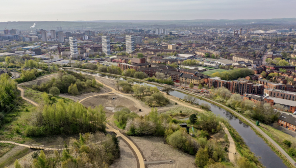
- We value, enjoy, protect and enhance our environment;
- We are healthy and active;
- We tackle poverty by sharing opportunities, wealth and power more equally.
National Indicators
The National Performance Framework measures and reports on progress by government in Scotland towards creating a more successful country, with opportunities for all to flourish through increasing sustainable economic growth. The Green Infrastructure Strategic Intervention delivers against twelve of the National Indicators in the National Performance Framework:
- Perceptions of local area
- Perceptions of local crime rate
- Places to interact
- Access to green and blue space
- Social capital
- Economic growth
- Carbon footprint
- Natural capital
- Visits to the outdoors
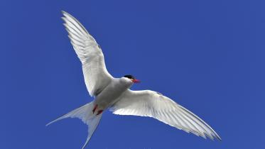
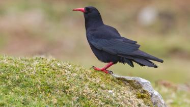
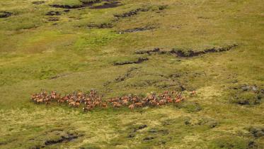
- Biodiversity
- Mental well-being
- Physical activity
All of the measures used within the Green Infrastructure Strategic Intervention will link back to this context.
National Surveys
There are a number of Scotland-wide surveys that are used to monitor the National Indicators and which NatureScot will use as part of the assessment of the impact of the Green Infrastructure Strategic Intervention. These include for example:
- Scottish Household Survey
- Scottish Health Survey
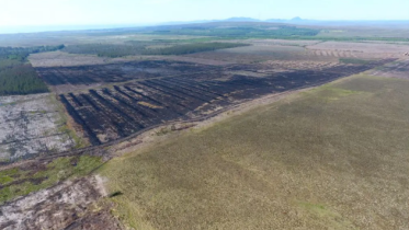
- Scottish Vacant & Derelict Land Survey
- Scotland’s People & Nature Survey (SPANS)
- State of Scotland’s Greenspace report
- Greenspace Use and Attitude Survey
- Scotland’s Greenspace Map
- Local Government Benchmarking Framework on Parks and Open Space Services.
Why undertake monitoring and evaluation?
We want to help deliver improved life chances and wellbeing for people through improving the quality, quantity and accessibility of green infrastructure, and how people engage with it and benefit from it.
The purpose of monitoring and evaluation is to provide evidence of the extent to which we have achieved this. It also allows us to track the management of the funded Projects, the inputs, outputs and results, and the impact that these make both individually and cumulatively.
As the Lead Partner delivering the Strategic Intervention, NatureScot is expected by the EU and the Scottish Government to oversee a programme of monitoring and evaluation that:
- evidences delivery of the Green Infrastructure Strategic Intervention in an efficient manner;
- assesses whether the Green Infrastructure Strategic Intervention has produced the desired results and what its impact has been; and
- informs the Scottish Government of the contribution made towards meeting the National Indicators.
How to plan for Monitoring and Evaluation
All grantees are required to report against a selection of the measures and indicators noted in this guidance. Those that are most appropriate to what the project will deliver should be chosen; it is not necessary to report against all of them. Of course, grantees can design their own additional measures over and above those in this guidance and this is encouraged.
All the measures to be used must be included in the Monitoring and Evaluation Plan, to be submitted along with the project Application. The final list of measures is agreed with NatureScot when we award our grant.
The Monitoring Framework
This section sets out the framework of indicators that can be used to monitor, evaluate and report on various aspects of the Green Infrastructure Strategic Intervention and the projects that contribute to it. These include:
- Results Indicators – to be reported on by NatureScot using information collected from national surveys and from Grantees.
- Outcome Measures – to be reported on by Grantees for their projects. NatureScot collates the information from all projects in order to report on the outcomes achieved by the Strategic Intervention as a whole.
- Process Measures – to be reported on by NatureScot using information collected from Grantees.
Further detail on each of the indicators is provided below and in the measures definitions in Annexes 2-4.
Result Indicators (reported on by NatureScot)
Results are the overall changes we want to see from the Green Infrastructure Strategic Intervention. Three Result Indicators have been agreed with the European Commission (see A, B and C in Table 1) to monitor progress for the Strategic Intervention as a whole. These will be reported by NatureScot, so no action is required from grantees.
| Indicator Name | Description | Outcome sought |
|---|---|---|
|
INDICATOR A: Number of Projects delivering new/improved green infrastructure |
A record of the number of Projects delivering new or improved green infrastructure |
New green infrastructure created and existing green infrastructure improved |
|
INDICATOR B: Percentage of the urban population that is satisfied with the quality of greenspace |
This measures the change in the levels of satisfaction of people with their local greenspace. | Improved perceptions of greenspace; Increased participation in use of the outdoors. |
|
INDICATOR C: Greenspace created or enhanced in urban areas |
This records the amount in hectares of greenspace that is created or improved as a result of the Projects in the Green Infrastructure Strategic Intervention |
Create New or Improve Existing Green Infrastructure; Improve vacant and derelict land; Support Economic Development (Target is 65ha by 2018 and 72.5ha by 2023 for LUPS areas; 5.1ha by 2018 for transitional areas (Highlands & Islands). |
Outcome Measures (reported on by Grantees)
A number of measures have been identified which will help us to monitor and evaluate the intended results (outcomes) for the Green Infrastructure Strategic Intervention. These are shown in table 2.
| No. | Measure Name |
|---|---|
| Measure 1 | Improved access to better greenspace |
| Measure 2 | Vacant and derelict land brought back into use |
| Measure 3 | Better connected green infrastructure |
| Measure 4 | Improved urban areas that are resilient to flooding |
| Measure 5 | Improved health and well-being |
| Measure 6 | Improved quality of place through better green infrastructure |
| Measure 7 | Improvement in the perceptions of local greenspace |
| Measure 8 | Increased attractiveness to investors |
| Measure 9 | Enhanced biodiversity of local greenspace |
A description of these outcomes and how they should be monitored and reported on is contained in Annex 3.
Not all of these apply to all projects. The outcome measures which are relevant to each project should be set out in the Monitoring & Evaluation Plan submitted with each project application and subsequently agreed between the grantee and NatureScot. Information and data for each agreed measure will be collected by grantees for their project and reported to NatureScot through the quarterly and final Progress Reports.
The frequency of reporting for each measure will be agreed as part of the Monitoring & Evaluation Plan – some measures require to be reported on each quarter, while others may only require to be reported on in the final report.
Other measures over and above those above may be selected to monitor progress and evaluate the impact of a project. Alternatively, grantees may use their own existing measures (as well as, or instead of, the menu measures), if they tell a strong story related to the outcomes the Green Infrastructure Strategic Intervention wishes to achieve. Where applicants propose to use outcome measures other than those defined in Annex 3, then a definition for each additional measure must be completed in a similar format to that used in the annex, along with agreement on frequency and format of reporting. These should also be included in the agreed Monitoring & Evaluation Plan for the project.
Process measures (reported on by NatureScot)
Process measures are used to monitor progress in delivering projects and to report on these individually and collectively. NatureScot will collect information from grantees through quarterly and final Progress Reports (see below).
NatureScot - Strategic Intervention Process Monitoring
NatureScot’s performance as Lead Partner for the Green Infrastructure Strategic Intervention will be assessed by Scottish Government and the EU against measures such as:
- Application process - customer experience, quality of guidance;
- Change Requests – number submitted and time taken to process;
- Claims – submission on time and accuracy;
- Transactions - compliance and failure rates;
- Eligible spend percentage against overall budget;
- Customer experience – feedback, complaints and compliments;
- Communications activity – success in promoting the Strategic Intervention and compliance with EU and Scottish Government branding requirements.
Grantee - Project management Process Monitoring
Grantees’ performance will be assessed by NatureScot against the following measures, using data collected by NatureScot when processing claims.
- Progress reports submitted on time
- Claims submitted on time
- Claim Return %
- Claim Return rate
- Transaction failure rate
- Claim submission after completion
- Eligible Spend against Budget Forecast
Refer to Annex 4 for the process measure definitions.
We will also gather data from the checklist in the Procurement Aide Memoire, which will be required to be submitted with quarterly claim reports, including:
- Evidence of contract advertising;
- Evidence of compliance with contract thresholds; and
- Evidence of compliant tender procedure.
Qualitative methods
The use of qualitative evidence in monitoring, evaluation and reporting provides a rich source of information to demonstrate the benefits of a project and the outcomes it has achieved. Qualitative evidence can include examples, case studies, surveys, workshop outputs, art pieces, stories, activity reports, first person pieces, video diaries, newsletters, plays, and so on. The options are broad ranging and innovation and creativity is encouraged.
The following principles should be considered when planning qualitative monitoring:
Plan ahead:
- be clear what kind of evidence you want to collect at the planning stage and how it will be used in reporting;
- ensure there is sufficient budget for it and appropriately skilled people to undertake it;
- prepare an implementation plan and share it with participants, so they know what to expect;
- have a framework in place to secure approval from people to use images of them or information about them.
Involve people:
- where possible, get the target audience involved in planning the monitoring and reporting and get them involved in gathering evidence;
- get creative and make it fun – think about what will be compelling when we tell the story of green infrastructure.
Reporting
Strategic Intervention – Reporting done by NatureScot
NatureScot is responsible for monitoring progress of all Projects individually and collectively towards delivering the Strategic Intervention’s outcomes:
- Nature, biodiversity and ecosystems
- Environmental quality, flooding and climate change
- Involving communities and increasing participation
- Increasing place attractiveness and competitiveness
- Improving health and well-being
…and Horizontal Themes:
- Sustainable development
- Equal opportunities and non-discrimination
- Equality between Men and Women
We will evaluate whether the Strategic Intervention is being delivered on time and on budget. We will also upload quarterly monitoring reports submitted with claims, including nil returns, to EUMIS for each of the Projects.
NatureScot will provide the Managing Authority with an Annual Report on progress with delivering the Challenge Funds and progress towards meeting targets. This report will also contain a narrative on results under each of the Green Infrastructure Outcomes and Horizontal Themes and provide evidence on compliance, process management and communications.
Project Reporting – Reporting done by Grantees
Grantees are required to report on all of the chosen measures at appropriate frequencies (see below), as agreed in the Monitoring & Evaluation Plan for their project. For some outputs and results, grantees will be asked to produce qualitative evidence to allow NatureScot to produce a narrative on why and how the Green Infrastructure Strategic Intervention has worked.
Milestones for the delivery of projects will be identified and agreed between the grantee, NatureScot and Managing Authority. The completion of milestones will be linked to payment claims. Grantees will be required to report the actual progress of implementation of each Operation against the planned forecast on a quarterly basis as part of completing a Progress Report (whether or not submitting a quarterly claim).
Following the final claim, annual reporting of results is expected by grantees until 2023.
The following table illustrates reporting frequencies:
| Report Type | Frequency |
|---|---|
| Progress Reports (Output/Result & Delivery Measures) | Quarterly |
| Final Report | 1 month after Project completion |
| Annual Reporting of Results | Following final claim, until 2023 |
| Auditable data | Retain until 2030 |
Quarterly reporting – Progress Report
Quarterly Progress Reports are required throughout the delivery period for the project. These must be provided using the template provided by NatureScot. These will include a report on progress against the measures agreed in the project’s Monitoring & Evaluation Plan and should be accompanied by appropriate evidence (data, photographs, video etc.).
Final Report
Grantees will be required to provide a Final Report at the completion of the Project. A template for this will be provided by NatureScot (following a similar format to the Quarterly Progress Reports).
Within 1 month of completion, the following should be provided to NatureScot:
- a final Project report, template provided by NatureScot;
- a one page ‘case study’ highlight report summarising your project’s activities, contribution to outcomes and impact;
- a 5 minute video for use online and at presentations showcasing the Project: capturing the Project from start to finish – aims, challenges, existing situation, what was done, the end result, people’s perceptions.
Annual Monitoring Reports
Grantees are required to provide annual reports starting 1 year after submission of the Final Report and running through until the end of the monitoring period in 2023. A template for this will be provided by NatureScot.
Auditable Data
Further evidence on the project may be requested up to the end of the EU auditable period (2030).
Use of Reported Information and Format
The data and information collected as part of monitoring progress against the measures may be used by NatureScot and/or Managing Authority (Scottish Government) in reports, case studies and publicity material. Therefore, it is important that grantees ensure all participants and staff that feature in the reporting are aware of this and have given the appropriate consent for their details to be shared. The Scottish Government has created a consent form which Projects can download and use for this purpose (see page 20).
Some of the measures require information in the form of GIS data, photographs and video clips. Grantees are required to submit data in these formats to the specifications set out in Annex 1.
ANNEX 1: Specifications for GIS data, photographs and video
1 – GIS data (applies to Green Infrastructure Fund applicants only)
Applicants should confirm whether they are OSMA members. If not, they will need to be able to demonstrate how they will meet the monitoring requirements for Green Infrastructure data.
NatureScot will supply a GIS file template to applicants for the collection of spatial data associated with the reporting and monitoring requirements of the programme. The template file will be configured appropriately for the type of information to be captured and the structure of the template is not to be altered without the consent of NatureScot.
All GIS data submitted by applicants should be complete with metadata captured to the latest UK GEMINI standard (currently (December 2015) UK GEMINI 2.2). Guidance on the UK GEMINI standard can be found on the website of the Association for Geographic Information, who oversee the standard.
2 – Photograph specification
All photographs commissioned or submitted should be in a digital format (jpg file). Images should be the maximum size that can be achieved by the camera. If we require smaller versions NatureScot can repurpose the file. Each image should have the following metadata (information):
- image ID;
- title;
- photographer (can be the organisation);
- short description;
- date taken;
- National Grid location
- Permissions;
- Copyright.
If the images/videos are to be supplied by freelance professionals then the images should have the requested file metadata tagged to the IPTC field of each image file. If not, then a separate accompanying spread sheet with the metadata will be required.
Please note that there's no routine deleting of images, so once an image is uploaded it will be on the NatureScot Image Library as long as NatureScot support it.
Grantees must give NatureScot the right to use the photographs, transparencies or digital images, including video images they provide to us. Grantees must get any permissions, including copyright, needed for these images to be used, including the consent of any persons appearing in them where applicable, before being sent to us and before they are to be used.
3 – Video specification
All submitted or commissioned video clips should be provided digitally as an uncompressed video. Video clips should be in a format capable of being uploaded to social media, for example through the NatureScot YouTube channel. There is no file size constraint for videos but ideally they should be filmed at 1080p 25fps. If the videos are uploaded to YouTube at that size they can be played back at lower resolutions.
As a last resort, where the large size of the video files makes it not feasible to email video clips, then hard copies will be required either as DVDs or Pen Drives. DVDs or Pen Drives should then be sent to the GI Admin Officer. Video clips should show the name and organisation (if relevant) of those talking on screen.
Each video clip should have the following metadata attached and be contained in a separate accompanying spreadsheet:
- video ID;
- title;
- photographer (can be the organisation);
- short description;
- date taken;
- permissions;
- copyright;
ANNEX 2: Result Indicator Definitions
| Indicator Name | INDICATOR A: Number of Projects delivering new/improved green infrastructure |
|---|---|
| Description | A record of the number of projects delivering new or improved green infrastructure |
| Outcome sought | Create New or Improve Existing Green Infrastructure |
| Data collector | NatureScot |
| Scope | Funded Projects within the Green Infrastructure Strategic Intervention |
| Frequency of data collection | Whenever new Projects are agreed |
| Data items | Number of agreed Projects in Lowland & Upland Scotland; number of agreed Projects in transition areas (Highlands & Islands). |
| Frequency of report | 2018, 2023 |
| Notes |
“Agreed” Projects mean the contract is let. Target is 7 in LUPS areas by 2018, and a further 7 by 2023. Target is 1 in HIE areas by 2018 Grantees are not required to report this indicator |
| Indicator Name | INDICATOR B: Percentage of the urban population that is satisfied with the quality of greenspace |
|---|---|
| Description | A record of the number of projects delivering new or improved green infrastructure |
| Outcome sought | Create New or Improve Existing Green Infrastructure |
| Data collector | NatureScot, via Scotland’s People and Nature Survey (SPANS) and through the Scottish Household Survey |
| Scope | Indicator B is not concerned with specific Projects or investment in particular sites. The indicator seeks to measure the wider impact of the Green Infrastructure Strategic Intervention and will monitor any difference at the Scotland-wide scale. |
| Frequency of data collection | After end of Project |
| Data items | Percentage of people living in urban areas who state they are either satisfied or fairly satisfied with the quality of their local greenspace. |
| Frequency of report | Annual |
| Notes |
Target is 75% by 2018, and 80% by 2023, from a baseline of 74% in 2013. This reflects an aspiration to close the gap between the levels of satisfaction amongst urban residents and those living in rural areas. Grantees are not required to report this indicator. |
| Indicator Name | INDICATOR C: Greenspace created or enhanced in urban areas |
|---|---|
|
Description |
This records the amount in hectares of greenspace that is created or improved as a result of the Projects in the Green Infrastructure Strategic Intervention |
|
Outcome sought |
Create New or Improve Existing Green Infrastructure; Improve vacant and derelict land; Support Economic Development |
|
Data collector |
Grantee (Scotland’s Greenspace Map will provide base data) |
|
Scope |
Greenspace is defined as any vegetated land or water within an urban area, this includes:
For the purposes of this indicator the measurement unit includes all types of greenspace (except private residential gardens) within the urban area and also urban greening of public realm and buildings with tree cover, planting, green roofs/walls. Scotland’s Greenspace Map shows the different typologies of existing greenspace. |
|
Frequency of data collection |
Quarterly |
|
Data items |
Number of hectares of greenspace created and/or improved by Projects; forecast date for completion; actual date of completion |
|
Presentation Format |
Applicants are asked to provide information in their application on the planned target of hectares of green infrastructure to be created and/or improved. Grantees are then required to report on progress against this target in quarterly progress reports. Any differences between the planned and actual delivery should be explained. For the final report: a pdf A4 map showing: the Project boundary, the actual area created and the actual area improved and any differences from ‘planned’ |
|
Frequency of report |
Quarterly |
|
Notes |
The overall target for the Strategic Intervention is currently 65ha by 2018 and 72.5ha by 2023 for LUPS areas; 5.1ha by 2018 for HIE areas (Highlands & Islands). |
ANNEX 3: Outcome Measure Definitions
| Indicator Name | 1: Improved Access to Better Green Infrastructure |
|---|---|
|
Description |
This relates to the improvement in access to greenspace close to where people live |
|
Contributions to outcomes |
Involving communities and increasing participation; Improving health and well-being |
|
Data collector |
Grantee (via Scotland’s Greenspace Map, OS AddressBase, Scottish Index of Multiple Deprivation (SIMD)) |
|
Scope |
This measure only includes greenspace that has unrestricted public access, which could include the following types: public park & garden, amenity space, playspace, playing fields, green corridors, woodland, open semi-natural and open water. |
|
Frequency of data collection |
To be agreed with NatureScot |
|
Data items |
Planned and actual number of households within 300m of new or improved publicly usable greenspace of 0.2ha or more in size; those falling within the 20% most deprived areas (identified in SIMD16); |
|
Presentation Format |
Using GIS, Grantees should estimate the impact of the Project. The different types of greenspace are shown on Scotland’s Greenspace Map and OS Address Base provides the data on properties and households. Note that a ‘network analysis’ is not required as a straight line buffer is sufficient. Specify the planned number of households that benefit from the project as follows: (i) all households, and (ii) households falling within an area of the lowest 20% SIMD. |
|
Frequency of report |
To be agreed with NatureScot |
| Measure Name | 2: Vacant and derelict land brought back into use |
|---|---|
| Description | This relates to the amount of area currently on the Scottish Vacant and Derelict Land Register that is brought back into a greenspace use. |
| Contribution to Outcomes | Increasing place attractiveness and competitiveness |
| Data collector | Grantee (via the Scottish Vacant and Derelict Land Register) |
| Scope | The measurement unit includes all types of greenspace (except private residential gardens) within the urban area. The Grantee must demonstrate that the vacant or derelict land is on the national register prior to the works being started. Only the portion of the site that is remediated as permanent greenspace should be recorded against the indicator. Temporary greening of vacant or derelict land is not included. |
| Frequency of data collection | To be agreed with NatureScot |
| Data items | Number of hectares of vacant or derelict land that is remediated as greenspace Map showing project boundary and planned area for remediation |
| Presentation Format |
Map or plan showing project boundary and planned area for remediation. Evidence that the site has been removed from the Vacant & Derelict Land Register (at completion of Project, or as soon as that evidence can be provided (ie, when the register is updated). |
| Frequency of report | To be agreed with NatureScot |
| Measure Name | 3: Vacant and derelict land brought back into use |
|---|---|
| Description | This relates to the length of new or improved green connection between and to greenspaces |
| Contribution to Outcomes | Involving communities and increasing participation; Increasing place attractiveness and competitiveness; Improving health and well-being |
| Data collector | Grantee (via Scotland’s Greenspace Map) |
| Scope | The measurement unit includes linear greenspaces, water courses and routes to and between greenspaces (eg links via public realm with tree cover, planting along route). Greenspaces includes all types except private residential gardens. |
| Frequency of data collection |
Quarterly |
| Data items | Length in kilometres of new or improved green connections between and to greenspace. |
| Presentation Format |
For the final report, a pdf A4 map should be provided, showing the Project boundary, the actual length of green connections created, the actual length of green connections improved and the greenspaces that are better connected. |
| Frequency of report | Quarterly |
| Measure Name |
4: Improved urban areas that are resilient to flooding |
|---|---|
| Description | This relates to the number of households and businesses that benefit from reduced flood risk as a result of new or improved green infrastructure |
| Outcome sought | Environmental quality, flooding and climate change |
| Data collector | Grantee (via Scotland’s Greenspace Map, Indicative Flood Risk Map, OS AddressBase) |
| Scope | The measurement unit includes the number of households and businesses within an indicative flood risk zone that have reduced flood risk and includes all types of greenspace, except private gardens |
| Frequency of data collection | To be agreed with NatureScot |
| Data items | Number of households and businesses with reduced flood risk |
| Presentation Format |
|
| Frequency of report | To be agreed with NatureScot |
| Measure Name | 5: Improved health and well-being |
|---|---|
| Description | This measure relates to the number of people engaged through Project activities that seek to increase community participation in greenspace. |
| Outcome sought | Improving health and well-being |
| Data collector | Grantee |
| Scope |
The measurement unit includes those benefitting from opportunities that promote the use of and participation in greenspace, such as through green exercise, biodiversity, environment, community growing and green skills:
User surveys can also be used to collect data on how the greenspace is used and if use of the greenspace has increased health and well-being. Use of methods, such as WEMWB, will help to understand this. The data should be collected to enable the protected characteristics relevant to the community to be monitored, including:
|
| Frequency of data collection | Quarterly |
| Data items | Number of people engaged through events/activities and/or volunteering opportunities. |
| Presentation Format |
For reporting, grantees should describe the method they plan to use for providing evidence that is appropriate to the opportunity (for example through participation records, postcode level address information, headcounts, registration sheets, number of hits on website, certificates issued).
Grantees may also wish to provide a photograph storyboard for key events and activities. |
| Frequency of report | Quarterly |
| Measure Name | 6: Improved quality of place through better green infrastructure |
|---|---|
| Description | This relates to the improvement to the quality of the green infrastructure in a locality |
| Outcome sought | Increasing place attractiveness and competitiveness |
| Data collector | Grantee (via Local authority open space audit, strategy or similar) |
| Scope | - |
| Frequency of data collection | To be agreed with NatureScot |
| Data items | The assessed quality of the green infrastructure |
| Presentation Format |
Evidence of the quality of the site before the start of works may come from an open space strategy that included an assessment of the quality of the greenspace and linkages. If this information is not available, or the assessment is no longer representative of the quality of the site, the Grantee could undertake an assessment using the Place Standard tool. By answering questions (as a group or individually) the tool creates a spider diagram, presenting the results for easy interpretation. For reporting:
photographs that illustrate the quality of the site before and after the works. |
| Frequency of report | To be agreed with NatureScot |
| Measure Name | 7: Improvement in the perceptions of local greenspace |
|---|---|
| Description | This relates to how people living close to the area of the Project perceive their local greenspace |
| Outcome sought |
Involving communities and increasing participation |
| Data collector | Grantee |
| Scope | - |
| Frequency of data collection | To be agreed with NatureScot |
| Data items | Proportion of the local community and/or users of the greenspace who are satisfied with the quality of the greenspace. |
| Presentation Format |
Information from people involved in and benefitting from the greenspaces may be collected through: door to door surveys; feedback from community organisations; personal case studies etc. NatureScot has a survey template which is available for use by grantees. This includes questions relating to use of greenspace, perceptions and protected characteristics and can be adapted to suit your project’s needs. |
| Frequency of report | To be agreed with NatureScot |
| Measure Name | 8: Increase attractiveness to investors |
|---|---|
| Description | The number of new businesses within five minutes’ walk of the greenspace |
| Contribution to Outcomes | Increasing place attractiveness and competitiveness |
| Data collector | Grantee |
| Scope | This measurement will consider the number of new businesses within 5 minutes’ walk of the greenspace which can be identified as an 'investment'. |
| Frequency of data collection | To be agreed with NatureScot |
| Data items | Number of new businesses within 5 minutes’ walk, justification that business constitutes investment in area (paid staff etc.), evidence from new business regarding extent that greenspace was factor in their location decision. |
| Presentation Format |
For quarterly and final reporting
Evidence from business that greenspace was a factor in their choice of location (level of impact greenspace had on decision, from ‘very high’ to ‘none’) |
| Frequency of report | To be agreed with NatureScot |
| Notes | Reporting to be carried out at agreed frequency until 2023 |
| Measure Name | 9. Enhanced biodiversity of local greenspace |
|---|---|
| Description | This relates to the number of different species within the greenspace |
| Contribution to Outcomes | Nature, biodiversity and ecosystems |
| Data collector | Grantee |
| Scope | This measurement unit includes all species present in all types of greenspace, within the project site boundary. |
| Frequency of data collection | To be agreed with NatureScot |
| Data items | Counts of individuals and diversity of species present |
| Presentation Format |
Evidence of site’s biodiversity before construction begins Counts of individuals at specified intervals List of different species within greenspace Use of OPAL surveys for assessment will provide robust and comparable data relating to biodiversity. These surveys can be undertaken by anyone and do not require specialist knowledge or equipment. |
| Frequency of report | Quarterly |
| Notes | Reporting to be carried out at agreed frequency until 2023 |
ANNEX 4: Process Measure Definitions
(NatureScot will collate the data outlined in this annex.)
| Measure Name | 1: Progress reports on time |
|---|---|
| Description | The % of progress reports by grantee, submitted by deadline. |
| Outcome sought | Progress Reports to be submitted from the first relevant quarter end by each Project whether expenditure has occurred or not and on time to avoid delay submitting batched claims to the Scottish Government by NatureScot |
| Data collector | NatureScot |
| Scope | Relates to all approved Project Progress Reports. |
| Frequency of data collection | Quarterly |
| Data items | Count of progress reports; date submitted; due date; calculation comparing due date with date submitted |
| Presentation Format | Bar chart |
| Frequency of report | Quarterly |
| Measure Name | 2: Claims submitted on time |
|---|---|
| Description | The % of eligible claims submitted on time to NatureScot. |
| Outcome sought | Grantees submit claims per the agreed budget and per the agreed timeline. |
| Data collector | NatureScot |
| Scope | All approved Project claims. |
| Frequency of data collection | Quarterly |
| Data items | Date claim submitted; due date; grantee name; project name; claim id; reason for non-submission of claim |
| Presentation Format | Bar chart |
| Frequency of report | Quarterly |
| Measure Name | 3: Claim return % |
|---|---|
| Description |
The % of claims that have to be returned to the grantee by NatureScot |
| Outcome sought | No claims returned by NatureScot |
| Data collector | NatureScot |
| Scope | All approved Project claims. |
| Frequency of data collection | Quarterly |
| Data items | Claims received; Grantee name; Project name; date submitted; date returned; reason for return |
| Presentation Format | Bar chart |
| Frequency of report | Quarterly |
| Measure Name | 4: Claim return rate |
|---|---|
| Description |
The number of times any one claim has to be returned to the grantee by NatureScot for correction. |
| Outcome sought | No claims returns |
| Data collector | NatureScot |
| Scope | All approved Project claims. |
| Frequency of data collection | Quarterly |
| Data items | Claim ID; date claim made; date returned; reason for return; Grantee name; Project name |
| Presentation Format | Bar chart |
| Frequency of report | Quarterly |
| Measure Name | 5: Transaction audit check failure rate |
|---|---|
| Description |
The number of transactions that fail NatureScot audit and compliance check. |
| Outcome sought | 100% compliance with no failure rate. |
| Data collector | NatureScot |
| Scope | All approved Project claims. |
| Frequency of data collection | Quarterly |
| Data items | Claim Id; grantee name; project name; claim date submitted; pass/fail; date of pass/fail; reason for fail |
| Presentation Format | Bar chart |
| Frequency of report | Quarterly |
| Measure Name | 6: Claim submission after completion |
|---|---|
| Description |
The % of claims left outstanding more than 6 months after the Project is complete. |
| Outcome sought | No claims submitted after completion. |
| Data collector | NatureScot |
| Scope | Relates to all approved Project claims. |
| Frequency of data collection | Quarterly |
| Data items | Total number of claims; Grantee name; Project name; date submitted; end date of Project |
| Presentation Format | Bar chart |
| Frequency of report | Quarterly |
| Measure Name | 7: Expenditure profile |
|---|---|
| Description |
Actual spend against budget forecast (Qtr, Year, Phase). |
| Outcome sought | Actual defrayed expenditure is in line with budget. |
| Data collector | NatureScot |
| Scope | Managing material variances against budget - Progress Reports and Re-Forecasting. |
| Frequency of data collection | Quarterly |
| Data items | Grantee name; project name; claim amount; claim date; current budget; forecast budget; quarter end date; year end date (date of report being made in those two cases); phase name |
| Presentation Format | Bar chart |
| Frequency of report | Quarterly |
Contact
Green Infrastructure